Latest Update: on 25th October 2015 @ 8.00 pm. IST
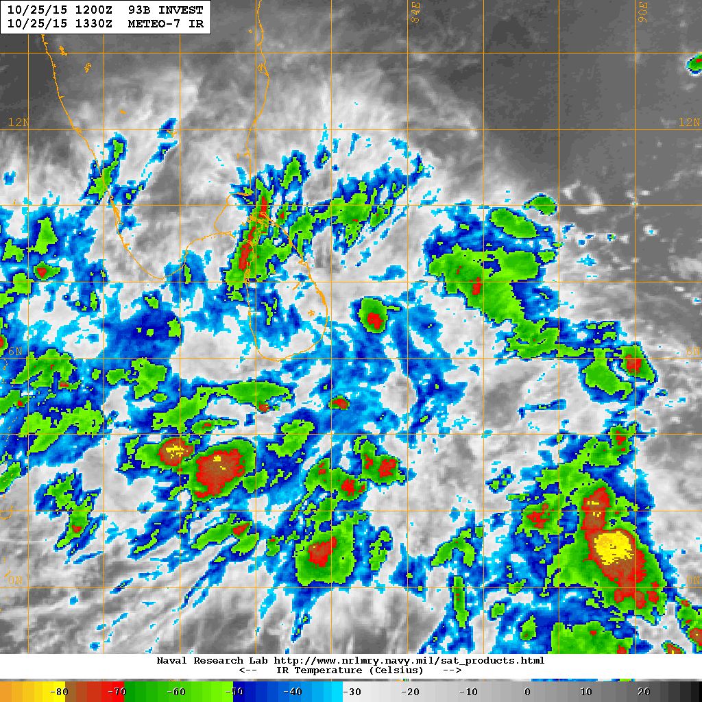
Low Pressure area developed over the Southwest Bay of Bengal persists. This System is being monitored as 93B.INVEST.
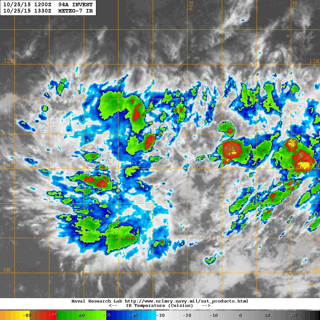
Under the influence of the trough of Low at mean sea level over Southeast & adjoining Southwest Arabian sea with an Upper Air Cyclonic Circulation aloft a Low Pressure area has developed over the same region. This System is being monitored as 94A.INVEST.
The Western Disturbance as an Upper Air Cyclonic Circulation over North Pakistan & neighborhood extending up to Mid-Tropospheric level with trough aloft along Long.67.0°E and North of Latitude 25.0°N. An induced Upper Air Cyclonic Circulation over Northwest Rajasthan & neighborhood extending up to 1.5 km above mean sea level persists.
93B.INVEST over Southwest Bay of Bengal Location 6.2 N. & 82.5 E. 20 knots with 1007 millibar Central Pressure NRL IR Satellite Image on 25th October @ 1330 UTC
94A.INVEST over Southeast Arabian Sea & Neighboring Southwest Arabian Sea Location 6.5 N. & 64.4 E. 20 knots with 1007 millibar Central Pressure NRL IR Satellite Image on 25th October @ 1330 UTC
Forecast: 25th to 31st October 2015
Both GSF and ECMWF shows that the Arabian Sea System will be stronger than the BOB System. Updates will be given in 24 hours.
The Western Disturbance will give heavy snowfall for Jammu & Kashmir and hilly regions of North India and rain for the plains of North Indian States during 25th to 26th October just like yesterday.
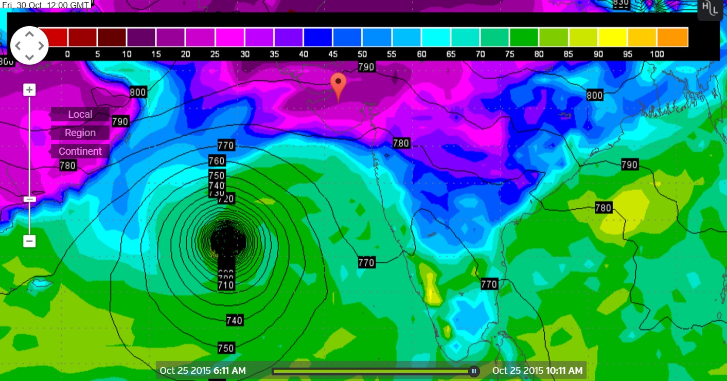
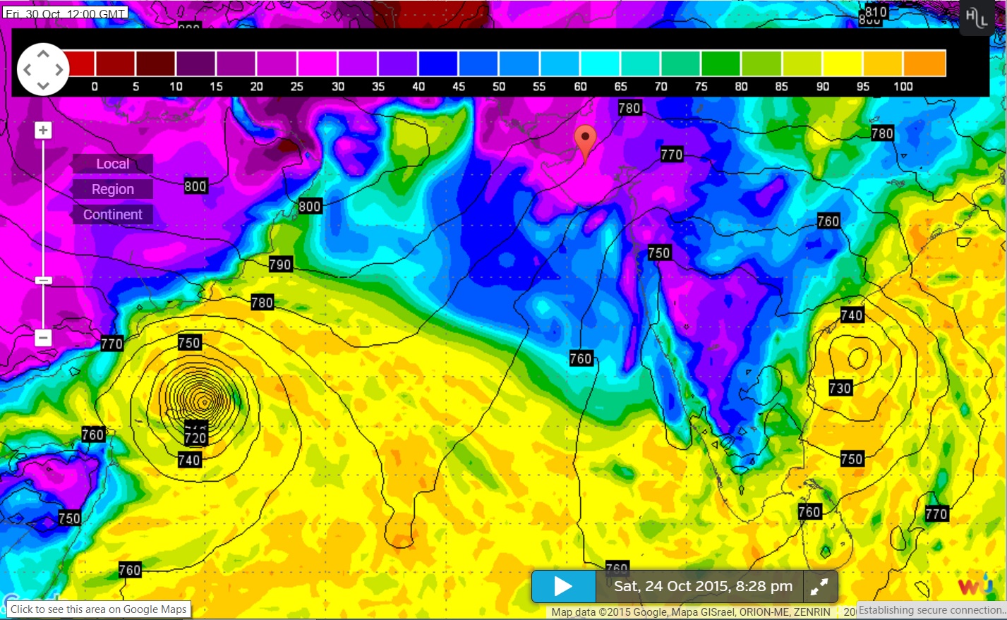
Wunderground Map showing System location on GSF 925 hPa
Forecast run 0000 UTC on 25th October 2015 valid 30th October 2015 @ 1200 UTC
Wunderground Map showing System location on GSF 925 hPa
Forecast run 0600 UTC on 25th October 2015 valid 30th October 2015 @ 1200 UTC
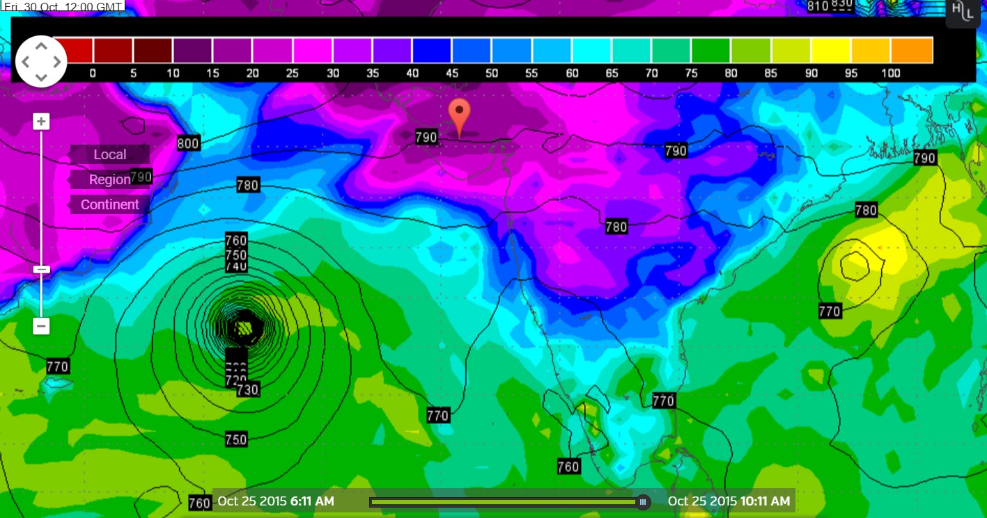
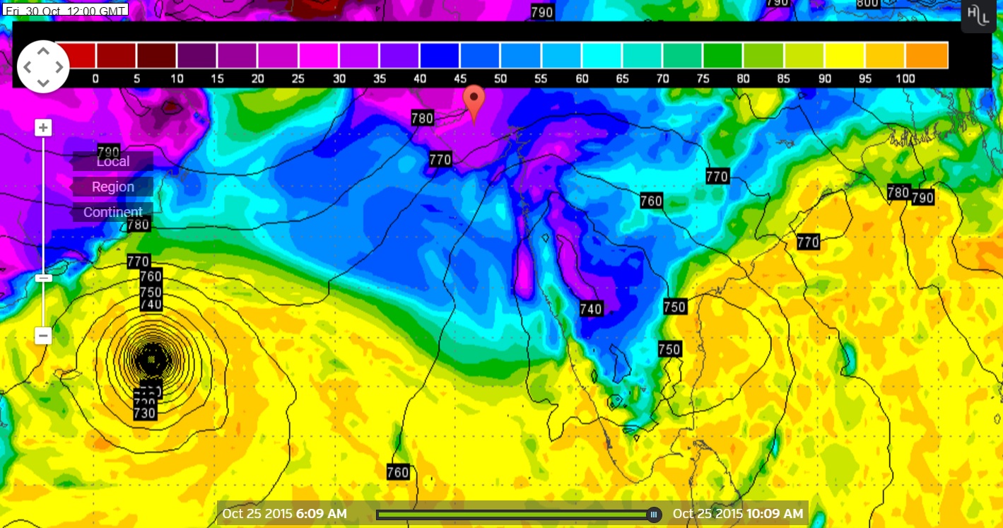
Wunderground Map showing System location on ECMWF 925 hPa
Forecast run 1200 UTC on 24th October 2015 valid 30th October 2015 @ 1200 UTC
Wunderground Map showing System location on ECMWF 925 hPa
Forecast run 00 UTC on 25th October 2015 valid 30th October 2015 @ 1200 UTC
Forecast: Saurashtra, Gujarat & Kutch: 25th October to 31st October
No direct effect from Bay of Bengal System and also not from the Arabian Sea System during the forecast period till 31st October. The weather is expected to be dry on most days. COLA/IGES indicates some light shower between 26th & 27th October for some parts of Saurashtra but the chances of this outcome could be 50- 50. The wind is expected to be from North or Northeast on most days during the forecast period.
અપડેટ 25 ઓક્ટોબર 2015 રાત્રે 8.00 કલાકે:
દક્ષીણ પશ્ચિમ બંગાળની ખાડી માં લો પ્રેસર છે અને દક્ષીણ પૂર્વ અને લાગુ દક્ષીણ પશ્ચિમ અરબી સમુદ્ર માં હવે લો પ્રેસર થયું છે.
વિવિધ ફોરકાસ્ટ મોડલ મુજબ બંગાળની સીસ્ટમ તેમજ અરબી નું નવું લો પ્રેસર બાબત માં મતમતાંતર છે. હજુ 24 કલાક આ અંગે અભ્યાસ કરવો જરૂરી છે.
વેસ્ટર્ન ડીસ્ટર્બન્સ ની અસર થી હજુ ગઈ કાલ ની જેમ 25 અને 26 તારીખ સુધી જમ્મુ અને કાશ્મીર અને ઊત્તર ભારત ના પહાડી વિસ્તારો માં હિમ વર્ષા તેમજ મેદાની વિસ્તારો માં વરસાદ થશે.
સૌરાષ્ટ્ર, કચ્છ અને ગુજરાત: 25 ઓક્ટોબર થી 31 ઓક્ટોબર 2015
આગાહી સમય ગાળા માં (31 ઓક્ટોબર સુધી ) બંગાળ ની ખાડી ની સીસ્ટમ કે અરબી ની સીસ્ટમ ની કોઈ સીધી અસર સૌરાષ્ટ્ર, કચ્છ અને ગુજરાત ને નહિ થાય. આગાહી સમય ના લગભગ દિવસો માં વાતાવરણ મુખ્યત્વે સુકું રહેશે. જોકે COLA/IGES મુજબ તારીખ 26th & 27th ઓક્ટોબર ના સૌરાષ્ટ્રમાં છાટાં છૂટી ની શક્યતા બતાવે છે પણ 50- 50 શક્યતા સમજવી. મહત્તમ દિવસે પવન હવે ઊત્તર અને ઊત્તર પૂર્વ તરફ થી ફૂંકાશે.