Current Weather Conditions on 5th October 2015 @ 8.00 am. IST
IMD Map showing the Withdrawal of Southwest Monsoon till 3rd October 2015.

Monsoon has not yet withdrawn South of Porbandar, Bhavnagar in Saurashtra & South of Baruch in Gujarat.
The Upper Air Cyclonic Circulation over Central Bay of Bengal at 3.1 km above mean sea level.
IMD 700 hPa Wind Forecast Valid 00 UTC 5th October 2015
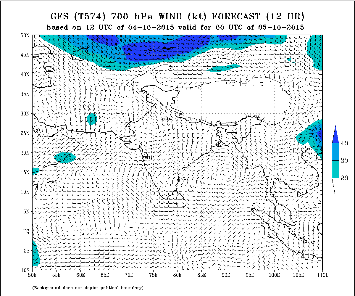
The East-West shear zone roughly along Latitude 15.0°N at 3.1 km above mean sea level persists.
The Western Disturbance as an Upper Air Cyclonic Circulation over North Pakistan & neighborhood extending up to 3.1 km above mean sea level persists.
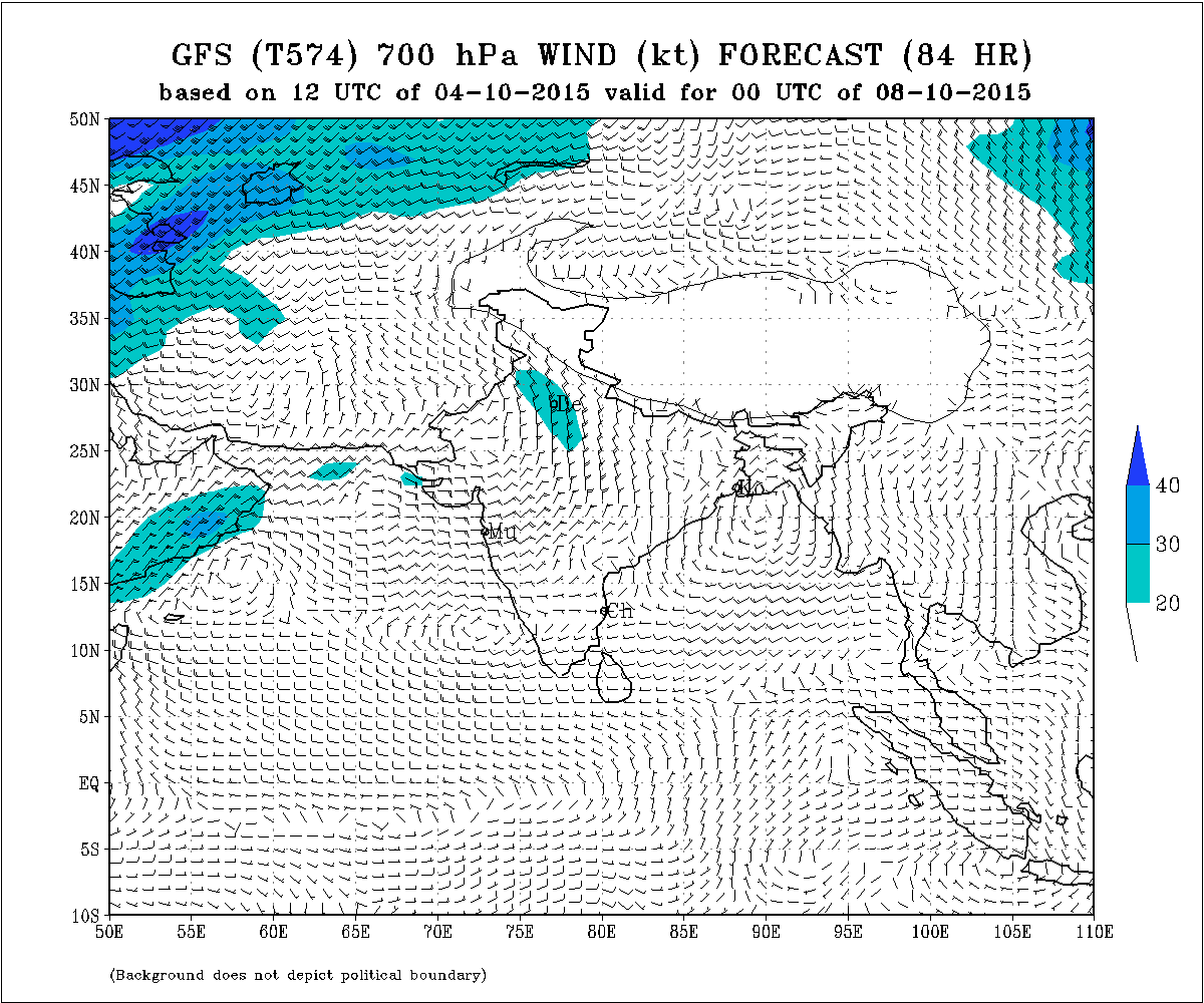
Forecast: 5th October to 9th October 2015
An Upper Air Cyclonic Circulation would develop over the East Central Arabian Sea around 8th October.
IMD 700 hPa Wind Forecast Valid 00 UTC 8th October 2015
Saurashtra, Gujarat & Kutch:
Weather will be clear on most days during the forecast period with no chance of any meaningful rainfall. The Maximum Temperature is expected to remain above normal over many places of Saurashtra, Gujarat & Kutch during the forecast period mainly from 6th to 9th October.
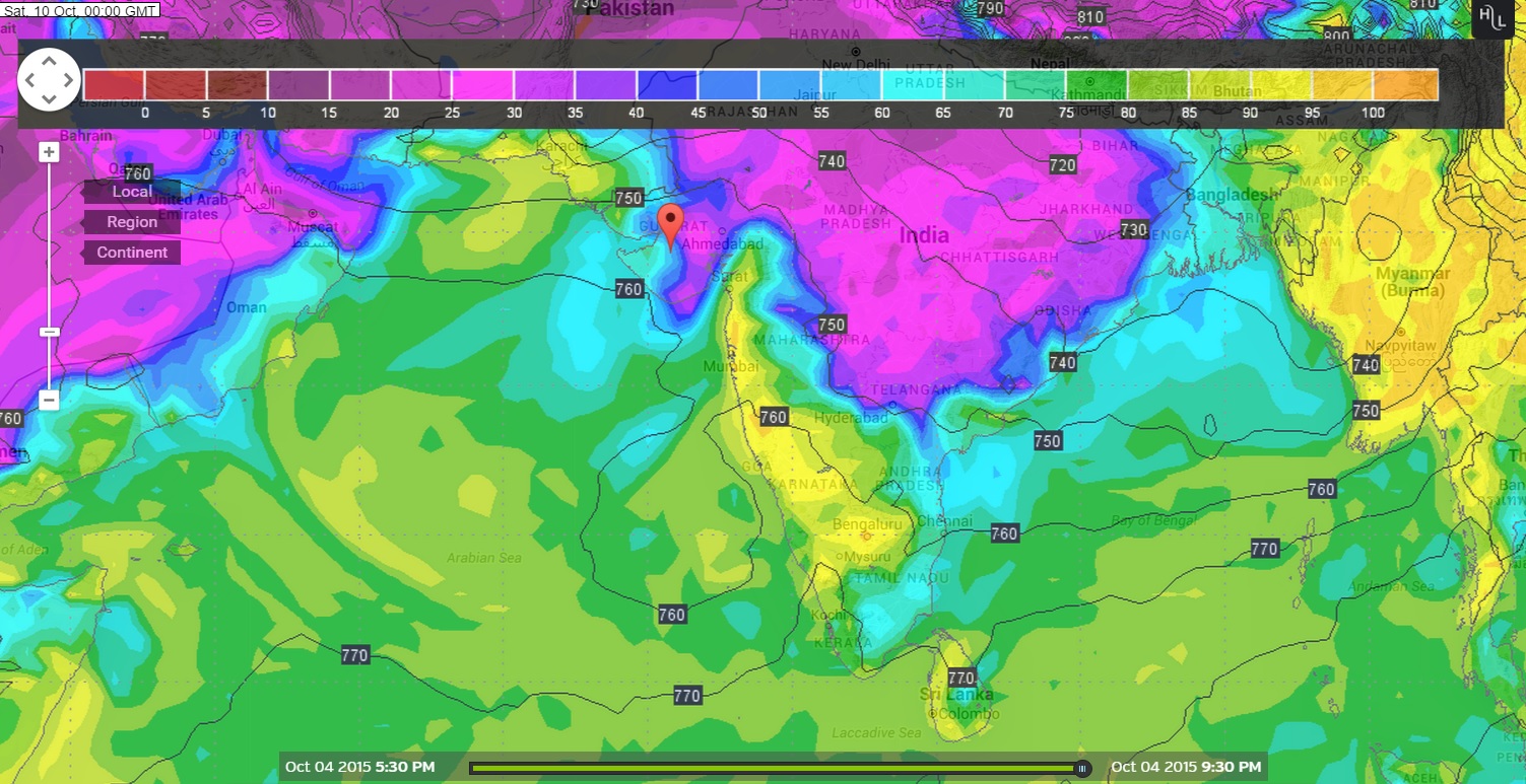
Advance Indication : ECMWF forecast model forecasts a strong System ( at least a Depression ) in the East Central Arabian Sea after the forecast period while the GFS forecast model does not concur with this outcome. There is differing outcome for the Arabian Sea System and so further update will be given in 48 hours.
Wunderground ECMWF 925 hPa Map showing Development of a System
@ 00 UTC on 10th October 2015

Wunderground GSF 925 hPa Map shows low possibility of a System
@ 00 UTC on 10th October 2015
અપડેટ તારીખ 5 ઓક્ટોબર સવારે 8.00 કલાકે:
દક્ષીણ પશ્ચિમ ચોમાસુ સમગ્ર યુપી અને એમપી ના વધુ ભાગો તેમજ બિહાર અને છતીશગઢ ના અમૂક ભાગ માંથી વિદાય લીધી છે.
દક્ષીણ પશ્ચિમ ચોમાસા ની વિદાય રેખા નકશા માં બતાવેલ છે. 3 ઓક્ટોબર તારીખ લખેલ લીલી લીટી ની ઉત્તરે બધા વિસ્તારો માંથી ચોમાસા એ વિદાય લીધી તેમ સમજવાનું. પોરબંદર થી ભાવનગર થી ભરૂચ ની દક્ષીણે ચોમાસા એ હજુ વિદાય લીધેલ નથી.
એક UAC મધ્ય બંગાળ ની ખાડી માં 3.1 કિમી ની ઉંચાયે છે.
પૂર્વ પશ્ચીમ નું શિયર ઝોન Latitude 15.0°N 3.1 કિમી ના લેવલ ઉપર છે.
વેસ્ટર્ન ડીસ્ટર્બન્સ 3.1 કિમી ના લેવલે ઊત્તર પાકિસ્તાન અને આસપાસ છે.
આગાહી: તારીખ 5 ઓક્ટોબર થી 9 ઓક્ટોબર
મધ્ય પૂર્વ અરબી સમુદ્ર માં તારીખ 8 ઓક્ટોબર આસપાસ એક UAC છવાશે.
સૌરાષ્ટ્ર, ગુજરાત અને કચ્છ:
થોડા વાદળો સૌરાષ્ટ્ર ના કાંઠા ઉપર ક્યારેક છવાય છે પણ આગાહી સમય માં કોઈ નોંધ પાત્ર વરસાદ ની શક્યતા નથી. ગરમી વધી છે અને આગાહી સમય માં સૌરાષ્ટ્ર, ગુજરાત અને કચ્છ ના ઘણા સેન્ટરો માં મહત્તમ તાપમાન નોર્મલ થી ઊંચું રહેશે ખાસ કરી ને તારીખ 6 થી 9 સુધી.
આગોતરું એન્ધાણ: આગાહી સમય પછી ECMWF ફોરકાસ્ટ મોડલ મૂજબ મધ્ય પૂર્વ અરબી સમુદ્ર માં એક મજબૂત સીસ્ટમ બનશે (ઓછા માં ઓછું ડીપ્રેસન ની માત્રા ) જયારે GSF ફોરકાસ્ટ મોડલ મૂજબ આવું કઈ નથી. બંને મોડલ માં મતમતાંતર હોઈ 48 કલાક પછી આ અંગે અપડેટ થશે.

Weather Forecast In Akila Daily Dated 5th October 2015
Scroll Up