Current Weather Conditions on 19th November 2015 @ 8.00 am. IST
The Bay of Bengal Low Pressure area has dissipated and the Associated Upper Air Cyclonic Circulation extending up to 3.1 km above mean sea level has tracked over Tamil Nadu, South Karnataka & Kerala past 24 hours and is now located over Southeast Arabian Sea vicinity of Coastal Kerala.
A fresh Western Disturbance would affect Western Himalayan Region from 22nd November.
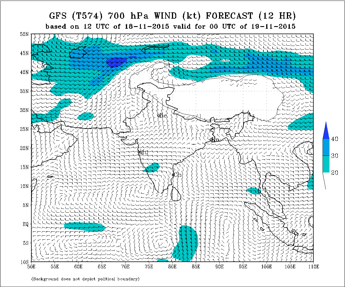
November GFS (T574) 700 hPa Wind Chart Valid 00 UTC 19th November 2015
Forecast: Saurashtra, Gujarat & Kutch: 19th November to 25th November
Maximum and Minimum Temperature is expected to be near normal for this time of the year. Increase in Temperature expected from 22nd on wards. The winds will be from North and Northeast.
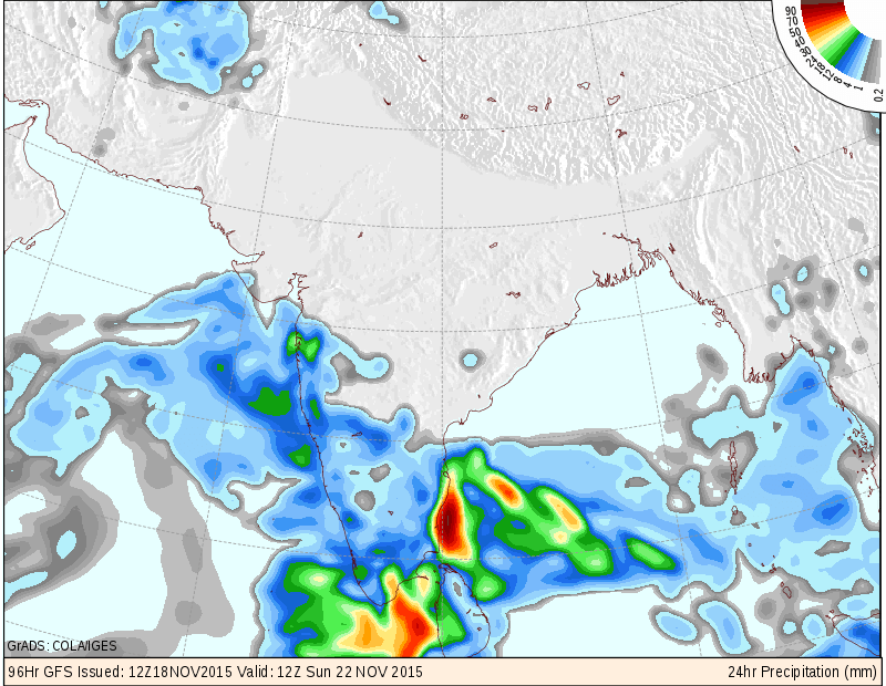
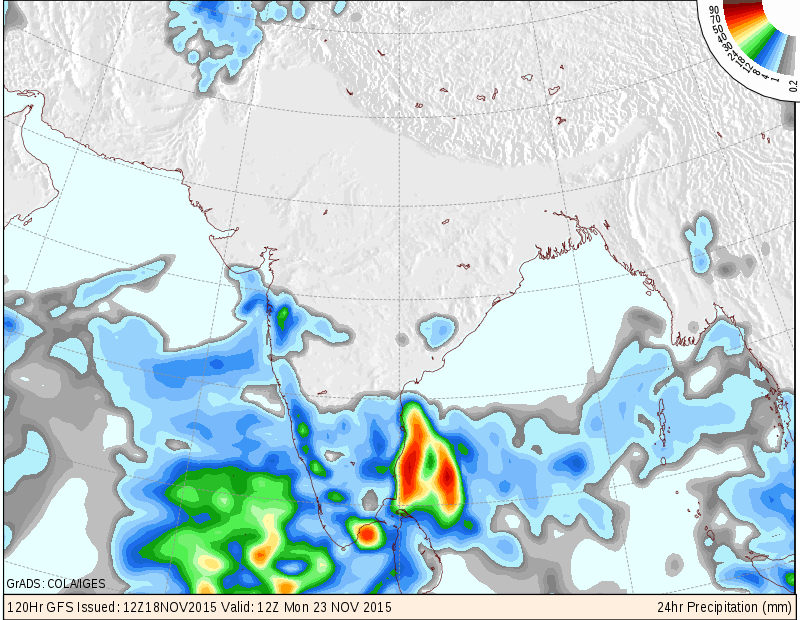
Due to the trough associated with the Western Disturbance and peripheral clouding associated with the Arabian Sea UAC, there is a 50% possibility of scattered showers in few places on 22nd/23rd November as shown in COLA/IGES Precipitation maps.
COLA/IGES Precipitation Map Valid 1200 UTC 22nd November 2015
COLA/IGES Precipitation Map Valid 1200 UTC 23rd November 2015
IMD GFS (T574) Rainfall Forecast Valid 1200 UTC on 22nd November 2015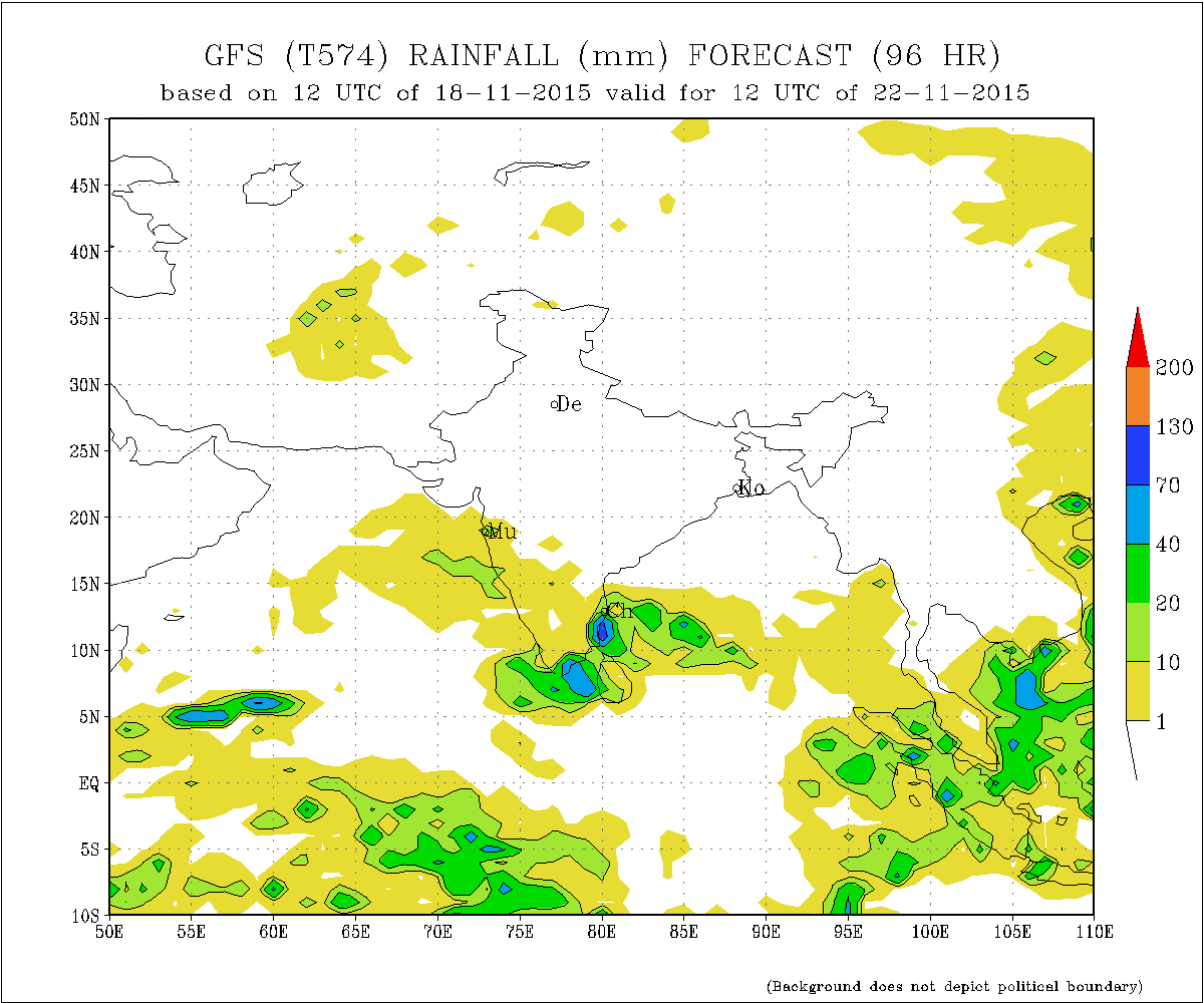
અપડેટ 19 નવેમ્બર 2015 સવારે 8.00 કલાકે:
બંગાળ ની ખાડી વાળું લો પ્રેસર હવે પૂરું થઇ ગયું. તેના અનુસંગિક UAC 700 hPA ના લેવેલે હતું તે તમિલનાડુ અને કર્નાટકા ઉપરથી હવે દક્ષીણ પૂર્વ અરબી સમુદ્ર ઉપર કેરલા નજીક છવાયેલ છે.
વેસ્ટર્ન ડીસ્ટર્બન્સ પશ્ચિમ હિમાલય ને 22 તારીખે અસર કરશે.
સૌરાષ્ટ્ર, કચ્છ અને ગુજરાત: 19 નવેમ્બર થી 25 નવેમ્બર 2015
મહત્તમ અને ન્યુનત્તમ તાપમાન નોર્મલ જેવું રહેશે. તારીખ 22 થી થોડું તાપમાન વધશે.
અરબી સમુદ્ર નું UAC મુખ્યત્વે પશ્ચિમ તરફ ગતિ કરશે. તેના અમૂક પૂછડિયા વાદળો અને વેસ્ટર્ન ડીસ્ટર્બન્સ ની સંયુક્ત અસર થી તારીખ 22/23 નવેમ્બર ના સીમિત વિસ્તાર માં પરચુરણ છાંટા છૂટી ની 50% શક્યતા છે. બે નકશા આપેલ છે જેમાં એક માં છાંટા છૂટી શક્યતા છે અને એક માં નથી.
Scroll Up