Current Weather Conditions on 29th June 8.00 pm.
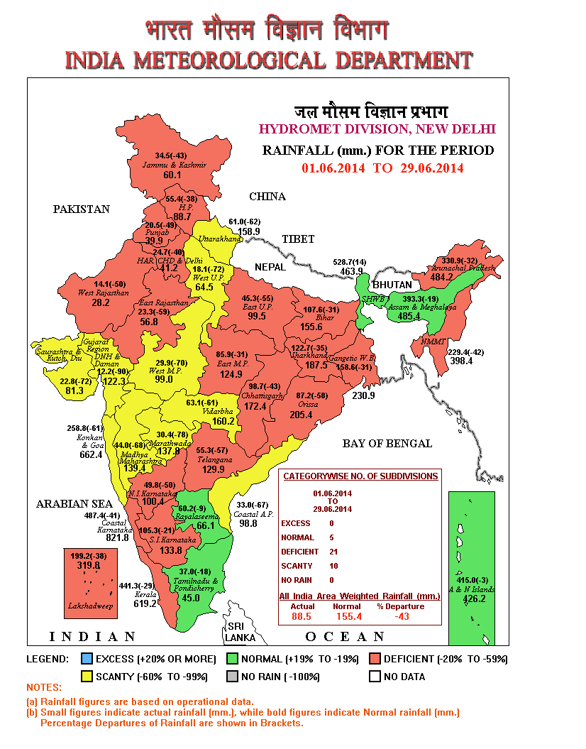
After an early onset of Southwest Monsoon over the Southern Coastal Saurashtra and South Gujarat on 15th June, there has not been any progress for Monsoon over rest of Saurashtra, Gujarat and whole of Kutch. There has not been any significant rainfall over Saurashtra, Gujarat & Kutch during the last two weeks. There is a shortfall of 72% over Saurashtra Kutch Sub-division with average rainfall of 22.8 mm. compared to normal of 81.3 mm. Similarly, Gujarat Sub-division has a 90% shortfall with average rainfall of 12.2 mm. against normal of 122.3 mm. till 29th June 2014. The deficit looks alarming but it is based on a small quantum of June average rainfall which is about 15 % of the Seasonal Rainfall.
 IMD Map showing the Progress of Southwest Monsoon Till 29th June 2014
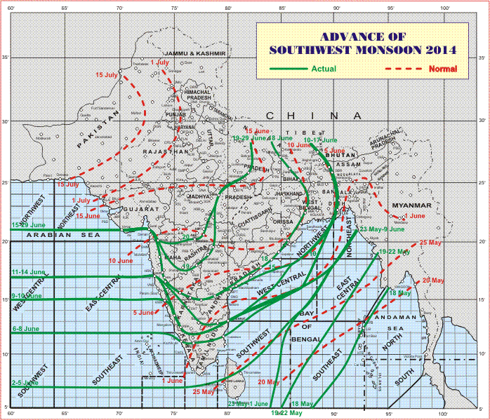
The Arabian branch of Southwest Monsoon has not moved ahead since 15th June and the Bay of Bengal Branch or the Eastern Branch has not moved since 19th June.
The Northern Limit of Monsoon (NLM) continues to pass through Lat. 21°N / Long. 60°E, Lat.21°N / Long. 65°E, Veraval, Surat, Nashik, Washim, Damoh, Sultanpur and Lat.28°N / Long. 82°E.
Conditions are becoming favorable for further advance of Southwest Monsoon into some more parts of Uttar Pradesh and some parts of Uttarakhand, Himachal Pradesh and Jammu & Kashmir during next 3 to 4 days.
The above clearly suggests that the Southwest Monsoon will be active along the Foothills of the Himalayas. The 925 Mb. charts also suggests that the Easterly winds are restricted to the Himalayas only.
The trough at mean sea level now extends from Northwest Rajasthan to Northeast Bay of Bengal across Haryana, Uttar Pradesh, Bihar, Jharkhand and Gangetic West Bengal.
There is a Cyclonic Circulation between 4.5 & 5.8 kms. above sea level over Northwest Bay of Bengal and neighborhood.
Forecast: 30th June to 5th July 2014
Cloudy as well as windy weather would prevail on most days of the forecast period with high winds on two to three days of the forecast period. Moisture laden winds will travel inland without precipitating any significant quantum of rain during the forecast period. There will be scattered showers initially along the South Coastal Saurashtra & South Gujarat and later other areas of Saurashtra, Gujarat & Kutch on two to three days of the forecast period.
The Eastern Branch of the Southwest Monsoon to move ahead in a day or two and the Western or the Arabian Branch may remain stagnant for few more days. Saurashtra, Gujarat & Kutch can get beneficial rain from the Bay of Bengal side only after the Southwest Monsoon sets in over rest of Maharashtra & rest of Madhya Pradesh.
IMD GFS Rainfall Forecast Valid for oo UTC 3rd July 2014 ( mainly 2nd July)
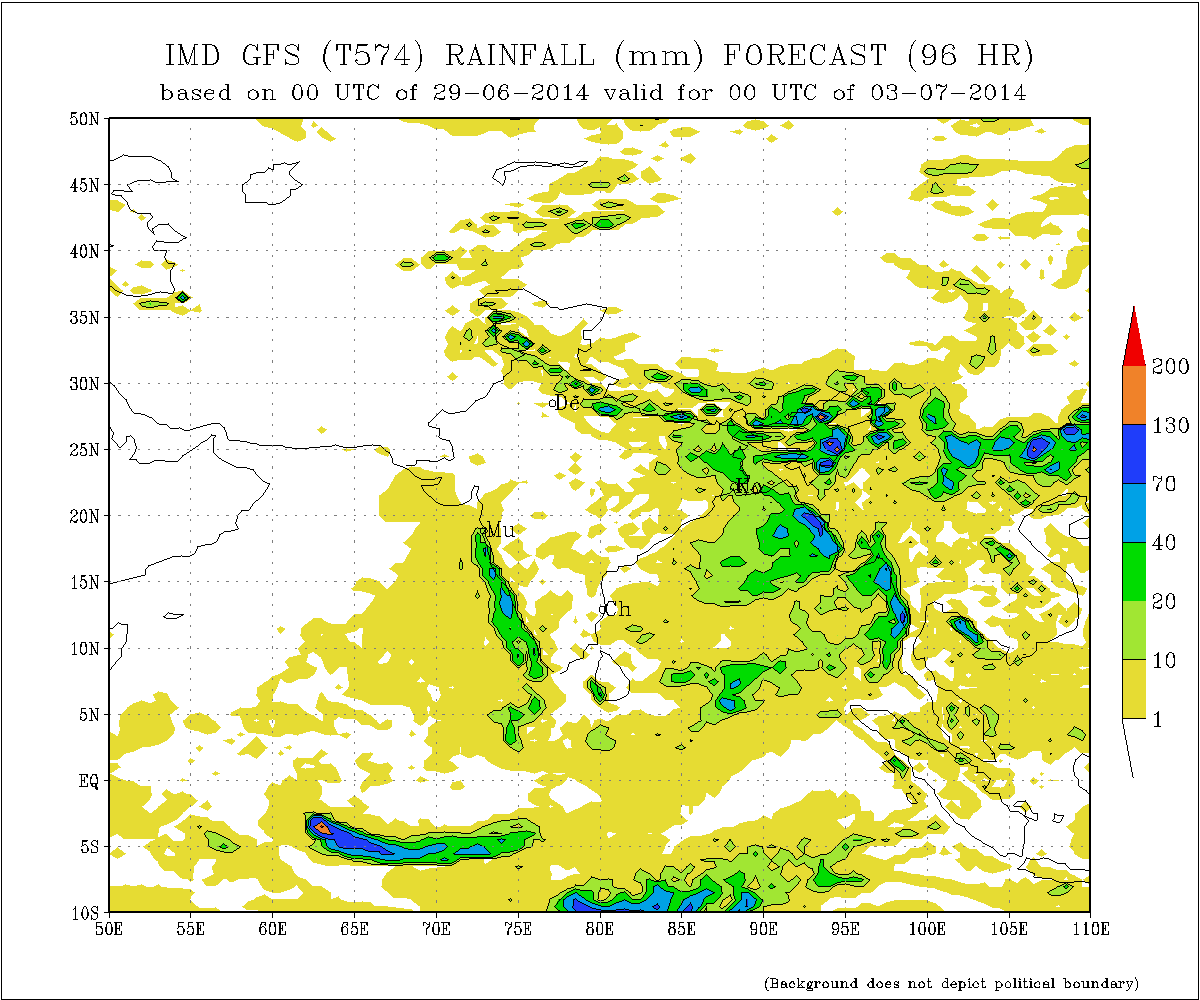
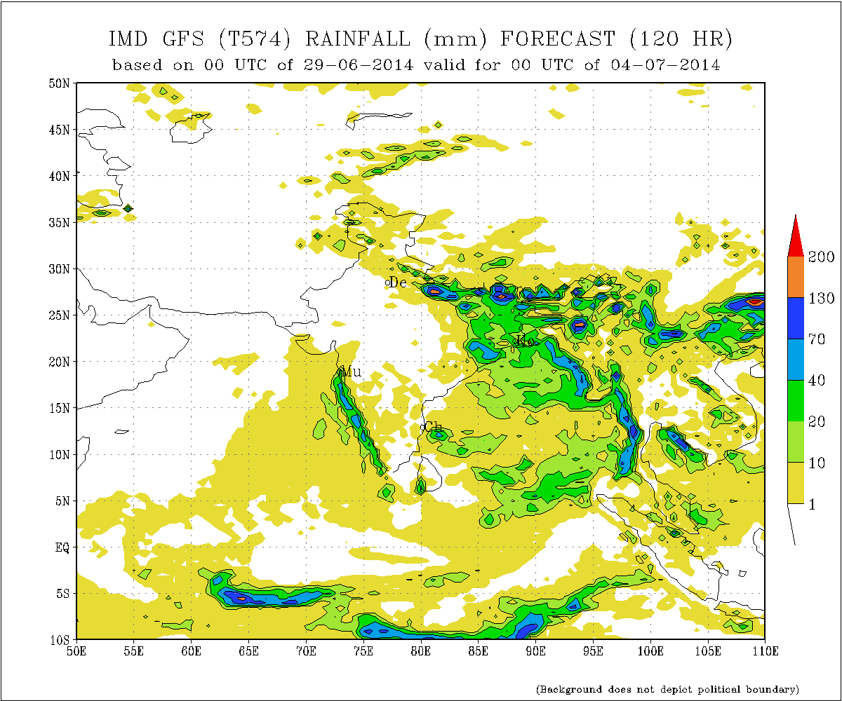
IMD GFS Rainfall Forecast Valid for oo UTC 4th July 2014 ( mainly 3rd July)
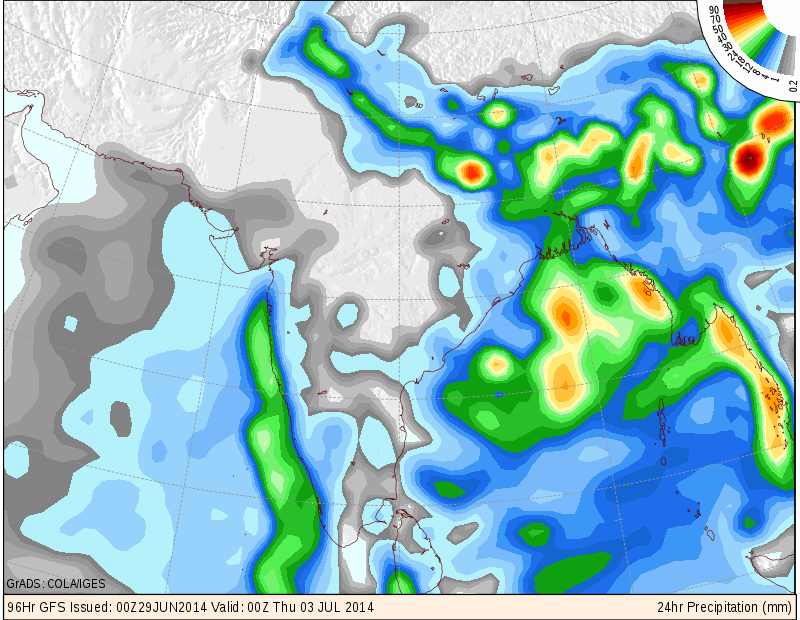
COLA/IGES Precipitation Forecast Map valid 00 UTC 3rd July 2014
(mainly 2nd July)