Current Weather Conditions on 15th June 2014 @ 2.00 pm.
The remnant of Cyclonic Storm ‘Nanauk’ had tracked Eastwards and now lies over Northeast Arabian sea with associated Upper Air Cyclonic Circulation extending upto 1.5 km above mean sea level. Strong winds from the Arabian Sea are blowing over Saurashtra, so moisture incursion over Saurashtra is taking place.
The off shore trough along Western India at mean sea level now extends from South Gujarat coast to North Kerala coast.
The cyclonic circulation over East central Bay of Bengal and neighborhood now lies over Northeast Bay of Bengal and neighborhood and extends up to Midtropospheric levels.
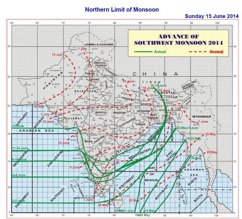
The Southwest Monsoon has further advanced into remaining parts of central Arabian Sea, some parts of north Arabian Sea, south Gujarat and south Madhya Maharashtra,remaining parts of Konkan, some parts of north interior Karnataka, most parts of south interior Karnataka, some parts of Rayalaseema and south coastal Andhra Pradesh and some more parts of west central Bay of Bengal. The Northern Limit of Monsoon (NLM) passes through Lat. 21 °N /Long. 60° E, Lat. 21° N / Long. 65 ° E, Veraval, Surat, Sangli, Bellary, Nandyal, Bapatla, Lat.18°N / Long. 86°E, Lat.22°N / Long.90°E,Cooch Behar and Gangtok. Conditions are becoming favourable for further advance of Southwest Monsoon into some more parts of interior Karnataka and Andhra Pradesh, remaining parts of Bay of Bengal, Sub-Himalayan West Bengal & Sikkim and some parts of Gangetic West Bengal, Odisha, Jharkhand and Bihar during next 3-4 days.
IMD Map Showing Northern Limit Of Southwest Monsoon on 15th June 2014
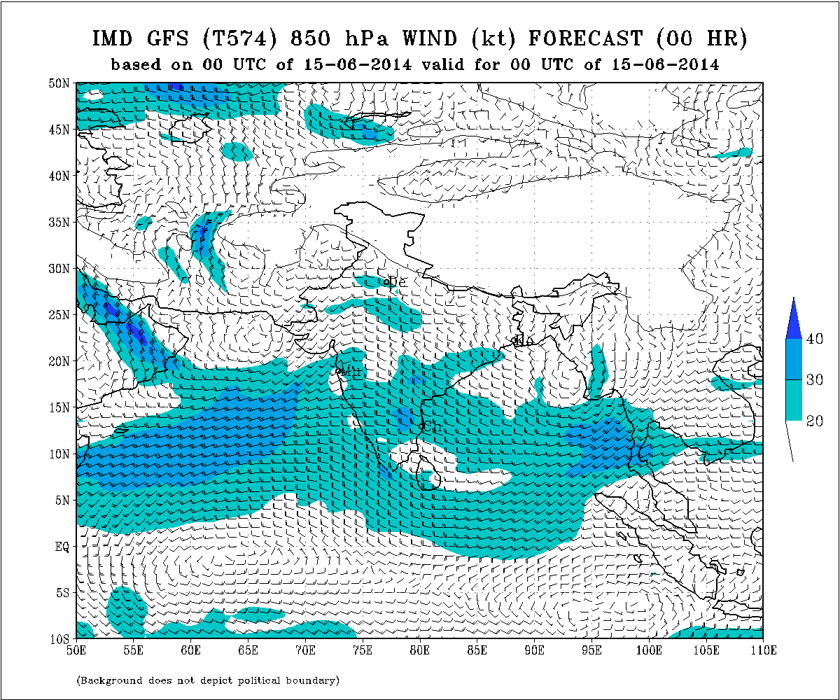
IMD GFS 850 hPa Wind Map Valid for 15-06-2014 @ 0000 UTC
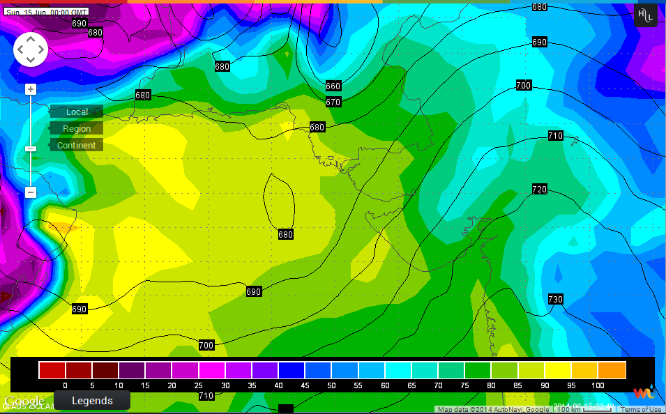
Wunderground Map of 925 Mb. Valid 15-06-2014 @ 0000 UTC
Forecast: 15th June to 19th June
Monsoon already set in over Coastal Saurashtra & South Gujarat today and so can expect rain during the forecast period.
Pre-monsoon activity (scattered rain/showers) to continue over rest of Saurashtra & North Gujarat.
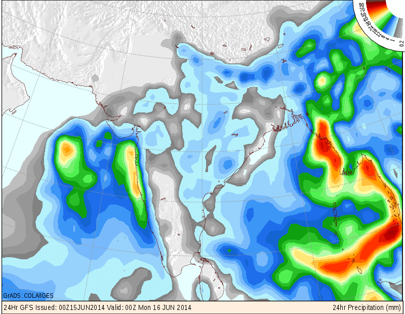
COLA/IGES Precipitation Forecast Map valid 0000 UTC of 16th June 2014
(Means mostly 15-06-14)
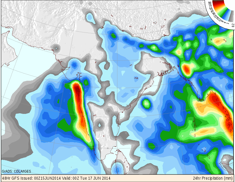
COLA/IGES Precipitation Forecast Map valid 0000 UTC of 17th June 2014
(Means mostly 16-06-14)
Weather Forecast In Akila Daily Dated 15th June 2014