Current Weather Conditions on 23rd June 2014 @ 6.00 pm.
There has been no meaningful rainfall over Saurashtra after the initial onset of Monsoon on 15th/16th June. The Arabian Branch of the Southwest Monsoon has remained weak for most parts of last week. There isn’t any significant rainfall reported over Saurashtra, Gujrat & Kutch during last six days.
Arabian Branch Of Southwest Monsoon is Standstill Over Coastal Saurashtra & South Gujarat. It has not budged an inch after 15th June.
Very windy conditions exists thoughout Saurashtrt, Kutch & Gujarat.
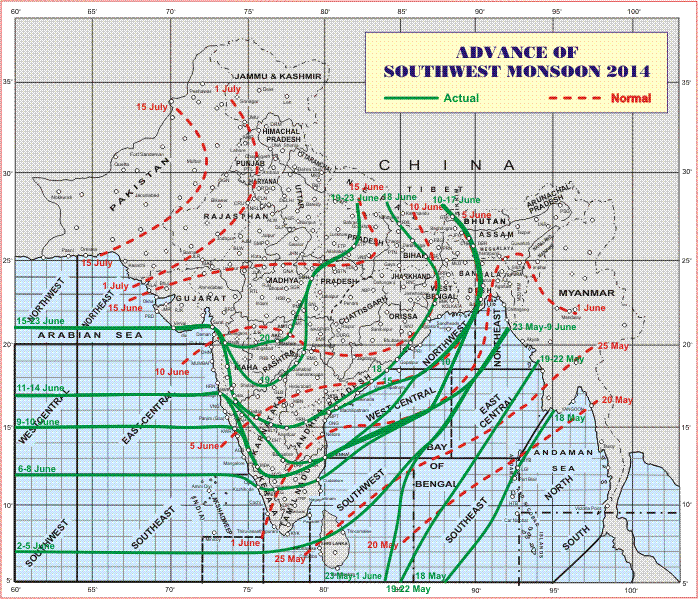
The Northern Limit of Monsoon (NLM) continues to pass through Lat. 21°N /Long. 60°E, Lat.21°N / Long. 65°E, Veraval, Surat, Nashik, Washim, Damoh, Sultanpur and Lat.28°N / Long. 82°E.
IMD Map Showing Northern Limit Of Southwest Monsoon on 23rd June 2014
The Low Pressure area over Bangla Desh and adjoining West Bengal
has become less marked. However, the associated Cyclonic Circulation
persists over Bangla Desh and adjoining West Bengal and extends upto
3.6 kms above sea level with a trough aloft.
The East-West trough at mean sea level from west Uttar Pradesh to Mizoram persists across East Uttar Pradesh, Jharkhand, Gangetic West Bengal, Bangla Desh and Meghalaya.
NCEP Indian Summer Monsoon Circulation Index Dated 22nd June 2014
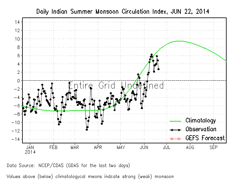 The above index normally shows forecast for one to two week ahead. However, currently no forecast is given, but only the actual index till now. It clearly shows that the Monsoon has been weak till now barring a few days.
Forecast: 23th June to 30th June
Saurashtra:
No meaningful rainfall is forecast during this period. Possibility of scattered showers mainly along the Coastal areas.
South Gujarat:
Scattered showers/light to rainfall on few days during the forecast period.
Kutch & North Gujarat:
No meaningful rainfall is forecast during the forecast period. Possibility of Isolated showers.
Scroll Up