Current Weather Conditions on 19th June 2014 @ 2.30 pm.
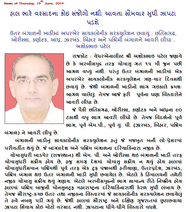
There has been no meaningful rainfall over Saurashtra after the initial onset of Monsoon on 15th/16th June. The Arabian Branch of the Southwest Monsoon is currently weak. The rain quantum over Saurashtra has decreased from 18th June onwards as had been mentioned earlier.
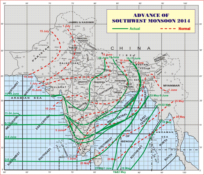
The Southwest Monsoon has further advanced into some more parts of Madhya Maharashtra, most parts of interior Karnataka and Telangana and remaining parts of coastal Andhra Pradesh, Rayalaseema, Odisha, Gangetic West Bengal,Jharkhand, Bihar, entire Chattisgarh and some parts of Vidarbha, east Madhya Pradesh and east Uttar Pradesh.
The Northern Limit of Monsoon (NLM) passes through Lat. 21°N / Long. 60°E, Lat. 21°N / Long. 65° E, Veraval, Surat, Nashik, Bidar, Adilabad, Damoh, Sultanpur and Lat. 28°N / Long. 82°E.
Conditions are favourable for further advance of Southwest Monsoon into remaining parts of north interior Karnataka, Telangana, east Madhya Pradesh and east Uttar Pradesh and some more parts of Vidarbha during next 48 hours.
IMD Map Showing Northern Limit Of Southwest Monsoon on 19th June 2014
Under the influence of the Cyclonic Circulation over Northwest Bay of Bengal and neighborhood a Low Pressure area has formed over coastal areas of Bangla Desh and neighborhood. Associated Cyclonic Circulation extends up to 7.6 kms above sea ala level.
The weak Off-shore trough runs from Maharashtra Coast to Kerala Coast but is expected to strengthen in 24 hours.
Forecast: 19th June to 23th June
Saurashtra:
Only scattered showers during the forecast period mainly along the Coastal areas.
South Gujarat:
Scattered showers/light to medium rainfall on few days during the forecast period.
Kutch & North Gujarat:
Isolated showers during the forecast period.
Weather Forecast In Akila Daily Dated 19th June 2014
Scroll Up