Current Weather Conditions on 28th May 2017 @ 10.30 am. IST
Sub: Depression over Central Bay of Bengal
Latest observations & satellite imagery indicate that a depression has formed over central Bay of Bengal and lay centred at 0530 hrs IST of today, the 28th May, 2017 near Latitude 14.0º N and Longitude 88.5 ºE, about 950 km south of Kolkata and 980 km south-southwest of Chittagong. The system is very likely to move north-northeastwards and reach Bangladesh coast by 30th May 2017 forenoon. It is very likely to intensify into a deep depression during next 24 hours.
INDIA METEOROLOGICAL DEPARTMENT
Bulletin No.: 01 (BOB 02/2017)
Time of issue: 0900 hours IST
Dated: 28.05.2017 available here IMD Bulletin No.: One
Current System over Central Bay Of Bengal is Deep Depression strength, however, IMD has it as Depression and we can expect them to upgrade it to Deep Depression in their subsequent Bulletins. This System is expected to strengthen further to a Cyclonic Storm within 24 hours. International Agencies have already put the System as Tropical Cyclone with 35 knots wind speed ( based on 1 minute average wind speed )
Note: IMD considers wind speed based on 3 minute Average in their System classifications.
મધ્ય બંગાળ ની ખાડી ની સિસ્ટમ ડીપ ડિપ્રેસન ની માત્રા એ પહોંચી – હવામાન ખાતા ની પુષ્ટિ બાકી છે. 24 કલાક માં સિસ્ટમ હજુ મજબૂત બનશે. ઇન્ટરનૅશનલ એજન્સી મુજબ વાવાઝોડું છે ( જે એક મિનિટ ની શરેરાશ પવન મુજબ ગણે છે ,જયારે હવામાન ખાતા મુજબ પવન ની ઝડપ 3 મિનિટ ની શરેરાશ મુજબ ગણતરી થાય.
| UW-CIMSS Automated Satellite-Based Advanced Dvorak Technique (ADT) Version 8.2.1 Tropical Cyclone Intensity Estimation Algorithm |
|
| Current Intensity Analysis | |
                     UW - CIMSS
              ADVANCED DVORAK TECHNIQUE
                  ADT-Version 8.2.1
         Tropical Cyclone Intensity Algorithm

             ----- Current Analysis -----
     Date :  28 MAY 2017    Time :   030000 UTC
      Lat :   14:23:59 N     Lon :   89:11:59 E


                CI# /Pressure/ Vmax
                2.8 / 998.2mb/ 41.0kt


             Final T#  Adj T#  Raw T#
                2.8     2.8     3.8

 Center Temp : -84.6C    Cloud Region Temp : -85.8C

 Scene Type : UNIFORM CDO CLOUD REGION

 Positioning Method : FORECAST INTERPOLATION

 Ocean Basin : INDIAN
 Dvorak CI > MSLP Conversion Used : CKZ Method

 Tno/CI Rules : Constraint Limits : 0.7T/6hr
                   Weakening Flag : OFF
           Rapid Dissipation Flag : OFF

 C/K/Z MSLP Estimate Inputs :
  - Average 34 knot radii : N/A
  - Environmental MSLP    : 1008mb

 Satellite Name :    MSG1
 Satellite Viewing Angle : 56.5 degrees

****************************************************
|
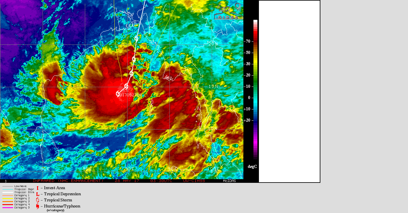
UW-CIMSS IR (NHC Enhancement) Satellite Image & Forecast Track of Cyclonic Storm 02 (TWO)
(IMD:Depressionon) 28th May 2017 @ 0330 UTC ( 09.00 am. IST)
1 knot= 1.85 km./hour
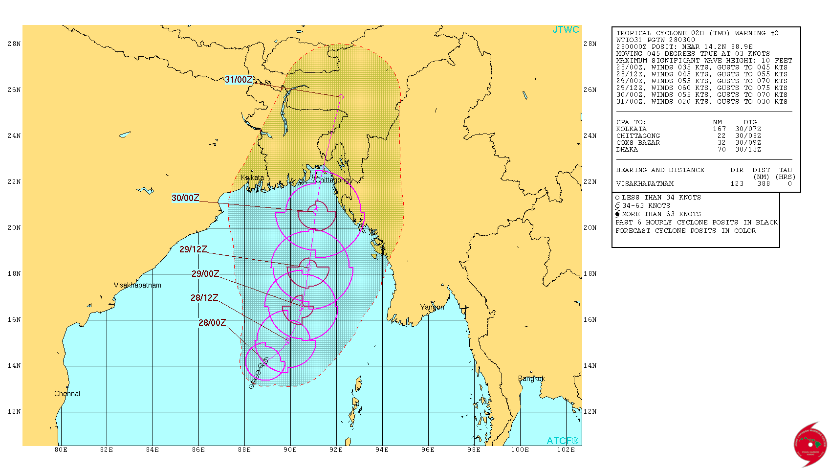
From JTWC:
JTWC Tropical Cyclone 02B (TWO) Warning No. 2 On 28th May 2017 @ 0300 UTC ( 08.30 am. IST)
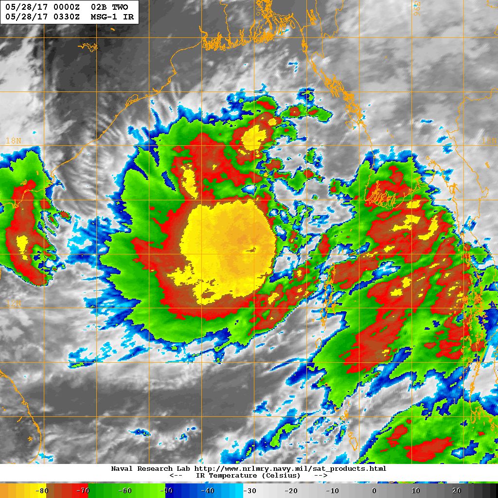
NRL IR Satellite Image of Tropical Cyclone 02B.TWO ( IMD: Depression )
on 28th May 2017 @ 0330 UTC (09.00 am. IST)
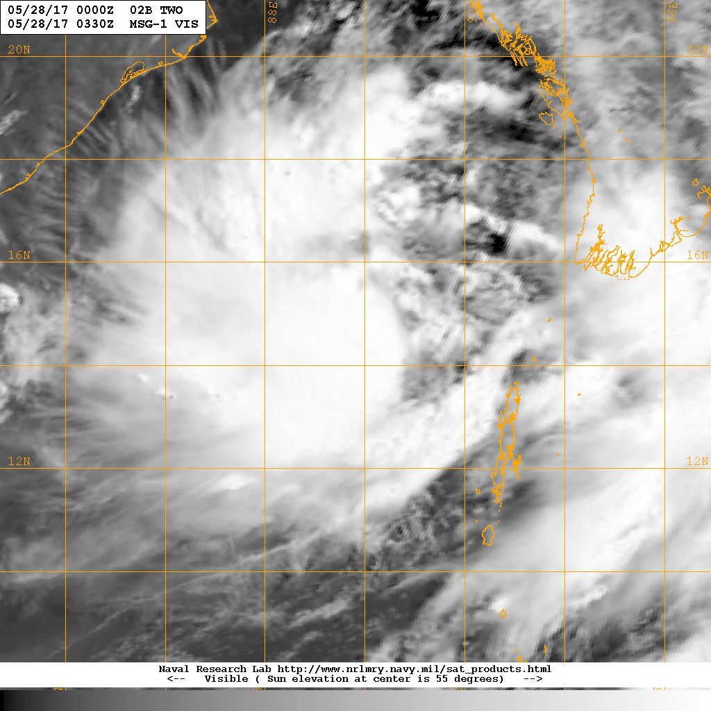
NRL Visible Satellite Image of Tropical Cyclone 02B.TWO ( IMD: Depression )
on 28th May 2017 @ 0330 UTC (09.00 am. IST)
Caution: Please refer/rely on IMD/RSMC Bulletins/Advisories for Storms & Weather related matter.
સાવચેતી:
સ્ટોર્મ કે હવામાન અંગે ની માહિતી માટે ભારતીય હવામાન ખાતા/ગવર્મેન્ટ ના બુલેટીન/સુચના પર નિર્ભર રહેવું.