Current Weather Conditions on 26th October 2014 @ 8.30 am.
The Depression over West Central Arabian Sea has organized further to a Deep Depression strength. This has yet to be confirmed by IMD. System is likely to move initially in a Northwesterly direction towards Oman. System expected to intensify further into a Cyclonic Storm.
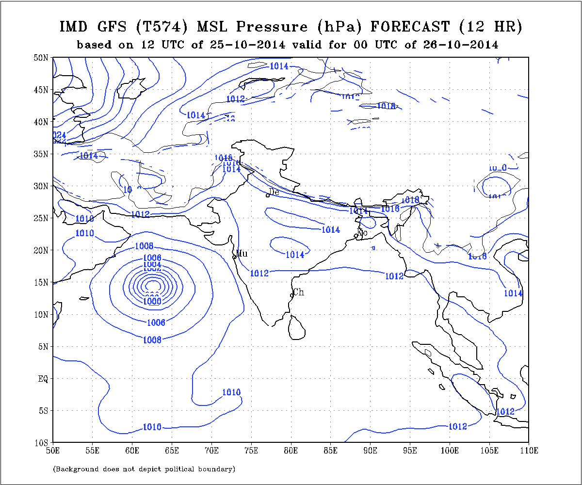
IMD GFS (T574) MSLP Forecast Chart Valid 26th October 2014 @ 00 UTC
JTWC Tropical Cyclone Warning Number 3
Dated 26-10-2014 @ 0300 UTC
1. TROPICAL CYCLONE 04A (FOUR) WARNING NR 003
   01 ACTIVE TROPICAL CYCLONE IN NORTHIO
   MAX SUSTAINED WINDS BASED ON ONE-MINUTE AVERAGE
   WIND RADII VALID OVER OPEN WATER ONLY
    ---
   WARNING POSITION:
   260000Z --- NEAR 14.1N 63.0E
     MOVEMENT PAST SIX HOURS - 360 DEGREES AT 04 KTS
     POSITION ACCURATE TO WITHIN 030 NM
     POSITION BASED ON CENTER LOCATED BY SATELLITE
   PRESENT WIND DISTRIBUTION:
   MAX SUSTAINED WINDS - 035 KT, GUSTS 045 KT
   WIND RADII VALID OVER OPEN WATER ONLY
   REPEAT POSIT: 14.1N 63.0E
JTWC Tropical Cyclone 04A (FOUR) Warning Number 3
Dated 26-10-2014 @ 0300 UTC
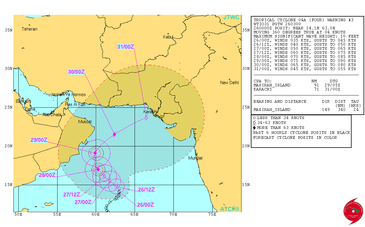
JTWC track suggests a re-curve as the System comes close to Oman. The re-curves would be Northeastwards & then Eastwards.
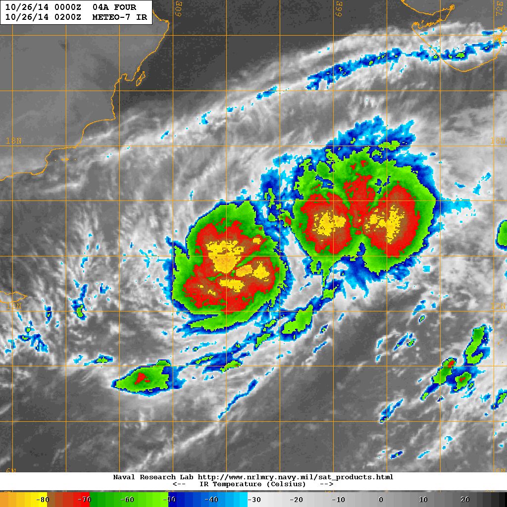
NRL IR Satellite Image Dated 26th October 2014 @ 0200 UTC
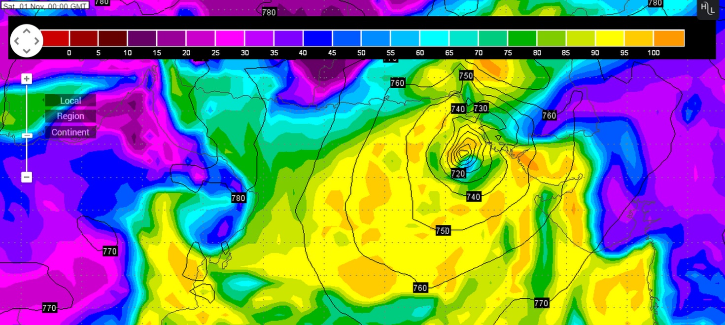
Wunderground ECMWF 925 hPa Forecat Chart Valid 1st November 00 UTC
(based on ECMWF Forecast run dated 25th October 12 UTC)
Wunderground GFS 925 hPa Forecat Chart Valid 31th October 00 UTC
(based on GFS Forecast run dated 25th October 12 UTC)
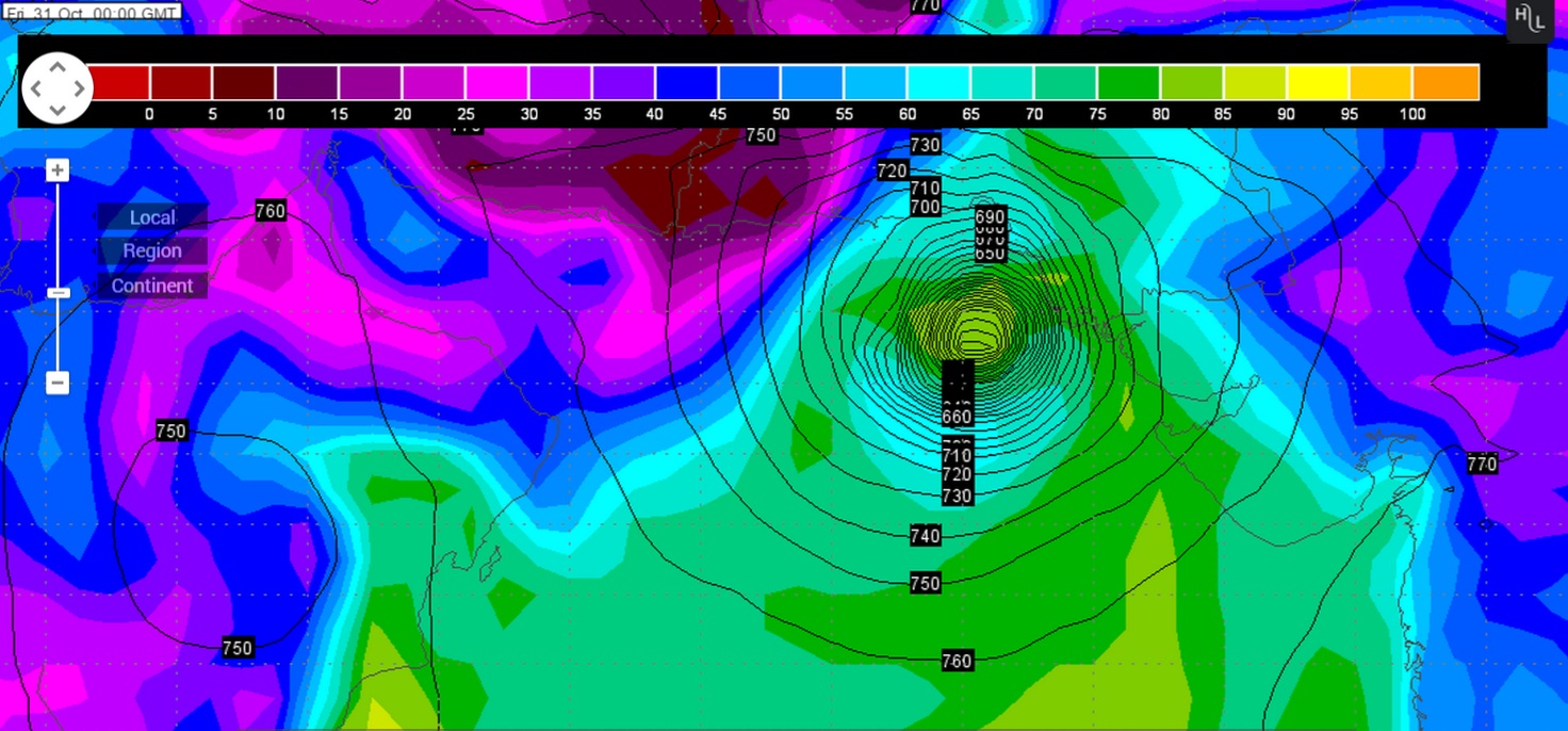
Forecast: 26th October to 1st November 2014
ECMWF & GSF are now having similar outcome for the System in the West Central Arabian Sea. GFS is nearly consistent with the forecast track by subsequently tracking the System Eastwards towards Gujarat/Pakistan, and now ECMWF also shows the System tracking towards Pakistan/Gujarat but about 24 hours later. There is differing of timing from both these forecast models, so the forecast confidence is yet low. Better forecast track will be available by tomorrow the 27th October. Now that both these models are suggesting re-curve towards Pakistan/Gujarat, farmers should be cautious. Future Western Disturbance during the forecast period could affect the final outcome this System. Updates will be given again if some more clarity of track is available.
Caution: Please refer/rely on IMD/RSMC Bulletins/Advisories for Storms & Weather related matter.
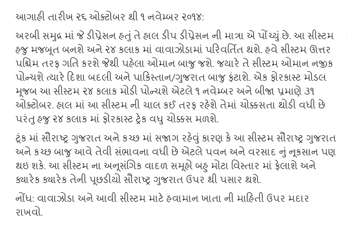
આગાહી તારીખ ૨૬ ઓક્ટોબર થી ૧ નવેમ્બર ૨૦૧૪:
અરબી સમુદ્ર માં જે ડીપ્રેસન હતું તે હાલ ડીપ ડીપ્રેસન ની માત્રા એ પોંચ્યું છે. આ સીસ્ટમ હજુ મજબૂત બનશે અને ૨૪ કલાક માં વાવાઝોડામાં પરિવર્તિત થશે. હવે સીસ્ટમ ઊત્તર પશ્ચિમ તરફ ગતિ કરશે જેથી પહેલા ઓમાન બાજુ જશે. જયારે તે સીસ્ટમ ઓમાન નજીક પોન્ચશે ત્યારે દિશા બદલી અને પાકિસ્તાન/ગુજરાત બાજુ ફંટાશે. એક ફોરકાસ્ટ મોડલ મૂજબ આ સીસ્ટમ ૨૪ કલાક મોડી પોન્ચશે એટલે ૧ નવેમ્બર અને બીજા પ્રમાણે ૩૧ ઓક્ટોબર. હાલ માં આ સીસ્ટમ ની ચાલ કઈ તરફ રહેશે તેમાં ચોક્કસતા થોડી વધી છે પરંતુ હજુ ૨૪ કલાક માં ફોરકાસ્ટ ટ્રેક વધુ ચોક્કસ મળશે.
ટૂંક માં સૌરાષ્ટ્ર ગુજરાત અને કચ્છ માં સજાગ રહેવું કારણ કે આ સીસ્ટમ સૌરાષ્ટ્ર ગુજરાત અને કચ્છ બાજુ આવે તેવી સંભાવના વધી છે એટલે પવન અને વરસાદ નું નૂકસાન પણ થઇ શકે. આ સીસ્ટમ ના અનૂસંગિક વાદળ સમૂહો બહુ મોટા વિસ્તાર માં ફેલાશે અને ક્યારેક ક્યારેક તેની પૂછડીયો સૌરાષ્ટ્ર ગુજરાત ઉપર થી પસાર થશે.
નોંધ: વાવાઝોડા અને આવી સીસ્ટમ માટે હવામાન ખાતા ની માહિતી ઉપર મદાર રાખવો.