Current Weather Conditions on 30th October 2014 @ 8.30 pm.
For Latest Bulletin from REGIONAL SPECIALISED METEOROLOGICAL CENTRE-TROPICAL CYCLONES, NEW DELHI click here…
‘NILOFAR’ has weakened to just 45 knots (83 kms./hour on 1 minute average basis) and is currently over the Northeast Arabian Sea. The Clouding associated with this System is over Saurashtra, Kutch, North Gujarat & Northeast Arabian Sea. The System Center is located at Lat 20.4 N & Long. 64.7 E. @ 1400 UTC and is on the Southwest periphery of the dense convective clouds.
Distance of System Center from Naliya: 525 Kms.
Distance of System Center from Dwarka: 485 Kms.
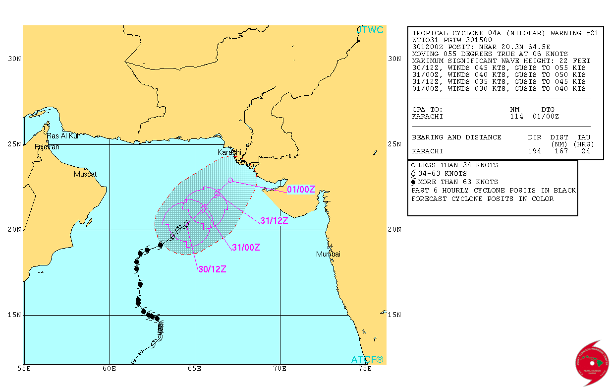
Location at 1200 UTC on 30th October 2014 is Lat. 20.3 N & Long. 64.5 E with 45 knots winds (83 kms./hour on 1 minute average speed basis) and 989 mb. Central Pressure. The System has weakened by 70 knots from its peak. Wave height of 22 feet.
Tropical Cyclone 04A (Nilofar) Warning #21 Issued at 30/1500Z
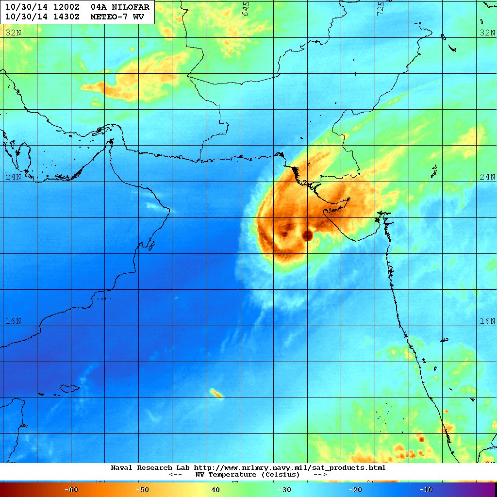
NRL IR Satellite Image of 04A.NILOFAR
Dated 30th October 2014 @ 1430 UTC

NRL Water Vapor Satellite Image of 04A.NILOFAR
Dated 30th October 2014 @ 1430 UTC
| UW-CIMSS Automated Satellite-Based Advanced Dvorak Technique (ADT) Version 8.2.1 Tropical Cyclone Intensity Estimation Algorithm |
|
| Current Intensity Analysis | |
                     UW - CIMSS
              ADVANCED DVORAK TECHNIQUE
                  ADT-Version 8.2.1
         Tropical Cyclone Intensity Algorithm

             ----- Current Analysis -----
     Date :  30 OCT 2014    Time :   140000 UTC
      Lat :   20:25:48 N     Lon :   64:42:19 E


                CI# /Pressure/ Vmax
                3.1 / 995.2mb/ 47.0kt


             Final T#  Adj T#  Raw T#
                2.5     2.4     2.3

 Center Temp :  -1.4C    Cloud Region Temp : -25.3C

 Scene Type : CURVED BAND with 0.29 ARC in MD GRAY
              Maximum CURVED BAND with 0.40 ARC in MD GRAY
               at Lat:  21:13:47 N  Lon:  64:41:59 E

 Positioning Method : FORECAST INTERPOLATION

 Ocean Basin : INDIAN
 Dvorak CI > MSLP Conversion Used : PACIFIC

 Tno/CI Rules : Constraint Limits : 0.7T/6hr
                   Weakening Flag : ON
           Rapid Dissipation Flag : FLAG

 C/K/Z MSLP Estimate Inputs :
  - Average 34 knot radii :   77km
  - Environmental MSLP    : 1009mb

 Satellite Name :    MET7
 Satellite Viewing Angle : 25.5 degrees

****************************************************
|
04A.NILOFAR

Forecast: 30th October to 2nd November 2014
Both major forecast models GFS & ECMWF do not expect the System to make landfall, however, both have differing outcome for distance to landfall.
As per GFS the System has started weakening and is expected to weaken considerably by 31st as it reaches vicinity of Saurashtra & Kutch and remain there for two days till 2nd November as remains of the Cyclone. As per last forecast runs this model also does not expect System to make landfall.
As per ECMWF the System has started weakening and is expected to remain far from Kutch & Saurashtra and dissipate at sea by 2nd November. This model does not expect the System to make landfall.
One thing is certain as per all models that the System is expected to weaken considerably during the next 36 hours. System not expected to make landfall even though it would be in the vicinity of Saurashtra & Kutch. Clouding associated with the System will be over Saurashtra, Kutch & Gujarat and adjoining Northeast Arabian Sea till 2nd November. Scattered showers, light to medium rainfall is expected over parts of Saurashtra & Kutch with isolated heavy rainfall over Kutch and Coastal areas of Saurashtra till 2nd November. Since the System is expected to weaken winds will be lower than expected earlier.
Caution: Please refer/rely on IMD/RSMC Bulletins/Advisories for Storms & Weather related matter.
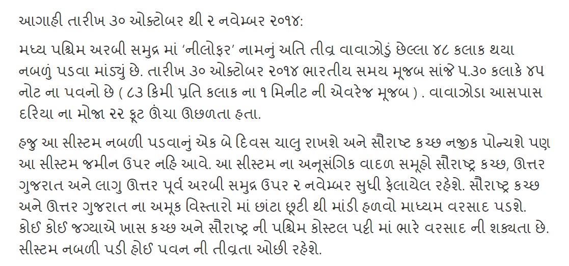
આગાહી તારીખ ૩૦ ઓક્ટોબર થી ૨ નવેમ્બર ૨૦૧૪:
મધ્ય પશ્ચિમ અરબી સમુદ્ર માં ‘નીલોફર’ નામનું અતિ તીવ્ર વાવાઝોડું છેલ્લા ૪૮ કલાક થયા નબળું પડવા માંડ્યું છે. તારીખ ૩૦ ઓક્ટોબર ૨૦૧૪ ભારતીય સમય મૂજબ સાંજે ૫.૩૦ કલાકે ૪૫ નોટ ના પવનો છે ( ૮૩ કિમી પ્રતિ કલાક ના ૧ મિનીટ ની એવરેજ મૂજબ ) . વાવાઝોડા આસપાસ દરિયા ના મોજા ૨૨ ફૂટ ઊંચા ઊછળતા હતા.
હજુ આ સીસ્ટમ નબળી પડવાનું એક બે દિવસ ચાલુ રાખશે અને સૌરાષ્ટ કચ્છ નજીક પોન્ચશે પણ આ સીસ્ટમ જમીન ઉપર નહિ આવે. આ સીસ્ટમ ના અનૂસંગિક વાદળ સમૂહો સૌરાષ્ટ્ર કચ્છ, ઊત્તર ગુજરાત અને લાગુ ઊત્તર પૂર્વ અરબી સમુદ્ર ઉપર ૨ નવેમ્બર સુધી ફેલાયેલ રહેશે. સૌરાષ્ટ્ર કચ્છ અને ઊત્તર ગુજરાત ના અમૂક વિસ્તારો માં છાંટા છૂટી થી માંડી હળવો માધ્યમ વરસાદ પડશે. કોઈ કોઈ જગ્યાએ ખાસ કચ્છ અને સૌરાષ્ટ્ર ની પશ્ચિમ કોસ્ટલ પટ્ટી માં ભારે વરસાદ ની શક્યતા છે. સીસ્ટમ નબળી પડી હોઈ પવન ની તીવ્રતા ઓછી રહેશે.
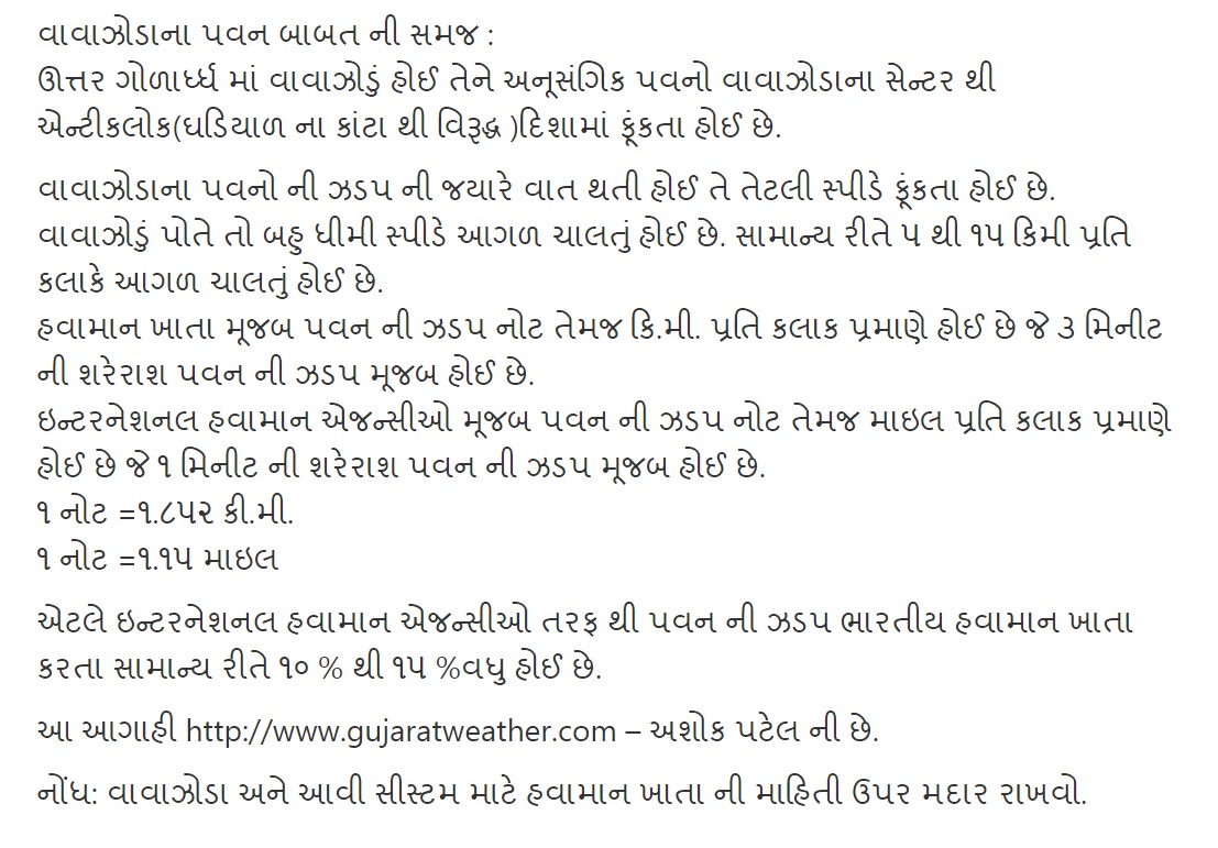
વાવાઝોડાના પવન બાબત ની સમજ :
ઊત્તર ગોળાર્ધ્ધ માં વાવાઝોડું હોઈ તેને અનૂસંગિક પવનો વાવાઝોડાના સેન્ટર થી એન્ટીકલોક(ઘડિયાળ ના કાંટા થી વિરૂદ્ધ )દિશામાં ફૂંકતા હોઈ છે.
વાવાઝોડાના પવનો ની ઝડપ ની જયારે વાત થતી હોઈ તે તેટલી સ્પીડે ફૂંકતા હોઈ છે. વાવાઝોડું પોતે તો બહુ ધીમી સ્પીડે આગળ ચાલતું હોઈ છે. સામાન્ય રીતે ૫ થી ૧૫ કિમી પ્રતિ કલાકે આગળ ચાલતું હોઈ છે. હવામાન ખાતા મૂજબ પવન ની ઝડપ નોટ તેમજ કિ.મી. પ્રતિ કલાક પ્રમાણે હોઈ છે જે ૩ મિનીટ ની શરેરાશ પવન ની ઝડપ મૂજબ હોઈ છે. ઇન્ટરનેશનલ હવામાન એજન્સીઓ મૂજબ પવન ની ઝડપ નોટ તેમજ માઇલ પ્રતિ કલાક પ્રમાણે હોઈ છે જે ૧ મિનીટ ની શરેરાશ પવન ની ઝડપ મૂજબ હોઈ છે. ૧ નોટ =૧.૮૫૨ કી.મી. ૧ નોટ =૧.૧૫ માઇલ
એટલે ઇન્ટરનેશનલ હવામાન એજન્સીઓ તરફ થી પવન ની ઝડપ ભારતીય હવામાન ખાતા કરતા સામાન્ય રીતે ૧૦ % થી ૧૫ %વધુ હોઈ છે.
આ આગાહી http://www.gujaratweather.com – અશોક પટેલ ની છે.
નોંધ: વાવાઝોડા અને આવી સીસ્ટમ માટે હવામાન ખાતા ની માહિતી ઉપર મદાર રાખવો.