Current Weather Conditions on 6th October 2014 @ 7.00 am.
Yesterday the Southwest Monsoon had further withdrawn from remaining parts of Jammu & Kashmir, Himachal Pradesh, West Uttar Pradesh, Saurashtra & Gujarat; entire Uttarakhand; some parts of East Uttar Pradesh & Madhya Pradesh; some parts of North Madhya Maharashtra & North Konkan and remaining parts of North Arabian Sea.
The withdrawal line of Southwest Monsoon passes through Lat.28°N & Long.82°E, Kheri, Kanpur, Nowgong, Khandwa, Malegaon, Dhanu, Lat.20°N & Long.70°E and Lat.20°N & Long.60°E.
The Withdrawal Of Southwest Monsoon 2014 Till 5th October 2014
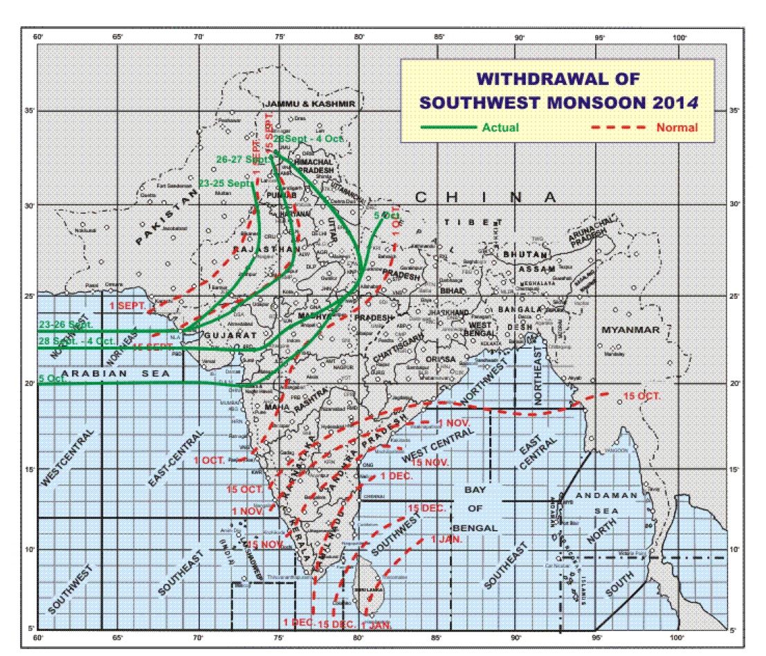
Note: Monsoon has withdrawn from areas West of the latest Green line.
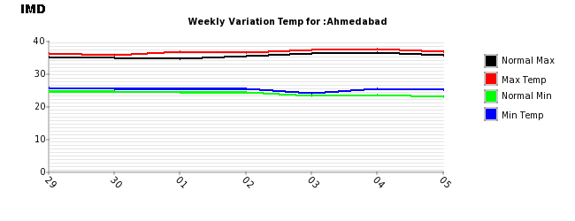
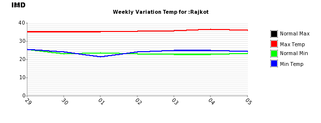
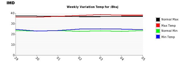
The thunder activity over Saurashtra & Gujarat has decreased during the last few days and has now stopped over most areas of Saurashtra & Gujarat. The Maximum and Minimum Temperature over most parts of Saurashtra, Gujarat & Kutch has been 1 to 2 Degrees above normal for this time of the year.
Weekly Temperature Variation for Ahmedabad Till 5th October 2014
Weekly Temperature Variation for Rajkot Till 5th October 2014
Weekly Temperature Variation for Bhuj Till 5th October 2014
The Western Disturbance as an Upper Air System would affect Western Himalayan region from 7th October onwards.
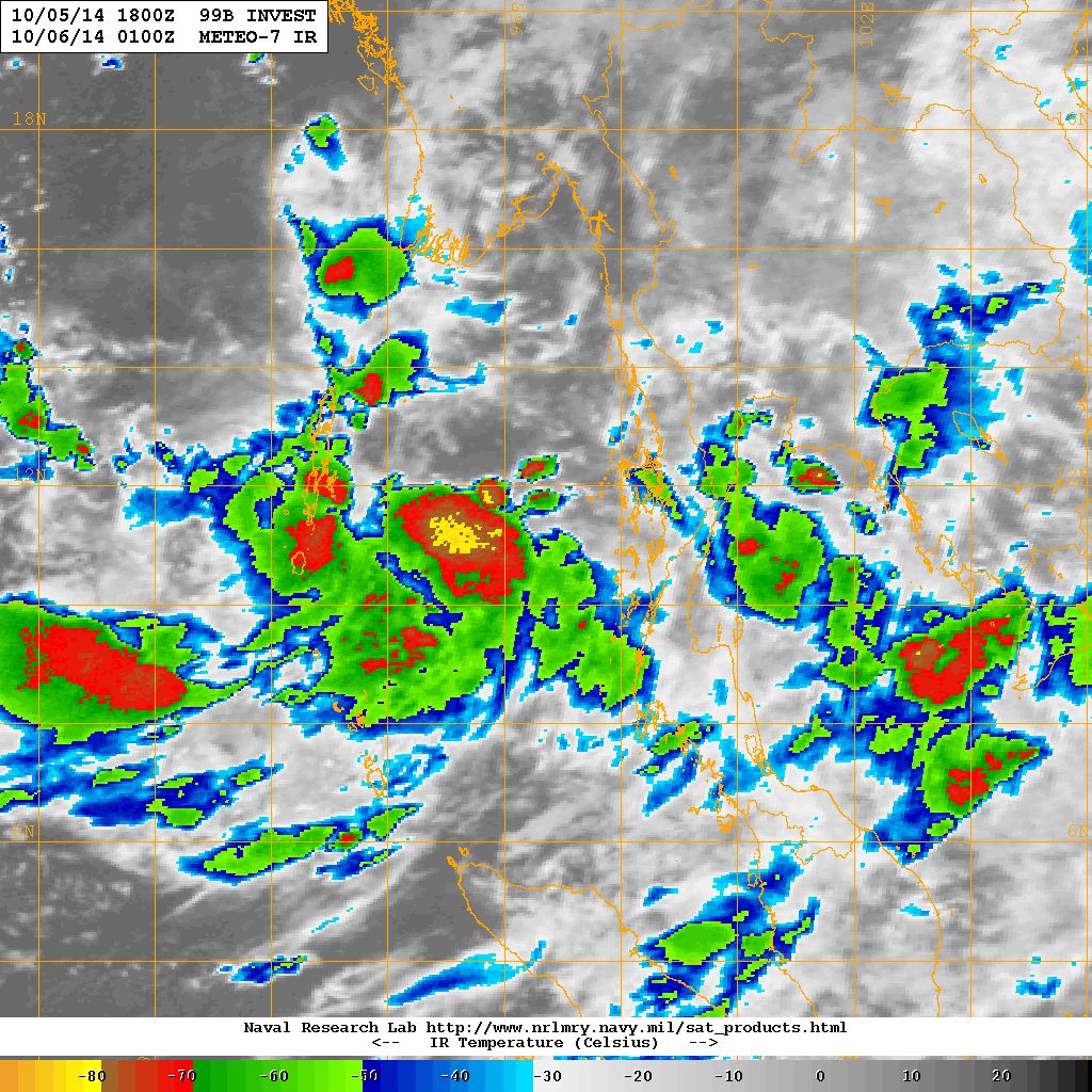
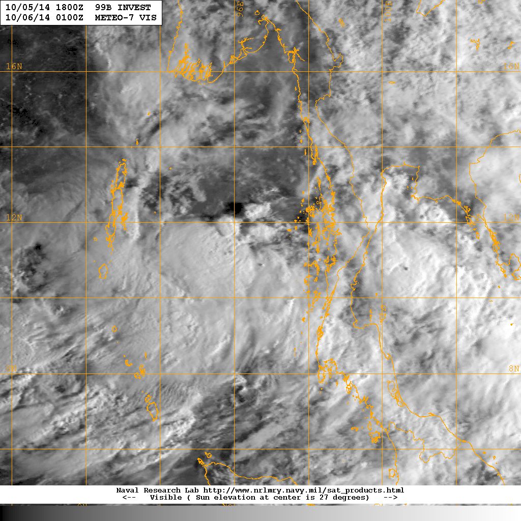
There was an Upper Air Cyclonic Circulation over Gulf of Siam and neighborhood extending up to Mid-Tropospheric levels. Under its influence, a Low Pressure area has formed over North Andaman Sea. NRL has started monitoring this as 99B.INVEST from 5-10-2014 @ 12.30 UTC. Last location was Lat. 11.0°N & Long. 96.7°E with 20 knots wind speed and 1007 mb. Pressure.
NRL IR Satellite Image of 99B.INVEST (Low Pressure)
on 6th October 2014 @ 01.00 UTC (6.30 am. IST )
NRL Visible Satellite Image of 99B.INVEST (Low Pressure)
on 6th October 2014 @ 01.00 UTC (6.30 am. IST )
Forecast: 6th October to 12th October 2014
There is an Upper Air instability over some parts of Saurashtra & Gujarat which will prevail till 8th October. However, mainly dry weather is expected for Saurashtra, Gujarat & Kutch. The Maximum Temperature over Saurashtra & Gujarat is expected to remain higher than normal and could increase by 1 to 2 Degrees during the forecast period.
Low Pressure – 99B.INVEST:
The Low Pressure area over the North Andaman Sea is expected to strengthen further to a Well Marked Low Pressure and then into a Depression during the next two days as it tracks towards the Bay of Bengal. Various forecast models have different tracks for this System. Updates will be given as & when more clarity of track is available.
Note: Refer/Rely on IMD/RSMC Bulletins/Advisories
તારીખ ૬ ઓક્ટોબર ૨૦૧૪:
દક્ષીણ પશ્ચિમ ચોમાસું સમગ્ર સૌરાષ્ટ્ર અને ગુજરાત માં થી વિદાય લીધી છે. ભારત ના બીજા ભાગો માંથી ચોમાસા એ વિદાય લીધી છે તે ઉપર આપેલ નકશામાં લીલી લીટી થી દર્શાવેલ છે. ઉપર ના નકશા માં દર્શાવેલ લીલી લીટી થી પશ્ચિમે ચોમાસા ની વિદાય થઇ ગઈ છે.
સૌરાષ્ટ્ર અને ગુજરાત માં ઠંડર એક્ટીવીટી ઓછી થઇ છે. મહતમ તેમજ ન્યુનતમ તાપમાન નોર્મલ થી એક બે ડીગ્રી ઊંચું રહે છે.
ઊત્તર ભારત માં તારીખ ૭ ઓક્ટોબર થી વેસ્ટર્ન ડિસ્ટર્બંન્સ ની અસર જોવા મળશે.
સિયામી દરિયા માં એક UAC હતું તે હવે નોર્થ આંદામાન સી માં લો પ્રેસર માં પરિવર્તિત થયું છે.
આગાહી: તારીખ ૬ થી ૧૨ ઓક્ટોબર ૨૦૧૪
સૌરાષ્ટ્ર ગુજરાત અને કચ્છ માં મુખ્યત્વે સુકું રહેશે. મહત્તમ તાપમાન માં હજુ એક થી બે ડીગ્રી નો વધારો આગાહી ના સમય ગાળા માં થશે.
લો પ્રેસર:
આ સીસ્ટમ આવતા બે દિવસ માં મજબૂત થશે. દર એક બે દિવસે અપડેટ આપવામાં આવશે.
Scroll Up