Current Weather Conditions on 21st July 2014 @ 2.00 pm.
Rainfall over Saurashtra & Gujarat and Kutch has stopped or become minimal from 19th till today the 21st July.
The UAC over Bay of Bengal has strenghtend to a Low Pressure over North Bay of Bengal on Sunday the 20th July. Today this Low Pressure was over North Bay of Bengal and adjoining areas of Gangetic West Bengal and Odisha has rapidly concentrated into a Depression and was located this morning of 21st July 2014 over Northeastern parts of Odisha and adjoining areas of Gangetic West Bengal near Lat. 22°N/ Long. 87°E.
The axis of monsoon trough at mean sea level now passes through Ferozepur, Delhi, Hardoi, Daltonganj, centre of Depression and thence southeastwards to east central Bay of Bengal. It extends upto 1.5 kms above sea level passing across the same region.
The offshore trough at mean sea level now extends from north Maharashtra coast to Karnataka coast.
IMD Weather Chart of 500 hPa Valid for 00 UTC 23rd July 2014

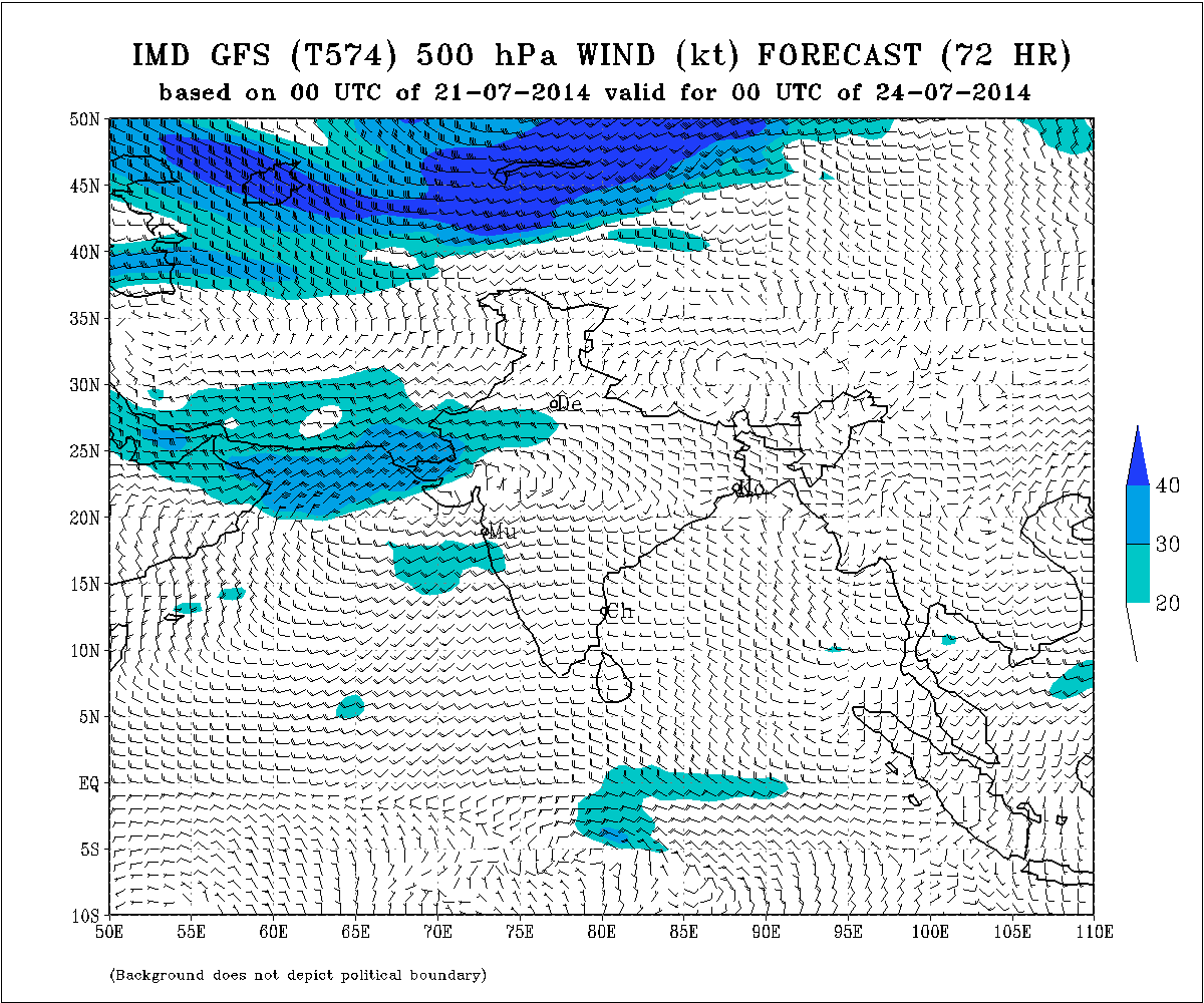
IMD Weather Chart of 500 hPa Valid for 00 UTC 24th July 2014
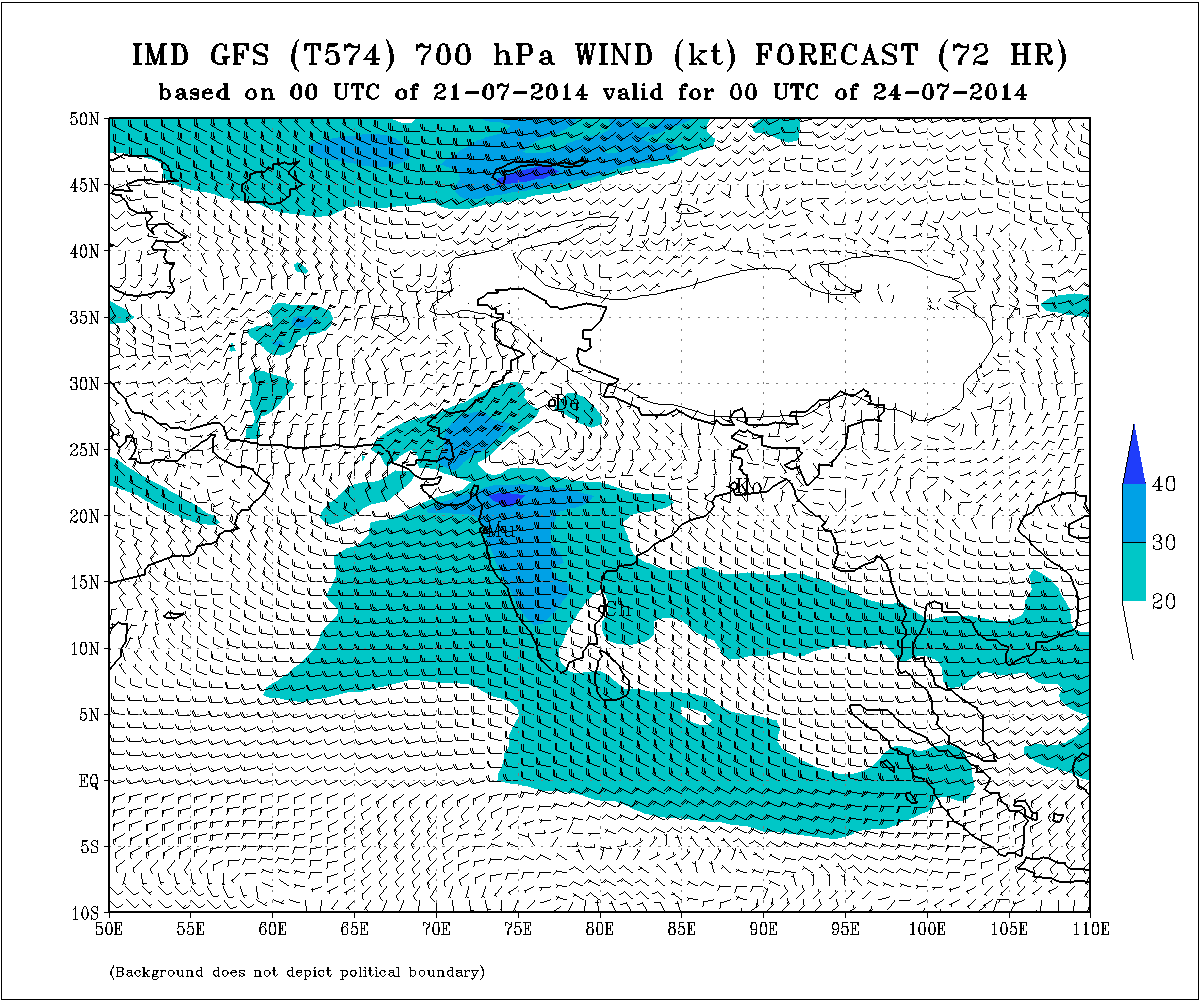
IMD Weather Chart of 700 hPa Valid for 00 UTC 24th July 2014
Forecast: 21st to 24th July 2014
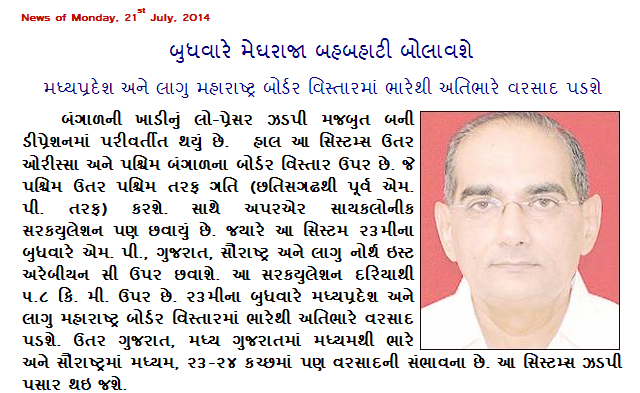
Heavy rainfall for Madhya Pradesh and adjoining border areas of Maharashtra State.
Scattered.
South Gujarat will receive rain on 22nd to 24th July
North Gujarat & Central Gujarat will receive Heavy rainfall mainly on 23rd/24th July.
Saurashtra will receive medium rainfall mainly on 23rd/24th July.
Kutch expected to receive rainfall on 23rd/24th July.
Weather Forecast In Akila Daily Dated 21st July 2014
Scroll Up