Current Weather Conditions on 19th July 2014 @ 2.00 pm.
સૌરાષ્ટ્ર અને ઉપર છવાયેલ અપાર એર સાયક્લોનિક સર્કુલેસન હવે નબળું પડ્યું છે.
આવતી કાલ થી બે ત્રણ દિવસ વરસાદ ની માત્ર અને વિસ્તાર ઘટશે.
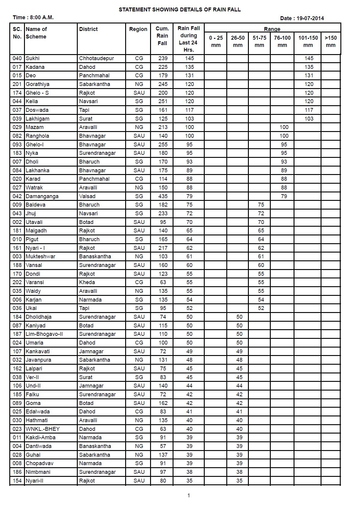
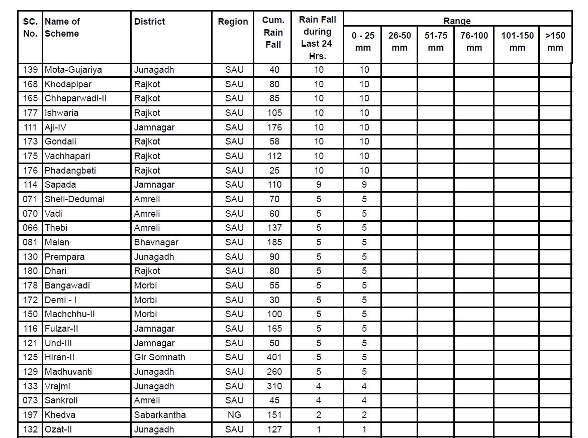
સૌરાષ્ટ્ર કચ્છ ના ડેમ વિસ્તાર ઉપર પડેલ વરસાદ ની વિગતો આપેલ છે.
There has been a good round of Rainfall over Saurashtra & Gujarat during the period 12th to 18th July. Also there has been rainfall over many places in Kutch during last two days.
The axis of monsoon trough at mean sea level now passes through Ganganagar, Narnaul, Hamirpur, Churk, Daltonganj, Bankura, Canning Town and thence Southeastwards to East Central Bay of Bengal. It extends upto 1.5 kms above sea level passing across the same region.
The Low pressure area over southwest Uttar Pradesh and neighborhood has become less marked. However, the associated Cyclonic Circulation now lies over Central parts of Uttar Pradesh and extends upto 3.6 kms above sea level.
The offshore trough at mean sea level from Gujarat coast to Karnataka coast persists.
There is an Upper Air Cyclonic Circulation between 1.5 & 5.8 kms above sea level over North Bay of Bengal and neighborhood. Under it’s influence a Low Pressure area may form over North Bay of Bengal during next 24 hours.
The cyclonic circulation over Gujarat and neighborhood has become less marked.
Cumulative as well as last 24 hours Rainfall over various Dams of Saurashtra & Gujarat till 19th July 8.00 am.

IMD Weather Chart of 700 hPa Valid for 00 UTC 21st July 2014

IMD Weather Chart of 700 hPa Valid for 00 UTC 22nd July 2014
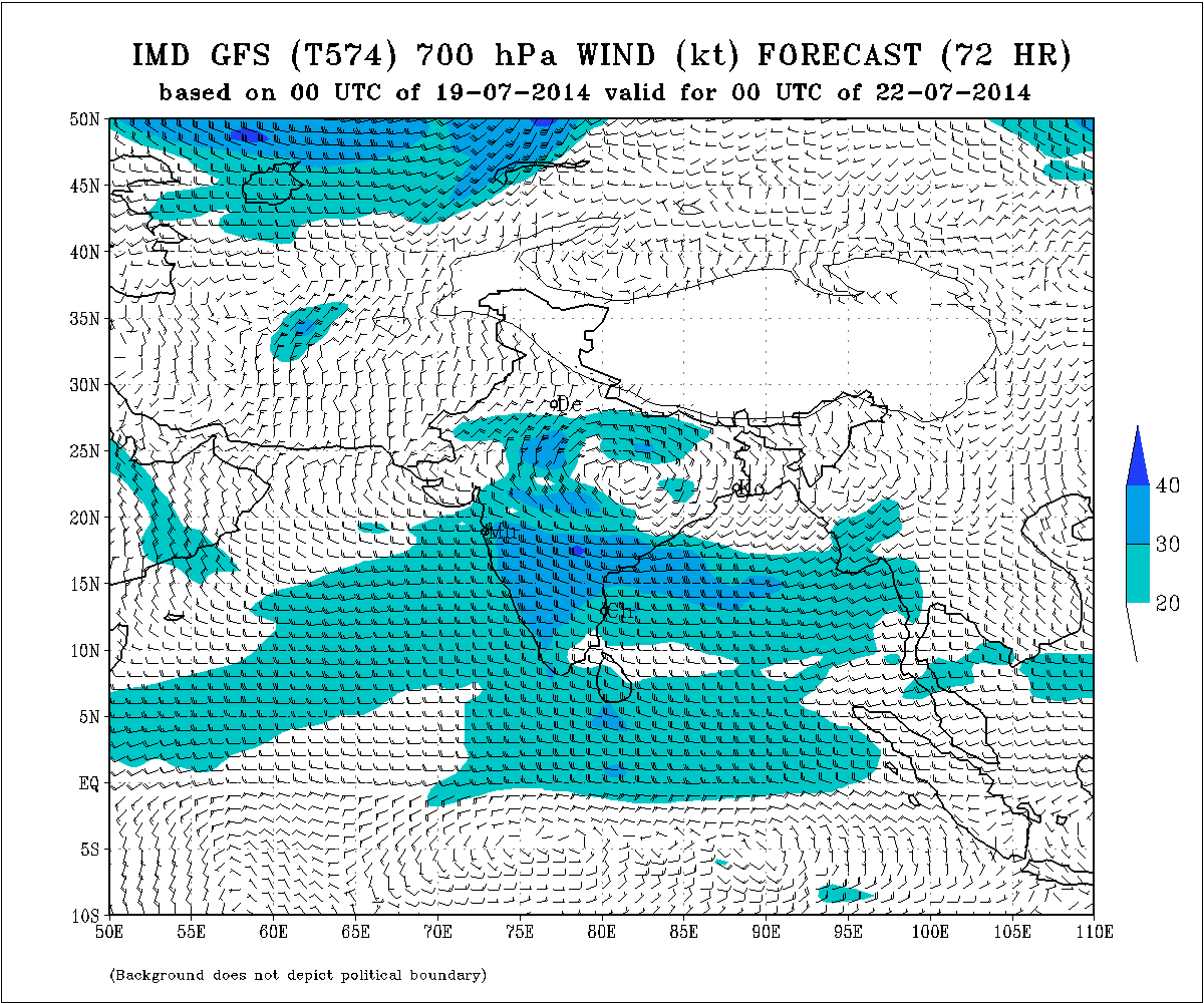
Forecast: 19th to 22nd July 2014
Scattered rainfall on 19th over Eastern Saurashtra, Gujarat. Rain quantity and rainfall area will decrease from tomorrow till 22nd July.
The Upper Air Cyclonic Circulation over the North Bay of Bengal is expected to descend to sea level to form a Low Pressure area over the same region. The may no last long but the associated Upper Air Cyclonic Circulation will remain strong and track towards North Chhatishgarh- Eastern Madhya Pradesh and vicinity by 22nd July.
Weather Forecast In Akila Daily Dated 19th July 2014
