Current Weather Conditions on 28th July 2014 @ 7.00 pm.
The Low Pressure area over Northwest Bay of Bengal and neighborhood persists. Associated Cyclonic Circulation extends up to 7.6 kms above sea level tilting southwestwards with height. System is expected to strengthen further during next 24 hours.
The axis of monsoon trough at mean sea level now passes through Anupgarh,
Narnaul, Shivpuri, Umaria, Ambikapur, Jharsuguda, Center of Low Pressure area
and thence Southeastwards to East Central Bay of Bengal. It extends up to 1.5
kms above sea level passing across the same region.
An offshore trough at mean sea level extends from South Gujarat coast to
Karnataka coast.
There is an Upper Air Cyclonic Circulation over Madhya Pradesh and vicinity.
IMD Weather Chart of 500 hPa Valid for 00 UTC 29th July 2014

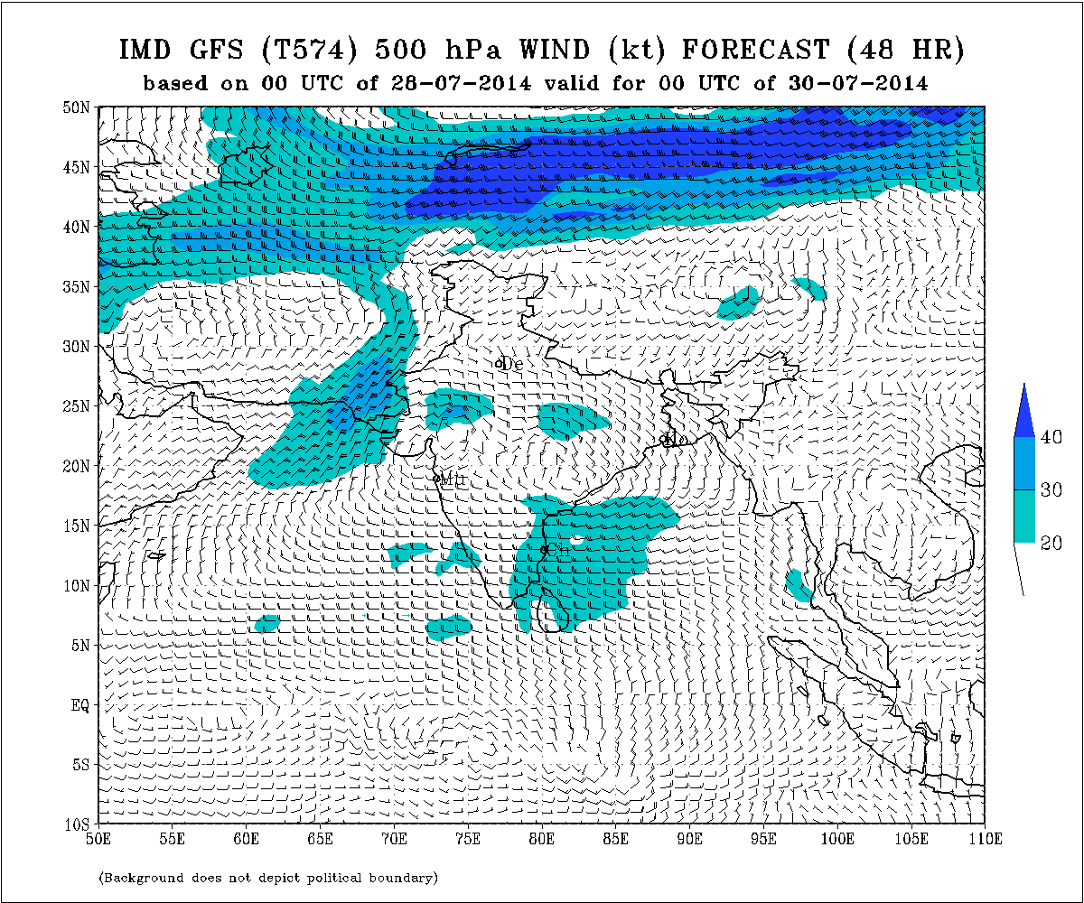
IMD Weather Chart of 500 hPa Valid for 00 UTC 30th July 2014

IMD Weather Chart of 700 hPa Valid for 00 UTC 29th July 2014

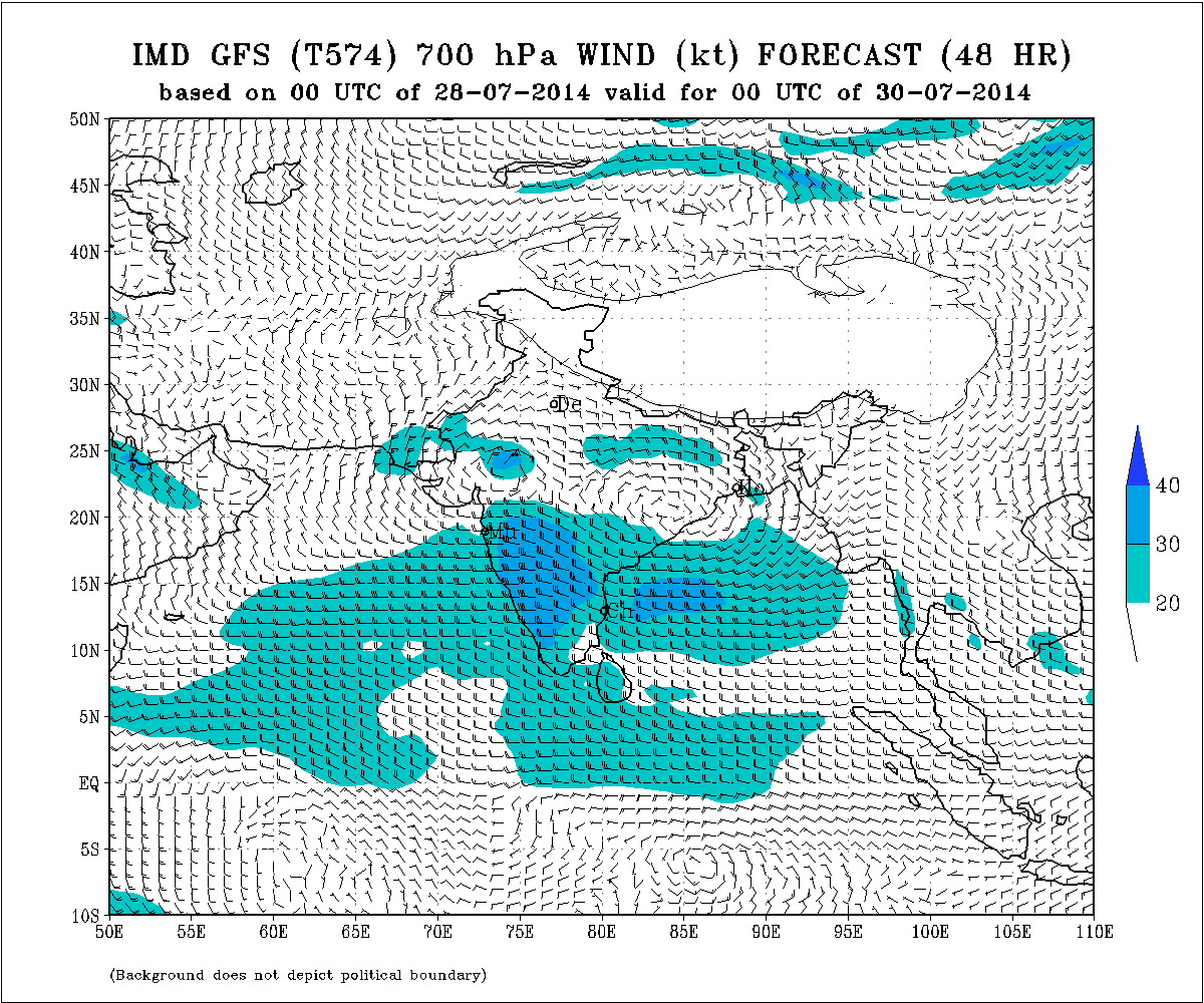
IMD Weather Chart of 700 hPa Valid for 00 UTC 30th July 2014

IMD Weather Chart of 700 hPa Valid for 00 UTC 31st July 2014

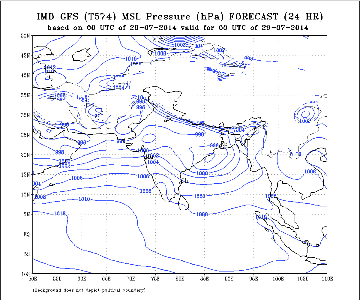
IMD Weather Chart of Mean Sea Level Pressure Valid for 00 UTC 29th July 2014

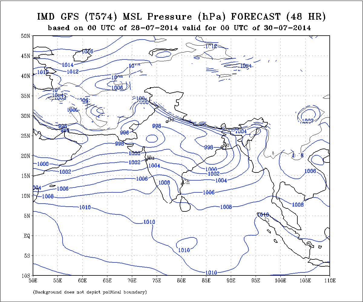
IMD Weather Chart of Mean Sea Level Pressure Valid for 00 UTC 30th July 2014

Forecast: 28th to 1st August 2014
Due to cumulative effects of the UAC over Madhya Pradesh and vicinity and the Bay of Bengal Low Pressure, a good round of rainfall is expected during the forecast period. Current forecast is that there would be heavy Rainfall over Gujarat, North Saurashtra, Coastal Saurashtra and Kutch with few of the places getting very heavy Rainfall. Rest of Saurashtra is expected to to get medium Rainfall during the forecast period.
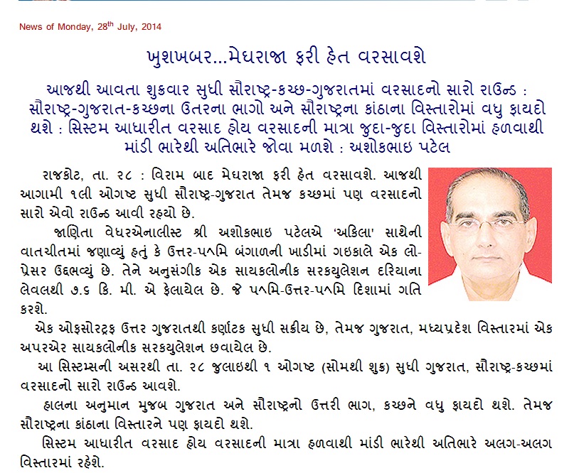
Weather Forecast In Akila Daily Dated 28th July 2014

Scroll Up

