Current Weather Conditions on 16th July 2014 @ 4.00 pm.
૧૨ તારીખે કરેલ આગાહી મૂજમ હજુ વરસાદ નો આ રાઉન્ડ ૧૮/૧૯ તારીખ સુધી રહેશે જે પૈકે ૧૬/૧૭ ના વધુ સારું છે. સૌરાષ્ટ્ર ગુજરાત અને હવે કચ્છ નો પણ વારો આવે તેજુ જણાય છે.
There has been rainfall most parts of Saurashtra during the last four days and over most parts of Gujarat during the last two days.
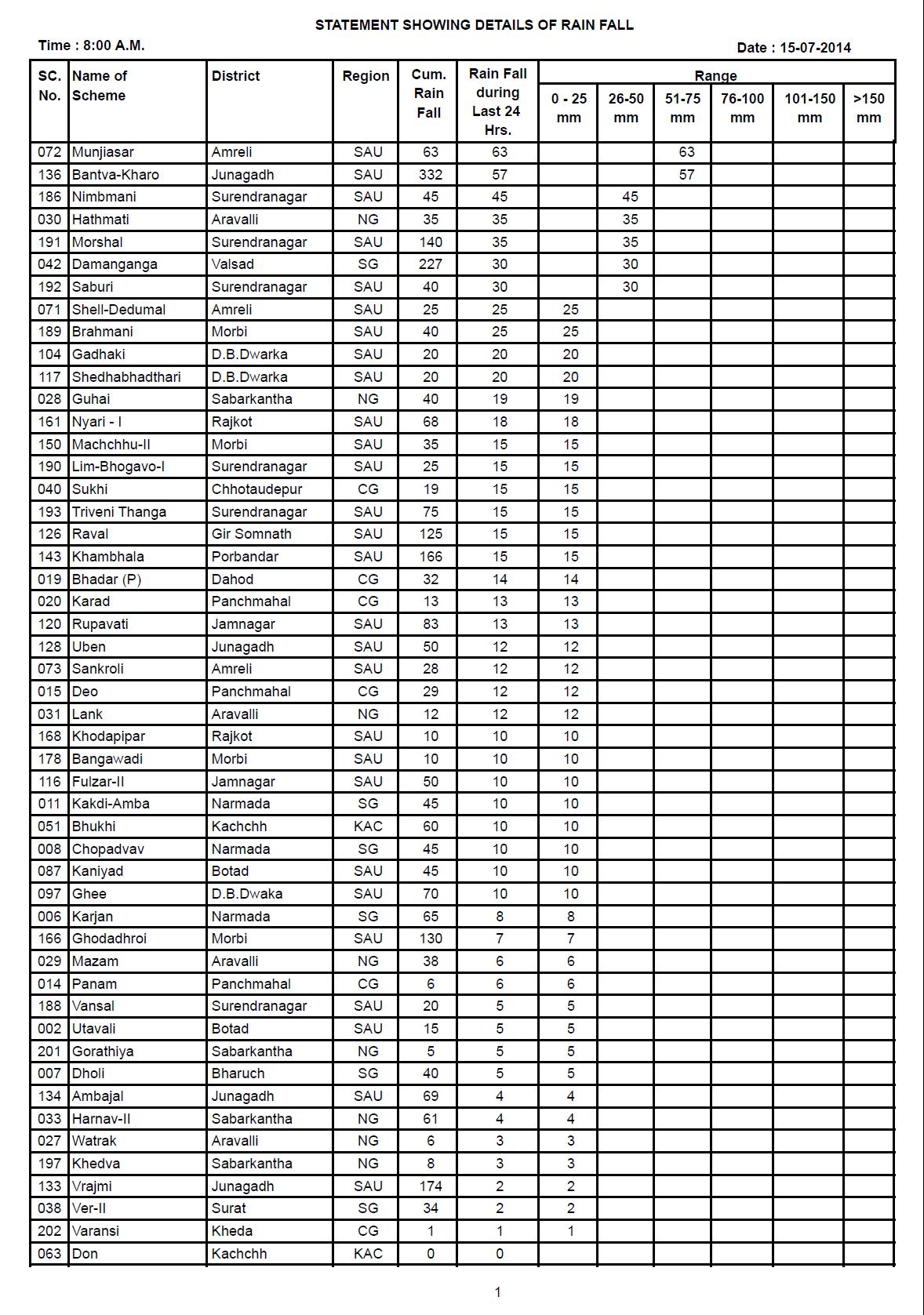
Cumulative as well as last 24 hours Rainfall over various Dams of Saurashtra & Gujarat till 15th July 8.00 am.
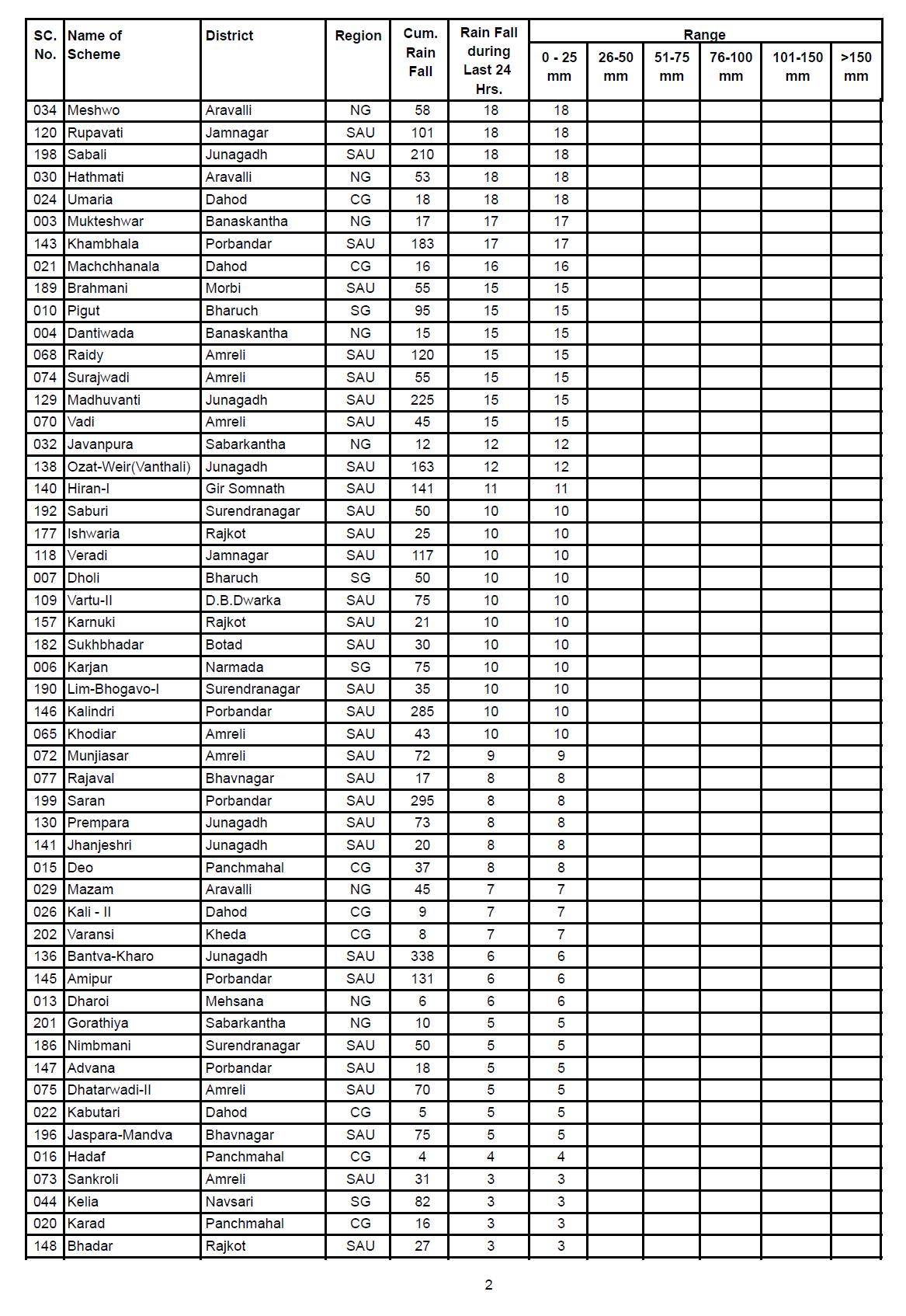
 Cumulative as well as last 24 hours Rainfall over various Dams of Saurashtra & Gujarat till 16th July 8.00 am.
 The Southwest Monsoon has further advanced into remaining parts of east Rajasthan and some more parts of Saurashtra, Gujarat Region and west Rajasthan.
The Northern Limit of Monsoon (NLM) passes through Lat. 21°N / Long. 60°E, Lat.21°N / Long. 65°E, Porbandar, Rajkot, Deesa, Jodhpur and Lat.28°N / Long. 72°E.
Also, conditions are favorable for further advance of Southwest Monsoon into remaining parts of the country during next 48 hours.
The Northern Limit of Monsoon (NLM) continues to pass through Lat. 21°N / Long. 60°E, Lat.21°N / Long. 65°E, Veraval, Surat, Indore, Shivpuri, Alwar, Bikaner and Lat.28°N / Long. 72°E.
The Low pressure area over Northern parts of Odisha and adjoining Chhattisgarh now lies over North Central Madhya Pradesh and neighborhood. Associated cyclonic circulation extends upto 4.5 kms above sea level.
The trough at mean sea level extending upto 1.5 kms above sea level now runs from North Rajasthan to East Central Bay of Bengal across northwest Madhya Pradesh, Center of Low Pressure area, North Chhattisgarh and Odisha.
The offshore trough at mean sea level from Gujarat coast to Kerala coast persists.
The cyclonic circulation between 3.1 & 5.8 kms a.s.l. over northeast Arabian Sea and adjoining Gujarat persists.
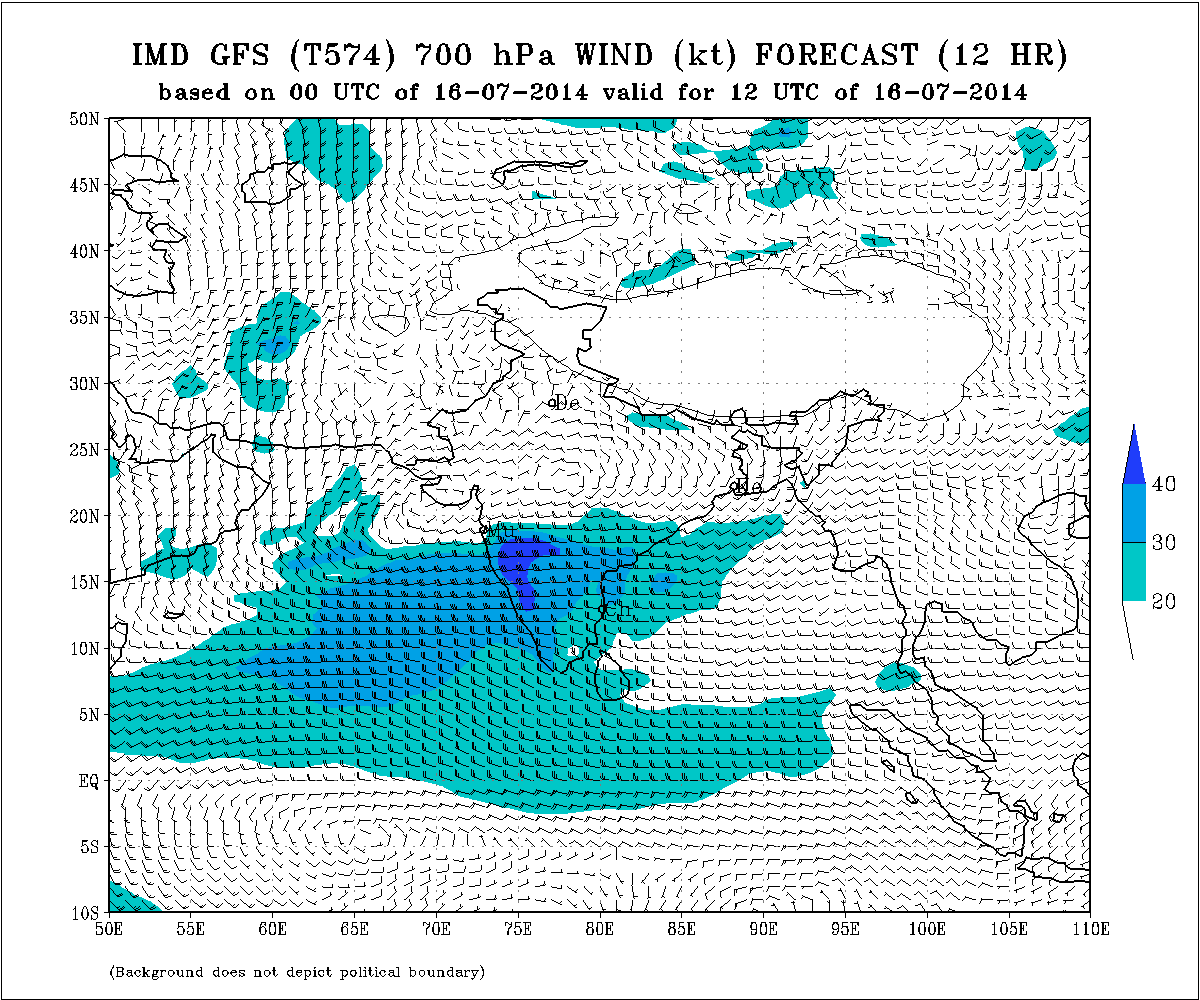
IMD Weather Chart of 700 hPa Valid for 12 UTC 16th July 2014
IMD Weather Chart of 700 hPa Valid for 00 UTC 17th July 2014

IMD Weather Chart of 700 hPa Valid for 00 UTC 18th July 2014
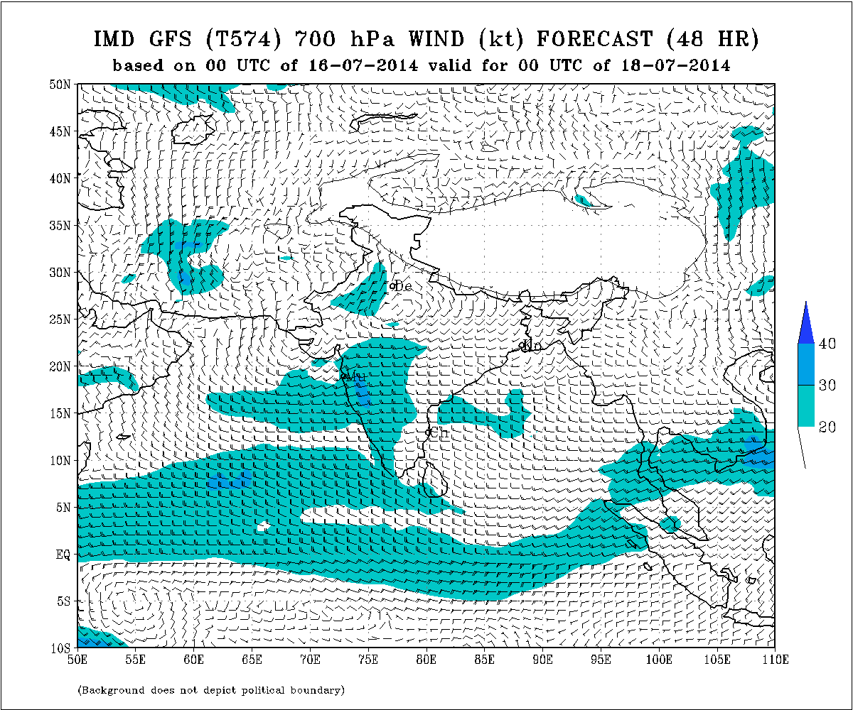
The two UAC have Merged into a broad Upper Air Cyclonic Circulation spread over Madhya pradesh till Gujarat and Saurashtra and parts of North East Arabian Sea. As per the Charts above the UAC over Madhya Pradesh will move Northwards while the UAC over the Arabian Sea and Saurashtra will remain in vicinity of Saurashtra, Gujarat and Kutch for two more days.
Forecast: Till 18th/19th July 2014
Medium to Heavy Rainfall will continue over Saurashtra & Gujarat as had been forecast on 12th July. Main rainfall quantum expected on 16th and 17th July. Kutch will also get rainfall.
Southwest Monsoon expected to cover the entire Country by 18th July.
Weather Forecast In Akila Daily Dated 16th July 2014
Scroll Up