Lottery Rainfall Round Expected Over Gujarat Region During 31st May–4th June | Temperature Likely To Reduce By 2°C To 39°C–42°C Range Over Saurashtra, Gujarat & Kutch
31 મે થી 4 જૂન દરમિયાન ગુજરાત રિજિયન માટે લોટરી વરસાદી રાઉન્ડની શક્યતા | સૌરાષ્ટ્ર, ગુજરાત અને કચ્છમાં તાપમાનમાં 2°C ઘટાડા સાથે 39°C થી 42°C રેન્જ રહેવાની શક્યતા
Gujarat Temperature Observations (28th May 2026)
Maximum temperatures were around 1.5°C to 3°C above normal across many hot centers of Gujarat State.
- Rajkot: 43.6°C (2.8°C above normal)
- Deesa: 42.2°C (1.2°C above normal)
- Amreli: 41.9°C (1.4°C above normal)
- Ahmedabad: 44.4°C (2.5°C above normal)
- Bhavnagar: 42.8°C (2.7°C above normal)
- Surendranagar: 44.7°C (2.3°C above normal)
Current normal maximum temperatures across most parts of Gujarat are around 40.5°C to 42°C.
Few Parameters From IMD Bulletin
The Northern Limit of Monsoon (NLM) continues to pass through:
9°N/60°E, 8.5°N/65°E, 8°N/70°E, 7.5°N/75°E, 8°N/80°E, 11°N/85°E, 15°N/90°E, 19°N/95°E and 21°N/97°E.
Conditions are favorable for further advance of the Southwest Monsoon into some more parts of the southwest & southeast Arabian Sea, Lakshadweep area, southwest, east-central & west-central Bay of Bengal, remaining parts of southeast Bay of Bengal and some parts of northeast Bay of Bengal during the next 2–3 days.
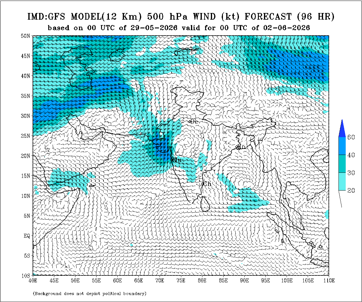
A Western Disturbance is seen as a trough in middle tropospheric westerlies with its axis at 5.8 km above mean sea level roughly along Longitude 74°E to the north of Latitude 32°N.
An upper air cyclonic circulation lies over Central Pakistan and adjoining areas extending up to 1.5 km above mean sea level.
A trough also runs from the cyclonic circulation over Central Pakistan to another cyclonic circulation over north interior Odisha across Rajasthan, Madhya Pradesh and north Chhattisgarh at 0.9 km above mean sea level.
Weather Forecast For Saurashtra, Gujarat & Kutch (29th May to 4th June 2026)
Wind Pattern
- Winds will predominantly remain from the Southwest direction.
- Wind speeds during the first two days are expected to remain around 15–25 km/hour with gusts reaching 25–35 km/hour.
- Subsequently, from around 31st May or 1st June onwards, wind patterns will vary depending upon upper atmospheric instability over different parts of Gujarat State.
Rainfall Forecast
Forecast Period: 29th May to 4th June 2026
A Lottery Rainfall Round is expected during the forecast period.
Gujarat Region:
Light to moderate rainfall is likely over scattered areas during 31st May to 4th June.
Saurashtra & Kutch:
Light showers/rain are likely on one or two days over different isolated areas during 31st May to 4th June.
Temperature Outlook
Maximum temperatures are expected to decline by around 2°C and move closer to near-normal levels during the forecast period.
Most hot centers across Gujarat are likely to record maximum temperatures in the range of 39°C to 42°C on most days during the forecast period.
Day-to-day fluctuations of around 1°C to 2°C are likely.
Summary:
Maximum temperatures across many parts of Gujarat remained above normal on 28th May 2026, with several centers recording temperatures between 42°C and 45°C. Maximum temperature expected to decrease by 2°C during the forecast period.
A “Lottery Rainfall Round” is expected during the period 31st May to 4th June 2026, where scattered areas of Gujarat Region may receive light/moderate rainfall and isolated heavy rainfall while Saurashtra & Kutch may receive isolated showers/light rainfall.
31 મે થી 4 જૂન દરમિયાન ગુજરાત રિજિયન માટે લોટરી વરસાદી રાઉન્ડની શક્યતા | સૌરાષ્ટ્ર, ગુજરાત અને કચ્છમાં તાપમાનમાં 2°C ઘટાડા સાથે 39°C થી 42°C રેન્જ રહેવાની શક્યતા
ગુજરાત તાપમાન અવલોકન (28 મે 2026)
ગુજરાત રાજ્યના ઘણા ગરમ કેન્દ્રોમાં મહત્તમ તાપમાન નોર્મલ કરતાં આશરે 1.5°C થી 3°C વધુ નોંધાયું હતું.
- રાજકોટ: 43.6°C (નોર્મલ કરતાં 2.8°C વધુ)
- ડીસા: 42.2°C (નોર્મલ કરતાં 1.2°C વધુ)
- અમરેલી: 41.9°C (નોર્મલ કરતાં 1.4°C વધુ)
- અમદાવાદ: 44.4°C (નોર્મલ કરતાં 2.5°C વધુ)
- ભાવનગર: 42.8°C (નોર્મલ કરતાં 2.7°C વધુ)
- સુરેન્દ્રનગર: 44.7°C (નોર્મલ કરતાં 2.3°C વધુ)
હાલ ગુજરાતના મોટા ભાગના વિસ્તારોમાં નોર્મલ મહત્તમ તાપમાન આશરે 40.5°C થી 42°C આસપાસ છે.
IMD બુલેટિનના કેટલાક મહત્વના પરિબળો
મોન્સૂનની ઉત્તર સીમા (NLM) હાલમાં નીચે મુજબ પસાર થાય છે:
9°N/60°E, 8.5°N/65°E, 8°N/70°E, 7.5°N/75°E, 8°N/80°E, 11°N/85°E, 15°N/90°E, 19°N/95°E અને 21°N/97°E.
આગામી 2–3 દિવસ દરમિયાન દક્ષિણ પશ્ચિમ મોન્સૂનના વધુ આગળ વધવા માટે પરિસ્થિતિ અનુકૂળ બની રહી છે. મોન્સૂન દક્ષિણ પશ્ચિમ અને દક્ષિણ પૂર્વ અરબી સમુદ્રના વધુ વિસ્તારો, લક્ષદ્વીપ વિસ્તાર, દક્ષિણ પશ્ચિમ, મધ્ય પૂર્વ અને મધ્ય પશ્ચિમ બંગાળની ખાડી, દક્ષિણ પૂર્વ બંગાળની ખાડીના બાકીના વિસ્તારો તેમજ ઉત્તર પૂર્વ બંગાળની ખાડીના કેટલાક વિસ્તારોમાં આગળ વધી શકે છે.
વેસ્ટર્ન ડિસ્ટર્બન્સ હાલ મધ્ય ટ્રોપોસ્ફેરિક પશ્ચિમ પવનોમાં ટ્રફ સ્વરૂપે જોવા મળે છે, જેની ધરી સરેરાશ સમુદ્ર સપાટીથી 5.8 કિમી ઊંચાઈએ આશરે 74°E રેખાંશ અને 32°N અક્ષાંશના ઉત્તર તરફ સ્થિત છે.
મધ્ય પાકિસ્તાન અને આસપાસના વિસ્તારો ઉપર એક અપર એર સાયક્લોનિક સર્ક્યુલેશન આવેલું છે, જે સરેરાશ સમુદ્ર સપાટીથી 1.5 કિમી સુધી વિસ્તરેલું છે.
બીજું એક ટ્રફ મધ્ય પાકિસ્તાનના સાયક્લોનિક સર્ક્યુલેશનથી લઈને ઉત્તર આંતરિક ઓડિશાના સાયક્લોનિક સર્ક્યુલેશન સુધી રાજસ્થાન, મધ્ય પ્રદેશ અને ઉત્તર છત્તીસગઢ મારફતે 0.9 કિમી ઊંચાઈએ પસાર થાય છે.
સૌરાષ્ટ્ર, ગુજરાત અને કચ્છ માટે હવામાન આગાહી (29 મે થી 4 જૂન 2026)
પવન પેટર્ન
- પવનો મુખ્યત્વે દક્ષિણ પશ્ચિમ દિશાના રહેશે.
- પ્રથમ બે દિવસ દરમિયાન પવનની ઝડપ આશરે 15–25 કિમી/કલાક રહેવાની શક્યતા છે અને ઝાટકાવાળા પવનો 25–35 કિમી/કલાક સુધી પહોંચી શકે છે.
- ત્યારબાદ 31 મે અથવા 1 જૂનથી રાજ્યના વિવિધ વિસ્તારોમાં ઉપરના વાતાવરણની અસ્થિરતાને આધારે પવનની દિશા અને ગતિમાં ફેરફાર જોવા મળી શકે છે.
વરસાદની આગાહી
આગાહી સમયગાળો: 29 મે થી 4 જૂન 2026
આ આગાહી સમયગાળા દરમિયાન “લોટરી વરસાદી રાઉન્ડ” ની શક્યતા છે.
ગુજરાત રિજિયન:
31 મે થી 4 જૂન દરમિયાન છૂટાછવાયા વિસ્તારોમાં હળવાથી મધ્યમ વરસાદની શક્યતા છે તેમજ ઇસોલેટેડ વિસ્તાર માં ભારે વરસાદ ની શક્યતા છે.
સૌરાષ્ટ્ર અને કચ્છ:
31 મે થી 4 જૂન દરમિયાન અલગ અલગ એકલ-દોકલ વિસ્તારોમાં એકાદ-બે દિવસ હળવા ઝાપટાં/વરસાદની શક્યતા છે.
તાપમાન અંગે અનુમાન
આગાહી સમયગાળા દરમિયાન મહત્તમ તાપમાનમાં આશરે 2°C ઘટાડો થવાની શક્યતા છે અને તાપમાન નોર્મલ નજીક પહોંચે તેવી શક્યતા છે.
ગુજરાતના મોટાભાગના ગરમ કેન્દ્રોમાં આગાહી સમયગાળા દરમિયાન મોટાભાગના દિવસોમાં મહત્તમ તાપમાન 39°C થી 42°C ની રેન્જમાં રહેવાની શક્યતા છે.
દિવસ પ્રમાણે તાપમાનમાં આશરે 1°C થી 2°C નો ફેરફાર શક્ય છે.
સારાંશ:
28 મે 2026ના રોજ ગુજરાતના ઘણા વિસ્તારોમાં મહત્તમ તાપમાન નોર્મલ કરતાં વધુ રહ્યું હતું અને કેટલાક કેન્દ્રોમાં 42°C થી 45°C વચ્ચે નોંધાયું હતું. આગાહી સમયગાળા દરમિયાન મહત્તમ તાપમાનમાં આશરે 2°C ઘટાડો થવાની શક્યતા છે.
31 મે થી 4 જૂન 2026 દરમિયાન “લોટરી વરસાદી રાઉન્ડ” ની શક્યતા છે, જેમાં ગુજરાત રિજિયનના છૂટાછવાયા વિસ્તારોમાં હળવાથી મધ્યમ વરસાદ તથા ક્યાંક ભારે વરસાદ પડી શકે છે, જ્યારે સૌરાષ્ટ્ર અને કચ્છમાં અલગ અલગ વિસ્તારોમાં હળવા ઝાપટાં/હળવા વરસાદની શક્યતા છે.
IMD નો સુધારેલ લાંબા ગાળાનો અંદાજ (LRF) – દક્ષિણ પશ્ચિમ ચોમાસું 2026
ભારતીય હવામાન વિભાગ (IMD) એ 2026 ના દક્ષિણ પશ્ચિમ ચોમાસા (જૂનથી સપ્ટેમ્બર) માટેનો સુધારેલ લાંબા ગાળાનો અંદાજ (LRF) જાહેર કર્યો છે. આ અંદાજ મુજબ સમગ્ર દેશ માટે મોસમી વરસાદ લાંબા ગાળાની સરેરાશ (LPA) ના આશરે 90% રહેવાની શક્યતા છે, જેમાં ±4% સુધીની મોડેલ ભૂલ મર્યાદા દર્શાવવામાં આવી છે. આથી દેશમાં ચોમાસું નોર્મલથી ઓછું રહેવાની શક્યતા વધુ દર્શાવવામાં આવી છે.
વિસ્તારવાર અંદાજ મુજબ ઉત્તર પૂર્વ ભારત ઉપર મોસમી વરસાદ નોર્મલ રહેવાની શક્યતા છે, જ્યારે મધ્ય ભારત, દક્ષિણ દ્વીપકલ્પીય ભારત અને ઉત્તર પશ્ચિમ ભારતમાં નોર્મલથી ઓછો વરસાદ રહેવાની સંભાવના છે. દેશના મોટા ભાગના વરસાદ આધારિત ખેતી વિસ્તારો આવરી લેતા મોન્સૂન કોર ઝોન (MCZ) વિસ્તારમાં પણ નોર્મલથી ઓછા વરસાદની શક્યતા દર્શાવવામાં આવી છે.
IMD મુજબ જૂનથી સપ્ટેમ્બર 2026 દરમિયાન દેશના મોટા ભાગના વિસ્તારોમાં નોર્મલથી ઓછો વરસાદ રહેવાની શક્યતા છે. જોકે ઉત્તર પશ્ચિમ ભારત, ઉત્તર પૂર્વ ભારત, દક્ષિણ દ્વીપકલ્પના પૂર્વીય ભાગો, પૂર્વ-મધ્ય ભારતના નજીકના વિસ્તારો તથા પૂર્વ ભારતના કેટલાક અલગ વિસ્તારોમાં નોર્મલથી વધુ અથવા નોર્મલ વરસાદ રહી શકે છે.
જૂન 2026 માટે અલગથી જોવામાં આવે તો સમગ્ર ભારતનો માસિક વરસાદ પણ નોર્મલથી ઓછો રહેવાની શક્યતા છે અને તે LPA ના 92% કરતા ઓછો રહેવાનો અંદાજ છે. દેશના મોટા ભાગના વિસ્તારોમાં જૂન દરમિયાન નોર્મલથી ઓછો વરસાદ રહેવાની શક્યતા છે, જ્યારે ઉત્તર પશ્ચિમ ભારત, ઉત્તર પૂર્વ ભારત, દક્ષિણ દ્વીપકલ્પીય ભારત અને મધ્ય ભારતના કેટલાક વિસ્તારોમાં નોર્મલથી વધુ અથવા નોર્મલ વરસાદ રહી શકે છે.
તાપમાનના અંદાજ મુજબ જૂન 2026 દરમિયાન દેશના મોટા ભાગના વિસ્તારોમાં મહત્તમ તાપમાન નોર્મલથી વધુ રહેવાની શક્યતા છે. જોકે મધ્ય ભારત, ઉત્તર પશ્ચિમ ભારત અને પૂર્વ ભારતના કેટલાક વિસ્તારોમાં મહત્તમ તાપમાન નોર્મલથી ઓછું અથવા નોર્મલ રહી શકે છે. લઘુત્તમ તાપમાન પણ દેશના મોટા ભાગના વિસ્તારોમાં નોર્મલથી વધુ રહેવાની શક્યતા છે, જ્યારે ઉત્તર પશ્ચિમ ભારત, મધ્ય ભારત અને નજીકના દક્ષિણ દ્વીપકલ્પીય વિસ્તારોમાં રાત્રિ તાપમાન નોર્મલથી ઓછું અથવા નોર્મલ રહી શકે છે.
એકંદરે IMD નો સુધારેલ અંદાજ દર્શાવે છે કે 2026 નું ચોમાસું નબળું અને અસમાન વરસાદવાળું રહી શકે છે, જ્યારે જૂન દરમિયાન દેશના ઘણા વિસ્તારોમાં નોર્મલથી વધુ ગરમી અનુભવાઈ શકે છે.
Caution: Please refer/rely on IMD/RSMC Bulletins/Advisories for Storms & Weather related matter.
સાવચેતી: સ્ટોર્મ કે હવામાન અંગે ની માહિતી માટે ભારતીય હવામાન ખાતા/ગવર્મેન્ટ ના બુલેટીન/સુચના પર નિર્ભર રહેવું.
Read Comment Policy – કમેન્ટ માટે માર્ગદર્શન વાંચો
How To Upload Profile Picture For WordPress – વર્ડપ્રેસ માં પ્રોફાઈલ પિક્ચર કેમ રાખવું
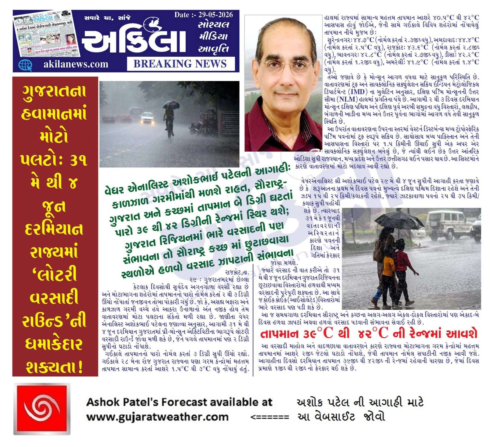
Forecast In Akila Daily Dated 29th May 2026
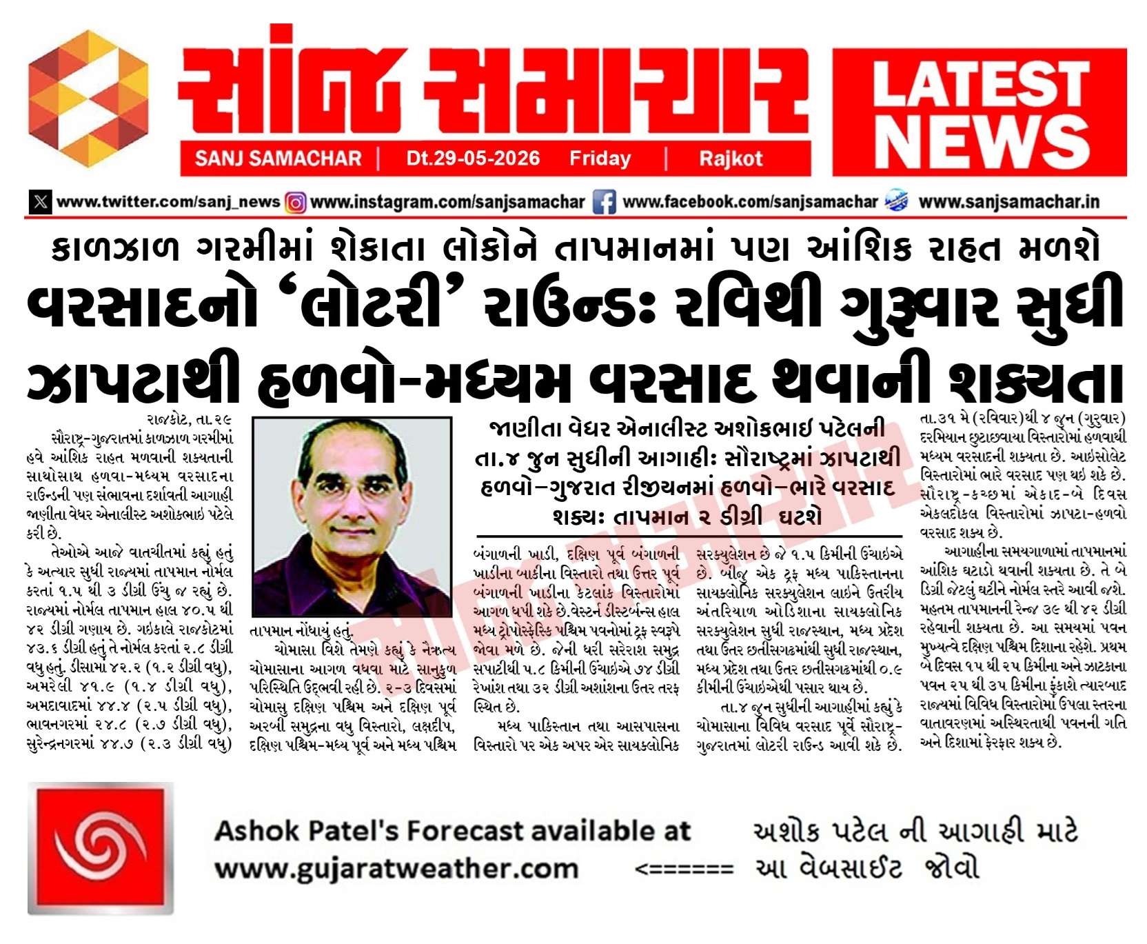
Forecast In Sanj Samachar Daily Dated 29th May 2026
Saheb 4 week updet karo
Monsoon officially arrived in Kerala today.
સર કાલે અમારે સુરેન્દ્રનગર સારો વરસાદ પડી ગયો
Saru thayu…jetlo aavi tetlo
સર અરેબિયાન સમુંદર ની પાંખ થોડી સ્પીડ માં હોવાથી દક્ષિણ suvrast માં સોમાંસુ વહલુ દાખલ થવાની શક્યતા વધી જાય ?imd gaf modal 14 તારીખ પશી રેન બતાવે સે
તારીખ 04 જૂન 2026 આજની પરિસ્થિતિ ભારતીય હવામાન વિભાગ અનુસાર મીડ ડે બુલેટિન – નૈઋત્યનું ચોમાસું આજે, 04 જૂન 2026 ના રોજ દક્ષિણપશ્ચિમ અને દક્ષિણપૂર્વ અરબી સમુદ્રના બાકીના ભાગો, મધ્યપશ્ચિમ અને મધ્યપૂર્વ અરબી સમુદ્રના કેટલાક ભાગો, સમગ્ર લક્ષદ્વીપ ટાપુઓ, કેરળ અને માહે, કર્ણાટકના કેટલાક ભાગો, તમિલનાડુના કેટલાક ભાગો, કોમોરિન વિસ્તારના બાકીના ભાગો, દક્ષિણપૂર્વ બંગાળની ખાડી તેમજ દક્ષિણપશ્ચિમ, મધ્યપશ્ચિમ, મધ્યપૂર્વ અને ઉત્તરપૂર્વ બંગાળની ખાડીના વધુ કેટલાક ભાગોમાં આગળ વધ્યું છે. – નૈઋત્યના ચોમાસાની ઉત્તરીય સીમા 14°N/60°E, 13.5°N/65°E, 13°N/70°E, મેંગલુરુ, ઉધગમંડલમ, કોડાઈકેનાલ, તૂતુકુડી, 8.8°N/79°E, 11°N/83°E, 14.5°N/87°E, 17.5°N/90°E, 20°N/93°E અને 22°N/95°E માંથી પસાર થાય છે. – આગામી 2 થી 3 દિવસ દરમિયાન નૈઋત્યનું… Read more »
IMD declared monsoon entry in keralam.
Sar 5 jun pachi leit thai tevu lageche gujrat ma rain ?
Gujarat nu normal 15 thi 20 June ganay.
today imd officially announces the onset of 2026 monsoon in Kerala…
Aaje Divyabhaskar ma photo aavyo che Amdavad – Rajkot highway pr Sayla ma Tornado no 🙂 Gai kale thyoto. US ni jem Storm season set thai rahi hoy am lagi ryu che Summer and Monsoon vcche….chella amuk varas thi 🙂
પિક્ચર 2 ખુબજ નુકસાન….ટોર્નેડો ના એરિયા માં આવેલ મોટાભાગ ના ખેતર માં મકાન ની છત, સોલાર પેનલ,વીજ લાઈન,ટપક ને નુકસાન,66kv ના થાંભલો પણ ઉખાડી નાખ્યો
Oh party tme to najre joyo……jordar yaar
કાલે સાંજે અમારા વિસ્તાર માં સર્જાયેલ મીની ટોર્નેડો
Aa bahu shaktishali hoy chhe. Hamna thoda varsho thaya dekhay chhe Tornado type prakriya.
ONI
MAM +0.50
ONI bhuli jaav RONI jovanu
Je MAM -0.1 chhe.
Ok Sir.
સરધારની આજુબાજુના ગામ ખારચિયા.મકનપર.હલેન્ડા રામળીયા વગેરે ગામમાં વાવણી લાયક વરસાદ છે.
Surendranagar ma vijli na kadaka bhadaka sathe full varsad chalu che
ખૂબ જ ભયાનક વીજળી અને કડાકા અને જોરદાર પવન સાથે વરસાદ ચાલુ છે….ખૂબ જ ભયાનક વીજળી અને કડાકા થાય છે
TS cluster formation around Amreli-Babra today
ECMWF forecast pramane
તારીખ 03 જૂન 2026 આજની પરિસ્થિતિ ભારતીય હવામાન વિભાગ અનુસાર મીડ ડે બુલેટિન – નૈઋત્યના ચોમાસાની ઉત્તરીય સીમા 10°N/60°E, 9°N/65°E, 8.5°N/70°E, 8°N/75°E, 7.8°N/78°E, 8°N/80°E, 10°N/80°E, 13°N/87°E, 16°N/90°E, 19°N/93°E અને 22°N/97°Eમાંથી પસાર થાય છે. – આગામી 24 કલાક દરમિયાન નૈઋત્યનું ચોમાસું દક્ષિણપશ્ચિમ અને દક્ષિણપૂર્વ અરબી સમુદ્રના વધુ કેટલાક ભાગો, લક્ષદ્વીપ ટાપુઓ, કેરળ અને તમિલનાડુના કેટલાક ભાગો, તેમજ દક્ષિણપશ્ચિમ, મધ્યપશ્ચિમ, મધ્યપૂર્વ અને ઉત્તરપૂર્વ બંગાળની ખાડીના વધુ કેટલાક ભાગો તથા દક્ષિણપૂર્વ બંગાળની ખાડીના બાકીના વિસ્તારોમાં આગળ વધવા માટે પરિસ્થિતિ અનુકૂળ છે. – ઉત્તરપશ્ચિમ ઉત્તર પ્રદેશ અને આસપાસના વિસ્તાર ઉપર આવેલું વેસ્ટર્ન ડીસ્ટર્બન્સ હવે પશ્ચિમ ઉત્તર પ્રદેશ અને આસપાસના વિસ્તાર પર UAC તરીકે છે… Read more »
Sir aa alnino chomasa ma je august ma alnino asr thase to sir aa alnino ketla samay taki riye eni asr ketlo taim lagi riye
El Nino thay te December sudhi toe rahe.
Haju shikhto hoy tyare ketli asar karey te nakki na rahe !
Aaj kaal ma El Nino ni update CPC and bija aapshe etle ahi janavish.
Porbandar ma Bhare ukdat ane garam bhej vara Pavan fukai che chella 3 thi 4 divas vadada jova madya hta aje fari akash clean thai gyu and models jota 10 june sudhi to hju varsad pde evu dekhatu nathi.
Ek uac Arabian sea ma Goa Coast najik che te pn tya j puru thai jai evu lage che.
સર ૨૪ ક્લાક rainfall deta આવી રીતે અડધા જ ખૂલે છે બધું બરાબર વંચાતું નથી
Fari chek karo
Hji sir issue ave chhe. 2 hours and 24 hours rainfall data ma pan issue ave chhe. Phone ne landscape mode kari ne portrait mode ma khulta barobar thay jay chhe.
Check karyu: Mobile version ma 24 hour ma taklif chhe. Desktop ma chale chhe
Sir bare nikdi ne fari thi jadap thi click karie chie to khule che. Last year pn emj thatu tu mare
Zoom -(minas dabavo ) aetle thy jase
Yes , 24 kalak vadu se te aem j khule se
Ok saheb khuli gayu
Rainfall data ni bare nikdi ne fari thi rainfall data ma jaav ane jaldi thi click karo to aakhu khuli jase
ઝૂમ માયનસ કરીને જોવો આખુ પેજ આવશે
જય મુરલીધર સાહેબ દેશી વર્તારા ના જાણકાર કે જેમણે ટેકનોલોજી શું છે એનાથી બિલકુલ અજાણ એવા બે ચાર દાયકાઓ પહેલાં ના ગુજરાત ના ધરતી પુત્રો કે જેમણે હાથના ટેરવા ને એમનું ગણિત બનાવી લીધું હતું એમનું દેશી અવકાશી વિજ્ઞાન કદાચ અત્યાર ની પેઢી ને મગજમાં ન પણ બેસે પણ ખરેખર એમનું અનુમાન એ સમયે પરફેક્ટ રહેતું આવનાર આઠ જુન આજુબાજુ મૃગશીર્ષ નક્ષત્ર ની શરૂઆત થાય છે ગયા વર્ષે ૨૮ સપ્ટેમ્બર ના હસ્ત નક્ષત્રમાં કદાચ ગુજરાત નો ૭૦ % વિસ્તાર ઓછાવત્તા પ્રમાણમાં વરસદે આવરી લીધો હતો એ પ્રમાણે ૮ જુન થી ૨૧ જુન સુધી મા વરસાદ ને આવવું જ પડે જોઈએ… Read more »
Nakshatro dar varshe chokkas tarikhe j bese. Kyarek ek divas farak thay.
Aadra 22 June
Jsk સર…. હા તારીખ ફિક્સ જેવું જ હોય… કદાચ એક દિવસ +- થાય…. પણ અહીં હમીર ભાઈ નું કેવું એવું છે કદાચ કે વડીલો એમ કયે કે હાથિયા માં વરસાદ જ્યાં પડ્યો હોય ત્યાં આગલા વર્ષે મૃગસીસ માં વાવણી થાય જ… જોયી હૂં થાય હવે… હરિ ઈચ્છા બળવાન.
જયશ્રી કૃષ્ણ સર ‘ અને બધા મીત્રોને ‘
આજે અત્યારે અમારા ગામથી ઉત્તર બાજુ એટલે કે ઉપલેટા ની ઉપરવાસ માં ગાજવીજ સંભળાય છે ‘ તો મિત્રો આજનો વરસાદ ક્યાં ક્યાં છે તે જણાવજો
સાહેબ અમારે ગઈ રાત્રે પોણા એક વાગ્યે અને પોણા ત્રણ વાગ્યે એમ બે રાઉન્ડ વરસાદ ના આવ્યા.
જય સીયારામ સાહેબ સરજી આજ ના સંદેશમાં એવું છે કે અરનીનોનું સંકટ ભારત માટે ખૂબ ખરાબ છે તો શું તે સાચી વાત છે તેના પર પ્રકાશ પાડશો
Haju EL Nino thayo nathi
Ok sir ji thanks
તારીખ 02 જૂન 2026 આજની પરિસ્થિતિ ભારતીય હવામાન વિભાગ અનુસાર મીડ ડે બુલેટિન – નૈઋત્યના ચોમાસાની ઉત્તરીય સીમા 10°N/60°E, 9°N/65°E, 8.5°N/70°E, 8°N/75°E, 7.8°N/78°E, 8°N/80°E, 10°N/83°E, 13°N/87°E, 16°N/90°E, 19°N/93°E અને 22°N/97°E પરથી પસાર થાય છે. – 04 જૂનની આસપાસ નૈઋત્યનું ચોમાસું દક્ષિણપશ્ચિમ અને દક્ષિણપૂર્વ અરબી સમુદ્રના વધુ કેટલાક ભાગો, લક્ષદ્વીપ ટાપુઓ, કેરળ અને તમિલનાડુના કેટલાક ભાગો, તેમજ દક્ષિણપશ્ચિમ, મધ્યપશ્ચિમ, મધ્યપૂર્વ અને ઉત્તરપૂર્વ બંગાળની ખાડીના વધુ કેટલાક ભાગો તથા દક્ષિણપૂર્વ બંગાળની ખાડીના બાકીના વિસ્તારોમાં આગળ વધવા માટે પરિસ્થિતિ અનુકૂળ છે. – દક્ષિણ કેરળના કિનારાથી દૂર દક્ષિણપૂર્વ અરબી સમુદ્ર પરનું અપર એર ચક્રવાતી પરિભ્રમણ, જે સરેરાશ સમુદ્ર સપાટીથી 5.8 કિમી સુધી વિસ્તરેલું છે… Read more »
Varsad na akda Dholka mate tadan khota che
5 mm nai 1-2 inch varsad hto
last year Bhi Avuj hatu
સાચી વાત છે
Gai kale rate 11 11:30 thi half an hour mst varsad/japta pchi fari rate 3 vaga thi 1kad 2 kalak sudhi varsad pdyo khub pavan ane gajvij sathe 🙂 bv mja aavi gai 🙂
Vatavarn bv thndu thai gayutu ane thndo varsad hto 🙂
Northeast thi aavyo bdho varsad jane chomasa nu aagman hoy 🙂
Sir.gy ratre ke varsad jatla vistar ma pdiyo tenu chokash Koi pn model ae batavyu n hatu…
NOMAD and IMD GFS
સુરેન્દ્રનગરમાં એક જ દિવસમાં સીઝનનો 20% વરસાદ પડી ગયો છે!
બીજી વાત, ગયા વર્ષ કરતાં ગુજરાતના મોટાભાગના સ્થળોએ સરેરાશ વરસાદમાં વધારો જોવા મળ્યો છે
ઉદાહરણ તરીકે:
રાજકોટ:
2025: 840mm
2026: 867mm
Correction: 20 mm, 20% nahi
11 vagya sara zhapta pachi
ratri 2:45 aaspas bhyankar vavajoda ane gajvij jode dodhmar varsad Varsad 3:45 sudhi
pachi 6:00 vagya sudhi hadvo chalu rahyo
Vavni layak pani pani
જય માતાજી
અશોકભાઈ અમારે રાત્રે જોરદાર પવન સાથે જોરદાર વરસાદ આવી ગયો
આ વખતનું wd ઘણું શક્તિશાળી હોય એવું લાગે છે
Dhrangadhra ma rate gaj vij sathe saro avo varsad
Vadodara ma 10.30 pm thi 12.30am sudhi moderate rain. Pavan starting ma hatu pachi hadvi gajvij hati.
Very heavy rains from last 35 minutes with heavy thunderstorm.
Sir surendranagar ma bhuka kadhe che varsad ane vijli
ઈશાન પુર્વ માં 11:30 પી.એમ.થી જોરદાર વીજળી થાય છે હજુ પણ ચાલુ જ છે.
અત્યારે ધીમે ધીમે મેઘગર્જના સંભાળાય છે.
કેટલીક માન્યતાઓ પર વિચાર કરવા જેવો ખરો જેમ કે મોટાભાગની દુનિયામાં એવી માન્યતા પ્રવર્તે છે કે પ્રદૂષણ થી વરસાદ માં ઘટાડો થાય પણ કદાચ મેં આ વેબસાઈટ માં જ એક વાર વાચ્યું હતું કે હવામાં પ્રદૂષણના કણો વાદળ ને બનવાને અને ઘટ્ટ બનાવવામાં વધુ મદદ કરે. અન્ય એક માન્યતા એવી કે ઝાડ વધારે હોય ત્યાં વરસાદ વધુ પડે પણ કદાચ એવું હશે કે જ્યાં વરસાદ વધુ પડે ત્યાં ઝાડ વધુ થાય અન્ય માન્યતા ભારે વરસાદથી પાણી જમીનમાં ન ઉતરતા દરિયામાં વહી જાય પણ આપણે ત્યાં તો ભારે વરસાદ પડે ત્યારે જ પાણીના તળ ઊંચા આવે. હા કદાચ ચોમાસામાં પૂરતો વરસાદ… Read more »
Ahmedabad Dholka pavan gajvij jode zordar varsad 11- 11:30 vache
Vadodara ma jordar vijli na kadaka bhadaka sathe atibhare varsad chalu with cyclone
Cyclone te Weather ni bhasha ma Tropical Storm kahevay.
Tamarey Cyclone na ganay.
Thank u sirji, navu janva malyu.
Gajvij ane pavan sathe mst varsad/japtu chale che 🙂 khub thndo che varsad 🙂