Ahmedabad

source: IMD
Surat

Rajkot

Porbandar

Surendranagar

Bhavnagar
< p>
New Kandla

Naliya

Mandvi

Amreli

Deesa

Baroda

Narmada

Veraval

Mahuva

Idar

Radhanpur

Bhuj

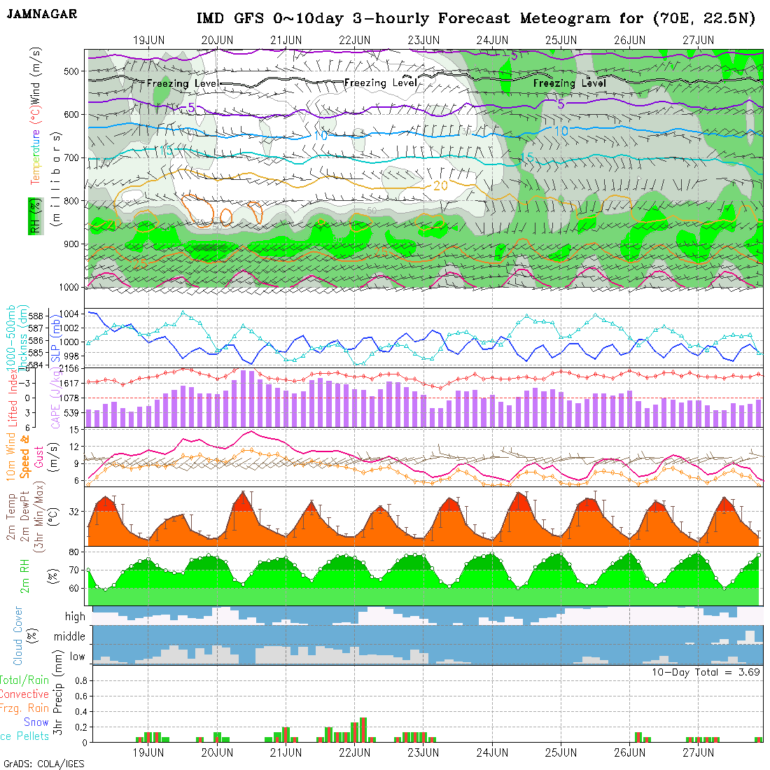
Jamnagar
Dwarka

Keshod

મિટિઓગ્રામ માર્ગદર્શન માટે ક્લિક કરો Meteogram – મિટિઓગ્રામ માર્ગદર્શન
[…] Gujarat Center Meteogram […]