Low Pressure System Tracking Towards Maharashtra–Madhya Pradesh Border Expected to Bring Beneficial Rainfall to Saurashtra, Kutch & Gujarat During 12th–17th September 2026
મહારાષ્ટ્ર–મધ્ય પ્રદેશ સરહદ તરફ આગળ વધી રહેલી લો પ્રેશર સિસ્ટમથી 12થી 17 સપ્ટેમ્બર 2026 દરમિયાન સૌરાષ્ટ્ર, કચ્છ અને ગુજરાતમાં લાભદાયી વરસાદની શક્યતા
Few parameters from IMD Morning Bulletin — 12th September 2026:
Low Pressure Area:
The Low Pressure Area over coastal areas of south Odisha and north Andhra Pradesh lay over South Chhattisgarh and neighbourhood at 0530 hrs IST on 12th September 2026.
The associated cyclonic circulation extends up to 9.4 km above mean sea level, tilting southwestwards with height.
The system is likely to move west-northwestwards across South Chhattisgarh and Vidarbha during the next 24 hours.
Monsoon Trough:
The Monsoon Trough at mean sea level now passes through:
Jaisalmer – Kota – Bhopal – Nagpur – centre of the Low Pressure Area over South Chhattisgarh and neighbourhood, and thence east-southeastwards to the Eastcentral Bay of Bengal.
The trough extends up to 1.5 km above mean sea level.
The trough from north Rajasthan to the cyclonic circulation associated with the Low Pressure Area over South Chhattisgarh and neighbourhood, extending across Madhya Pradesh and Chhattisgarh up to 3.1 km above mean sea level, has merged with the Monsoon Trough.
Western Disturbance:
The Western Disturbance, seen as a cyclonic circulation over north Punjab and neighbourhood, now lies over north Pakistan and adjoining Jammu, between 3.1 and 4.5 km above mean sea level.
A trough aloft in the middle tropospheric westerlies, with its axis at around 5.8 km above mean sea level, runs roughly along Long. 70°E to the north of Lat. 30°N.
Weather Forecast for Saurashtra, Gujarat & Kutch (12th–17th September 2026)
Overall: Rainfall prospects have improved due to the Low Pressure Area and associated Upper Air Circulation (UAC) which is tilting southwestward with height. The System is now tracking towards Maharasthra and adjoining Madhya Pradesh border areas.
The Monsoon trough has become normal is expected to move further Southwards towards for the next couple of days.
Gujarat Region
- Rainfall: Isolated/Scattered to Fairly Widespread/Widespread rainfall is likely over parts of Gujarat Region on different days, mainly during 12th–17th September.
- 50% of the area is expected to receive 35–50 mm of total rainfall during the forecast period.
- The remaining 50% of the area is expected to receive 50–75 mm of total rainfall during the forecast period.
- Some locations could receive more than 150 mm of total rainfall.
Saurashtra & Kutch
- Rainfall: Isolated/Scattered to Fairly Widespread/Widespread rainfall is likely on different days of the forecast period, mainly during 12th–17th September.
- 50% of the area is expected to receive 35–50 mm of total rainfall during the forecast period.
- The remaining 50% of the area is expected to receive 50-75 mm of total rainfall during the forecast period.
- Some locations could receive more than 150 mm of total rainfall.
Introducing: KOLA Interactive Rainfall Forecast Atlas
All India States and within each State up to District level Rainfall data is available. Select your State and subsequently all Districts will also be listed within your State in Alphabetical order. This data is based on IMD GFS Daily Precipitation Forecast for 1 to 10 days.
મહારાષ્ટ્ર–મધ્ય પ્રદેશ સરહદ તરફ આગળ વધી રહેલી લો પ્રેશર સિસ્ટમથી 12થી 17 સપ્ટેમ્બર 2026 દરમિયાન સૌરાષ્ટ્ર, કચ્છ અને ગુજરાતમાં લાભદાયી વરસાદની શક્યતા
IMDના સવારના બુલેટિન — 12 સપ્ટેમ્બર 2026ના કેટલાક મહત્વપૂર્ણ પરિબળો:
લો પ્રેશર એરિયા:
દક્ષિણ ઓડિશા અને ઉત્તર આંધ્ર પ્રદેશના દરિયાકાંઠાના વિસ્તારો પર આવેલો લો પ્રેશર એરિયા 12 સપ્ટેમ્બર 2026ના 0530 કલાકે IST દક્ષિણ છત્તીસગઢ અને આસપાસના વિસ્તારો પર સ્થિત હતો.
આ સિસ્ટમ સાથે સંકળાયેલું ચક્રવાતી પરિભ્રમણ સમુદ્ર સપાટીથી 9.4 કિમી સુધી વિસ્તરેલું છે, જે ઊંચાઈ સાથે દક્ષિણપશ્ચિમ તરફ ઝૂકેલું છે.
આ સિસ્ટમ આગામી 24 કલાક દરમિયાન દક્ષિણ છત્તીસગઢ અને વિદર્ભમાંથી પશ્ચિમ-ઉત્તરપશ્ચિમ તરફ આગળ વધે તેવી શક્યતા છે.
મોન્સૂન ટ્રફ:
સમુદ્ર સપાટી પરનો મોન્સૂન ટ્રફ હાલમાં નીચેના વિસ્તારો પરથી પસાર થાય છે:
જૈસલમેર – કોટા – ભોપાલ – નાગપુર – દક્ષિણ છત્તીસગઢ અને આસપાસના વિસ્તારો પર આવેલા લો પ્રેશર એરિયાના કેન્દ્રમાંથી પસાર થઈને, ત્યારબાદ પૂર્વ-દક્ષિણપૂર્વ તરફ મધ્ય-પૂર્વ બંગાળની ખાડી સુધી વિસ્તરે છે.
આ ટ્રફ સમુદ્ર સપાટીથી 1.5 કિમી સુધી વિસ્તરેલો છે.
ઉત્તર રાજસ્થાનથી દક્ષિણ છત્તીસગઢ અને આસપાસના વિસ્તારોમાં આવેલા લો પ્રેશર એરિયા સાથે સંકળાયેલા ચક્રવાતી પરિભ્રમણ સુધીનો ટ્રફ, જે મધ્ય પ્રદેશ અને છત્તીસગઢ પરથી પસાર થઈને સમુદ્ર સપાટીથી 3.1 કિમી સુધી વિસ્તરેલો હતો, તે હવે મોન્સૂન ટ્રફ સાથે ભળી ગયો છે.
વેસ્ટર્ન ડિસ્ટર્બન્સ:
ઉત્તર પંજાબ અને આસપાસના વિસ્તારો પર ચક્રવાતી પરિભ્રમણના સ્વરૂપમાં રહેલું વેસ્ટર્ન ડિસ્ટર્બન્સ હવે ઉત્તર પાકિસ્તાન અને તેને અડીને આવેલા જમ્મુ વિસ્તારમાં, સમુદ્ર સપાટીથી 3.1થી 4.5 કિમીની ઊંચાઈ વચ્ચે સ્થિત છે.
મીડ એટમોસ્ફિયર માં રહેલો ઉપરનો ટ્રફ, જેની ધરી સમુદ્ર સપાટીથી આશરે 5.8 કિમીની ઊંચાઈએ છે, આશરે 70°E રેખાંશથી 30°N અક્ષાંશની ઉત્તરે પસાર થાય છે.
સૌરાષ્ટ્ર, ગુજરાત અને કચ્છ માટે હવામાન આગાહી (12થી 17 સપ્ટેમ્બર 2026)
એકંદર સ્થિતિ: લો પ્રેશર એરિયા અને તેની સાથે સંકળાયેલું અપર એર સર્ક્યુલેશન (UAC) વધતી ઉંચાઈએ દક્ષિણ પશ્ચિમ તરફ ઝુકે છે. સિસ્ટમ હવે મહારાષ્ટ્ર તથા તેને અડીને આવેલા મધ્ય પ્રદેશના સરહદી વિસ્તારો તરફ આગળ વધી રહ્યું હોવાથી વરસાદની શક્યતાઓમાં સુધારો થયો છે.
મોન્સૂન ટ્રફ હવે તેની સામાન્ય સ્થિતિમાં આવી ગયો છે અને આગામી એક-બે દિવસ દરમિયાન તે વધુ દક્ષિણ તરફ ખસે તેવી શક્યતા છે.
ગુજરાત રિજિયન
- વરસાદ: 12થી 17 સપ્ટેમ્બર દરમિયાન મુખ્યત્વે અલગ-અલગ દિવસોએ ગુજરાત રિજિયનના આઇસોલેટેડ/છૂટાછવાયા થી ઠીકઠાક વ્યાપક/વ્યાપક વિસ્તારોમાં વરસાદની શક્યતા છે.
- આગાહીના સમગ્ર સમયગાળા દરમિયાન ગુજરાત રિજિયનના 50% વિસ્તારમાં 35–50 મીમી જેટલો કુલ વરસાદ પડવાની શક્યતા છે.
- બાકીના 50% વિસ્તારમાં 50–75 મીમી જેટલો કુલ વરસાદ પડવાની શક્યતા છે.
- કેટલાક સ્થળોએ 150 મીમીથી વધુ કુલ વરસાદ પડી શકે છે.
સૌરાષ્ટ્ર અને કચ્છ
- વરસાદ: 12થી 17 સપ્ટેમ્બર દરમિયાન મુખ્યત્વે અલગ-અલગ દિવસોએ સૌરાષ્ટ્ર અને કચ્છના આઇસોલેટેડ/છૂટાછવાયા થી ઠીકઠાક વ્યાપક/વ્યાપક વિસ્તારોમાં વરસાદની શક્યતા છે.
- આગાહીના સમગ્ર સમયગાળા દરમિયાન સૌરાષ્ટ્ર અને કચ્છના 50% વિસ્તારમાં 35–50 મીમી જેટલો કુલ વરસાદ પડવાની શક્યતા છે.
- બાકીના 50% વિસ્તારમાં 50–75 મીમી જેટલો કુલ વરસાદ પડવાની શક્યતા છે.
- કેટલાક સ્થળોએ 150 મીમીથી વધુ કુલ વરસાદ પડી શકે છે.
પરિચય: KOLA Interactive Rainfall Forecast Atlas
ભારતના તમામ રાજ્યો તેમજ દરેક રાજ્યના જિલ્લા સ્તર સુધીના વરસાદના અનુમાન ઉપલબ્ધ છે. તમારું રાજ્ય સિલેક્ટ કરો અને પછી દરેક ડીસ્ટ્રીકટ ના આંકડા ઉપલબદ્ધ થશે અલ્ફાબેટિક ક્રમ માં. આ માહિતી IMD GFS મોડેલના 1 થી 10 દિવસના દૈનિક વરસાદ (Daily Precipitation)ના ફોરકાસ્ટ અનુમાન પર આધારિત છે.
Caution: Please refer/rely on IMD/RSMC Bulletins/Advisories for Storms & Weather related matter.
સાવચેતી: સ્ટોર્મ કે હવામાન અંગે ની માહિતી માટે ભારતીય હવામાન ખાતા/ગવર્મેન્ટ ના બુલેટીન/સુચના પર નિર્ભર રહેવું.
Read Comment Policy – કમેન્ટ માટે માર્ગદર્શન વાંચો
How To Upload Profile Picture For WordPress – વર્ડપ્રેસ માં પ્રોફાઈલ પિક્ચર કેમ રાખવું
Forecast In Akila Daily Dated 12th September 2026
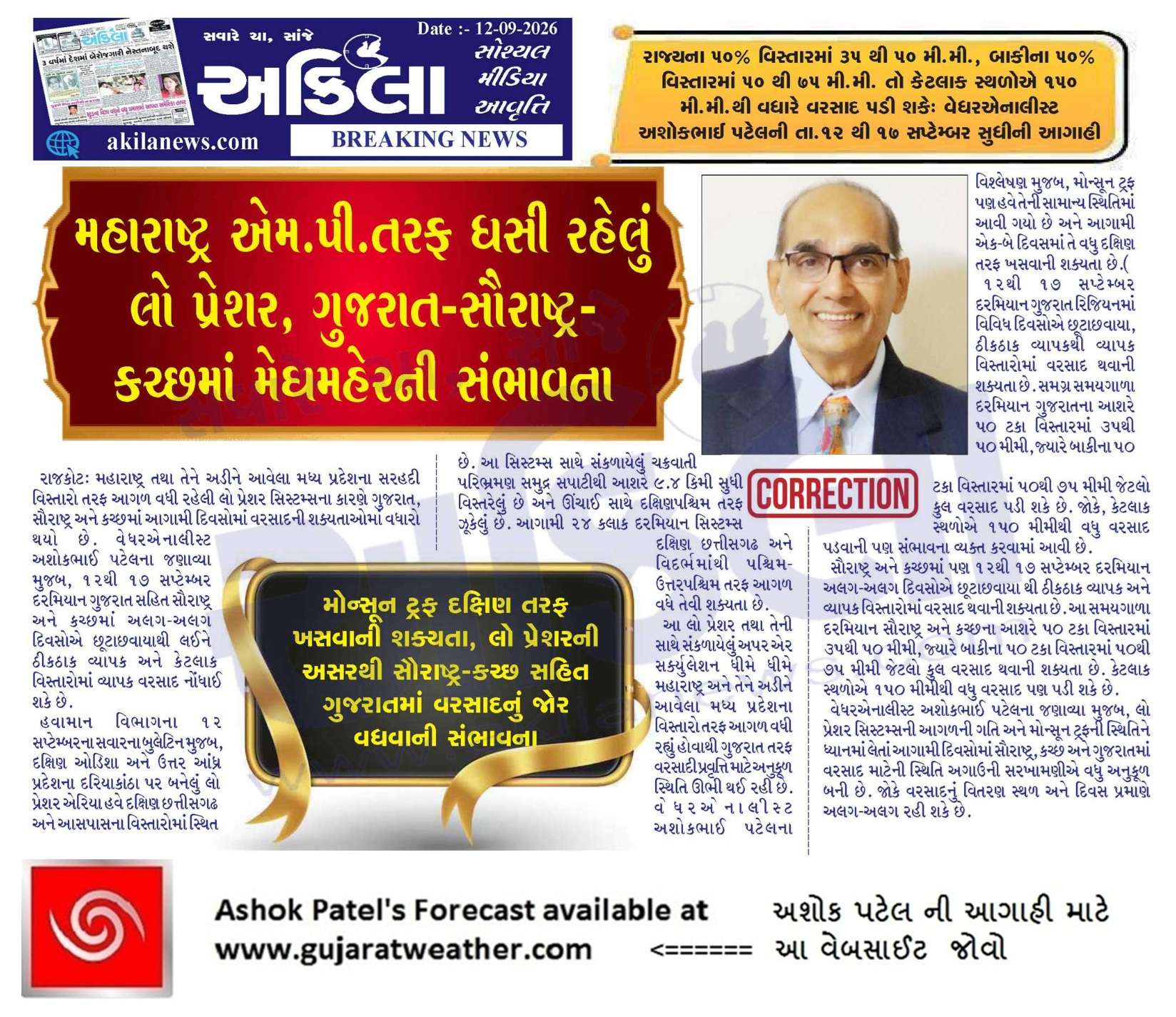
Pending Forecast In Sanj Samachar Daily Dated 12th September 2026
KOLA Interactive Rainfall Forecast Atlas
ICON Model aajthi chalu karyu chhe.
IOCN Model is now available
1 કલાક થી મધ્યમ ગતિ એ વરસાદ ચાલુ , અંતે આવ્યો ખરો !
Kamlapur ma કલાક thi chalu che varsad
Porbandar City Ma 4 Vaga Sudhi ma mand 15 mm pochyo Ek saro redo avi ne dhimi gatie chalu che Hju next 48 hrs che Asha Che Jordar avse.
હેલો. સર તમે આ વરસાદ વિશે હવે બાકી રહેલા વિસ્તાર મા આગાહી સમય મા આશા રાખીશકાય જવાબ આપવા વિનંતિ
Saro varsad saru thayo 5pm thi
Gir somnath veraval una kodinar daruya6 pati ma savar thi saro varsad salu
Dhodhamar varsad chlu cijn no fast varsad
Rajkot thi kalavad sudhi no vistar rhi gyo east and west bne side thunder storm activity chalu 6
Avse ????
Sar 3 ins jevo padigayo.
3.30 thi 5 sudhi ma 2 inch hji pan full speed ma chalu
ખટાટોપ વાદળ અને અંધારું ફૂલ થઈ ગયું છે સતા પણ વરસાદનો એક સાટો પણ પડતો નથી
Jay shree Krishna sir derdi kumbhaji ma3/45thi 4/49saro varshad che anehaji chalu che
Rajkot Vadu vadad gondal chlau rain last 20 mint thi
Saurashtra ma haju mota thunderstorm nathi banta 1-2 inch ma haafi jaay chhe
Last 1 kalak thi madhiyam chalu chhe joye hve 3 divas ma shu made chhe
Sir amare aave em Che varasad ?
સર અમારે હજી વરસાદ બોવ જામતો નથી સરમાઈ છે બોવ થોડીક વાર વરસી ને બંધ થઈ જાય છે
પોરબંદર માં ઝરમર ચાલુ, ECMWF ગામ ગાડું કરીને હવે ધીમે ધીમે પાણીમાં બેસવા માંડ્યું
આ વખતની સીઝનનો સૌ પ્રથમ વખત તાલાલા ગીર પંથકમાં ભારે વરસાદ ચાલુ
Rajkot ketlo pado koi andaj varsad
Rajkot City ma 2 inch varsad bapore 3 thi 4 vachche.
44 mm as per SEOC, Gandhinagar
RMC rainfall figures 2-4 PM
Central zone: 50mm
East zone: 42 mm
West zone: 47 mm
Sir jor nathi pakad to varshad
JX-NDMAEW-Gઆગામી ૨૪ કલાક દરમિયાન મોરબી, રાજકોટ અને સુરેન્દ્રનગર જિલ્લાઓમાં અમુક સ્થળોએ ભારેથી અતિ ભારે વરસાદ અને છૂટાછવાયા સ્થળોએ અત્યંત ભારે વરસાદ થવાની પ્રબળ શક્યતા છે. અત્યારે અમારે આવા મેસેજ આવે છે
Kalavd varsadh hoy to kejo
Keshod ma gai kal no 13 mm ane aajno 4 mm saghe kul 17 mm tahak tahak thi thayel chhe have pavan ni speed pan vadhi gai chhe ane vadal pan khulla jevu thai gayu chhe to have varasad ni asha chhodi ane have bija kame lagi jaye.
હા ભાઈ અમારે પણ આવુજ છે ૪ કલાક ફુવારા હાલે એટલુંય માંડ થયું હોય તો સારું
Sir , Jamnagar sanj sudhi ma 5 to 6 pachhi Sara varsad ni asha chhe ,joie have.mitro update karjo blog ma.
Megharaja dhimi dhare beating chalu kari che
Agad su thay joie
જય માતાજી
અશોકભાઈ….અમારે ગઈકાલ બપોરના 2 વાગ્યા થી વરસાદ શરૂ થયો છે જે અત્યારે પણ ધીમીધારે ચાલુ જ છે
આ રાઉન્ડ માં પવન ની ગતિ ઓછી છે.
લાગે છે સવાર નું પીળું પડેલ રેડ એલર્ટ હવે રાતુ થઈ રહ્યું છે… રાજકોટ ના ઇન્દિરા ચોક આસપાસ જોરદાર વરસાદની જમાવટ સાથે વાદળો ઉપર ગણેશ બાપા ગેડી દડો રમી રહ્યા છે… જય ગણેશ બાપા…
રાજકોટ મા બાકાજિકી
Dear sir
Rajkot ma dhodhmar varsad sharu light thunderstorm sathe
Thanks
Sir amre pan rajkot ni jem maja j aavavani hoy to bhale var lage mara vala Ashok Sir… Jay Shree Rdhe Krisbna Ji…
Saro varsad last 30 mnt thi
Nazar na lagadta
Rajkot ma finally chalu thayo!
3.00 vagya thi meghmaraj ni dhamakedar enty …
રાજકોટ મા સારી શરૂઆત થઇ ગઈ છે
Dhime dhare varsad ni saruat
લાગશે વાર પણ આવશે મજા.
ખૂબ સારી વરસાદ રાજકોટ સેન્ટ્રલ ઝોન ma chalu. 29minit thi.
Message ndmaew mathi avelse
કોટડા અરડોઈ વચ્ચે પાણ જોગ વરસાદ ના સમાચાર હતા…
ડોળિયા , કેશરપર, સેજકપર માં પણ આવા જ વરસાદ ના સમાચાર છે હજુ ખેતરો માં ખાબોચિયા પણ નથી થયા
આજે સવારે ૯ વાગે ટીવી ન્યૂઝ માં પણ રાજકોટ જિલ્લા માં ત્રણ કલાક રેડ એલર્ટ હતું પણ લાગે છે રેડ એલર્ટ પીળું પડી ગયું લાગે છે કોઈ નોંધ પાત્ર વરસાદ ના વાવડ નથી
Finally Porbandar City Ma Saro Varsad Chalu thyo
Porbandar ni aju baju na gadma pn varsad chalu
Sri Aa varsad Avi sake
બધાંજ બોલ ઉતાવળ કરે છે
સર ની આગાહી ૧૭ તારીખ સુધી છે
સરે જે આગાહી કરી છે તેમાં બંધાય વારો આવી જશે
અમારે ૨,૧૫ ના વાગ્યા થી સાલું થયો છે
Tamari vaat 110% sachi che, Mane pan em hatu k rai jashu pan bhukka kathe che varsad. Ashok Sir ni aagahi etle “LODHA MA LITO” bhai…
IMD: Ahmedabad
24 hours ma Rajkot, Surendranagar and Morbi ma Extremely Heavy Rain nu Alert aapyu 6e.
From: Monday 14, 1:00 pm
To. : Tuesday 15, 1:00 pm
Kale sanje dhodhmar pchi aakhi raat dhimo dhimo chalu rhyo pchi savare 9 10 vagya thi fari gajvij kadakao sathe dhodhmar pdyo lgbhg 1:30ek vagya sudhi pdyo pchi jrmr chalu che 🙂
So aaje work from home 🙂
Chotila ma versad aavese
આગામી ૨૪ કલાક દરમિયાન મોરબી, રાજકોટ અને સુરેન્દ્રનગર જિલ્લાઓમાં અમુક સ્થળોએ ભારેથી અતિ ભારે વરસાદ અને છૂટાછવાયા સ્થળોએ અત્યંત ભારે વરસાદ થવાની પ્રબળ શક્યતા છે.
આવો sms રાજકોટ vara ne aave che.
Pan saheb તેવું કઈ દેખાતું કેમ નથી.
Message mokalnar kon chhe?
BP-NDMAEW
IMD: Ahmedabad
Havaman khatavara
JE.NDMAEW.G
તારીખ:- 14 સપ્ટેમ્બર 2026 આજની પરિસ્થિતિ ભારતીય હવામાન વિભાગ અનુસાર મીડ ડે બુલેટિન – 19 સપ્ટેમ્બર, 2026 ની આસપાસ પશ્ચિમ રાજસ્થાનના કેટલાક ભાગોમાંથી દક્ષિણ-પશ્ચિમ ચોમાસાની વિદાય માટે અનુકૂળ પરિસ્થિતિઓ બની રહી છે. – દક્ષિણ-પૂર્વ રાજસ્થાન અને લાગુ ગુજરાત પ્રદેશ તથા દક્ષિણ-પશ્ચિમ મધ્ય પ્રદેશ પરનું લો પ્રેશર હવે દક્ષિણ-પૂર્વ રાજસ્થાન અને લાગુ ઉત્તર ગુજરાત પર સ્થિત છે. તેનુ આનુષંગિક UAC હવે સરેરાશ સમુદ્ર સપાટીથી 7.6 km ઊંચાઈ સુધી વિસ્તરે છે અને ઊંચાઈ સાથે દક્ષિણ તરફ ઝૂકેલું છે. – સરેરાશ સમુદ્ર સપાટી પર મોન્સૂન ટ્રફ હવે નલિયા, દક્ષિણ-પૂર્વ રાજસ્થાન અને લાગુ ઉત્તર ગુજરાત પરના લો પ્રેશરના કેન્દ્ર, રાજગઢ, દમોહ, પેન્ડ્રા રોડ, રાઉરકેલા… Read more »
Dwarka porbandar thi sara samachar ave chhe ganapati bapa sundh bhari ne aviya chhe. Amare 24 kalak ma dhimidhare 1 inch + varasad chhe. Ganapati bapa moriya
Sir ગોંડલ આજુબાજુમાં વરસાદ માટે હવે શક્યતા ખરી પાન જોગી વરસાદ નથી પડ્યો