Current Weather Conditions on 24th June 2013 @ 10.30 am.
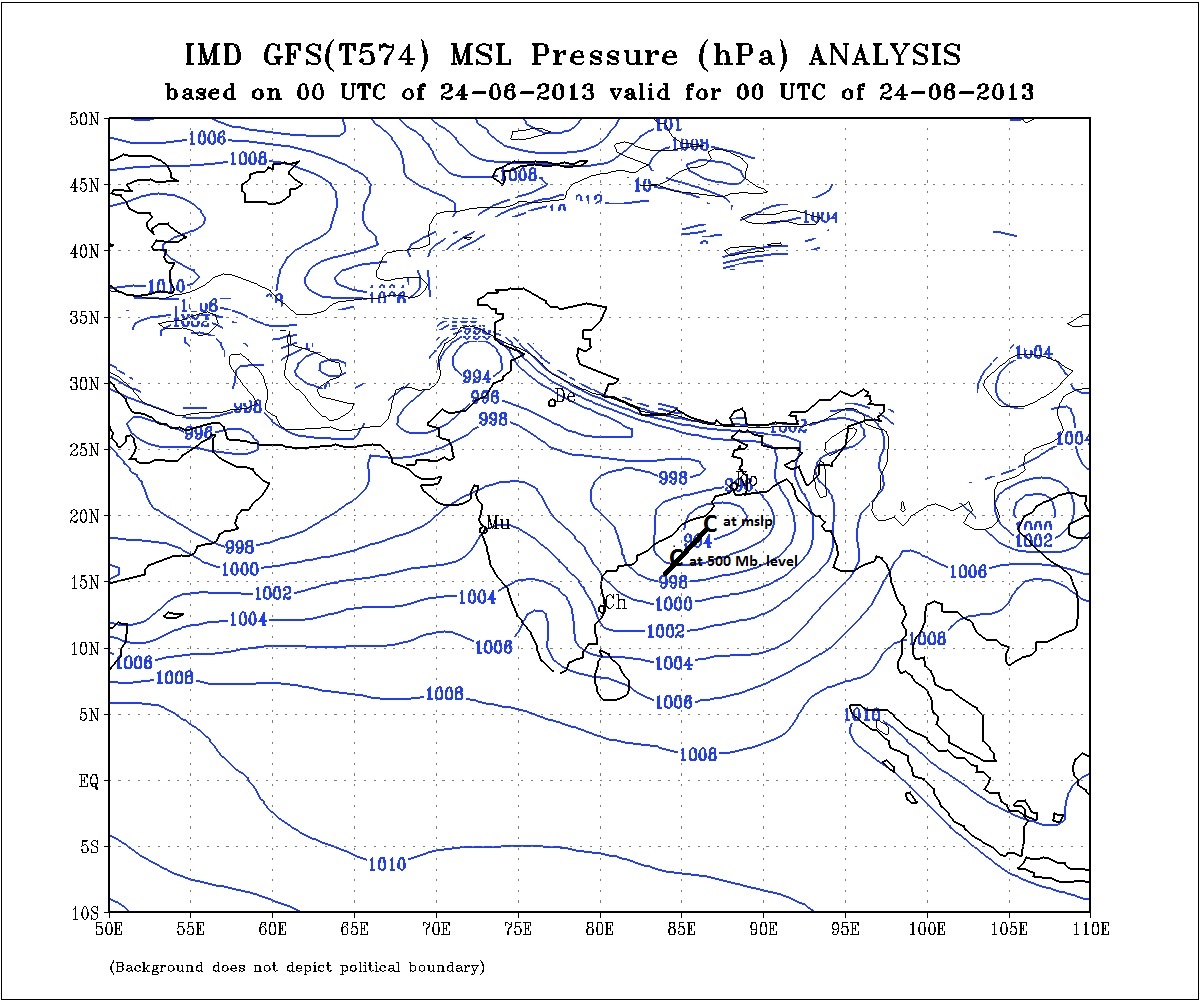
On Saturday the 22nd June 2013 an Upper Air Cyclonic Circulation strengthened into a Low Pressure area over the Northwest Bay of Bengal and adjoining Coastal Odisha & Coastal West Bengal. The associated Cyclonic Circulation extends up to 7.6 Kms. and is tilting Southwestwards with height. This morning the Low Pressure area is located over Coastal areas of Odisha and West Bengal and adjoining Northwest Bay of Bengal with Associated Cyclonic Circulation extending up to 7.6 km above sea level tilting Southwestwards with height.
The axis of monsoon trough at mean sea level passes through Ferozpur, Meerat, Kanpur, Ambikapur, Keonjhargarh, Center of Low Pressure area and thence Southeastwards to Eastcentral Bay of Bengal.
There is an offshore trough at mean sea level from Maharashtra coast to Kerala coast.
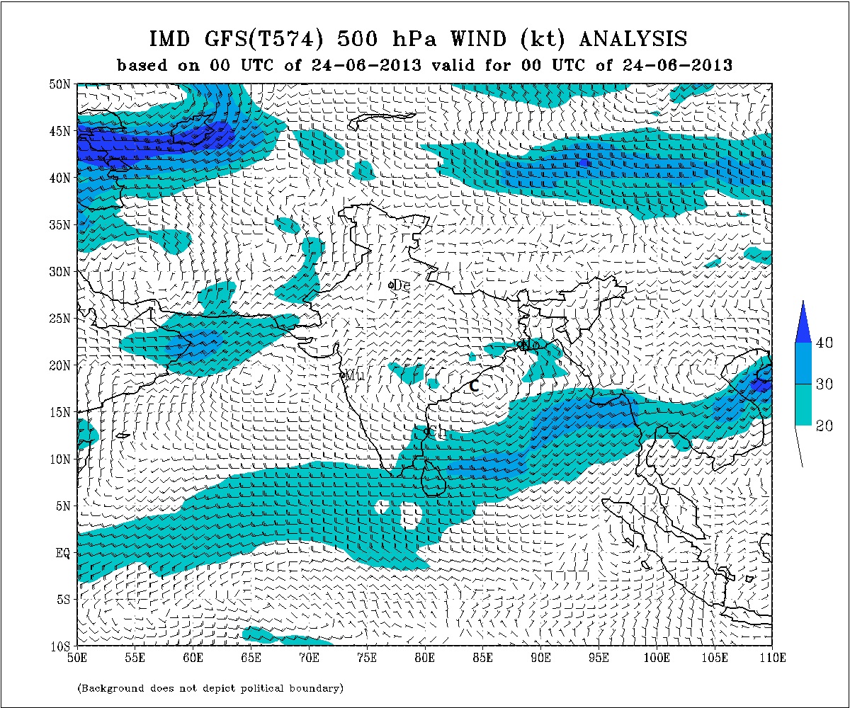
What is the meaning of Low Pressure area with Associated Cyclonic Circulation extending upto 7.6 km above sea level tilting Southwestwards with height ? It means that if a line is drawn through the center of Low Pressure at sea level and the centers of Cyclonic Circulation at 700 Mb., 500 Mb. or say 400 Mb. respectively it would be going towards the Southwest. As an example mslp and 500 Mb. level charts have been show with a “C” marked for the center of Circulation. On mslp chart the center at 500 Mb. is also plotted and the line going Southwestwards as we go from lower to upper levels.
NCEP/GFS Bias-Corrected Precipitation Forecasts
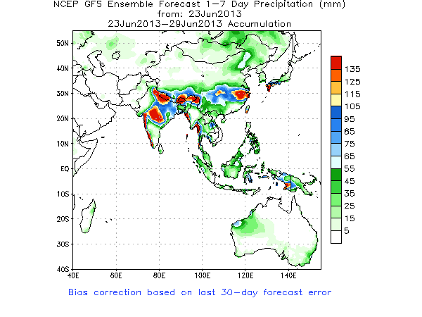
Forecast: Up to 29th June
There is an UAC at 700 level over the Arabian Sea near Coastal Saurashtra & Kutch for past two days and it is expected to persist. The Low Pressure will track over Odisha, Chhatishgarh, Vidarbh and then Madhya Pradesh during the next two days. The Low could probably fizzle out but the Upper Air Cyclonic Circulation will remain and is expected to track Northwards. Due to interaction of the two UACs and moisture incursion over Saurashtra/Gujarat around 26th & 27th June, South Gujarat, Central Gujarat and parts of North Gujarat will get medium to heavy rainfall. Saurashtra will receive light to medium but scattered rainfall during this period. There is also a possibility of scattered rain over some parts of Saurashtra today.
Heavy rainfall areas over India during 23rd to 29th June are Chhatishgarh, Madhya Pradesh and adjoining Maharashtra area, Parts of Uttar Pradesh and Uttaranchal and Coastal areas of West Coast of India.
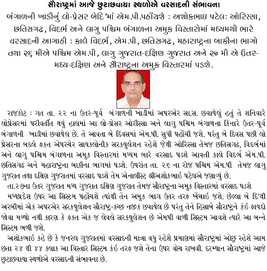
Weather Forecast In Akila Daily Dated 24th June 2013 @ 10.30 am.