Current Weather Conditions On 13th June 2013 @ 2.00 pm.
There has been all round rainfall over whole of Saurashtra, South Gujarat, Central Gujarat and some parts of North Gujarat. Some places have received exceptionally heavy rainfall till date. Kutch has received less rainfall till now.
The Low Pressure area over Northwest Bay of Bengal has strengthened to a Well Marked Low Pressure area over South Coastal Odisha and neighborhood. Associated
Cyclonic Circulation extends up to 7.6 Kms. above sea level, tilting Southwestwards with height.
The trough at mean sea level now runs from West Rajasthan to East Central Bay of Bengal
across East Rajasthan, Madhya Pradesh, Chhattisgarh and the Center of the Well Marked
Low Pressure area.
The off-shore trough at mean sea level from South Gujarat coast to Kerala coast now
extends from South Gujarat coast to Lakshadweep area.
The Cyclonic Circulation over Northeast Arabian Sea in the vicinity of Saurashtra & Kutch now lies in the vicinity of Southeast Pakistan and adjoining Kutch and extends up to Mid Tropospheric levels.
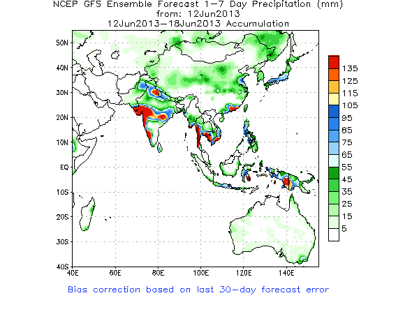
NCEP/GFS Bias-Corrected Precipitation Forecasts
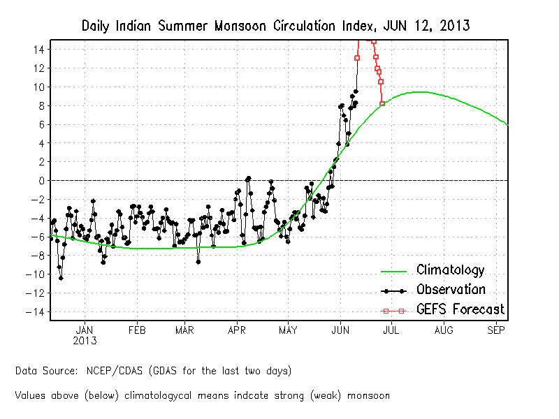
The Monsoon is expected to be vigorous for the next two weeks as can be seen from the Indian Monsoon Index.
From IMD:
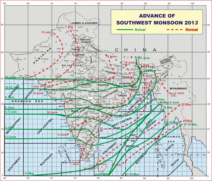
The Southwest Monsoon has further advanced into remaining parts of north Arabian
Sea, Gujarat State; some more parts of Madhya Pradesh and some parts of southeast
Rajasthan.
The Northern Limit of Monsoon (NLM) passes through Lat. 25° N / Long. 60° E,
Lat. 25° N / Long. 65° E, Udaipur, Guna, Satna, Ranchi, Berhampore, Jalpaiguri and
Gangtok.
Conditions are favourable for further advance of southwest Monsoon into some more parts of Rajasthan; remaining parts of Madhya Pradesh, Jharkhand and West Bengal& Sikkim and some parts of Bihar and Uttar Pradesh during next 2 – 3 days.
IMD Map of Advance of Southwest Monsoon 2013 on 10th June 2013
Forecast: 13th June to 19h June
The Well Marked Low Pressure is expected to track mainly West Northwestwards over Orissa, Chhatishgarh, Vidarbh and then along M.P. Maharashtra border. The Low or a trough will linger in M.P. and the associated Upper Air Cyclonic Circulation will track Westwards towards Gujarat.
Conditions will be very good for heavy to very heavy rainfall over Saurashtra & Gujarat. Some parts of Gujarat are expected to receive extreme heavy rainfall during the forecast period.
Note: Further update will be given as and when warranted. This forecast does not imply that all the regions will receive rain on all the days of the forecast period. This forecast is given up to 19th June and does not imply anything about what will happen from 20th June onwards.
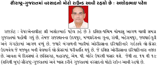
Weather Forecast In Akila Daily dated 13th June 2013 @ 1.30 pm.