Isolated Pre-Monsoon Activity Likely Over Saurashtra, Gujarat & Kutch During 13th–20th June 2026 – Temperature Likely To Decline To Range 38.5°C–41.0°C
13થી 20 જૂન 2026 દરમિયાન સૌરાષ્ટ્ર, ગુજરાત અને કચ્છમાં આઇસોલેટેડ પ્રી-મોન્સૂન એક્ટિવિટીની શક્યતા – મહત્તમ તાપમાન 38.5°C થી 41.0°Cની રેન્જમાં રહેવાની સંભાવના
Gujarat Temperature Observations (12th June 2026)
Maximum temperatures were around near normal to about 3°C above normal across many hot centers of Gujarat State.
- Rajkot: 40.9°C (2.2°C above normal)
- Deesa: 39.8°C (0.2°C above normal)
- Amreli: 39.3°C (1.5°C above normal)
- Ahmedabad: 42.7°C (3.0°C above normal)
- Vadodara: 40.4°C (1.1°C above normal)
- Surendranagar: 41.8°C (2.4°C above normal)
Current normal maximum temperatures across most parts of Gujarat has now decreased to around 38.5°C to 39.5°C. Ahmedabad has normal maximum temperatures near 40°C.
Advance of Southwest Monsoon 2026
As per the IMD Bulletin:
The Northern Limit of Monsoon continues to pass through 18°N/60°E, 18°N/65°E, 18°N/70°E, Harnai, Solapur, Hyderabad, Bhadradri Kothagudem, Kalingapatnam, Paradeep, Baripada, Purulia, Dhanbad, Muzaffarpur and 28.3°N/83°E as on 13th June, 2026.
Conditions are favorable for further advance of southwest monsoon into remaining parts of Karnataka, Telangana, Andhra Pradesh, West Bengal, some more parts of Odisha and some parts of South Chhattisgarh during next 2-3 days.
Weather Forecast For Saurashtra, Gujarat & Kutch (13th-20th June 2026)
Pre-Monsoon Activity
Isolated pre-monsoon activity is expected on some days during the forecast period.
The term Isolated refers to rainfall occurring over 1% to 25% of the area. It does not indicate the amount of rainfall expected.
Temperature Outlook
Maximum temperatures are expected to decline by around 1°C to 1.5°C in next two days and is expected to be near normal over most centers during the rest of the forecast period.
Most hot centers across Gujarat are likely to record maximum temperatures in the range of 38.5°C to 41.0°C.
Winds
- Predominantly Southwest winds during the forecast period.
- Wind speeds are expected to vary between 15 km/h and 40 km/h.
13થી 20 જૂન 2026 દરમિયાન સૌરાષ્ટ્ર, ગુજરાત અને કચ્છમાં આઇસોલેટેડ પ્રી-મોન્સૂન એક્ટિવિટીની શક્યતા – મહત્તમ તાપમાન 38.5°C થી 41.0°Cની રેન્જમાં રહેવાની સંભાવના
ગુજરાત તાપમાન અવલોકન (12 જૂન 2026)
ગુજરાત રાજ્યના ઘણા ગરમ કેન્દ્રોમાં મહત્તમ તાપમાન નોર્મલ આસપાસથી લઈને નોર્મલ કરતાં આશરે 3°C સુધી વધુ નોંધાયું હતું.
- રાજકોટ: 40.9°C (નોર્મલ કરતાં 2.2°C વધુ)
- ડીસા: 39.8°C (નોર્મલ કરતાં 0.2°C વધુ)
- અમરેલી: 39.3°C (નોર્મલ કરતાં 1.5°C વધુ)
- અમદાવાદ: 42.7°C (નોર્મલ કરતાં 3.0°C વધુ)
- વડોદરા: 40.4°C (નોર્મલ કરતાં 1.1°C વધુ)
- સુરેન્દ્રનગર: 41.8°C (નોર્મલ કરતાં 2.4°C વધુ)
હાલમાં ગુજરાતના મોટા ભાગના વિસ્તારોમાં નોર્મલ મહત્તમ તાપમાન હવે ઘટ્યું છે જે લગભગ 38.5°C થી 39.5°C ગણાય. અમદાવાદમાં નોર્મલ મહત્તમ તાપમાન લગભગ 40°C આસપાસ ગણાય.
દક્ષિણ-પશ્ચિમ ચોમાસાની પ્રગતિ 2026
IMD બુલેટિન મુજબ:
13 જૂન 2026ના રોજ ચોમાસાની ઉત્તર સીમા (Northern Limit of Monsoon) 18°N/60°E, 18°N/65°E, 18°N/70°E, હરનાઈ, સોલાપુર, હૈદરાબાદ, ભદ્રાદ્રી કોઠાગુડેમ, કાલિંગપટ્ટનમ, પારાદીપ, બારીપદા, પુરુલિયા, ધનબાદ, મુઝફ્ફરપુર અને 28.3°N/83°Eમાંથી પસાર થઈ રહી છે.
આગામી 2 થી 3 દિવસ દરમિયાન દક્ષિણ-પશ્ચિમ ચોમાસું કર્ણાટક, તેલંગાણા, આંધ્ર પ્રદેશ અને પશ્ચિમ બંગાળના બાકીના વિસ્તારોમાં તેમજ ઓડિશાના વધુ કેટલાક ભાગો અને દક્ષિણ છત્તીસગઢના કેટલાક વિસ્તારોમાં આગળ વધવા માટે પરિસ્થિતિ અનુકૂળ છે.
સૌરાષ્ટ્ર, ગુજરાત અને કચ્છ માટે હવામાન આગાહી (13થી 20 જૂન 2026)
પ્રી-મોન્સૂન એક્ટિવિટી
આગાહી સમયગાળા દરમિયાન કેટલાક દિવસોમાં આઇસોલેટેડ પ્રી-મોન્સૂન એક્ટિવિટીની શક્યતા છે.
“આઇસોલેટેડ” (Isolated) શબ્દનો અર્થ એ છે કે વિસ્તારના 1% થી 25% ભાગમાં વરસાદી પ્રવૃત્તિ થઈ શકે. તેનો અર્થ વરસાદના પ્રમાણ સાથે સંબંધિત નથી.
તાપમાન
આગામી બે દિવસ દરમિયાન મહત્તમ તાપમાનમાં આશરે 1°C થી 1.5°Cનો ઘટાડો થવાની શક્યતા છે અને ત્યારબાદ આગાહી સમયગાળા દરમિયાન મોટા ભાગના કેન્દ્રોમાં તાપમાન નોર્મલ આસપાસ રહેવાની સંભાવના છે.
ગુજરાતના મોટા ભાગના ગરમ કેન્દ્રોમાં મહત્તમ તાપમાન 38.5°C થી 41.0°Cની રેન્જમાં નોંધાવાની શક્યતા છે.
પવન
આગાહી સમયગાળા દરમિયાન મુખ્યત્વે દક્ષિણ-પશ્ચિમ દિશાના પવનો ફૂંકાવાની શક્યતા છે.
પવનની ઝડપ આશરે 15 કિમી/કલાકથી 40 કિમી/કલાક વચ્ચે રહેવાની સંભાવના છે.
Caution: Please refer/rely on IMD/RSMC Bulletins/Advisories for Storms & Weather related matter.
સાવચેતી: સ્ટોર્મ કે હવામાન અંગે ની માહિતી માટે ભારતીય હવામાન ખાતા/ગવર્મેન્ટ ના બુલેટીન/સુચના પર નિર્ભર રહેવું.
Read Comment Policy – કમેન્ટ માટે માર્ગદર્શન વાંચો
How To Upload Profile Picture For WordPress – વર્ડપ્રેસ માં પ્રોફાઈલ પિક્ચર કેમ રાખવું
Forecast In Akila Daily Dated 13th June 2026
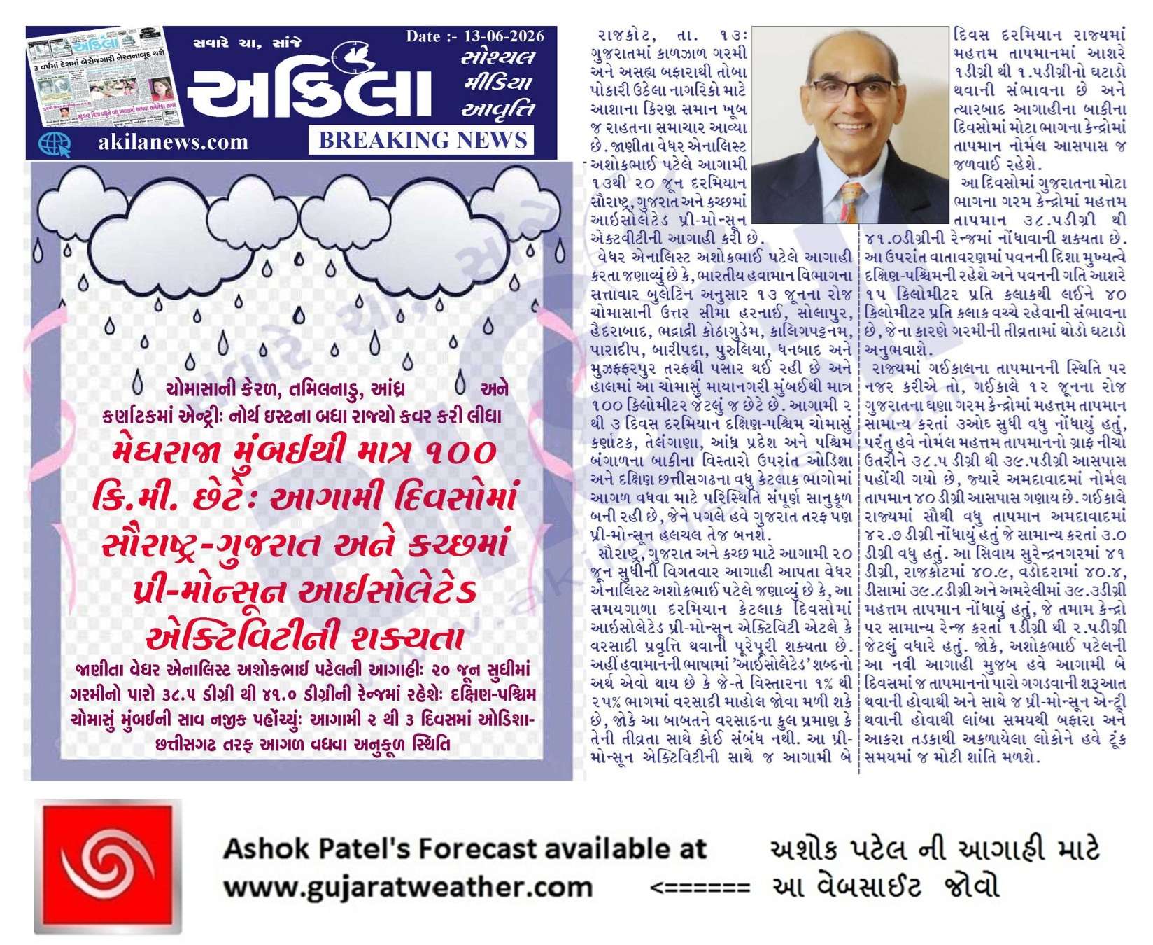
Forecast In Sanj Samachar Daily Dated 13th June 2026
Sir, લાંબા સમયથી અરબી સમુદ્રમાં વાદળછાયું વાતાવરણ અને વરસાદનો અભાવ હોવાથી, શું તે IOD પોઝિટિવ બનાવવામાં મદદ કરી શકે છે?
IOD positive maate South Arabia Sea Garam and SETIO thando hovo joiye ( South East Tropical Indian Ocean) BOB na Dakshin bhaag.
IOD positive nagative mate alnino lanino ni Jem koi threshold criteria hoy ?
Yes +0.4 and -0.4 C je 12 week ni sharerash rahevi joiye. jema 8 week sadang. (BOM Australia mujab)
જયશ્રી કૃષ્ણ મિત્રો ‘ ગુજરાત માટે ચોમાસુ તો સ્લીપીંગ મોડમાં ચાલ્યુ ગયું ‘ હવે તો અરબી સમુંદર જગાડે તો સારુ ’22 તારીખની થોડિક આશા હતી તે પણ નહીવત થઈ ગઈ ‘ હવે તો અષાઢી બીજ પછીની વાટ જોવાની ‘ આ વખતે 2026 નુ ચોમાસુ વિચીત્ર થવાનુ છે .
14 તારીખ થી mumbai છું, બીલકુલ વરસાદ નથી. છાંટો પણ નથી પડ્યો. ના તો ખાસ વાદળ છે. તડકો ફુલ છે. જ્યારે કચ્છમાં ઝાપટા ચાલુ થયા ના વાવડ છે.
અલનીનો ની તમારા નામ વારી પોસ્ટ ફરે છે તે સાચી છે કે ખોટી છે
Ahi comment mathi upaadi and Mithu marchu umerel chhe.
Maro comment ma jawab El nino Babat:
“El Nino ke La nina te koi ek divas ni prakriya nathi. 6-8 Mahina minimum aa prakriya chalu thay thi bandh thay sudhi samay laagey.
El Nino India Desh level na Chomasa ne negative asar karto hoy chhe.
Alag alag Rajyo ne vadh ghat asar hoy chhe.
North East Rajyo ne faydo hoy chhe.
Gujarat Region ne khas asar nathi karto (Aa chhela 150 varsah na data parthi lakhu chhu)
Saurashtra Kutch Ne 10% Negative asar thay chhe (sharerash )”
તો. પગલા. કેમ. અવળા. આ. વખતે.
સર આપનું સ્ટેટમેન્ટ છે કે આપના નામ પર બિલ ફાડ્યું છે?
Ahi comment mathi upaadel chhe. Amuk gharnu umerel chhe.
Ahi Gujarat Region Kahel te Gujarat kari nakhyu. Saurashtra nu kai na kahyu.
Misinformation and sansanaati maate ni vaat chhe.
Maari comment jawab rupey chhe te vancho El Nino babat.
IMD nu settelite khotvai gyu lage ?
Koney kahyu?
2023.2024.ma elnino hato tayare kayu fektar kaam kariyu varshad aapde shara hta
2023 ma Positive IOD plus Biparjoy Cyclone ni meherbani hati
2024 ma fari neutral thai gayu hatu
2023 ma September ma lagbhag IOD Positive baju gayo.
Porbandar City na amuk area ma sanje jordar varsadi zaptu pdyu and Aje mostly Ghata Varsadi vaddao jova mlya.
2012 માં ઓલું વરસાદ વરસાવવા માટે જે મશીન બનાવ્યું હતું એને કોક ક્યો કે હવે પાછું ચાલુ કરે
Where is the monsoon?
On holiday !
Sir koe technical glitch chhe? K pa6i me ek Blog vanchyo hato ema jet stream nu reason apyu. (પશ્ચિમી જેટ પ્રવાહનું અસામાન્ય દક્ષિણ તરફનું સ્થળાંતર ઉપલા સ્તરના પૂર્વીય જેટમાં દખલ કરી રહ્યું છે, જે સામાન્ય રીતે ચોમાસાના પરિભ્રમણને ચલાવે છે.)
Chomasa ma 200 hPa na pavano East thi West hoy.
Haal aapadey West this East chhe.
sir to havethi aapni baju etle k gujarat baju ni pankh aagal vadhse ne?
Pahela Mumbai pahonvu padey.
Haju vaar lagshe.
મુંબઈ માં હજૂ કોઈ આશર નથી દેખાતું.
શ્રી ગણેશ થાય એટલે જાણવું.
જય સીયારામ
Good afternoon sir..sir aa vakhte ae nathi samajatu ke..bangal ni khadi ma aek pan kem system active aatyar sudhi ma nathi thai ..tenu su karan hoy sake please sir answer.. nahitar aatyre sudhi available hoy j system..
TV ma toe avey chhe ke Gujarat par babbey System Shakriya thaiy !
System etle shu ?
Normally Majbut UAC ne System ganay, pachhi Low Pressure, WMLP, Depression, Deep Depression and Cyclone.
Atyare toe trough hoy ene pan System kahe chhe.
તારીખ: 15 જૂન 2026 ભારતીય હવામાન વિભાગ (IMD) મુજબ આજની મહત્વપૂર્ણ હવામાન પરિસ્થિતિ નૈઋત્યનું ચોમાસું આજે 15 જૂન 2026ના રોજ આગળ વધી આંધ્રપ્રદેશના બાકી વિસ્તારો, પશ્ચિમ બંગાળ તથા મધ્યપશ્ચિમ બંગાળની ખાડી, તેમજ તેલંગાણા, ઓડિશા, ઝારખંડ અને બિહારના વધુ વિસ્તારોમાં પહોંચી ગયું છે. ચોમાસાની ઉત્તર સીમા (NLM) હાલ 18°N/60°E, 18°N/65°E, 18°N/70°E, હરનાઈ, સોલાપુર, હૈદરાબાદ, ભદ્રાચલમ, કોરાપુટ, ફુલબાની, રાંચી, જામુઈ, મુઝફ્ફરપુર અને 28.3°N/83°E પરથી પસાર થાય છે. આગામી 4 થી 5 દિવસ દરમિયાન ચોમાસું વધુ આગળ વધીને મધ્ય અરબી સમુદ્રના કેટલાક ભાગો, મહારાષ્ટ્ર, કર્ણાટકના બાકી વિસ્તારો, તેલંગાણા, ઓડિશા, ઝારખંડ, બિહાર તથા છત્તીસગઢના કેટલાક વિસ્તારોમાં આગળ વધવા માટે પરિસ્થિતિ અનુકૂળ છે. સમુદ્ર સપાટી… Read more »
Hve na 2 3 di ma south gujarat and south saurashtra ma japta to chalu thse em ECMWF btave che 🙂
Mne to Nomad GFS j gme che….bhle a kye em no thay pn saru to btave j 🙂 hahaha
25 જૂન સુધી કાઇ વરસાદ આવે એવું લાગતું નહી 25 પછી GSF મોડેલ Western ghats માં થોડુંક એક્ટિવ બતાવે છે એની સિવાય કઈ વિશેષ નહીં . ક્યાંક છાંટા કે ઝાપટું પડે કદાચ બાકી ગુજરાત માં વરસાદ હાલ તો કાઇ ચોમાસું સેટ થાય એવું લાગતું નહી .હજુ સુધી એક પણ સિસ્ટમ બંગાળ માં કે અરબ સાગર માં બની નહિ . જે બહુ મોટી વાત છે 15 જૂન સુધી નોર્મલ બે સિસ્ટમ તો થઈ જ જાય બંગાળ તરફ પણ હજુ કોઈ લો પ્રેશર બન્યું નહીં . પેસેફિક તરફ થી પણ કોઈ સિસ્ટમ આ તરફ આવી નહી ક્રોસ કરીને .. નોર્મલ તારીખ 21… Read more »
Haji apde Chomasa mate ghani raah jovi padse bhai. June end pan aavi jay kasu kehvay nai. Aa vakhate paschimi garam suka pawano willian banya che chomasa mate.
Hal daxin gujrat na surat city ma bav primonsun ochi che to sir have ketla divas rah jovo jose
Gujarat ma Chomasu bese tyare pahela tamaro vaaro avashe.
Mumbai ma chomasu besey te pahela pre-monsoon vaaro avashe SUrat ne.
નમસ્કાર સર અમારે આજે વહેલી સવારે 4વાગ્યે સમાન્ય છાંટ છૂટ હતી
સર imd 10 દિવસ વરસાદ માટે નું મોડલ જોયે તો 25 જૂન સુધી નું તો આખા ભારત માં ગણા ગઠ્યા વિસ્તાર માં વરસાદ શે જે વીસિત્ર લાગે કે આ નોર્મલ કહેવાય?
Hamana IMD GFS and IMD BFS ma kaink technical issue hoy shakey.
Thoda time pahela Saurashtra kanthe Ek CYclone batavata hata and bije divase gayab !
તો અત્યારે કયા મોડલ ઉપર વધુ વિસ્વાસ રાખી શકાય
Badhu jovay IMD GFS, KOLA ECMWF and KOLA NONADS GFS
નમસ્તે અશોક સર,તમે જે વાત આટલા મહિના થી કહેતા હતા તે હવે આજે imd ના ડાયરેક્ટર કરી છે.El nino mid September પછી સક્રિય થશે એટલે ચોમાસા પર તેની ખાસ અસર નહીં રહે. આવા સચોટ અભ્યાસ પર અવાર નવાર પ્રકાશ પાડવા બદલ આભાર
El Nino ke La nina te koi ek divas ni prakriya nathi. 6-8 Mahina minimum aa prakriya chalu thay thi bandh thay sudhi samay laagey.
El Nino India Desh level na Chomasa ne negative asar karto hoy chhe.
Alag alag Rajyo ne vadh ghat asar hoy chhe.
North East Rajyo ne faydo hoy chhe.
Gujarat Region ne khas asar nathi karto (Aa chhela 150 varsah na data parthi lakhu chhu)
Saurashtra Kutch Ne 10% Negative asar thay chhe (sharerash )
બરોબર sir પણ અલનીનો ના કારણે બંગાળની ખાડીમાં સિસ્ટમ બનવા માં અડચણ ઊભી થઈ શકે?? અને જો થાય તો ગુજરાત માં છુટા છવાયા વરસાદ સિવાય બીજી આશા ના રહે..??
2023 EL Nino varash hatu. Jokey First thresh hold JJA ma thayo hato. Aa vakhate Pahelo thresh hold AMJ ka MJJ banshe.
2023 Total 10 System bani hati Jovo 2023 ma banel Sysem Vigat
જય મુરલીધર સાહેબ
દેશી અનુમાન અનુસાર હાથીયો વરશે તો બીજા વર્ષે મૃગશીર્ષ નક્ષત્ર મા વાવણી લાયક વરસાદ થાય એ આ વર્ષે તદન ખોટું સાબિત થયું
હવે એક કહેવત છે કે રૂણ (રોહિણી)તપે
મૃગશીર્ષ વાય તો આદ્રા મા મે (વરસાદ)થાય
જય મુરલીધર સાહેબ
છેલ્લા ત્રણ ચાર વર્ષથી એકંદરે વરસાદ સારા થયા છે અત્યાર ના સમયે દક્ષિણ ગુજરાત માં વરસાદ ની શરૂઆત થય જતી હોય છે તો ગયા વર્ષે સૌરાષ્ટ્ર મા પણ અમુક જગ્યાએ વાવણી લાયક વરસાદ આ સમય આજુબાજુ થય ગયો હતો એટલે ધરતી પુત્રો ની મીટ આકાશ તરફ વધી ગય છે કે હજુ સુધી કેમ ચોમાસું એકટીવ કેમ નથી થતું
બસ હવે તો આ પવન જે જોર જોરથી ફૂંકાઇ છે એ બંધ થાય તો આશા નું કિરણ જાગે
સર.. અલનિનો/ લાનિનો/ ન્યુટ્રલ થવા નો સમય ગાળો/ સાયકલ અંદાજે કેટલા વર્ષ ની હોય શકે..? મારી જાણકારી મુજબ 2023 ના ચોમાસા સમયે અલનિનો ની અસર હતી..
Samanya ritey 6-8 mahina thi 12 mahina hoy.
2-5 varshe EL nino hoy and 2-5 varshe La Nina hoy
સર IOD ની સ્થિતિ અત્યારે કેવી છે ને આગળ કેવીક રહેશે
Ahi Menu ma chhe
jovo IOD maate ni link chhe
લિંક માં જોતા અત્યરે iod પોઝિટિવ તરફ જય રય્હો છે ખરું ને
Haju ghanu chhetu chhe. Haal Neutral ganay
Sir Bharat GFS ane IMD GFS ma su fer ?
Fakt resolution farak chhe.
IMD BFS 6 km ni grid hoy chhe, etle ke 6*6 km na area sudhi nu nirikhshan kare.
Jyare IMD GFS 12*12 km grid chhe.
Monsoon likely to get delayed in Gujarat. May reach Gujarat around 25th or 26th June ane sharuat nabdi rese. Dhime dhime jor pakadse monsoon in June end.
U were talking about 21st to 22nd June and now it’s 25th or 26th and again I think that you will be saying the monsoon rains will not reach Gujarat till 1st July …
Till 12th June, conditions were favourable for monsoon to move ahead but due to constant westerly dry winds, monsoon winds are not able to set in & monsoon is stuck in Maharashtra since last 5 days. As per my study, still conditions are not favourable for monsoon to set in Mumbai also till next 4 to 5 days. We have to wait for monsoon to come in Gujarat atleast till 26th June or June end. Let’s wait & watch & hope to set monsoon in Gujarat at the earliest.
તારીખ: 14 જૂન 2026 આજની પરિસ્થિતિ ભારતીય હવામાન વિભાગ (IMD) મુજબ: – નૈઋત્ય ચોમાસાની ઉત્તર સીમા (NLM) હાલ 18°N/60°E, 18°N/65°E, 18°N/70°E, હરનાઈ, સોલાપુર, હૈદરાબાદ, ભદ્રાદ્રી કોઠાગુડેમ, કલિંગપટ્ટનમ, પરાદીપ, બારિપાડા, પુરુલિયા, ધનબાદ, મુઝફ્ફરપુર અને 28.3°N/83°E પરથી પસાર થઈ રહી છે. – આગામી 4 થી 5 દિવસ દરમિયાન નૈઋત્ય ચોમાસું મહારાષ્ટ્રના વધુ ભાગોમાં, કર્ણાટકના બાકી ભાગોમાં, તેલંગાણા, આંધ્ર પ્રદેશ, પશ્ચિમ બંગાળ તેમજ ઓડિશા, ઝારખંડ, બિહાર અને દક્ષિણ છત્તીસગઢના કેટલાક વધુ ભાગોમાં આગળ વધવા માટે પરિસ્થિતિ અનુકૂળ છે. – ઋતુજન્ય ટ્રફ (Seasonal Trough) દરિયાઈ સપાટીએ પશ્ચિમ રાજસ્થાનથી ગંગેટિક પશ્ચિમ બંગાળ સુધી ઉત્તર-પૂર્વ રાજસ્થાન, ઉત્તર મધ્ય પ્રદેશ, દક્ષિણ ઉત્તર પ્રદેશ, બિહાર અને ઝારખંડમાંથી પસાર… Read more »
સર આ સિઝન મા આપણા બન્ને સમુન્દ્ર મા જે વાવાઝોડા બનવા જોઈ તે આજ સુધી નથી બન્યા તેવું અગાઉ ક્યારેય તમે. જોયું છે કે આ વર્ષે જ આવું છે હું 2012 થી અહી જોડાયેલો છું લગભગ એક થી વધુ મોટી સીસ્ટમ ચોમાસા પહેલાં તો બની જ હોય
Aama badhu janavel chhe.
India Cyclone-Depression vigere
Gya varshe pn lagbhag nata banya
જયશ્રી કૃષ્ણ સર અને બધા મિત્રોને ‘ અત્યાર ના રમકડા જોતા તો એવુ લાગે કે વરસાદ ‘ તા :22 જૂન પછી ધીરે ધીરે સૌરાષ્ટ્ર ગુજરાત માં આગળ વધશે ‘ આમેય બાવીશ તારીખે આદ્વા નક્ષત્ર બેસે છે એટલે પવન પણ ત્યાં સુધી રહેશે ‘ ઘણા વર્ષોથી જોવ છુ કે જ્યાં સુધી પૂર્વ છેડો (બીઓબી ) જોર કરતો હોય ત્યાં સુધી પશ્ચિમ છેડો ( અરબી )આગળ ઓછો ચાલે ‘ ક્યારેક ભાગ્યે જ બંને છેડા એક સાથે ચાલતા હોય છે
Hello sir a bija agahi vada a vars sav nabdu batave che al nino ne hisabe saurashtrama. Khare khar a sachu che.hu e badhane manto nathi tame kyo ek sachu please ans apjo
Hu Lamba gaada ni agahi karto nathi etle tamone madad nahi kari shaku.
સર windy app હવે ખુલે છે પણ થોડા દિવસ નું બતાવે છે અને ત્યારબાદ ઝાંખી થઈ જાય છે.
Subscription maate evu karel chhe.
mafat jovanu bandh karyu chhe etle SUbscription karvu padey.
Ahi ECMWF and Nomads GFS mafat chhe.
Sir aa chomasu Maharashtra pase aavi ne kem atki jaay che mostly??
Maharashtra ma aa vakhte atakyu.
Normally Gujarat cover karva ma 14 divas IMD batavey chhe tena Normal Map ma.
Ok sir
Wd ne Hisabe Suko Pradesh gnato Rajasthan ma Most time divso thi Varsad Che Tya Normal Thi vadhu Varsad pdi gyo And Gujarat Garmi Sathe Koru Dhakod And Suka Pavan Fukai che.
Sachi vaat che. UP, Delhi, Rajasthan, Uttrakhand, Bihar, eastern states ne badhe atyare full varsad che ane ahiya suka garam pawano funkai rahya che.
Banne alag alag Varsad chhe. North east ma chomasu besi gayu chhe .
Rajasthan and zdelhi ma nahi.
Bangal jityu atale bangal ni pakh halase?
અલનીનો વારી લપ તો બવ ચગાવી ન્યુઝ વાળાઓએ…સર
Aakhu Chomasu aamaj chalshe !
વાવણી લાયક વરસાદ ની હજુ વાર છે કે, થઈ જશે
Thay toe karo !
Sir tamare kyare vavani karvi premonsoon ma k saro varsad thay tyare ?
Pani hoy etlu orvel chhe.
Haji thoda diwas raah jovi padse vavnilayak varsad mate. 22 ke 23 June thi kaik aasha rakhi sakay Gujarat ma chomasa na aagman ni. Tya sudhi kai khaas nathi.
chomasani nirthan limit no Purva chhedo vadhu progress kare chhe, paschim chheda ma bahu aagad nathi chaltu!
નમસ્કાર.. નવી અપડેટ મા ચોમાસું આગળ વધી રહ્યું છે.. તે જાણી ને આનંદ થયો.. આપણા બાપ દાદા કહેતા.. મુંબઈ વરસાદ થાય પછી આપણે સૌરાષ્ટ્ર /કચ્છ વારા એ 10 દિવસે આશા રખાય.. હજુ કાંઇ મોડું નથી થયું.. આદ્રા નક્ષત્ર મા વાવણી નો વરસાદ થઇ જશે.. એવું લાગે છે..
Sir varsad ni thodik rah jovdav se 23 tarikh thi aapde vatavar sudhre che sara varsad mate 1 dt aaspas skyta ganvi ke kem sir barobar che ke kem
21 tarikh pachi vatavaran sudhartu dekhase jo badhu barobar chalyu to. 7 diwas sudhi joya rakho su thay che. Tya sudhi aavuj gharmi ane bafara nu vatavaran rese.
તો સર વાવણી માટે હજુ રાહ જોવી પડશે તેવુ લાગે છે અને સર પવન ક્યારે ઘટશે જય શ્રી કૃષ્ણ
Sir have.. sansanati mate navo shabd avyo… Godzilla alnino…!!
સરસ,
sir અમારે પંચમહાલ ને તો ઉપર ના map જોતા 28 th June પછીજ મેલ પડે એવું લાગે છે…ecmfw માં પણ આવુજ છે..
Sir, atyare El nino ni position su chhe ?
Chhele MAM season ma RONI Index -0.1C chhe. El Nino pahelo thresh hold koi pan mahina ni aakhar ma nakki thay. Haal ni paristhiti: ERSST.v5 mujab April and May 2026 na SST anomaly chhe. 2026 4 -0.18C 2026 5 0.45C RONI Index ni Pahelo thresh hold AMJ 2026 ma hansal karvo hoy toe: April na -0.18+ May na 0.45 + June 2026 SST je avey te (Mahina ni aakhar ma avey tyare) = 1.35 athva vadhu thay toe Pahelo thresh hold thay. Matlab em ke June SST anomaly +1.08 athva vadhu avavi joiye. AMJ season maate 0.5C hansal karva maate… Read more »
સર આ ડેટા તમે કઈ વેધર એજન્સી સાઇટ પરથી મેળવો છો ?
NOAA કે અન્ય કોઈ બીજી સાઇટ?
CPC RONI
બહુજ સરસ માહિતી આપો છો સર તમો અપડેટ નો ટાઇમ થાય કે તરત નવી અપડેટ આપો છો આભાર વ્યક્ત કરુ છુ તમારો.તમે દર વર્ષે ખેડૂતો ને માર્ગદર્શન આપો છો.પણ સર આ વર્ષે ચોમાસુ કેવું જશે એ નક્કી અસમંજસ જેવું છે..એટલે તમારી મહેનત થોડીક વધશે આ વર્ષે.કહેવાનો મારો મતલબ એ છે કે વરસાદ નો ટાઇમ થાય ને વાવેતર થયું હોય ને કોઈ ને બાકી હોય તો વરસાદ ક્યારે આવશે.એ જાણવા ની ઈચ્છા વધતી જાતી હોય છે.પણ સાચી માહિતી ખેડૂતો ને કોઈ આપતુ નથી.સરકાર પણ નથી આપતી.અને યુટ્યુબ ના આગાહીકાર ની તો વાત જ ના કરો.આજે આમ કહીને કાલે ફરી જાય છે.એટલે… Read more »
તારીખ: 13 જૂન 2026 ભારતીય હવામાન વિભાગ (IMD) મુજબ આજની મિડ-ડે પરિસ્થિતિ – નૈઋત્યના ચોમાસાની ઉત્તર સીમા (NLM) હાલ 18°N/60°E, 18°N/65°E, 18°N/70°E, હરનાઈ, સોલાપુર, હૈદરાબાદ, ભદ્રાદ્રી કોઠાગુડેમ, કલિંગપટ્ટણમ, પારાદીપ, બારીપાડા, પુરુલિયા, ધનબાદ, મુઝફ્ફરપુર અને 28.3°N/83°E પરથી પસાર થાય છે. – આગામી 2 થી 3 દિવસ દરમિયાન નૈઋત્યનું ચોમાસું કર્ણાટક, તેલંગાણા, આંધ્ર પ્રદેશ, પશ્ચિમ બંગાળના બાકી વિસ્તારો તેમજ ઓડિશા અને દક્ષિણ છત્તીસગઢના કેટલાક વધુ વિસ્તારોમાં આગળ વધવા માટે પરિસ્થિતિ અનુકૂળ છે. – ઉત્તર હરિયાણા અને આસપાસ વિસ્તારોમાં આવેલ વેસ્ટર્ન ડિસ્ટર્બન્સ સાયક્લોનિક સર્ક્યુલેશન રૂપે યથાવત છે, જે સમુદ્ર સપાટીથી 3.1 થી 4.5 કિમી ઊંચાઈ સુધી ફેલાયેલું છે. તેની સાથે મધ્ય ટ્રોપોસ્ફેરિક પશ્ચિમી… Read more »
Have aavi gae chomasani asar, amara vistarma vadala aakho divas taki rahe chhe.
sir akila vala e tamaro new Pic update kari didho. & Biju e puchvanu k aalga 2-3 day ma chomasu aagal vadhse to tema maharashtra nu name kem nathi? km k haju aakha maharashtra ma chomasu bethu nathi.
Evo matlab ganay ke aavata bey tran divas ma CHomasu agad chalshe, parantu te Bengal ni baju ni Pankh chalshe.
ha bas ej dowd hato km k last 3-4 days thi e bajuj chale 6 . to have aapni baju wait & watch
Yes. Pahela Mumbai pachhi raah jovo
Jai Shree Krishna!
Western Disturbance in April and May months is it normal ?
Isn’t it causing the north of India to cool down? Which is not causing the low to pull the monsoon?
There are no low forming in either BOB or Arabian???
Yes the WD does spoils the North Inda heating as well as the wind patterns.
જય દ્વારકાધીશ સર આ પ્રીમોનસુન મા છાંટા સુટી જ આવછે કે પસી કયાય વાવણી લાયક વરસાદ આવે
Tamara nasib !
Sara smachar chhe,