Current Weather Conditions on 24th July 2017
Monsoon Status based on IMD Inferences:
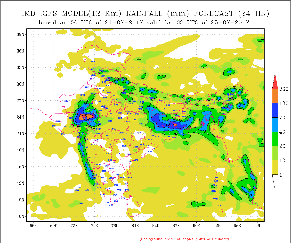
The Low Pressure is over South Rajasthan & neighborhood. Associated Cyclonic Circulation extends up to 7.6 km. above mean sea level.
The other Low Pressure is over Gangetic weest Bengal and neighborhood. Associated Cyclonic Circulation extends up to 7.6 km above mean sea level.
The Axis of Monsoon at mean sea level runs from Bikaner, Low Pressure over South Rajasthan, Shivpuri, Low over Gangetic West Bengal and thence towards Northeast Bay of Bengal.
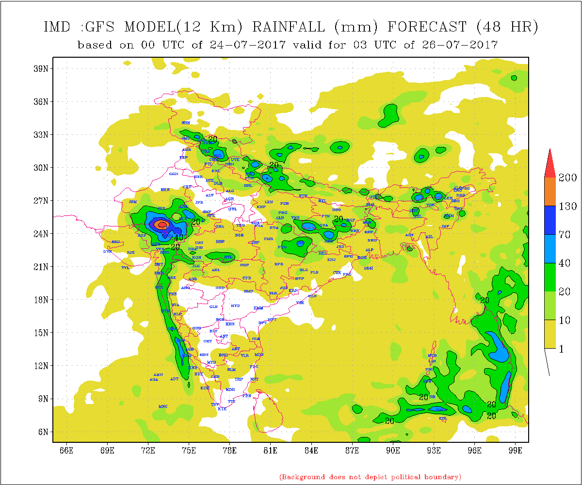
Many parts of M. P./Gujarat border areas, Rajasthan/Gujarat border areas, North Gujarat, East Central Gujarat, South Gujarat, & Saurashtra and some parts Kutch have received good round of rainfall.
Saurashtra, Kutch & Gujarat :
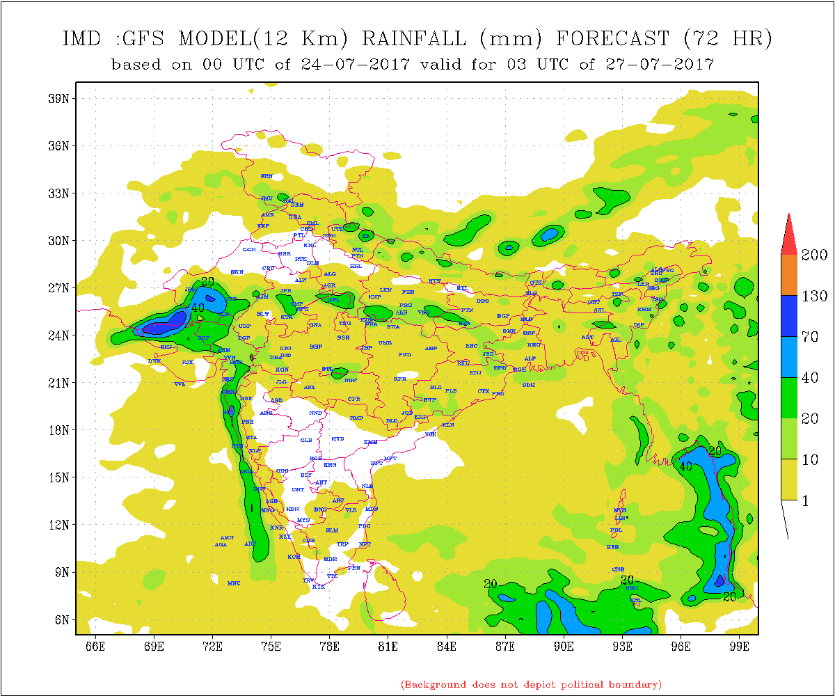
North Gujarat will continue to get heavy to very heavy rain and all its (North Gujarat’s) adjoining areas of North Saurashtra, East Central Gujarat & Kutch expected to receive rain next two days. There is a varying opinion from 26th between forecast models. Some models show the System tracking Westwards, so there is a possibility of Rainfall round for Kutch, North Saurashtra, West Saurashtra and scattered for rest of Saurashtra.
Note: Refer/rely on IMD Advisories and Weather Bulletins
સૌરાષ્ટ્ર , કચ્છ અને ગુજરાત :
તારીખ 24 થી 26 જૂલાઇ 2017
હાલ માં ઉત્તર ગુજરાત માં અતિ વરસાદ પડેલ છે અને ચાલુ છે ઘણી જગ્યાએ. તેવી રીતે લાગુ મધ્ય ગુજરાત ના ભાગો, લાગુ સૌરાષ્ટ્ર ના ભાગો અને લાગુ કચ્છ ના ભાગો માં પણ વરસાદ છે. હજુ આવતી કાલે પણ વરસાદી માહોલ ઉપર જાણવેલ વિસ્તારો માં રહેશે. વિવિદ્ધ ફોરકાસ્ટ મોડલ મુજબ 26 તારીખ થી મતમતાંતર રહે છે. અમૂક ફોરકાસ્ટ મોડલ મુજબ રાજસ્થાન વાળી સિસ્ટમ/યુએસી 26 તારીખ આસપાસ પશ્ચિમ બાજુ ચાલે તેવી શક્યતા દર્શાવે છે, જેથી કચ્છ અને પશ્ચિમ અને ઉત્તર સૌરાષ્ટ્ર ને વરસાદ નો રાઉન્ડ આવી શકે. બાકી ના સૌરાષ્ટ્ર માં છૂટો છવાયો વરસાદ પડી શકે. હવામાન ખાતા ની સૂચના પ્રમાણે વર્તવું.
નોંધ: હવામાન ખાતા ની આગાહી/સૂચના પર નિર્ભર રહેવું.