Current Weather Conditions on 26th July 2017
Evening Update:
લો નબળું પડ્યું અને હવે યુએસી છે 5.8 કિમિ ઉંચાઈ સુધી.
ઝારખંડ ઉપર ડિપ્રેસન છે.
ચોમાસુ ધરી નો પશ્ચિમ છેડો રાજસ્થાન માં વધુ ઉત્તર બાજુ ગયો.
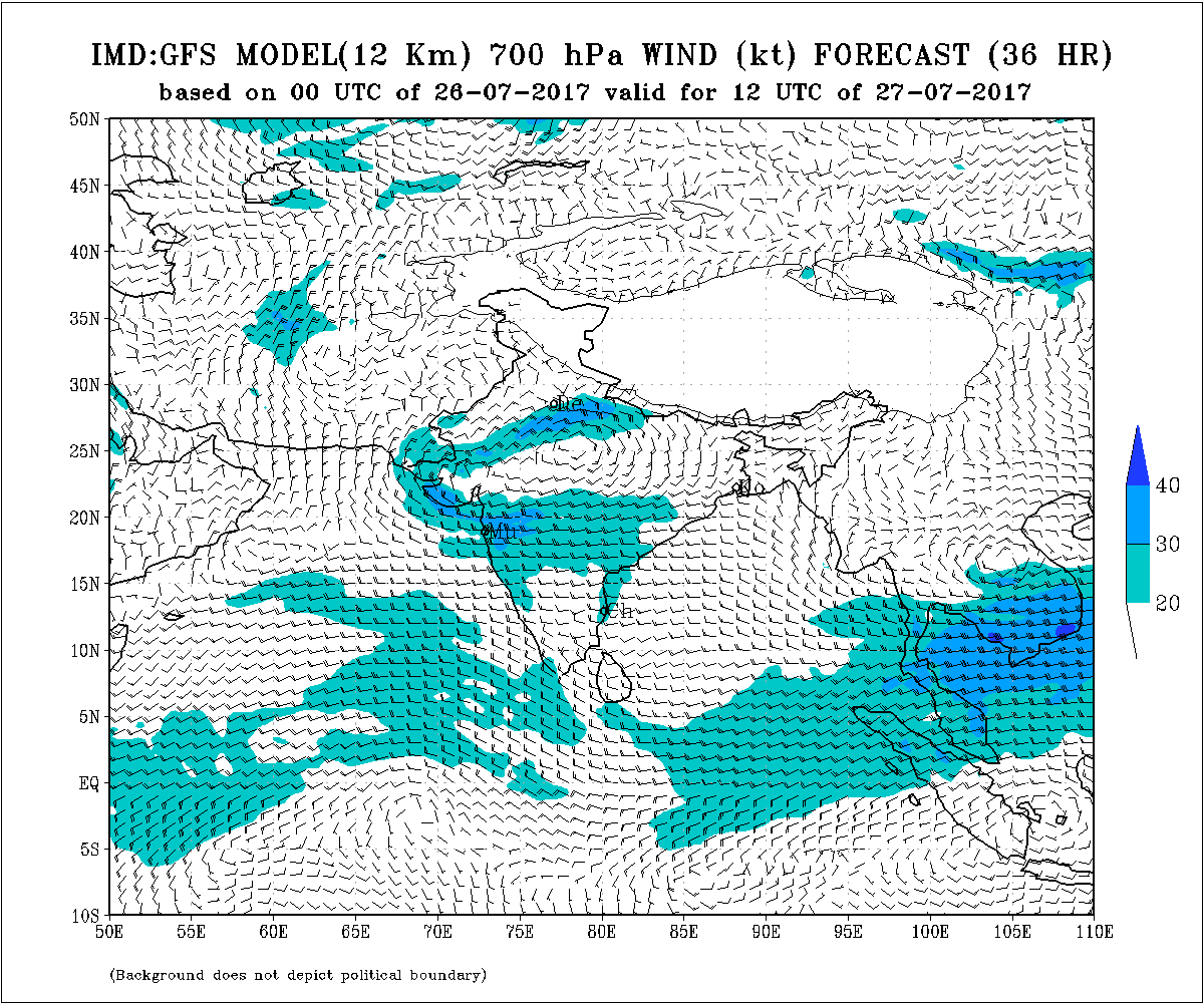
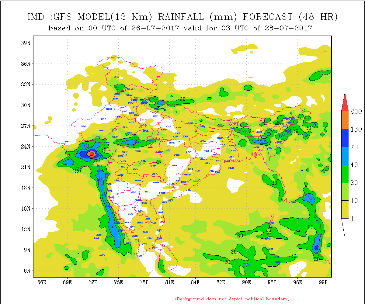
The low pressure area over North Gujarat & Adjoining Rajasthan has weakened. However, the associated UAC still persists and extends up to 5.8 km above mean sea level.
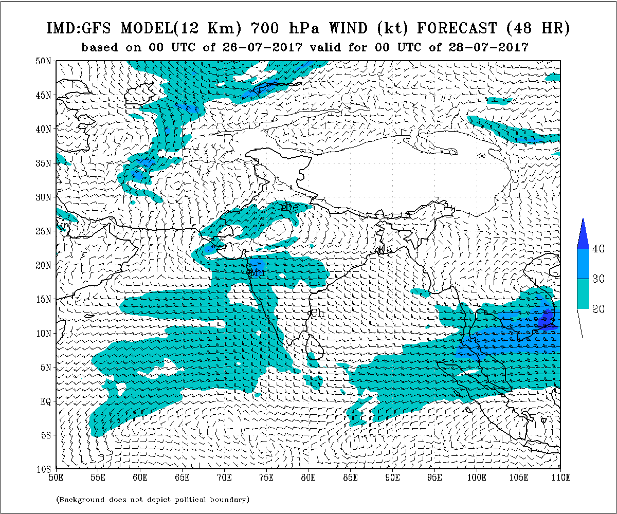
The Well Marked Low Pressure area from West Bengal is over Jharkhand and intensified into Depression over Northwest Jharkhand & neighborhood. This System expected to track West Northwest and weaken gradually.
The Axis of Monsoon trough at mean sea level passes through Anupgarh, Jaipur, Center of Depression over Jharkhand, Diamond Harbour and thence towards Northeast Bay of Bengal.
Morning Update:
The Low Pressure is now over North Gujarat & Adjoining Rajasthan border areas. Associated UAC extends up to 5.8 km and tilting Southwestwards with height.
Saurashtra, Kutch & Gujarat :
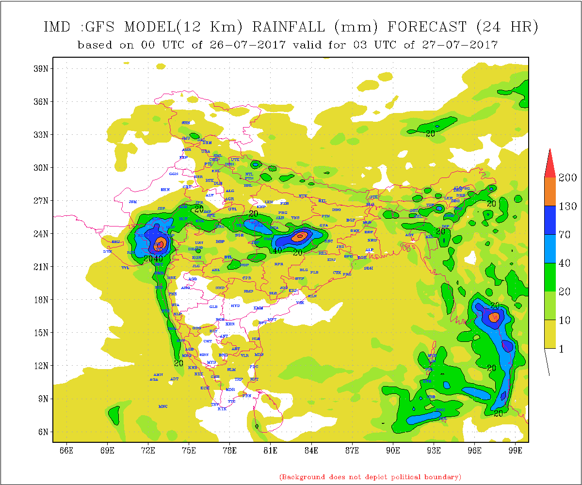
North Gujarat has received extremely heavy rainfall during last two/three days and is expected to receive more rain today. The rain belt will shift Westwards from Aravalli, Banaskantha & Palanpur Districts now and medium, heavy to very heavy rain is expected over Kutch, adjoining and near by Patan, Mehsana, Ahmadabad, Surendranagar, Morvi, Rajkot, Botad, Jamnagar Districts, during 26th to 28th July. Rest of Gujarat & Saurashtra will receive scattered medium rain with isolated heavy rain.
Note: Refer/rely on IMD Advisories and Weather Bulletins
લો પ્રેસર હવે નોર્થ ગુજરાત (બનાસકાંઠા) અને લાગુ રાજસ્થાન બોર્ડર વિસ્તાર માં છે. અનૂસંગિક યુએસી 5.8 કિમિ સુધી ફેલાયેલ છે.
સૌરાષ્ટ્ર , કચ્છ અને ગુજરાત :
તારીખ 26 થી 28 જૂલાઇ 2017
હાલ માં ઉત્તર ગુજરાત માં બનાસકાંઠા, સાબરકાંઠા, અરાવલી, પાટણ, અમદાવાદ ભારે થી અતિ ભારે વરસાદ પડેલ છે અને હજુ ચાલુ છે. હવે વરસાદ નો વિસ્તાર બનાસકાંઠા, સાબરકાંઠા, અરાવલી તરફ થી પશ્ચિમ તરફ સરકે છે જેથી કચ્છ, પાટણ, મેહસાણા,અમદાવાદ, સુરેન્દ્રનગર, મોરબી, રાજકોટ, જામનગર ,બોટાદ, જિલ્લા માં મધ્યમ, ભારે અને અતિ ભારે વરસાદ ની સંભાવના છે. બાકી ના સૌરાષ્ટ્ર, ગુજરાત માં છૂટો છવાયો હળવો/મધ્યમ વરસાદને ક્યાંક ક્યાં ભારે વરસાદ પડી શકે.
નોંધ: હવામાન ખાતા ની આગાહી/સૂચના પર નિર્ભર રહેવું.
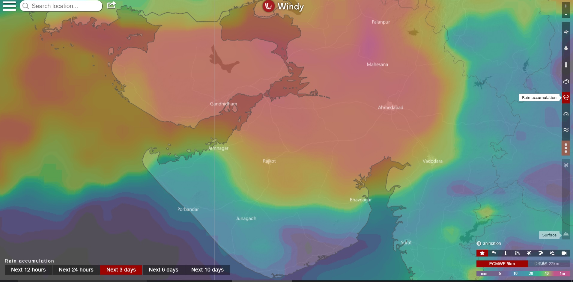
ECMWF Three Days Precipitation map from windy for period 26th to 28th July 2017
(map of 26th Morning available forecast run)
Color: Purple is extreme heavy, and decreasing quantity towards orange, yellow & blue.
મોડલ મુજબ ત્રણ દિવસ નો વરસાદ નો નકશો 26 થી 28 જૂલાઇ 2017 માટે.
કલર પ્રમાણે જાંબલી અતિ ત્રીવ વરસાદ અને પછી ગુલાબી અને ઓરેન્જ અને પીળો અને બ્લુ તરફ ક્રમશ ઘટતી માત્રા.