Weather Conditions on 19th September 2017
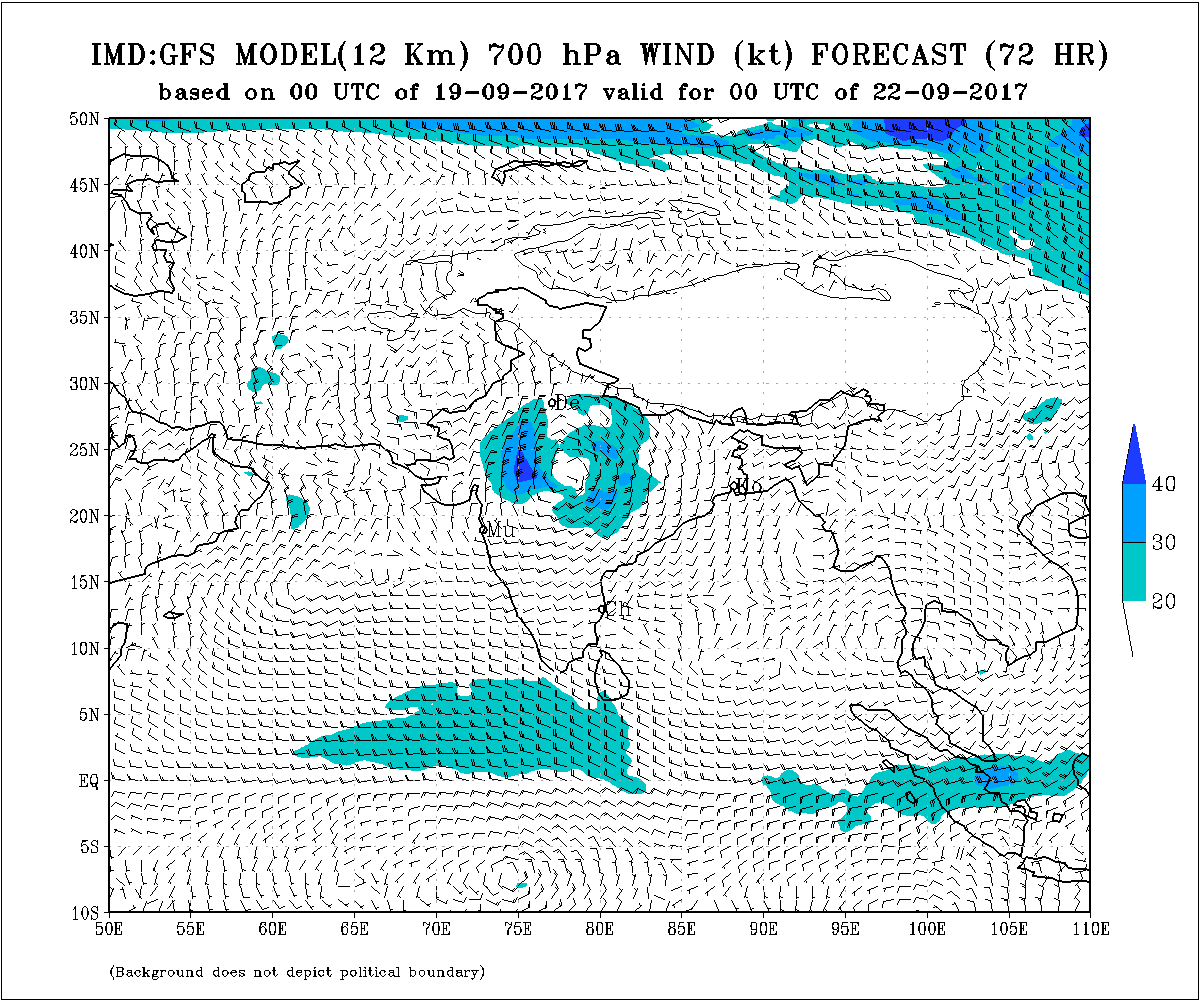
Under the influence of an Upper Air Cyclonic Circulation over North West Bay Of Bengal, a Low Pressure has developed over the same region and neighboring Odisha & West Bengal. The Associated Upper Air Cyclonic Circulation extends up to 5.8 km above mean sea level tilting Southwestwards with height.
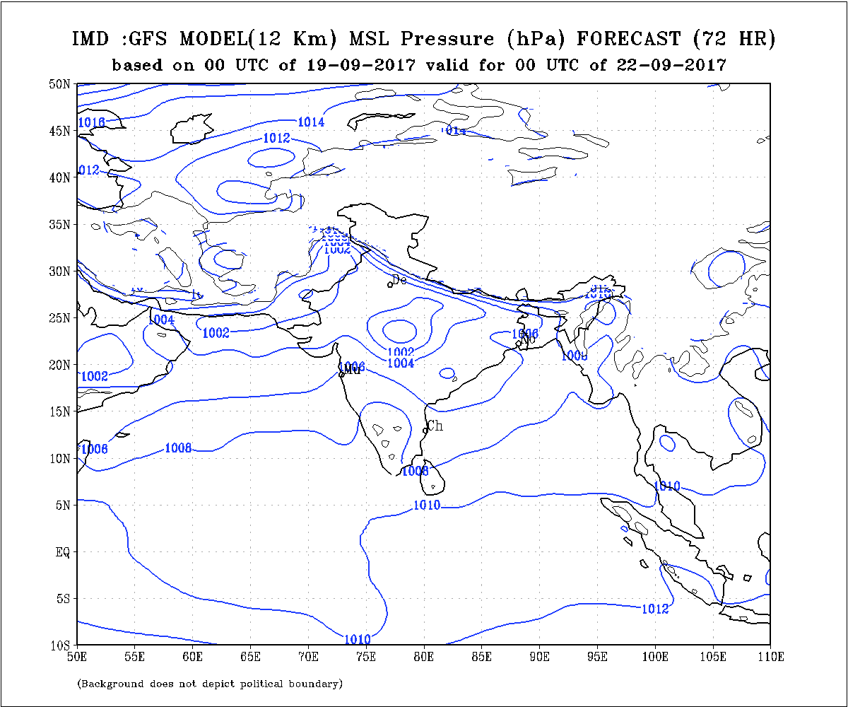
The Axis of Monsoon trough at mean sea level now passes through Amritsar, Karnal, Mainpuri, Siddhi, Ambikapur and Center of Low Pressure over North West BOB and thence towards East Central BOB.
Monsoon off-shore trough now runs along Goa to Karnataka Coast at mean sea level.
The Upper Air Cyclonic Circulation over South Gujarat is now over Konkan and adjoining Madhya Maharashtra between 1.5 to 5.8 km above mean sea level.
The current Western Disturbance as a trough at 5.8 km above mean sea level axis runs along 72 E. & North of 26 N. has moved away in Easterly direction.
Another Western Disturbance at 3.1 km above mean sea level is over North Pakistan,
Third Western Disturbance is over West Afghanistan at 3.1 to 5.8 km above mean sea level.
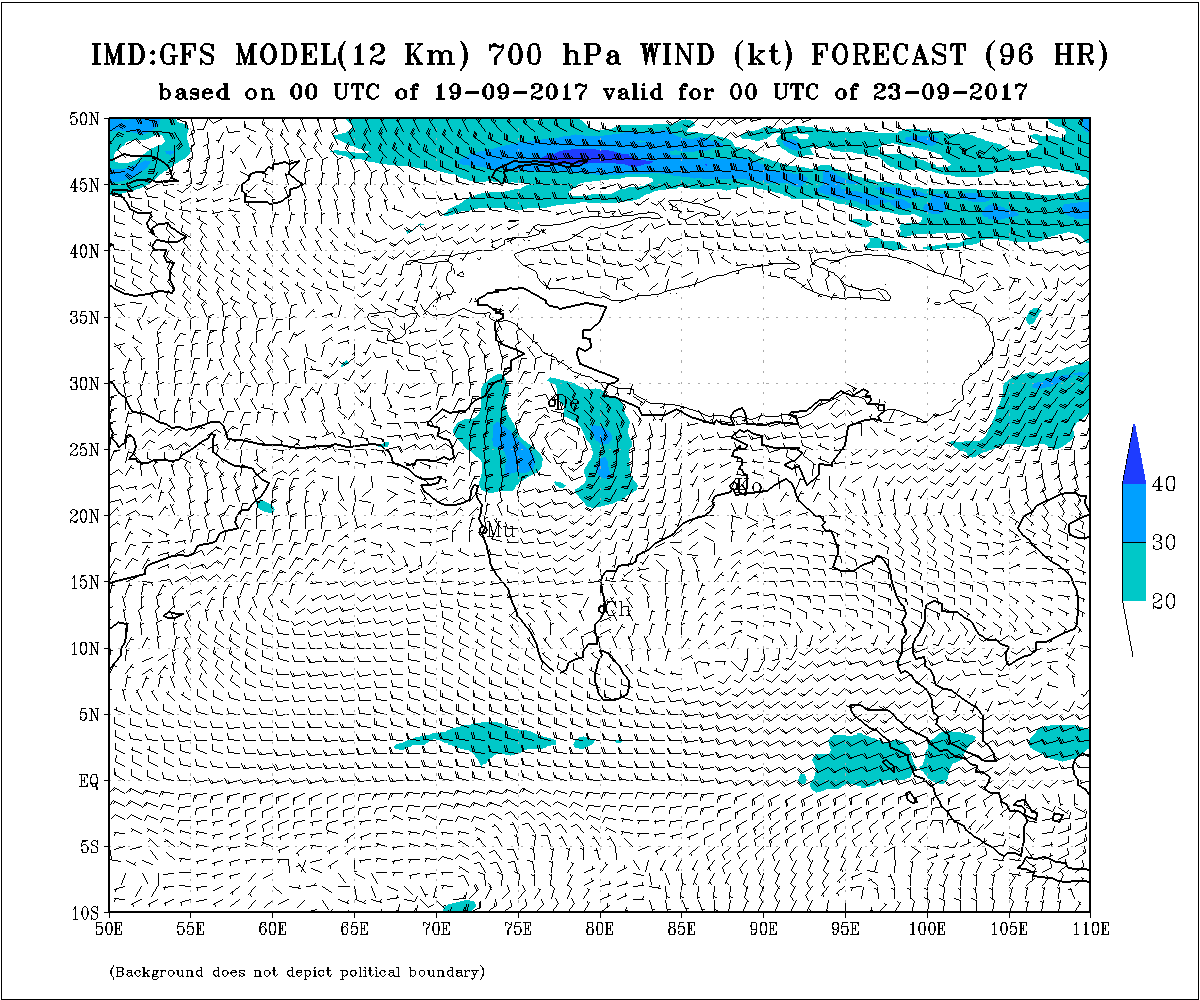
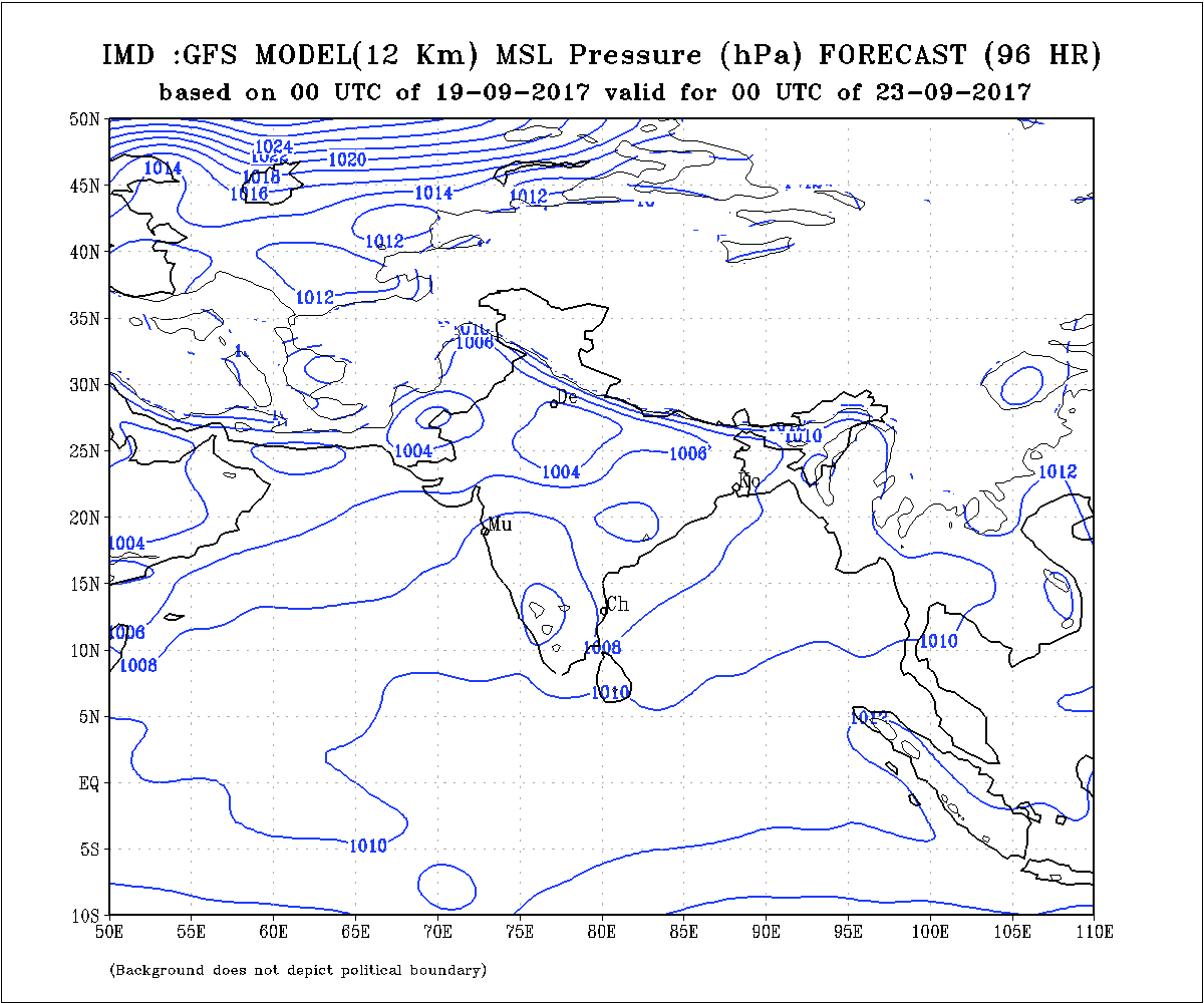
Due to cumulative effects of Western Disturbance and alignment of Axis of Monsoon, the Low Pressure System is expected to track towards North Madhya Pradesh and North India, hence possibility of it affecting Gujarat is minimal. Upper air humidity over most parts of Saurashtra, Kutch & Gujarat will be low during the forecast period.
Forecast: Saurashtra, Gujarat & Kutch
Updated for 19th to 25th September 2017
South Gujarat and M.P. Gujarat border areas could get rain on couple of days of the forecast period and scattered showers on some days.
Saurashtra, Kutch and rest parts of of Gujarat is not expected to get meaningful rainfall during the forecast period. Stray scattered showers possible.
ઉપરા ઉપર વેસ્ટર્ન ડિટરબન્સ તેમજ ચોમાસુ ધરી ની સ્થિતિ ને હિસાબે લો પ્રેસર સિસ્ટમ નોર્થ એમ. પી. તેમજ નોર્થ ઇન્ડિયા બાજુ જાય તેવું અનુમાન છે એટલે ગુજરાત ને ખાસ અસર કરે એવું નથી એવું હાલ તારણ છે. સૌરાષ્ટ્ર, કચ્છ અને ગુજરાત ઉપર ઉપલા લેવલે ભેજ પણ ઘટેલ રહેશે.
આગાહી: સૌરાષ્ટ્ર, કચ્છ અને ગુજરાત
અપડેટ 19 થી 25 સપ્ટેમ્બર 2017
દક્ષિણ ગુજરાત અને એમ.પી. ગુજરાત બોર્ડર વિસ્તારો માં બેક દિવસ છૂટો છવાયો વરસાદ અને ક્યારેક ઝાપટા.
સૌરાષ્ટ્ર કચ્છ અને ગુજરાત ના બાકી ના ભાગો માં કોઈ નોંધ પાત્ર વરસાદ ની શક્યતા ઓછી. ક્યારેક છુટા છવાયા ઝાપટા
Caution:
Please refer/rely on IMD/RSMC Bulletins/Advisories for Storms & Weather related matter.
સાવચેતી:
સ્ટોર્મ કે હવામાન અંગે ની માહિતી માટે ભારતીય હવામાન ખાતા/ગવર્મેન્ટ ના બુલેટીન/સુચના પર નિર્ભર રહેવું.
વાંચવા માટે ઇમેજ એક કે બે વાર ક્લિક કરો – Click Image below once or twice to read details.