Current Weather Conditions on 12th August 2015 @ 9.00 am. IST
A Low Pressure area has developed over West Central & adjoining Northwest Bay of Bengal off North Andhra & Odisha Coast extending upto Mid-Tropospheric level.
The Axis of Monsoon trough passes through Bikaner, Jaipur, Guna, Raipur then Center of Low Pressure area over West Central & adjoining Northwest Bay of Bengal and thence South Eastwards to East Central Bay of Bengal.
There is an Upper Air Cyclonic Circulation over Haryana adjoining areas extending upto 3.1 km above mean sea level.
The Western Disturbance as an Upper Air trough in Mid-Tropospheric Westerlies roughly along Longitude 72.0°E and North of Latitude 30.0°N persists and is still moving away East Northeastwards.
The Upper Air Cyclonic Circulation over South Chhattisgarh & adjoining Vidarbha extending upto 3.1 km above mean sea level persists.
An Upper Air Cyclonic Circulation over Saurashtra & Kutch and neighborhood between 1.5 and 5.8 km above mean sea level persists. The UAC at 700 hPa is expected to remain in the vicinity of Saurashtra & Kutch and adjoining Northeast Arabian Sea for 3-4 days.
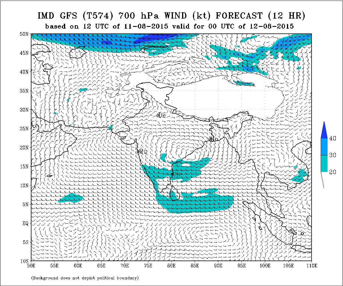
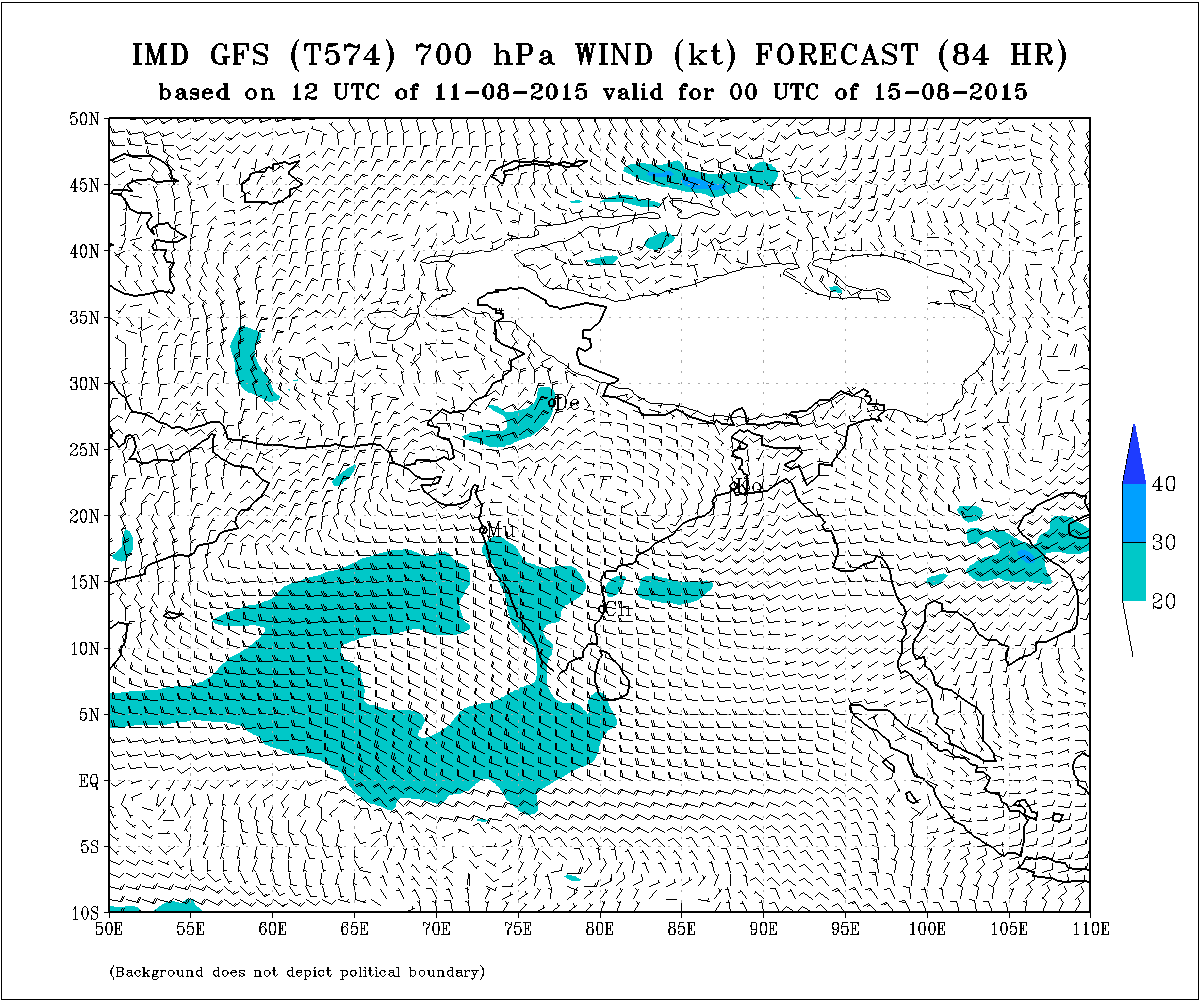
There would be a broad Upper level Circulation at 700 hPa like the Axis of Monsoon at 3.1 Km. & it would extend from the UAC over Saurashtra/Kutch to the UAC of the Low Pressure area. The Low Pressure System will track northwards along with the UAC at 700 hPa. The alignment of Axis will change from current NW towards SE to West towards East as can be seen from the IMD Weather charts below:
IMD GFS (T574) 700 hPa Wind Forecast Valid for oo UTC 12-08-2015
IMD GFS (T574) 700 hPa Wind Forecast Valid for oo UTC 15-08-2015
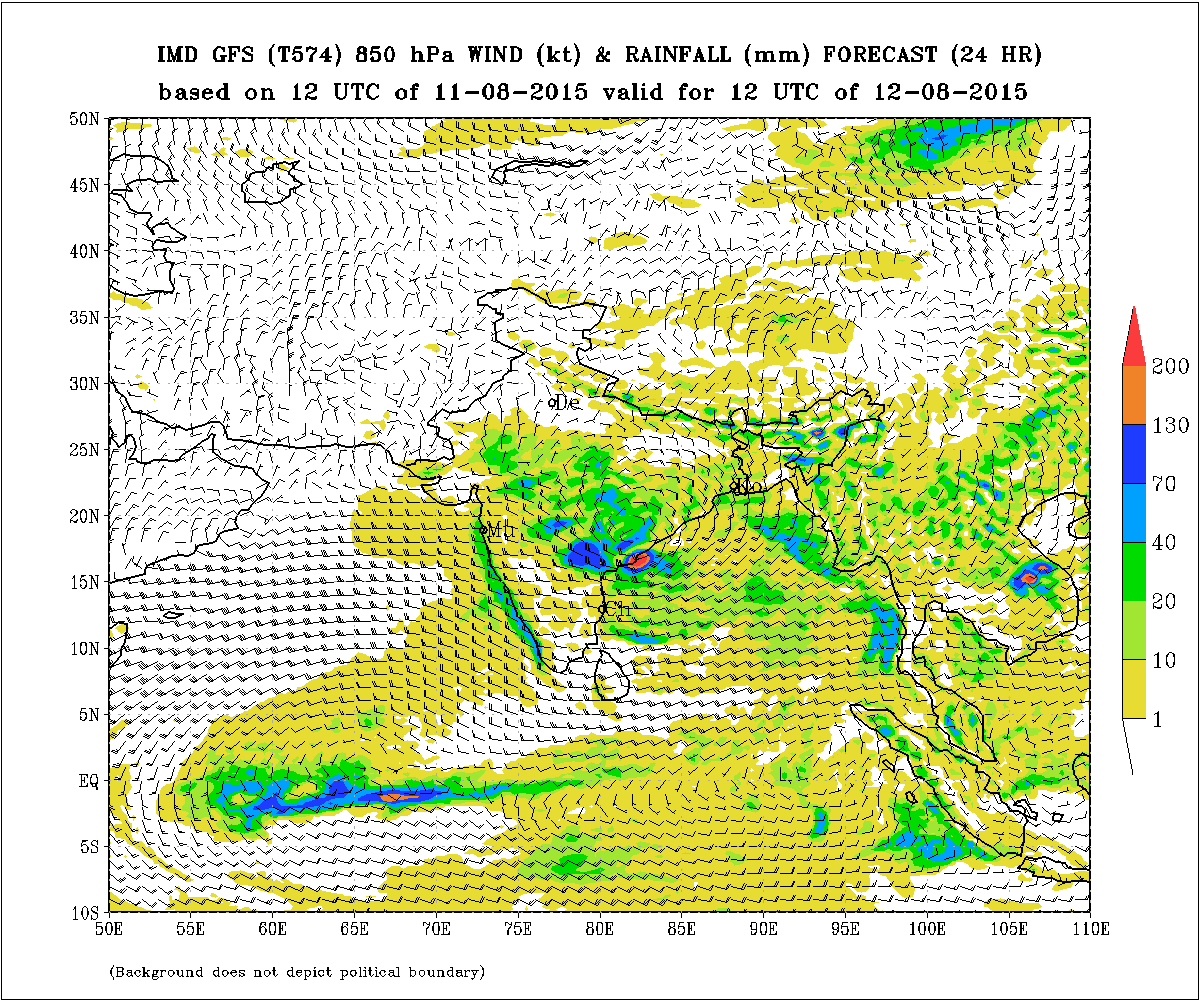
IMD GFS (T574) 850 hPa Winds & Rainfall (mm.) Forecast (24 Hours)
based on 1200 UTC of 11-08-2015 valid for 1200 UTC of 12-08-2015
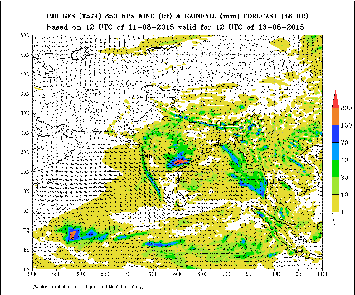
IMD GFS (T574) 850 hPa Winds & Rainfall (mm.) Forecast (24 Hours)
based on 1200 UTC of 12-08-2015 valid for 1200 UTC of 13-08-2015
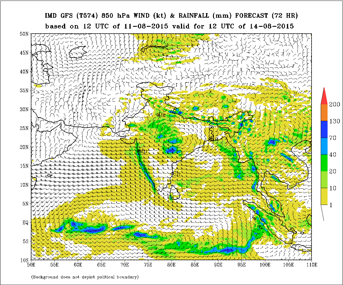
IMD GFS (T574) 850 hPa Winds & Rainfall (mm.) Forecast (24 Hours)
based on 1200 UTC of 13-08-2015 valid for 1200 UTC of 14-08-2015
Forecast: 12th August to 16th August 2015
Saurashtra, Kutch & Gujarat
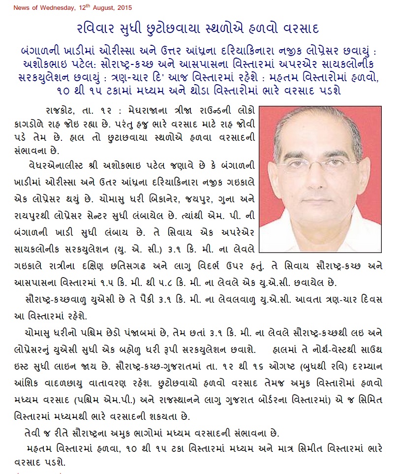
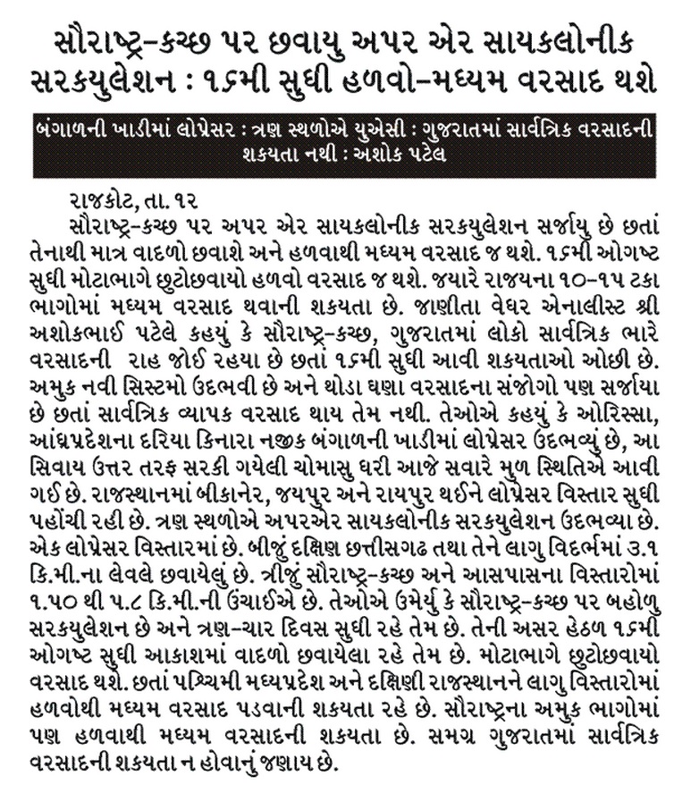
The whole Gujarat State is waiting for heavy rainfall over the State. Currently there would be partly cloudy weather and scattered light to medium rain on most days during the forecast period. Border areas of Gujarat near West Madhya Pradesh as well as border areas of Gujarat near South Rajasthan could get medium rain and some of pockets of these areas getting heavy rain. Similarly some areas of Saurashtra could get medium rain.
Overall whole Gujarat the rain will be scattered light rain with 10 to 15 % geting medium and few pockets heavy rainfall.
સૌરાષ્ટ્ર કચ્છ ગુજરાત:
તારીખ 12 ઓગસ્ટ થી 16 ઓગસ્ટ 2015
સૌરાષ્ટ્ર અને કચ્છ અને લાગુ ઊત્તર પૂર્વ અરબી સમુદ્ર નજીક નું UAC 3-4 દિવસ રહેશે. ઓડીશા ના લો પ્રેસર વાળું UAC ઊત્તર તરફ જશે એટલે 3.1 કિમી માં ધરી જેવું બહોળું સર્ક્યુલેસન ફેલાશે.
સમગ્ર ગુજરાત ભારે વરસાદ ની રાહ જોવે છે. હાલ માં અંશત વાદળ છાયું વાતાવરણ રહેશે. છૂટો છવાયો હળવો વરસાદ તેમજ અમૂક વિસ્તારો માં હળવો – મધ્યમ વરસાદ. જેમાં પશ્ચિમ એમ. પી. અને દક્ષીણ રાજસ્થાન ને લાગુ ગુજરાત ના બોર્ડેર વિસ્તારો માં હળવા- મધ્યમ વરસાદ ની શક્યતા છે. સીમિત વિસ્તાર માં મધ્યમ -ભારે વરસાદ. તેવી રીતે સૌરાષ્ટ્ર ના અમૂક ભાગો માં મધ્યમ વરસાદ ની શક્યતા છે.
જનરલ ગુજરાત માં મહત્તમ વિસ્તાર માં હળવા વરસાદ ની શક્યતા અને 10% થી 15 % વિસ્તાર માં મધ્યમ વરસાદ. સીમિત વિસ્તાર માં મધ્યમ -ભારે વરસાદ.
.
Weather Forecast In Akila Daily Dated 12th August 2015
Weather Forecast In Sanj Samachar Daily Dated 12th August 2015
Scroll Up