Current Weather Conditions on 11th May 2014 @ 4.00 pm.
The Western Disturbance as an Upper Air Cyclonic Circulation extending up to Mid
Tropospheric levels over Jammu & Kashmir and neighbourhood persists. System would
move eastnortheastwards.
An induced Cyclonic Circulation extending upto 0.9 km above Sea Level lies over Northwest Rajasthan and neighbourhood.
The Maximum Temperature has declined over most parts of Saurashtra, Kutch & Gujarat from yesterday. This afternoon thunder storm has been reported over some parts of Saurashtra including Rajkot.
Forecast: 11th to 17th May 2014
Saurashtra, Kutch & Gujarat:
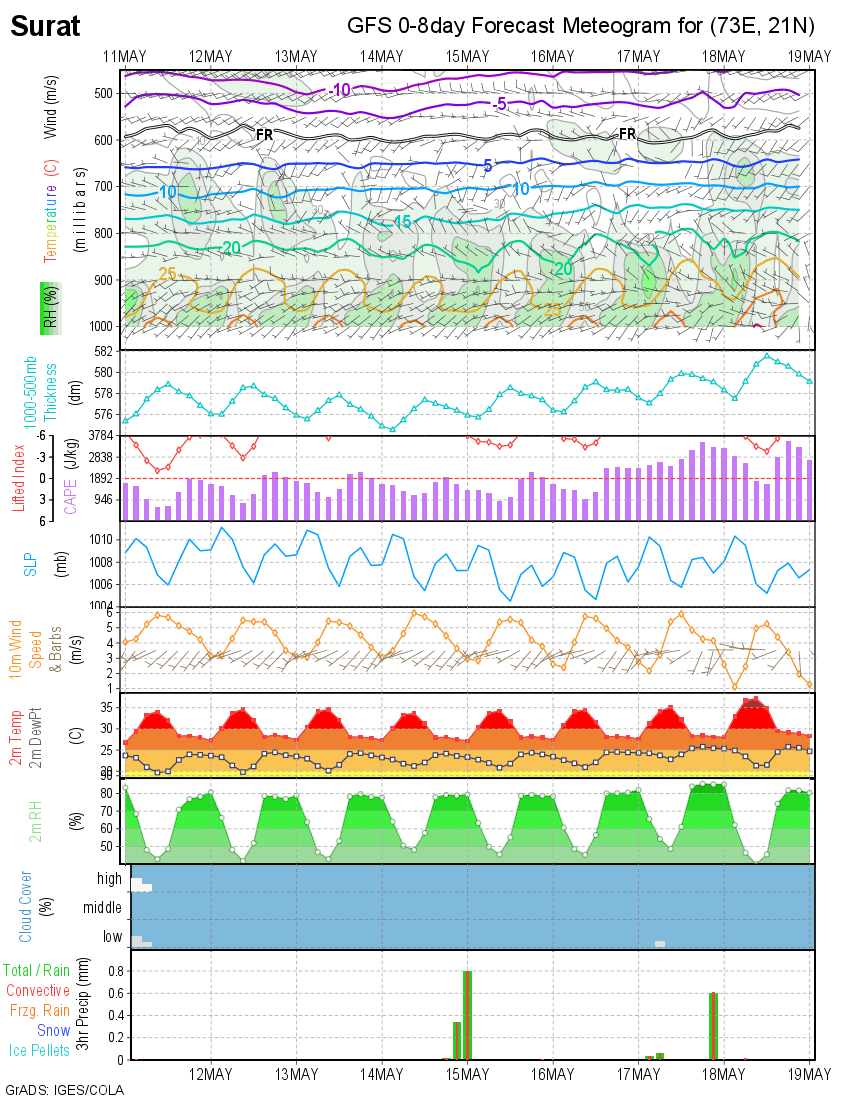
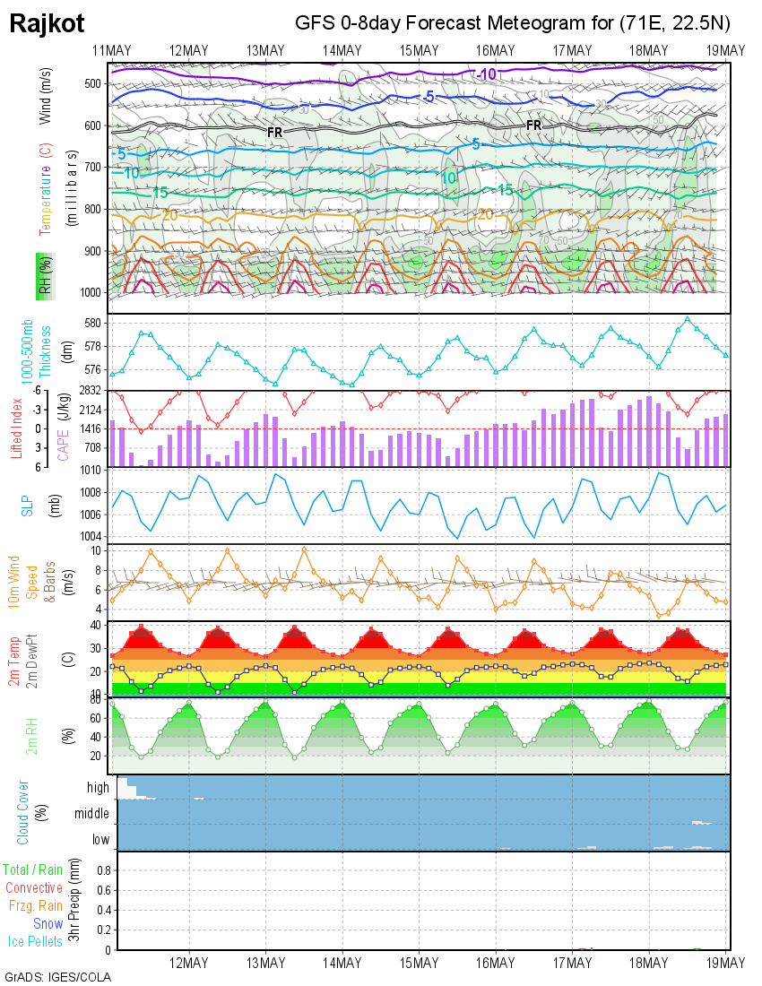
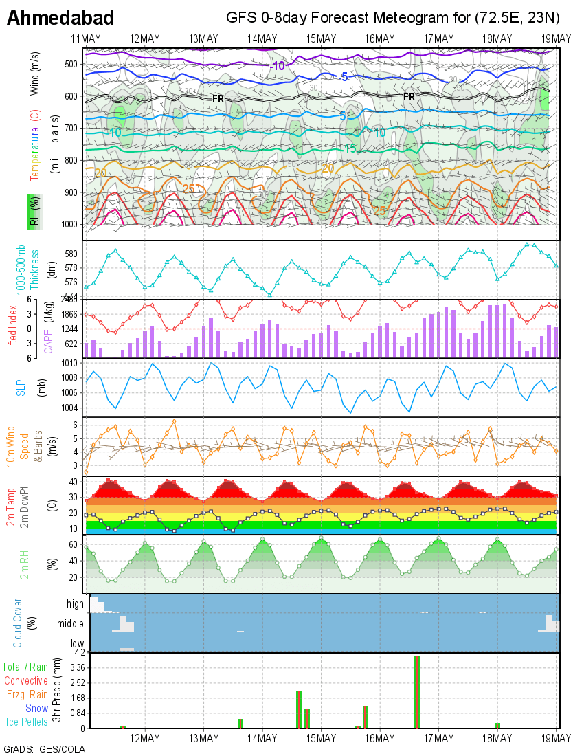
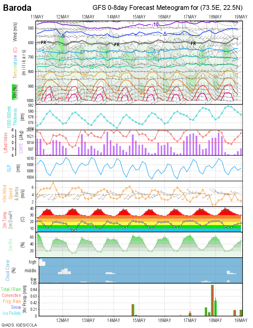
IGES/COLA Meteogram has been showing the Lifted Index -5.0 or less during the next week suggesting very unstable weather. CAPE ( Covective Available Potential Energy ) is forecast to be very high along with forecast for very high wind speeds during the evening hours.
Due to high winds from the Arabian Sea moisture incursion will take place coupled with Atmospheric instability over whole Gujarat, there would be chances of thunder storms over pockets of Saurashtra, Kutch & Gujarat till 17th May 2014.
Western Disturbance and induced Cyclonic Circulation over Northwest Rajasthan will enhance the unstable conditions over Gujarat especially North Gujarat.
Note: The Meteogram for Rajkot does not show rain, however, Rajkot has already received thunder storm rain today.
IGES/COLA 0-8 Day Meteogram For Rajkot Forecast Date 11th May 2014
IGES/COLA 0-8 Day Meteogram For Ahmedabad Forecast Date 11th May 2014
 IGES/COLA 0-8 Day Meteogram For Baroda Forecast Date 11th May 2014
 IGES/COLA 0-8 Day Meteogram For Surat Forecast Date 11th May 2014