Current Weather Conditions on 5th May 2014 @ 10.00 am.
After the last hot weather round over Saurashtra, Kutch & Gujarat, the Maximum Temperature has decreased over all the places during the last two three days. Rajkot was at 41.3 C about 1 Degree C more than normal while Ahmedabad was 39.6 C about 1.4 C less than normal. Similarly Bhuj recorded 39.2 C about 1 C. less than normal while Deesa recorded 38.0 C about 2 C less than normal. There was high instability in the upper atmosphere during the last two days and unseasonal rain/hail was reported from some isolated places.
Many places of Rajasthan, U.P., West Bengal, Vidarbha, Jharkhand, Andhra Pradesh
recorded Maximum temperature in the range of 43 to 46 C between 28th April to 2nd May. The Maximum temperature all over India had decreased and on 4th may there was no Major Center with Maximum Temperature of 43.0 C or above. There has been scattered rainfall over Northeastern States, West Bengal, some parts of North India. Simultaneously South Indian States of Karnataka, Kerala and parts of Tamilnadu also received scattered rainfall during the last few days.
Forecast: 6th to 8th May
Saurashtra, Gujarat & Kutch:
The Maximum Temperature will again increase by 2 to 3 Degree C over most places of forecast region during the forecast period. The Maximum Temperature be in the range of 41 to 44 C which is about 1 to 3 Degree C above normal.
North & East Inda:
The Maximum Temperature is expected to increase again on 8th & 9th May over U.P., Bihar, Jharkhand, West Bengal and adjoining States. The Maximum Temperature over the Hot Spots of these States could range between 43 to 45 C during the forecast period.
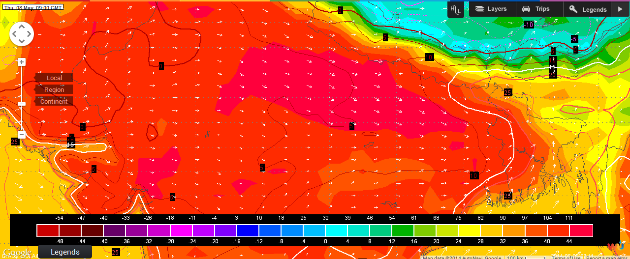
Wunderground Map Showing Forecast Hot Spot Areas on 8th May @ 0900 UTC
Based on Forecast Run Dated 5th May 2014 @ 0000 UTC
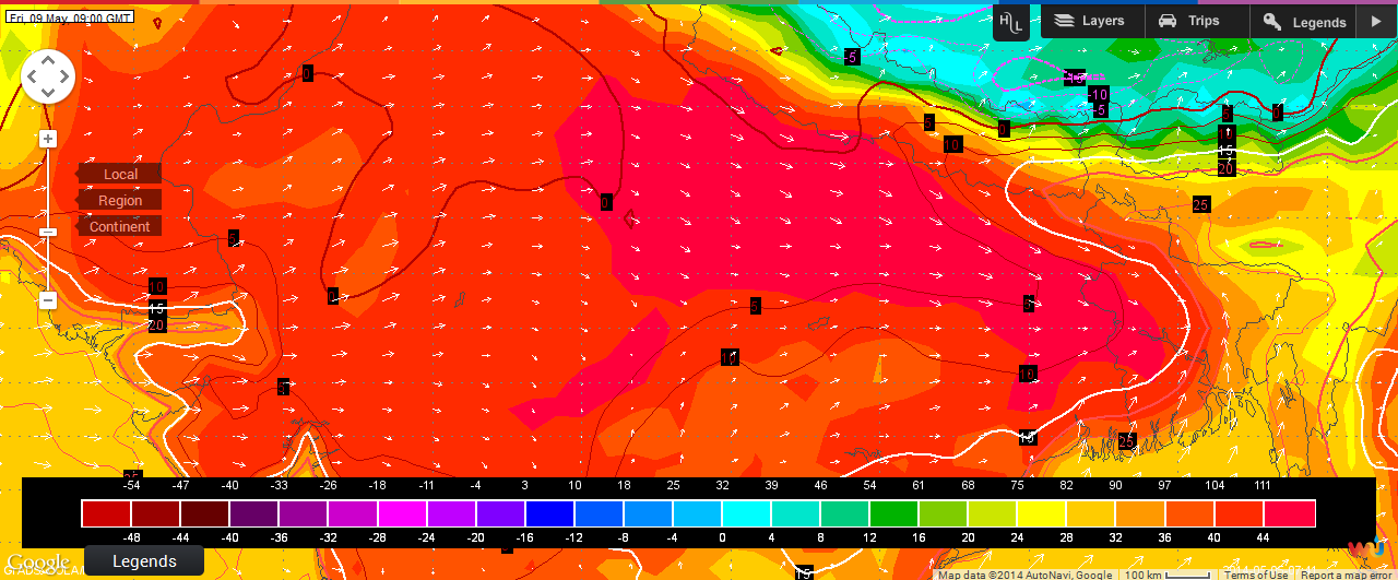
Wunderground Map Showing Forecast Hot Spot Areas on 9th May @ 0900 UTC
Based on Forecast Run Dated 5th May 2014 @ 0000 UTC
South India: 5th to 9th May
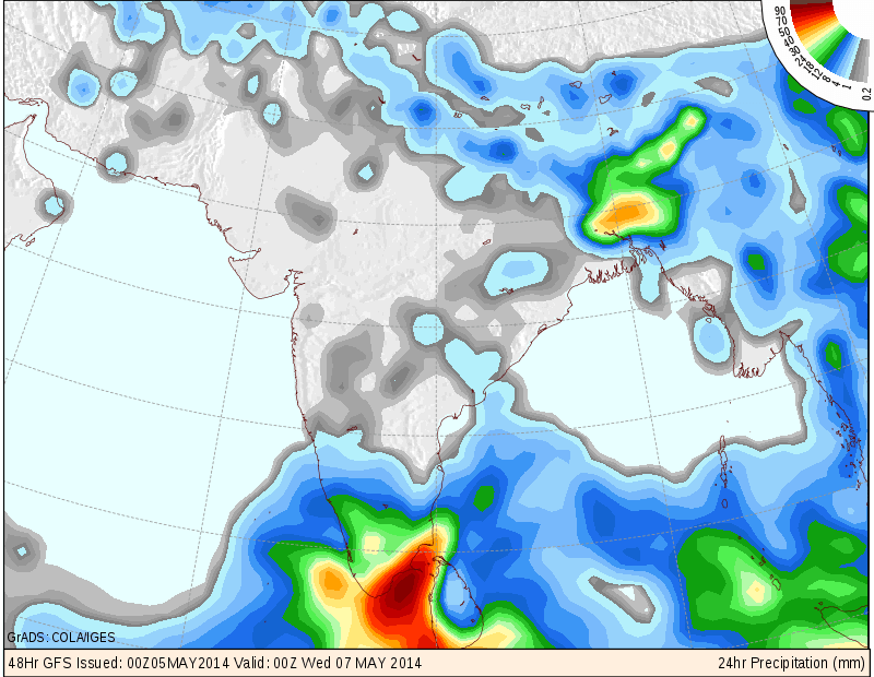
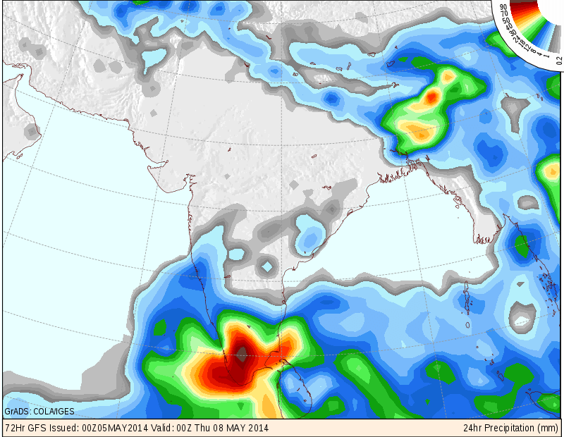
There is and Upper Air Cyclonic Circulation South of Peninsular India and West Of Sri Lanka. A Low Pressure area is expected to develop near the vicinity of this region during the next 48 hours. This System is expected to track Northerly and then Northeastwards. Wide spread rainfall is expected over Karnataka, Kerala and Tamilnadu during the Forecast Period.
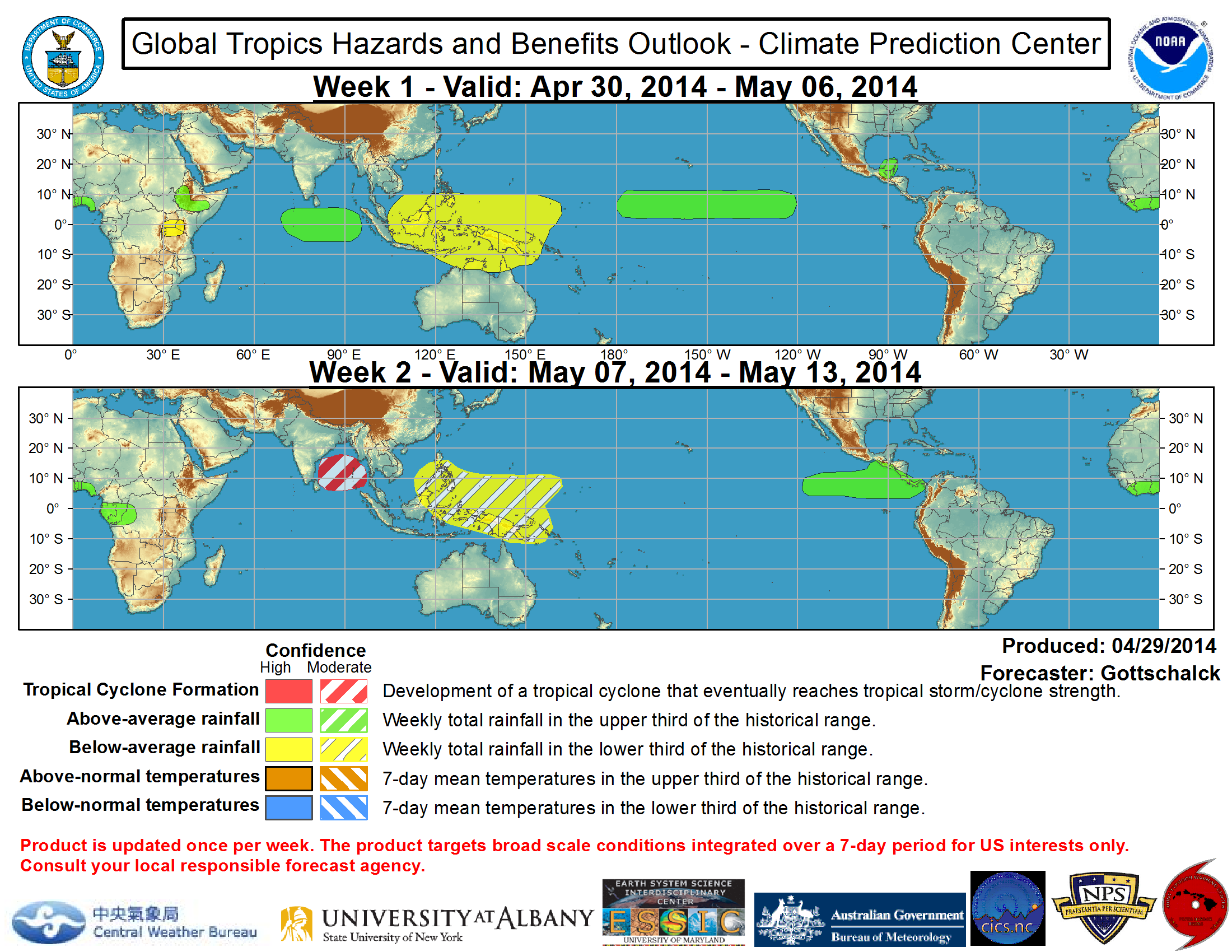
Global Tropical Hazards and Benefits Outlook – CPC shows possibility of Tropical Cyclone formation during week May 7th to May 13th.
COLA/IGES Forecasts of Vertical Velocity or Precipitation
Valid 7th May 2014 @ 00 UTC
COLA/IGES Forecasts of Vertical Velocity or Precipitation
Valid 7th May 2014 @ 00 UTC
Weather Forecast In Akila Daily Dated 5th May 2014 @ 10.00 am.