Monsoon Onset Expected Over Parts of South Gujarat and Coastal Saurashtra In Couple Of Days (Forecast: 14–21 June 2025)
દક્ષિણ ગુજરાત અને કોસ્ટલ સૌરાષ્ટ્રના કેટલાક ભાગોમાં બે થી ત્રણ દિવસ માં ચોમાસું પ્રવેશવાની શક્યતા (આગાહી: 14-21 જૂન 2025)
Current Weather Conditions – 14th June 2025
Gujarat Observations
- Maximum temperatures over many parts of Gujarat are currently 1°C below normal to 1°C above normal.
- Normal maximum temperatures range between 38°C to 39°C across most locations, while North Gujarat normally sees around 40°C.
Maximum Temperatures on 13th June 2025
| Location | Max Temp (°C) | Departure from Normal |
|---|---|---|
| Rajkot | 40.0°C | 1°C above normal |
| Amreli | 36.7°C | 1°C below normal |
| Deesa | 40.8°C | 1°C above normal |
| Ahmedabad | 40.6°C | 1°C above normal |
| Bhuj | 39.6°C | Near normal |
- The Western Branch of the Southwest Monsoon has stalled since 26th May.
- The Eastern Branch has also stalled since 29th May.
Expected to move forward in two three days.
Current Synoptic Conditions
Date: 14th June 2025
Northern Limit of Monsoon (NLM)
The NLM currently passes through:
17.0°N/55°E → 17.5°N/60°E → 18.0°N/65°E → 18.5°N/70°E → Mumbai → Ahilyanagar → Adilabad → Bhawanipatna → Puri → Sandhead Island → 23.5°N/89.5°E → Balurghat → 30.0°N/85.0°E
Monsoon Advancement Outlook
- Favorable conditions exist for the further advance of the Southwest Monsoon over:
- Some parts of Gujarat
- Additional areas of Vidarbha, Chhattisgarh & Odisha (next 2 days)
- West Bengal, Jharkhand & Bihar (within subsequent 3 days)
Synoptic Features
- An upper air cyclonic circulation lies over West Rajasthan & adjoining Pakistan, with a trough extending to north Madhya Maharashtra (lower troposphere).
- A second circulation is over Marathwada (lower & middle troposphere), tilting southwestwards, with a trough extending to coastal Andhra Pradesh.
- A Western Disturbance is seen as a trough in middle tropospheric westerlies, with its axis at 5.8 km above mean sea level, running along longitude 70°E, north of latitude 26°N.
- A cyclonic circulation lies over south Bangladesh & adjoining north Bay of Bengal, with a trough extending to south Odisha.
- Another circulation is over the west-central Bay of Bengal, off north coastal Andhra Pradesh, in middle troposphere.
Expected Synoptic Evolution
15th June (Morning):
- UAC at 700 hPa and 500 hPa expected west of Mumbai and south of Saurashtra.
16th–19th June:
- The 700 hPa UAC is likely to track northwards towards Gujarat and remain in its vicinity.
16th–17th June:
- A UAC at 850 hPa is expected to form near/over Gujarat State.
Forecast for Gujarat, Saurashtra & Kutch
Period: 14th–21st June 2025
Wind Patterns
- Predominantly southwesterly to westerly winds.
- Wind speeds: 12–20 km/h, with gusts of 20–35 km/h.
- During thunderstorms, gusts may reach 35–40 km/h.
Sky Conditions
- Generally partly cloudy, with intermittent increase in cloudiness.
Monsoon Activity
- Southwest Monsoon is expected to set in over South Gujarat and Coastal Saurashtra within the next couple of days.
- Monsoon will gradually cover more areas of the state during the forecast period.
- Pre-monsoon activity will continue in regions where monsoon onset has not yet been declared.
Rainfall Forecast
Saurashtra & Kutch & Gujarat Region (14th–21st June)
-
-
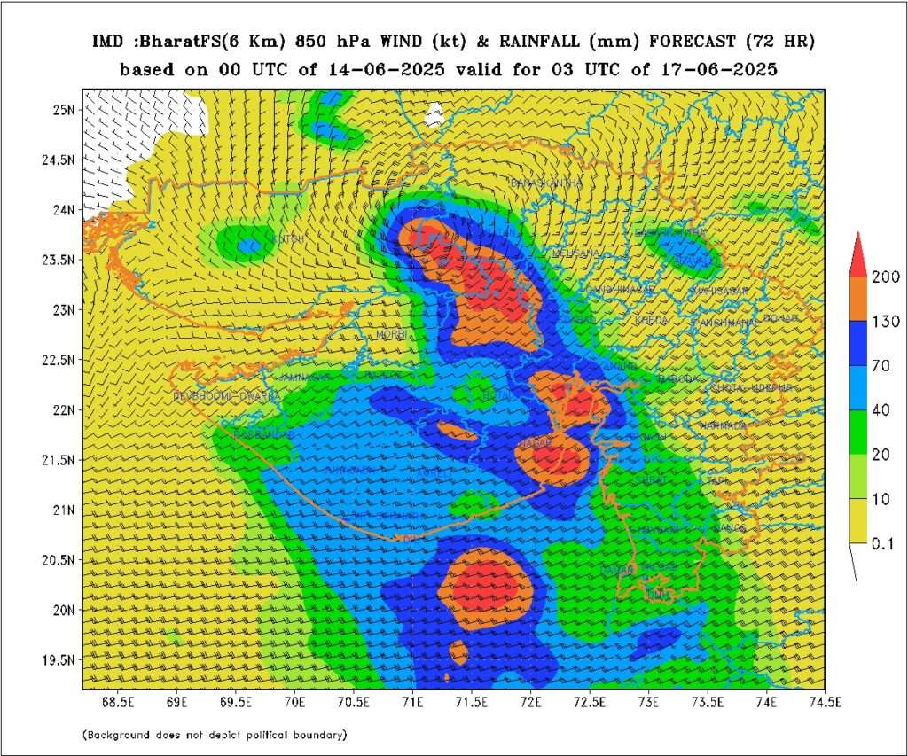
Light rainfall likely at many places on different days with scattered moderate rain, accompanied by thunderstorm and lightning with Isolated heavy rainfall on various days at different locations.
See IMD Forecast: IMD GFS Forecast valid for 03 UTC 17-08-2025
-
️
દક્ષિણ ગુજરાત અને કોસ્ટલ સૌરાષ્ટ્રના કેટલાક ભાગોમાં બે થી ત્રણ દિવસ માં ચોમાસું પ્રવેશવાની શક્યતા (આગાહી: 14-21 જૂન 2025)
️
-
હાલની હવામાન સ્થિતિ – 14 જૂન 2025
ગુજરાત માટે અવલોકનો
ગુજરાતના અનેક ભાગોમાં મહત્તમ તાપમાન હાલમાં સામાન્ય કરતાં 1°C ઓછુંથી લઈને 1°C વધારે છે.
સામાન્ય મહત્તમ તાપમાન મોટાભાગના સ્થળોએ 38°C થી 39°C વચ્ચે રહે છે, જ્યારે ઉત્તર ગુજરાતમાં સામાન્ય તાપમાન આશરે 40°C હોય છે.
13 જૂન 2025 ના મહત્તમ તાપમાન
સ્થળ મહત્તમ તાપમાન (°C) સામાન્યથી ભિન્નતા રાજકોટ 40.0°C 1°C વધારે અમરેલી 36.7°C 1°C ઓછી ડીસા 40.8°C 1°C વધારે અમદાવાદ 40.6°C 1°C વધારે ભુજ 39.6°C સામાન્યની આસપાસ દક્ષિણપશ્ચિમ ચોમાસાની પશ્ચિમી શાખા 26 મે થી સ્થિર છે અને પૂર્વ શાખા પણ 29 મે થી સ્થિર છે, જે 2 દિવસ માં શક્રિય થશે.
હાલની સિનોપ્ટિક સ્થિતિ
તારીખ: 14 જૂન 2025
ચોમાસાની ઉત્તર સીમા (NLM)
હાલમાં NLM નીચેના માર્ગે પસાર થાય છે:
17.0°N/55°E → 17.5°N/60°E → 18.0°N/65°E → 18.5°N/70°E → મુંબઈ → અહિલ્યાનગર → અડિલાબાદ → ભવનિપાટણા → પુરી → સૅન્ડહેડ આઇલેન્ડ → 23.5°N/89.5°E → બાલુરઘાટ → 30.0°N/85.0°E
ચોમાસુ આગળ વધવા ની સંભાવના
આવતા દિવસોમાં દક્ષિણપશ્ચિમ ચોમાસા માટે અનુકૂળ પરિસ્થિતિઓ દેખાઈ રહી છે:
-
ગુજરાતના કેટલાક ભાગો (આગામી 2 થી 3 દિવસ)
-
વિદર્ભ, છત્તીસગઢ અને ઓડિશાના વધુ ભાગો (આગામી 2 દિવસ)
-
પશ્ચિમ બંગાળ, ઝારખંડ અને બિહારના કેટલાક ભાગો (પછીના 3 દિવસમાં)
સિનોપ્ટિક લક્ષણો
-
પશ્ચિમ રાજસ્થાન અને આસપાસના પાકિસ્તાન વિસ્તારમાં ઉપરની સપાટીએ UAC, જેનાથી ઉત્તર મધ્ય મહારાષ્ટ્ર સુધી ટ્રફ વિસ્તાર છે.
-
મરાઠવાડા વિસ્તારમાં ઉપરની અને મધ્ય સપાટીએ બીજું UAC, જે ઊંચાઈ સાથે દક્ષિણ પશ્ચિમ તરફ ઝૂકે છે અને આંધ્ર પ્રદેશના કાંઠે ટ્રફ વિસ્તાર છે.
-
પશ્ચિમ વિક્ષેપ (Western Disturbance) મધ્ય સપાટી પર પશ્ચિમ પવનવાળા ક્ષેત્રોમાં ટ્રફ રૂપે દેખાય છે, જેમાં તેની ધરી 5.8 કિમી ઊંચાઈએ, લૉંગિટ્યુડ 70°E ઉપર અને Latitude 26°Nથી ઉત્તર તરફ છે.
-
દક્ષિણ બાંગ્લાદેશ અને ઉત્તર બંગાળની ખાડી વિસ્તારમાં UAC, જેનાથી દક્ષિણ ઓડિશા તરફ ટ્રફ જાય છે.
-
બીજું UAC પશ્ચિમ-મધ્ય બંગાળની ખાડીમાં, ઉત્તર કાંઠા આંધ્ર પ્રદેશના નજીક, મધ્ય સપાટીએ જોવા મળે છે.
આગામી સિનોપ્ટિક પરિબળો
15 જૂન (સવાર):
UAC 700 hPa અને 500 hPa સ્તરે, મુંબઈથી પશ્ચિમ અને સૌરાષ્ટ્રથી દક્ષિણ તરફ સર્જાય તેવી સંભાવના.
16થી 19 જૂન:
700 hPa UAC ગુજરાત તરફ ઉત્તર દિશામાં આગળ વધશે અને રાજ્યની નજીક રહેશે.
16થી 17 જૂન:
850 hPa UAC ગુજરાત રાજ્ય નજીક અથવા ઉપર વિકસશે તેવી સંભાવના છે.
આગાહી: ગુજરાત, સૌરાષ્ટ્ર અને કચ્છ માટે
અવધિ: 14થી 21 જૂન 2025
પવનની દિશા અને ગતિ
-
મુખ્યત્વે દક્ષિણપશ્ચિમથી પશ્ચિમ દિશાના પવન.
-
ગતિ: 12–20 કિમી/કલાક, અને તીવ્ર પવનમાં 20–35 કિમી/કલાક.
-
ગાજ વીજ સમયે પવનની તીવ્રતા 35–40 કિમી/કલાક સુધી પહોંચી શકે છે.
આકાશની સ્થિતિ
-
સામાન્ય રીતે આંશિક વાદળછાયું, ક્યારેક વાદળતા વધે તેવી શક્યતા..
ચોમાસું પ્રવેશ અને પ્રવૃત્તિ
-
દક્ષિણપશ્ચિમ ચોમાસું આગામી 2–3 દિવસમાં દક્ષિણ ગુજરાત અને કોસ્ટલ સૌરાષ્ટ્રમાં પ્રવેશી શકે છે.
-
ત્યાર બાદ આગાહી સમય માં ચોમાસુ ક્રમશ આગળ ચાલશે.
-
જ્યાં ચોમાસું જાહેર થયું નથી ત્યાં પ્રી-મોન્સૂન પ્રવૃત્તિ ચાલુ રહેશે.
વરસાદની આગાહી
ગુજરાત રિજિયન અને સૌરાષ્ટ્ર-કચ્છ (14થી 21 જૂન)
-
હળવો મધ્યમ વરસાદ અને સીમિત વિસ્તારો માં ભારે વરસાદ ની શક્યતા અલગ અલગ દિવસે. ક્યારેક છુટા છવાયા વિસ્તાર માં. તો ક્યારેક ઠીક ઠીક વ્યાપક વિસ્તાર માં.
⚠️ Advisory
Caution: Please refer/rely on IMD/RSMC Bulletins/Advisories for Storms & Weather related matter.
સાવચેતી: સ્ટોર્મ કે હવામાન અંગે ની માહિતી માટે ભારતીય હવામાન ખાતા/ગવર્મેન્ટ ના બુલેટીન/સુચના પર નિર્ભર રહેવું.
Read Comment Policy – કમેન્ટ માટે માર્ગદર્શન વાંચો
How To Upload Profile Picture For WordPress – વર્ડપ્રેસ માં પ્રોફાઈલ પિક્ચર કેમ રાખવું
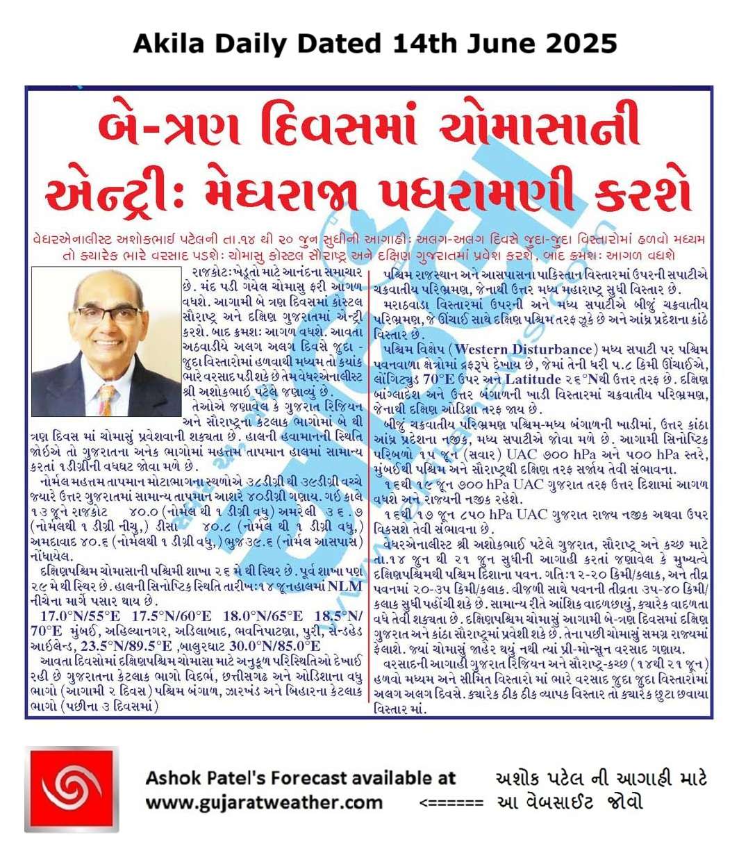
Forecast In Akila Daily Dated 14th June 2025
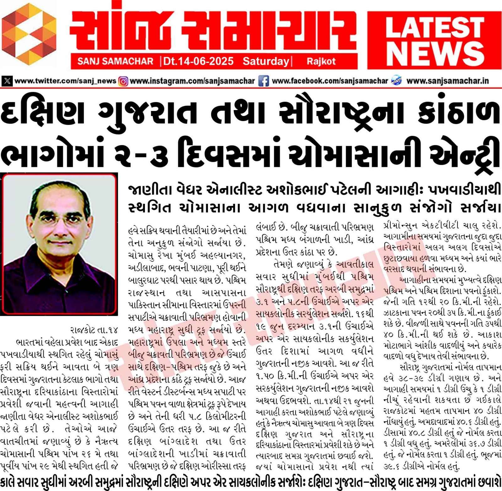
Forecast In Sanj Samachar Daily Dated 14th June 2025
-
તારીખ 15 જુન 2025 આજની પરિસ્થિતિ ભારતીય હવામાન વિભાગ અનુસાર મીડ ડે બુલેટિન ❖ નૈઋત્ય ના ચોમાસાની રેખા 17.0°N/55°E, 17.5°N/60°E, 18°N/65°E, 18.5°N/70°E, મુંબઈ, અહિલ્યાનગર, આદિલાબાદ, ભવાનીપટના, પુરી, સેન્ડહેડ આઇલેન્ડ, 23.5°N/89.5°E, બાલુરઘાટ, 30°N/85°Eમાંથી પસાર થાય છે. ❖ નૈઋત્ય નું ચોમાસું આગામી 24 કલાક દરમિયાન ગુજરાતના કેટલાક ભાગો, વિદર્ભ, છત્તીસગઢ અને ઓડિશાના કેટલાક ભાગોમાં તેમજ આગામી 3 દિવસ દરમિયાન પશ્ચિમ બંગાળ, ઝારખંડ, બિહાર અને પૂર્વ ઉત્તર પ્રદેશના કેટલાક ભાગોમાં નૈઋત્ય નું ચોમાસું પ્રગતિ માટે પરિસ્થિતિઓ અનુકૂળ છે. ❖ દક્ષિણ બાંગ્લાદેશ અને સંલગ્ન ઉત્તર બંગાળની ખાડી પરનુ UAC હવે ઉત્તર પશ્ચિમ બંગાળની ખાડી અને તેના આસપાસના વિસ્તાર પર છે અને તે સરેરાશ સમુદ્ર… Read more »
Jsk સર…. વાહ સરજી…ખેડૂત ભાઈઓ માટે ખુબજ સારી અને સમયસર વાવણી થઈ જાય એવી માહિતી આપતી અપડેટ.. જય હો
ગોંડલ મા પવન સાથે વરસાદ. ચાલુ
Thanks sir monsoon first update
Botad ma Saro varsad che
Thank you sir…apexit samaye update
Thank you sir
Thanks sir new update aapava badal aabhar
Good new
Thanks sir for new update apava badal
6 pm. jordar katakana bhadakka sathe chata chalu tya
Abhar sar..thanks
Thanks sir
Thanks for new update sir
Cola kem manu ma nathi batavtu?
COLA bandh thai gayu chhe.
Thank you sir for new update
khubh saras varasad vijadina kadaka bhadaka sathe
1.5 thi 2 itch
Thanks sir new apdate apva badal
Thank You Sir For New Update….Jay Shree Radhe Krishna Ji….
Thank you for new update
Thank you for new update
સાથે વ્હાલનાં વધામણાં ની રાહ
Thanks for new update sir
Lage se have vavani thai jase!
Thank you for new update sar
Thanks for new update
Thanks you sir new upadates
Thanks sir
Thenks sar
Thanks for new update sir
Thanks you for new update
Thank you for update sir
સર.હવેતો કોરમાં વાવીદેવું હો
સર જય શ્રીકૃષ્ણ આભાર અપડેટ બદલ……
Thank you
Thanks sir for new update
Thank you sir for New update
Thanks for update
અપડેટ આપવા બદલ આભાર સાહેબ
Jay shree krishna sir tamari update aavi atle aanand aaviyo Karan ke have paku kahevay ke varshad aaveshe
Thanks
Theks sr.for new apdet
New Update apva Badal sir tamaro abhar
Thanks sir for good new apdet
Thank you sir
અમારે ઈડર તાલુકાના પશ્ચિમના ગામડાઓમાં ભારે પવન સાથે વરસાદ પડ્યો. ગઈ રાત્રિ દરમિયાન..
Thanks sar new apdet
તારીખ 14 જુન 2025 આજની પરિસ્થિતિ ભારતીય હવામાન વિભાગ અનુસાર મીડ ડે બુલેટિન ❖ નૈઋત્ય ના ચોમાસાની રેખા 17.0°N/55°E, 17.5°N/60°E, 18°N/65°E, 18.5°N/70°E, મુંબઈ, અહિલ્યાનગર, આદિલાબાદ, ભવાનીપટના, પુરી, સેન્ડહેડ આઇલેન્ડ, 23.5°N/89.5°E, બાલુરઘાટ, 30°N/85°Eમાંથી પસાર થાય છે. ❖ નૈઋત્ય નું ચોમાસું આગામી 2 દિવસ દરમિયાન ગુજરાતના કેટલાક ભાગો, વિદર્ભ, છત્તીસગઢ અને ઓડિશાના કેટલાક ભાગોમાં તેમજ આગામી 3 દિવસ દરમિયાન પશ્ચિમ બંગાળ, ઝારખંડ અને બિહારના કેટલાક ભાગોમાં નૈઋત્ય નું ચોમાસાની પ્રગતિ માટે પરિસ્થિતિઓ અનુકૂળ છે. ❖ ઉત્તરપશ્ચિમ રાજસ્થાન પરનુ UAC હવે પશ્ચિમ રાજસ્થાન અને લાગુ પાકિસ્તાન પર છે અને તે સરેરાશ સમુદ્ર સપાટીથી 1.5 કિમી સુધી વિસ્તરે છે. ❖ એક ટ્રફ હવે પશ્ચિમ… Read more »
Thank You !
Thanks for update
Wellcome to Gujarat sw monsoon 2025 thank you sir
Thank you for new update sir
Sir jamnagar dist ma kyar thi varsad chalu thase
Thenks
ખુબ સરસ સમાચાર
Thank you sir for new update
Thanks, saheb
Thanks for update
Thank you sir new update apva Badal