Current Weather Conditions on 8th August 2014 @ 11.53 pm.
The Depression had weakened to a Low Pressure area and has reached East Rajasthan and vicinity.
The axis of monsoon trough at mean sea level passes through Anupgarh, Narnaul, Agra, Sultanpur, Bhagalpur, Kolkata and thence Southeastwards to Eastcentral Bay of Bengal. It extends upto 2.1 km above mean sea level.
The upper air cyclonic circulation over north Bay of Bengal and neighborhood extending up to 7.6 km above mean sea level tilting southwestwards with height persists. Under Its influence, a low pressure area may develop over the same region within 24 hours.
The Off-shore trough at mean sea level runs from North Maharashtra coast to Kerala coast.
The upper air cyclonic circulation over Kutch & neighborhood at 3.1 Km. above mean sea level persists.
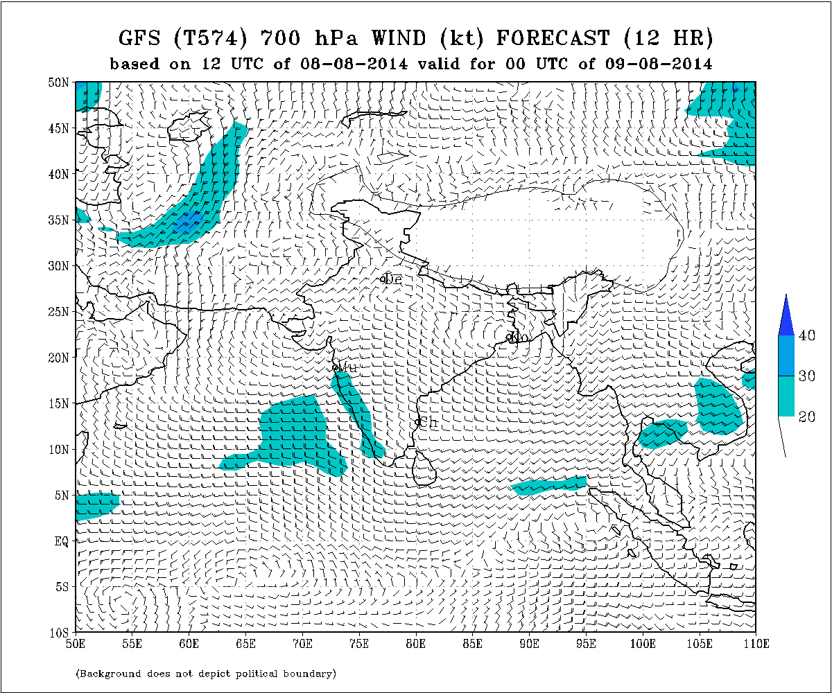
IMD Weather Chart Showing 700 hPa Winds Valid 0000 UTC on 9th August
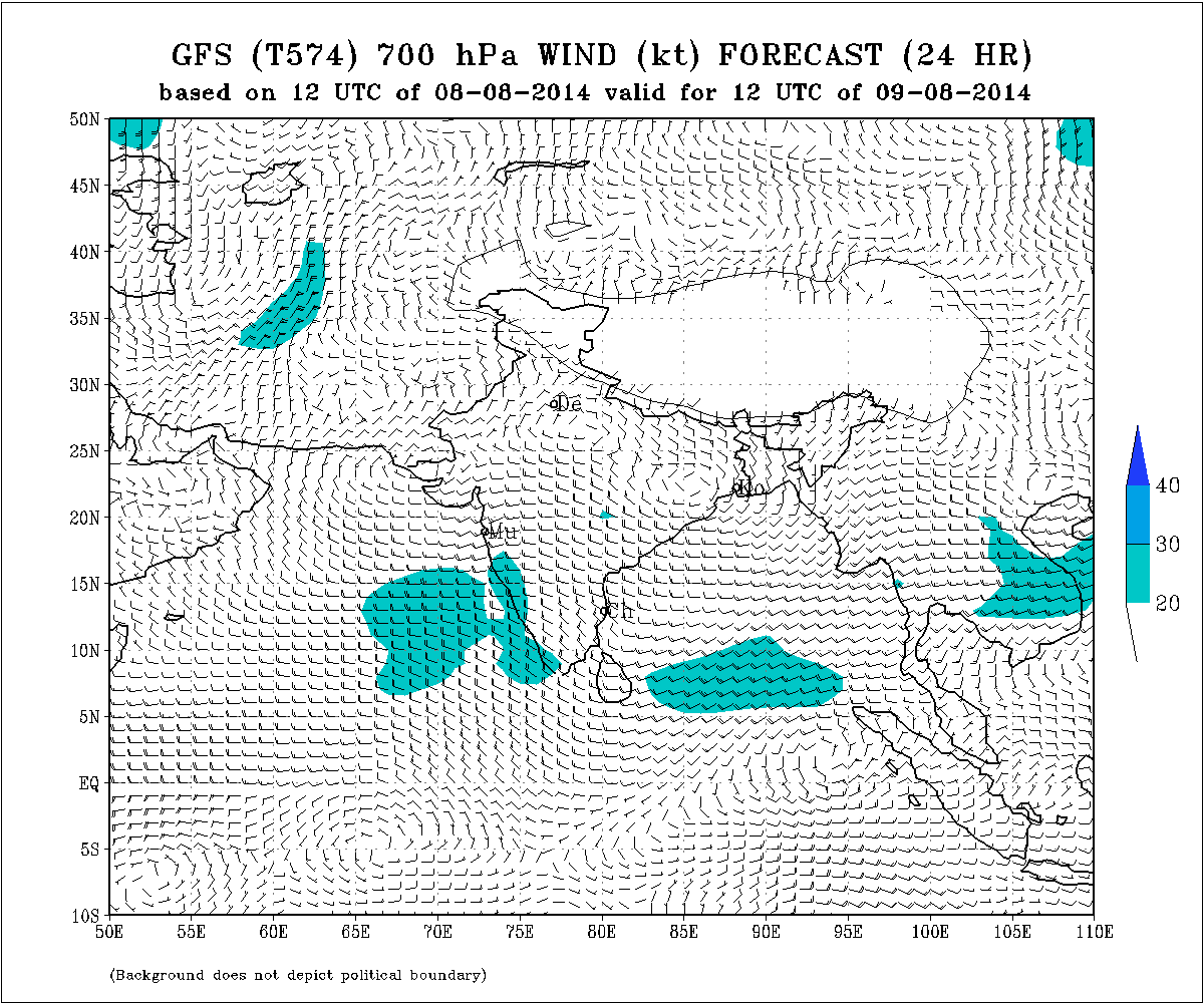
IMD Weather Chart Showing 700 hPa Winds Valid 1200 UTC on 9th August
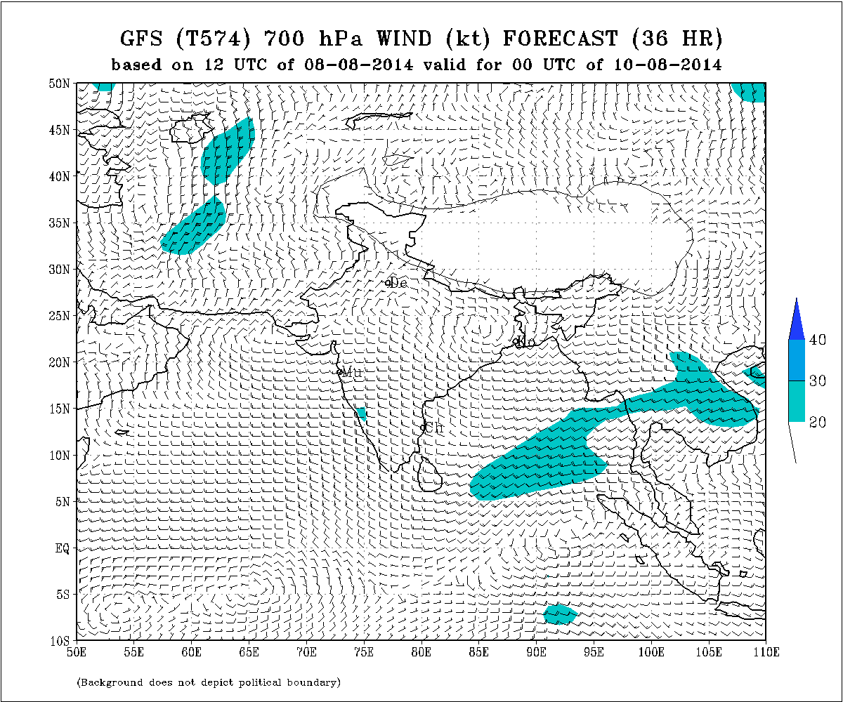
IMD Weather Chart Showing 700 hPa Winds Valid 0000 UTC on 10th August
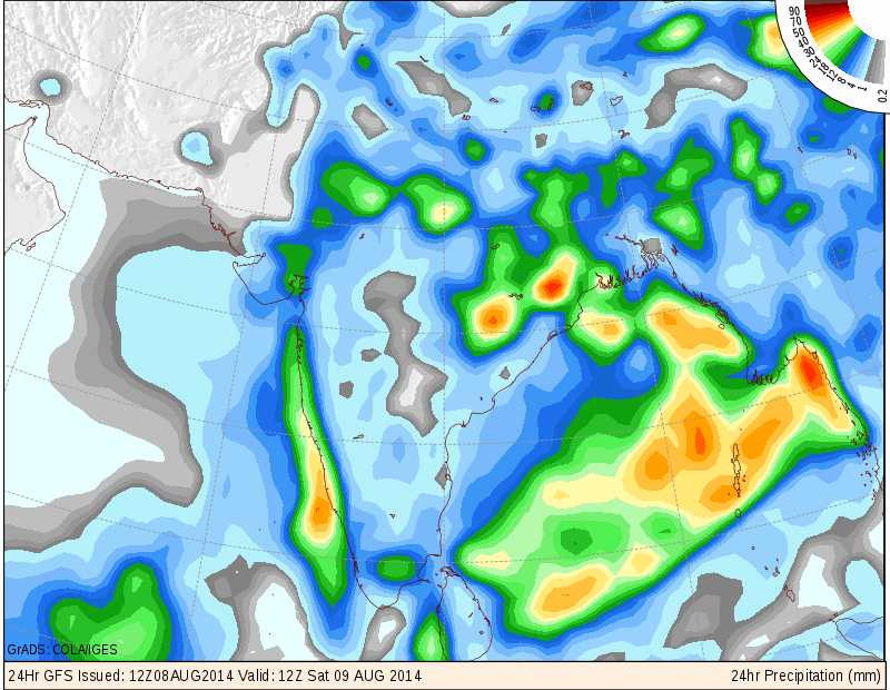
COLA/IGES GFS Precipitation Forecast Map Valid 1200 UTC 9th August 2014
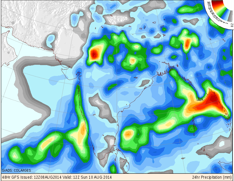
COLA/IGES GFS Precipitation Forecast Map Valid 1200 UTC 10th August 2014
Forecast: 9th August to 14th August 2014
The is a weak Upper Air Cyclonic Circulation at 700 hPa or 3.1 Kms. above mean sea level over Kutch, Western Saurashtra, Sindh and vicinity which would be gone within 24 to 36 hours.
Saurashtra, Gujarat & Kutch :
Scattered light/medium rainfall possible on 9th August.
10th to 14th August there would be scattered showers/light rain but quantity of rain and the area of rain coverage would be less.
સૌરાષ્ટ્ર, ગુજરાત અને કચ્છ :
તારીખ ૯ ના છૂટો છવાયો હળવો મધ્યમ વરસાદ પડશે.
તારીખ ૧૦ થી ૧૪ ઓગસ્ટ દરમ્યાન છૂટો છવાયા ઝાપટા અથવા હળવો વરસાદ પડશે પરંતુ વરસાદ ની માત્રા તથા વિસ્તાર ઓછો રહેશે.
Scroll Up