Current Weather Conditions on 13th August 2014 @ 8.00 am.
The axis of monsoon trough at mean sea level passes through Ferozepur, Ambala, Bareilly, Gorakhpur, Bhagalpur, Malda and thence Eastwards to East Arunachal Pradesh. It extends up to 0.9 km above mean sea level.
The western end of monsoon trough is shifting northwards thereby the axis of monsoon trough has nearly moved to along the foothills of Himalayas.
The off-shore trough at mean sea level continue to run from South Maharashtra coast to Kerala coast.
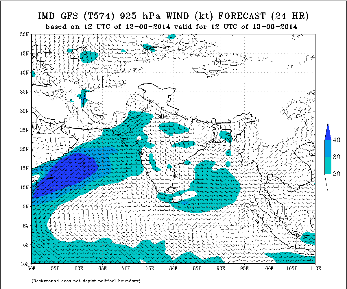
IMD Weather Chart Showing 925 hPa Winds Valid 1200 UTC on 13th August
IMD Weather Chart Showing 925 hPa Winds Valid 1200 UTC on 14th August
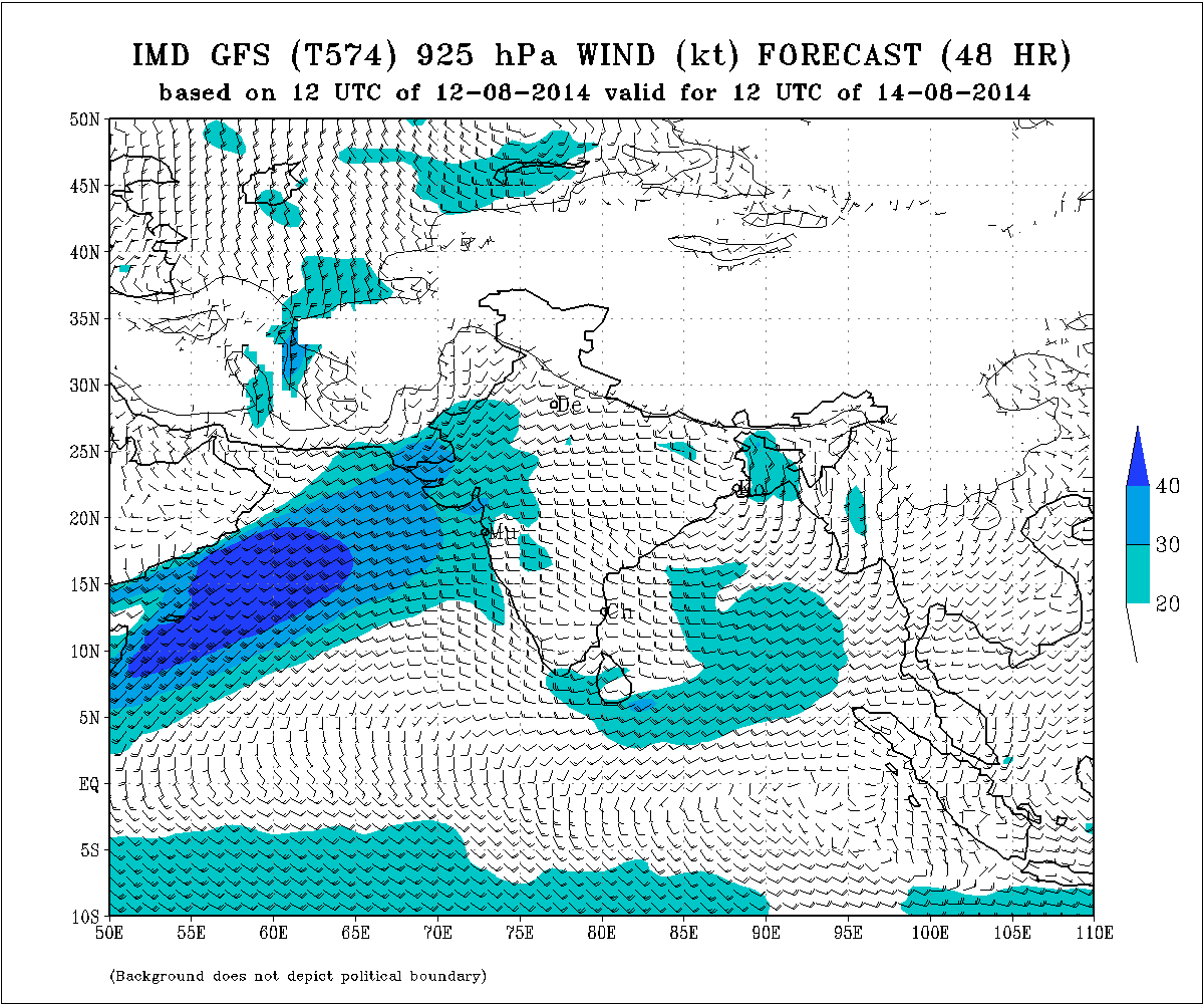
The above charts of 925 hPa shows that the axis of monsoon is along the Himalayas. Only westerly winds can be seen and the Easterly winds are absent.
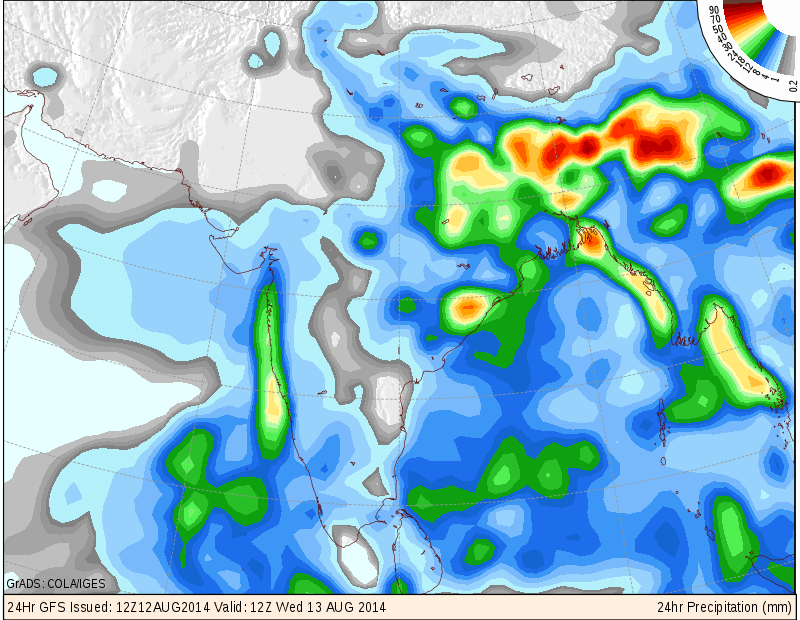
COLA/IGES GFS Precipitation Forecast Map Valid 1200 UTC 13th August 2014
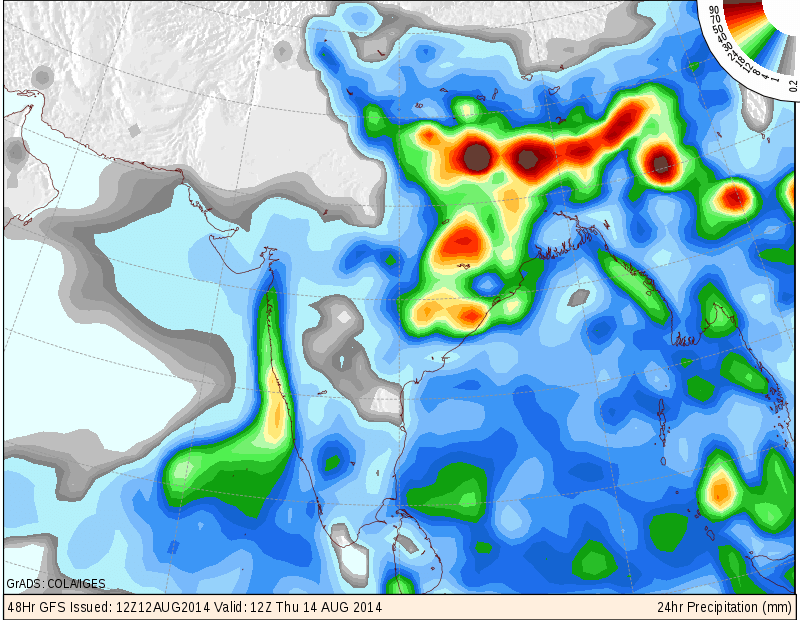
COLA/IGES GFS Precipitation Forecast Map Valid 1200 UTC 14th August 2014
Forecast: 13th August to 18th August 2014
Saurashtra, Gujarat & Kutch :
13th to 18th August there would be scattered showers/light rain but quantity of rain and the area of rain coverage would be less in latter half of forecast period.
South Gujarat is expected to get off & on scattered light to medium rainfall during the forecast period.
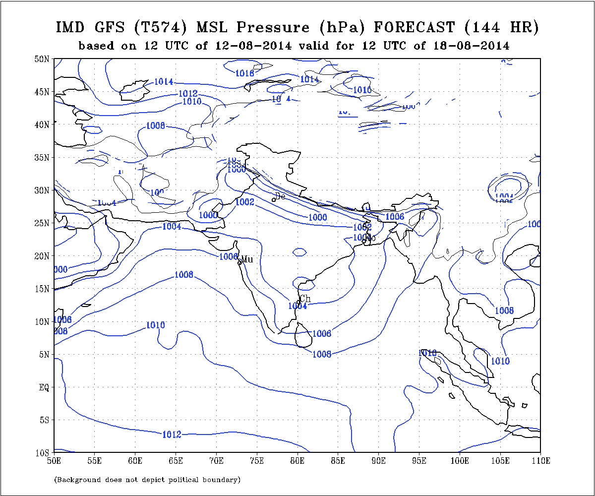
A Low Pressure area could develop over the West Central Bay of Bengal around 18th August.
IMD Weather Chart Showing Forecast MSLP Valid 1200 UTC 18th August 2014
સૌરાષ્ટ્ર, ગુજરાત અને કચ્છ :
તારીખ ૧૩ થી ૧૮ ઓગસ્ટ દરમ્યાન છૂટો છવાયા ઝાપટા અથવા હળવો વરસાદ પડશે પરંતુ વરસાદ ની માત્રા તથા વિસ્તાર આગાહી ના પાછલા દિવસો માં ઓછી/ઓછો રહેશે.
દક્ષીણ ગુજરાત માં આગાહી ના સમય દરમ્યાન ક્યારેક ક્યારેક છૂટો છવાયો હળવો મધ્યમ વરસાદ થશે.
તારીખ ૧૮ ઓગસ્ટ આસપાસ મધ્ય પશ્ચિમ બંગાળની ખાડી માં એક લો પ્રેસર થવાની શક્યતા છે.
Scroll Up