Current Weather Conditions on 4th August 2014 @ 8.00 am.
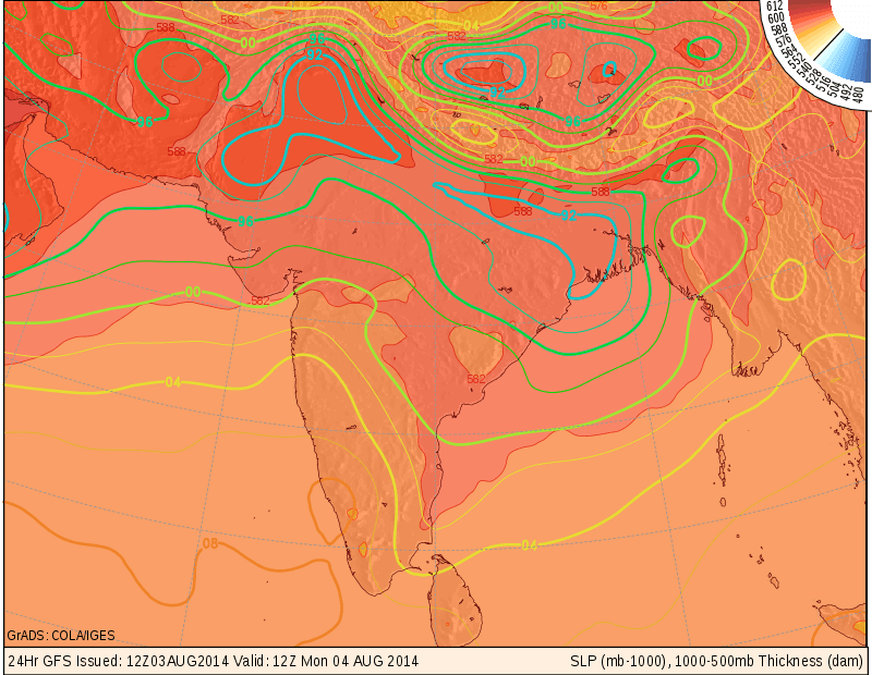
A Low Pressure area developed over North Bay Of Bengal on 3rd August and by evening it had strengthened to a Well Marked Low Pressure over the same region. Associated Upper Air Cyclonic Circulation extends up to 7.6 Kms. above mean sea level. It would move West Northwesterly direction during next 48 hours.
The axis of monsoon trough at mean sea level passes through Amritsar, Karnal, Hardoi, Gaya, Purulia, Center of Well Marked Low Pressure area and thence Southeastwards to Eastcentral Bay of Bengal. It also extends up to 1.5 km above mean sea level.
The Off-shore trough at mean sea level from South Gujarat coast to Kerala Coast persists.
COLA/IGES GFS Map For MSLP Valid 1200 UTC 4th August 2014
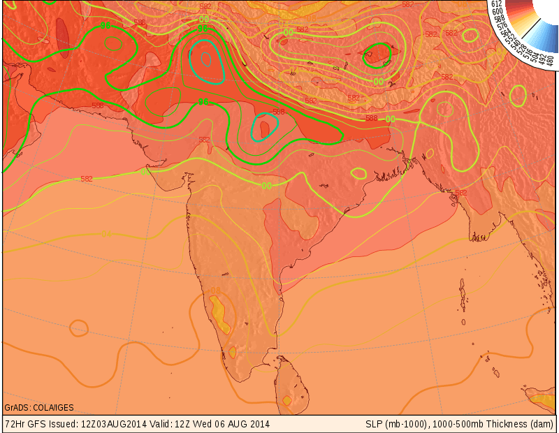
COLA/IGES GFS Map For MSLP Valid 1200 UTC 6th August 2014
Forecast: 4th August to 7th August 2014
The Well Marked Low Pressure is expected to track West Northwest direction and track over Chhatishgarh and by 6th August this System will reach Madhya Pradesh.
Saurashtra, Kutch & Gujarat:
Scattred showers/rainfall possible during the forecast period with more chance on 6th-7th August.
તારીખ ૪ થી ૭ ઓગસ્ટ
આગાહી:
બંગાળની ખાડી માં જે વેલ માર્કડ લો પ્રેસર છે તે પશ્ચિમ ઊત્તર પશ્ચિમ દિશા માં ગતિ કરશે અને તારીખ ૬ સુધી માં તે એમ પી સુધી પોંચશે.
સૌરાષ્ટ્ર, કચ્છ અને ગુજરાત:
તારીખ ૪ થી ૭ દરમ્યાન છુટા છવાયા ઝાપટા/વરસાદ પડશે જેમાં વધુ શકયતા ૬ અને ૭ તારીખે રહેશે.