Current Weather Conditions on 3rd July 2013 @ 10.30 am.
The Low Pressure area over Northeast Madhya Pradesh and adjoining Southeast Uttar Pradesh and North Chhattisgarh now lies as a Well Marked Low Pressure area over Northwest Madhya Pradesh and neighbourhood. Associated Cyclonic Circulation extends upto 5.8 kms above sea level.
The axis of the monsoon trough at mean sea level now passes through Bikaner, Jaipur, Center of the Well Marked Low Pressure area, Pendra, Sambalpur, Paradip and thence Southeastwards to East Central Bay of Bengal.
There is an offshore trough from Gujarat coast to Kerala coast.
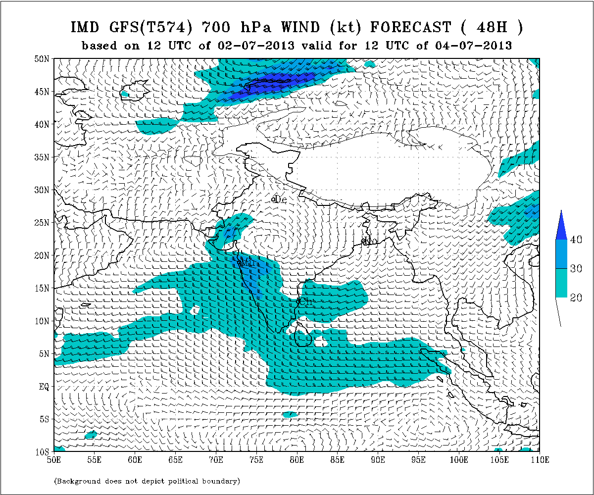
IMD Chart shows the UAC at 700 Mb. over Madhya Pradesh valid 1200Z of 4th July 2013
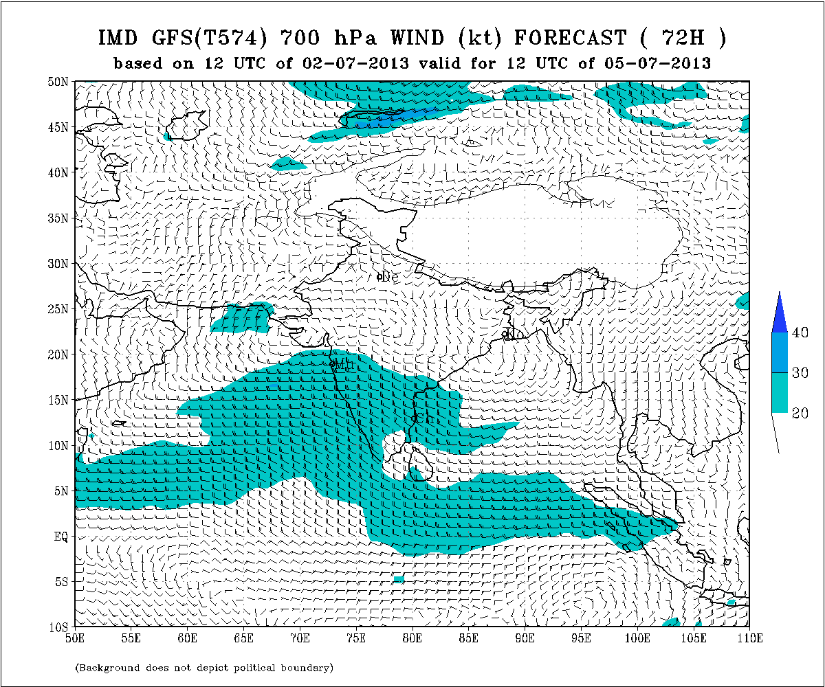
IMD Chart shows the UAC at 700 Mb. from M.P. to Saurashtra valid 1200Z of 5th July 2013
Daily Indian Summer Monsoon Index suggests two spells of active Monsoon during the next two weeks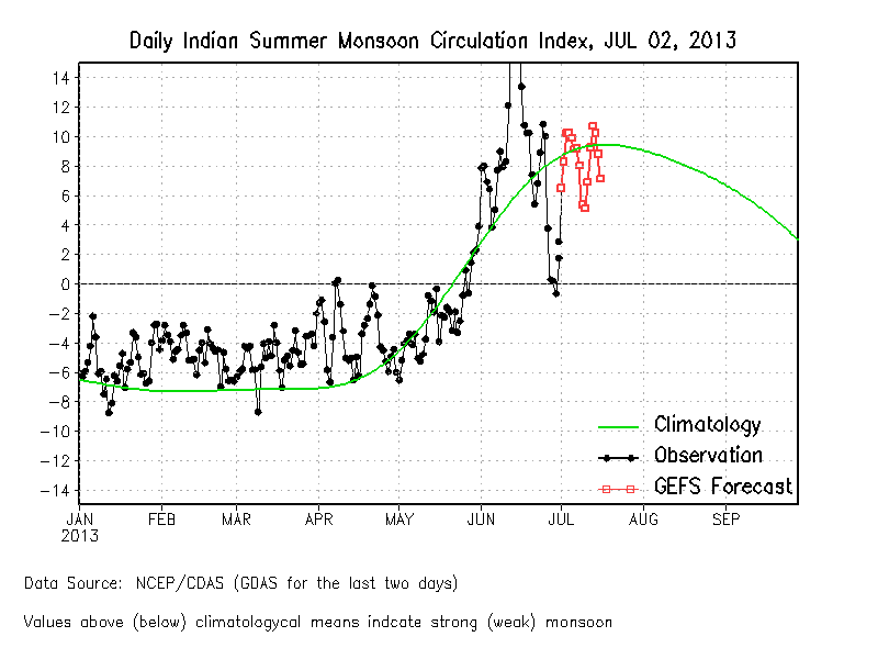 NCEP/GFS Bias-Corrected Weekly Rainfall Forecast
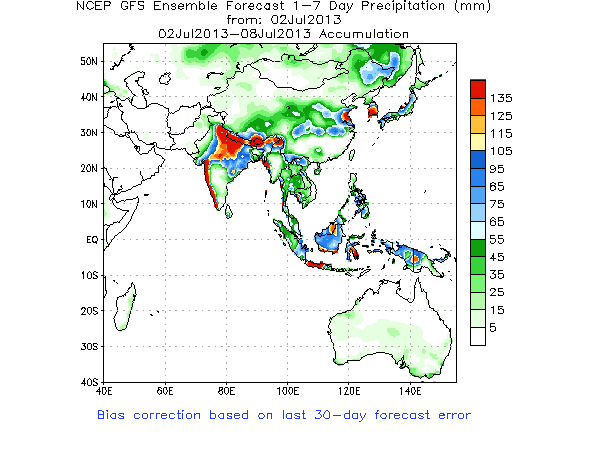
The above chart suggests weekly rainfall till 8th July amount of 35 mm to 100 mm for Saurashtra while South Gujarat could get 100 to 150 mm and North Gujarat could get 35 to 100 mm. & Kutch up to 40 mm.
Forecast: Update
Condition good for Rainfall over Gujarat, Saurashtra & Kutch
Due to Westwards track of UAC from Madhya Pradesh conditions will be good for rainfall over Gujarat on 3rd to 5th July and Saurashtra by 4th & 5th and Kutch by 5th July. Rainfall quantum will vary from heavy to medium to light since this is dependent on final UAC track and the clouding associated with it.
Weather Forecast In Akila Daily Dated 3rd July 2013 @ 10.30 am.
