Current Weather Conditions On 15th June 2013 @ 2.00 pm.
The Low Pressure area has tracked towards Madhya Pradesh and is lying over Southeast Madhya Pradesh and neighborhood with associated Cyclonic Circulation now extends up to Mid-Troposheric level tilting Southwestwards with height.
The trough at mean sea level now runs from West Rajasthan to East Central Bay of
Bengal across East Rajasthan, West Madhya Pradesh, the Centre of the low pressure
area and North coastal Andhra Pradesh.
There is an off-shore trough at mean sea level from South Gujarat coast to North Kerala Coast.
The Cyclonic Circulation lies over Northeast Arabian Sea and parts of Saurashtra & Kutch.
From IMD:
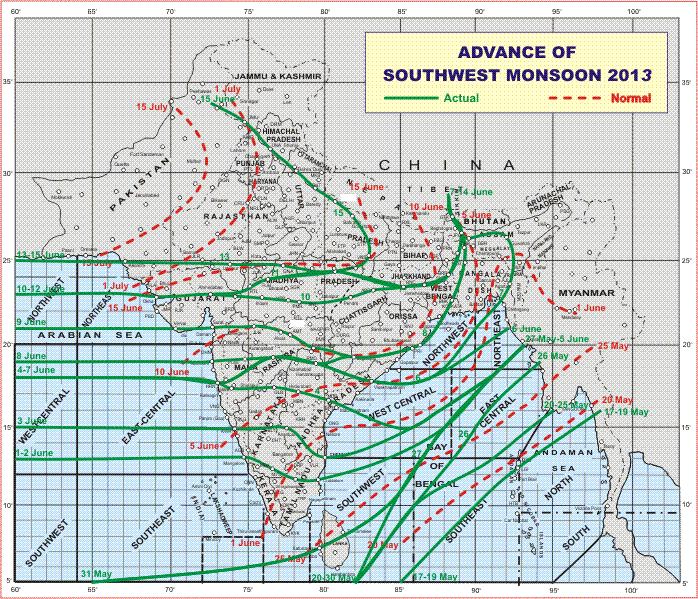
The Southwest Monsoon has further advanced into remaining parts of West
Bengal & Sikkim, Jharkhand, entire Bihar, Uttarakhand, Himachal Pradesh and
Jammu & Kashmir; some more parts of east Madhya Pradesh and some parts of
east Uttar Pradesh.
The Northern Limit of Monsoon (NLM) passes through Lat. 25° N / Long. 60° E,Lat. 25° N / Long. 65° E, Udaipur, Guna, Satna, Varanasi, Bahraich, Pantnagar,Dehradun, Una and Jammu.
IMD Map Of Advance Of Southwest Monsoon 2013
Forecast: up to 20th June
The Low Pressure was expected to track towards Southeast Rajasthan North Gujarat border area. However, latest forecast runs are showing that the Low Pressure and associated UAC will track over Central M.P. on 16th June and on 17th June will track Northwards towards North M.P. & U.P. border areas. Hence the quantum of rain forecast on 14th June for period up to 20th June may to go down in some areas of Gujarat & Saurashtra.
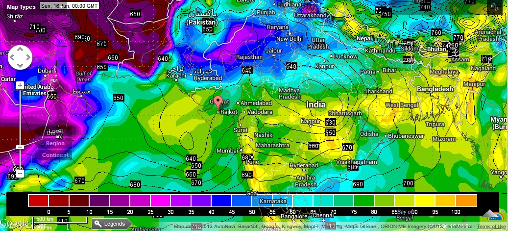
925 Mb. Chart shows the location of the System over Central M.P. on 16th June
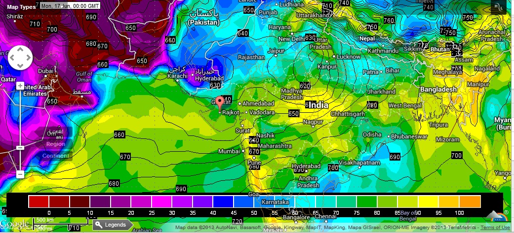
925 Mb. Chart shows the location of the System over North M.P. on 17th June
Weather Forecast In Akila Daily dated 15th June 2013 @ 2.00 pm.