Current Weather Conditions on 5th September 2012 @ 8.00 pm. IST
The Well Marked Low Pressure is currently over East Madhya Pradesh and Vidarbha vicinity.
The Upper Air Cyclonic Circulation over Gujarat region & neighbourhood persists.
The offshore trough runs from Gujarat coast to Kerala coast.
The Western end of the Axis of Monsoon is normally over Rajasthan, however, currently it has shifted Southwards so the Axis of Monsoon trough at mean sea level passes through Deesa, Ujjain, Center of Well Marked Low Pressure area, Jharsuguda, Balasore and thence Southeastwards to Eastcentral Bay of Bengal.
There has been very good rainfall over whole Saurshtra as had been forecast on 3rd September. The details of District wise rainfall data till morning of 5th September is given below.
District Average Rainfall till 5th September and last 24 hours figures:
1 Surendranagar Total 226 mm. and Last 24 hours 10 mm.
2 Rajkot Total 229 mm. and Last 24 hours 11 mm.
3 Jamnagar Total 212 mm. and Last 24 hours 76 mm.
4 Porbandar Total 120 mm. and Last 24 hours 33 mm.
5 Junagadh Total 278 mm. and Last 24 hours 61 mm.
6 Amreli Total 265 mm. and Last 24 hours 1 mm.
7 Bhavnagar Total 295 mm. and Last 24 hours 24 mm.
Some notable rainfall over Saurashtra during the last 24 hours till morning of 5th September are as under:
Dwarka 165 mm.
Khambhaliya 164 mm.
Maliya Hatina 172 mm.
Keshod 136 mm.
Talala 97 mm.
Jamnagar 91 mm.
Bhavnagar 75 mm.
Rajkot received only 12 mm.
What will the outcome of the current two Systems for Saurashtra ?
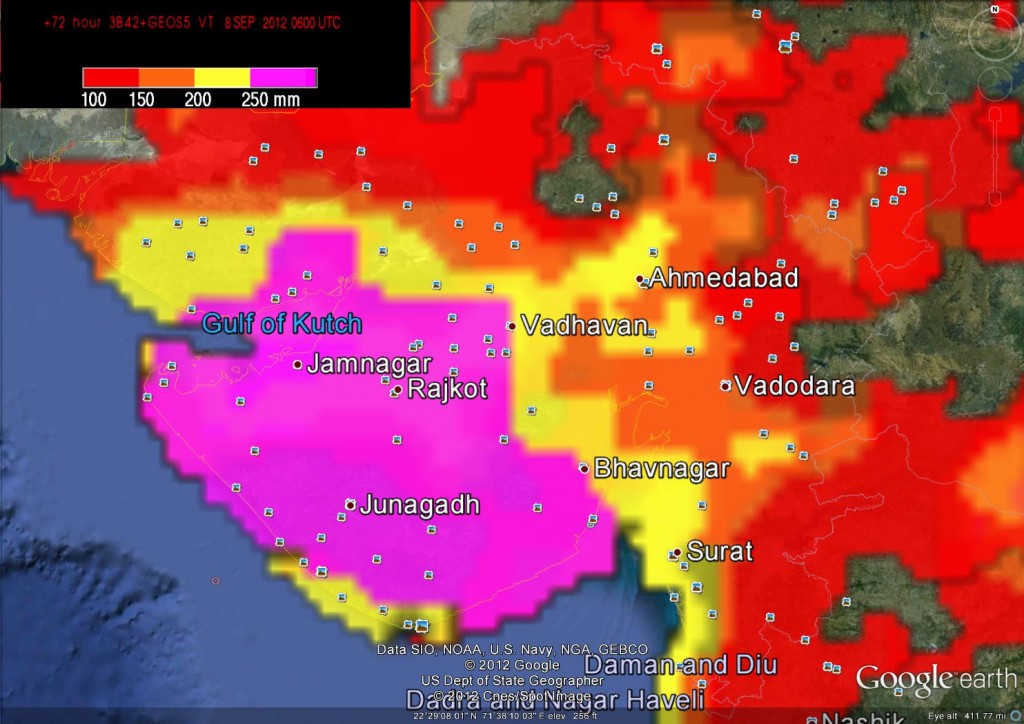
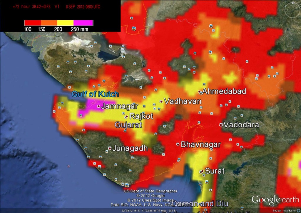
Here are two Experimental Rainfall Forecast Maps and there is a big difference between the quantity of rain Forecast by each of them. These are Experimental products only. Refer/Rely on official IMD weather Forecasts.
TRMM Realtime Satellite Rainfall (3B42RT) & GEOS-5
Cumulative of Actual rainfall already occurred from 2nd September till 5th September plus the Rainfall Forecast from 5th to 8th September.
TRMM Realtime Satellite Rainfall (3B42RT) & GFS
Cumulative of Actual rainfall already occurred from 2nd September till 5th September plus the Rainfall Forecast from 5th to 8th September.


what about saurastra??? junagadh distict- una,kodinar,veraval
when rain will stop in south gujrat
Dear ashokbhai I am enabled to open satelite image on my apple iPad and my mobile phone so kindly check the website from any mobile phone thanks
There are many visitors to site using Apple products as well as Mobile phones with Android OS. I will check on Apple ipad.
what about north gujarat?sbarkantha.modasa samlaji?
pls rply
Bayad Modasa Prantij and all areas nearing you are receiving good rain recently and weather is yet good for some more rain.