Current Weather Conditions on 12th December 2013 @ 10.00 am.
Very Severe Cyclonic Storm “MADI” tracked mainly Northerly direction till it reached about Lat. 15.5N & Long. 85.5E. on 10th December 2013. As had been indicated on 8th December 2013 relying on the Forecast Model runs from both GFS & ECMWF the System was forecast to take a “V” turn and track back Southwest towards the Tamilnadu Coast. The forecast model run has been validated becasue the track back towards Tamilnadu coast began from 10th December.
Various stages of intensification for 06B.Madi – Very Severe Cyclonic Storm as given from JTWC as well as IMD are given below:
- 92B.INVEST first appeared 2013-11-30 1900z @ 4.0°N 88.0°E
- JTWC designates as TC 06B 06-12-2013, 0300z @ 9.8°N 83.8°E
- Depression BOB 08 from IMD 06-12-2013, 0600z @ 10.0°N 84.0°E
- Deep Depression BOB 08 from IMD 06-12-2013, 2000z @ 10.0°N 84.0°E
- Cyclonic Storm Madi from IMD 07-12-2013, 0400z @ 10.5°N 84.0°E
- Severe Cyclonic Storm Madi from IMD 07-12-2013, 1100z @ 10.5°N 84.0°E
- Very Severe Cyclonic Storm Madi from IMD 08-12-2013, 0800z @ 12.3°N 84.7°E
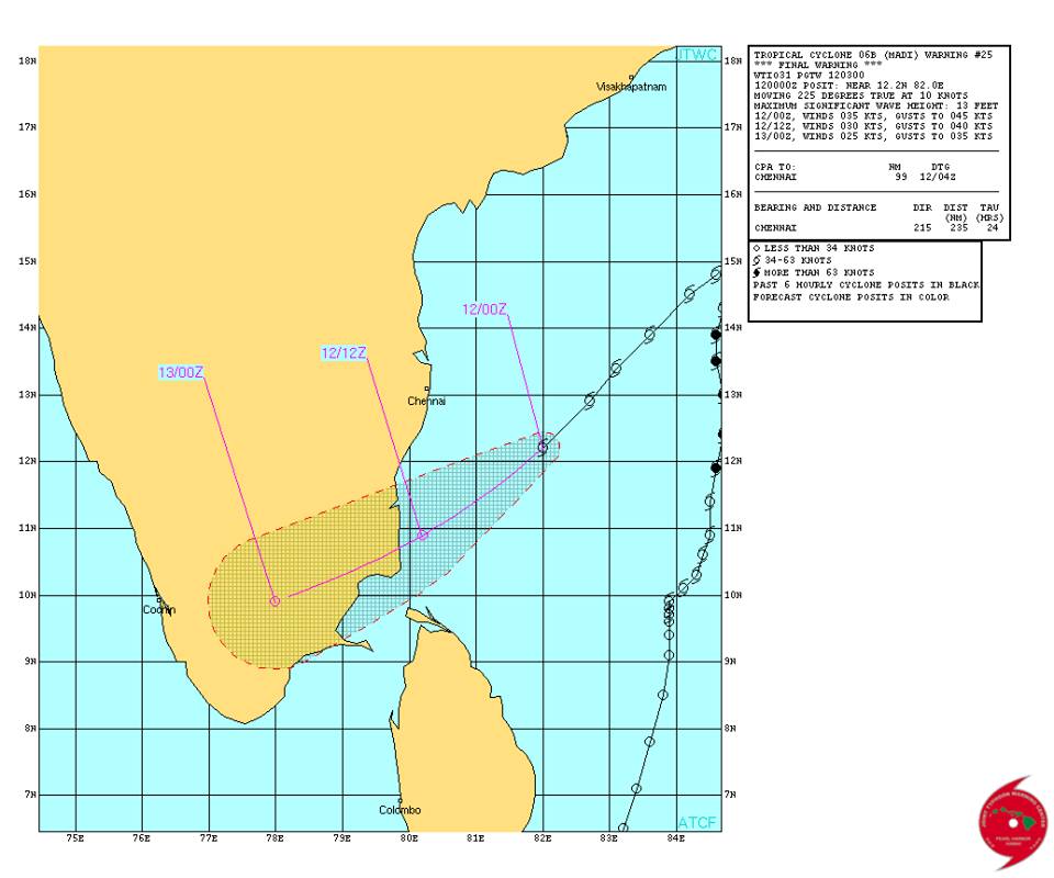
JTWC has issued Cyclone Warning No. 25 for 06B.MADI located near Lat. 12.2N. & Long. 82.0 E. with winds speeds of 35 knots ( on 1 minute average wind speed basis).
JTWC Tropical Cyclone 06B.Six Warning #25
Issued at 0300Z on 12th December 2013
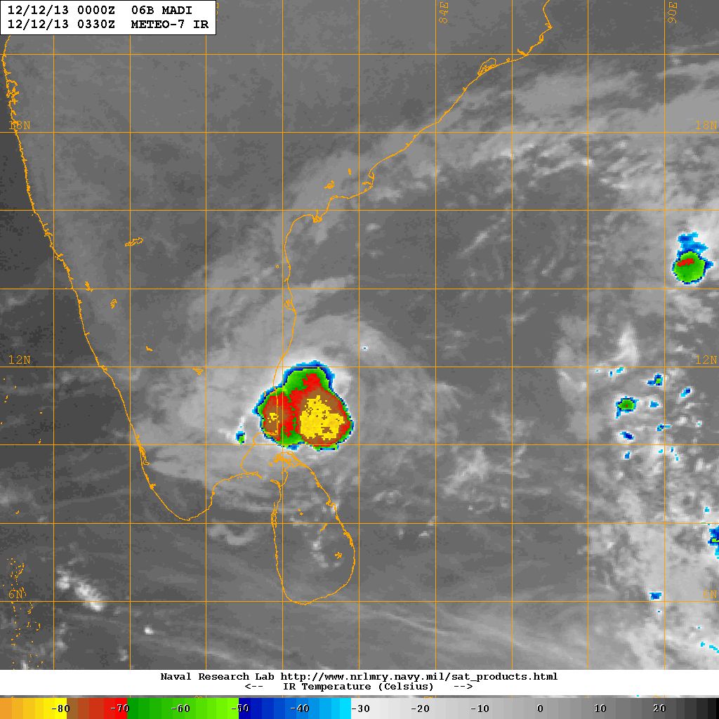
NRL IR Satellite Image Of 06B.MADI Near Tamilnadu Coast
on 12th December 2013 at 0330 UTC ( 9.00 am. IST)
Forecast dated 8th December is reproduced here:
Tropical Cyclone “MADI” is expected to track mainly Northwards for the next three days and is expected to track back Southwestwards towards Sri Lanka / South Tamilnadu Coastal areas from 11th onwards for the next few days. Both ECMWF as well as GFS 0000z Forecast runs of 7th December concur with the above scenario but it could pan out with a 24 hour difference between the two models.
GFS 7th December 2013 925 Mb. Forecast Run 0000z
Valid 12th December 2013 1200z

ECMWF 7th December 2013 925 Mb. Forecast Run 0000z
Valid 12th December 2013 1200z

Current Conditions & Forecast: 12th December to 17th December
Saurashtra, Gujarat & Kutch:
The Maximum and Minimum Temperature is near normal over most parts of the region with an exception of Bhuj where the Maximum as well as Minimum Temperature is ruling higher than normal for this time of the year. There could be some measurement anomaly in Bhuj where the Maximum Temperature was 31.6 C. being 3 C. above normal and Minimum Temperature 16.7 C being 7 C. above normal.
The Normal Maximum as well as Minimum Temperature incrementally decreases as December progresses. The Maximum as well as Minimum Temperature is expected to decrease gradually during the forecast period. Temperature could be near normal to 1 to 2 Degree below normal during the forecast period.
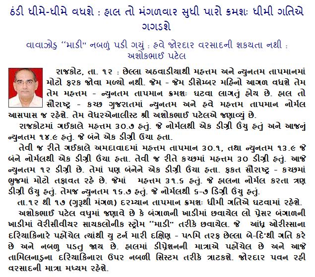
Weather Forecast In Akila Daily Dated 12th December 2013 @ 10.00 am.