Current Weather Conditions on 28th November 2013 @ 12.30 pm.
Very Severe Cyclonic Storm “LEHAR” started weakening from yesterday morning and continued to so during the last 24 hours. Currently the System is of barely Deep Depression Strength located at Lat. 15.0 N. & Long. 82.0 E. over West Central Bay of Bengal. Central Pressure has increased to above 1000 Mb. Winds are around 30 knots. The Cyclone center is about 160 Kms. Southeast Machilipatnam and 200 Kms. East Southeast of Chirala both places of Andhra Pradesh. Currently the System is tracking West Northwestwards at about 15 to 18 Kms./hour. System is expected to make landfall after 1200 UTC today 28th November 2013 between Machilipatnam & Ongole in the vicinity of Chirala/Bapatla. Convective clouds and the System Center are in separate locations so technically landfall timings may differ.
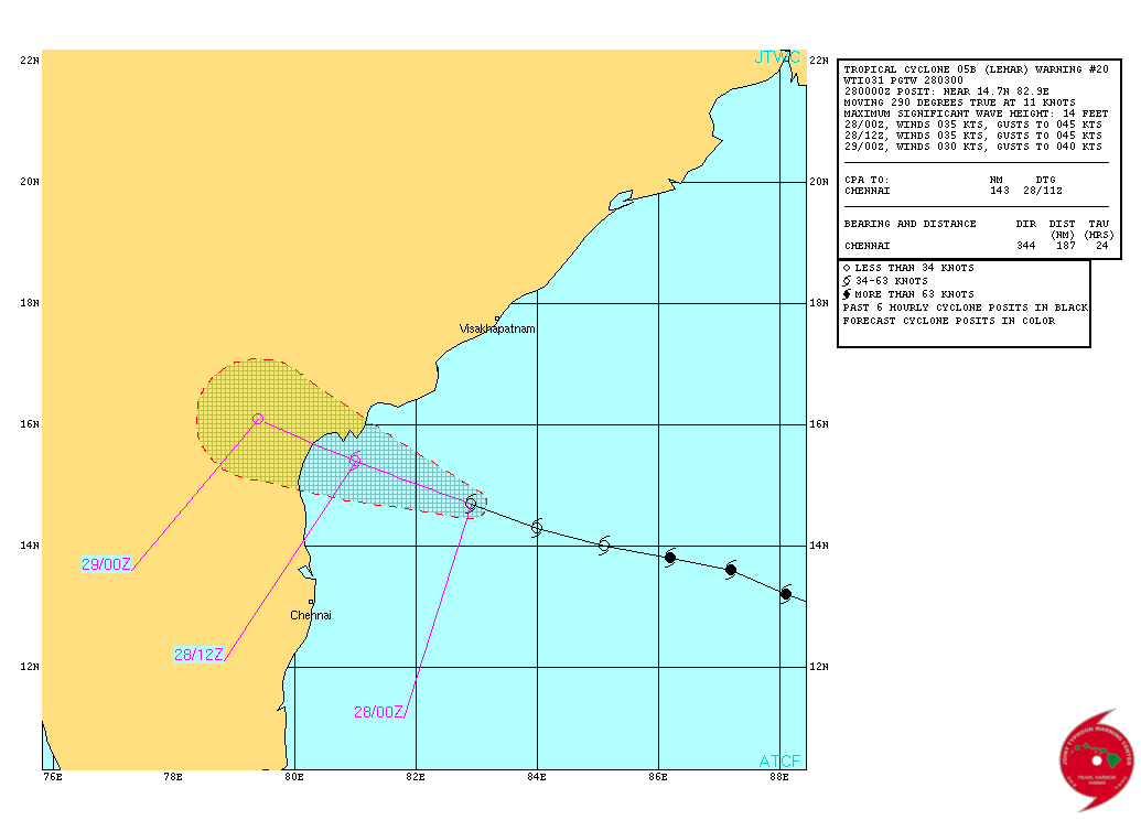
JTWC Tropical Cyclone 05B.Lehar Warning #20
Issued at 28/0300Z
NRL IR Satellite Image Of 05B.LEHAR
on 28th November 2013 at 0630 UTC ( 12.00 pm. IST)
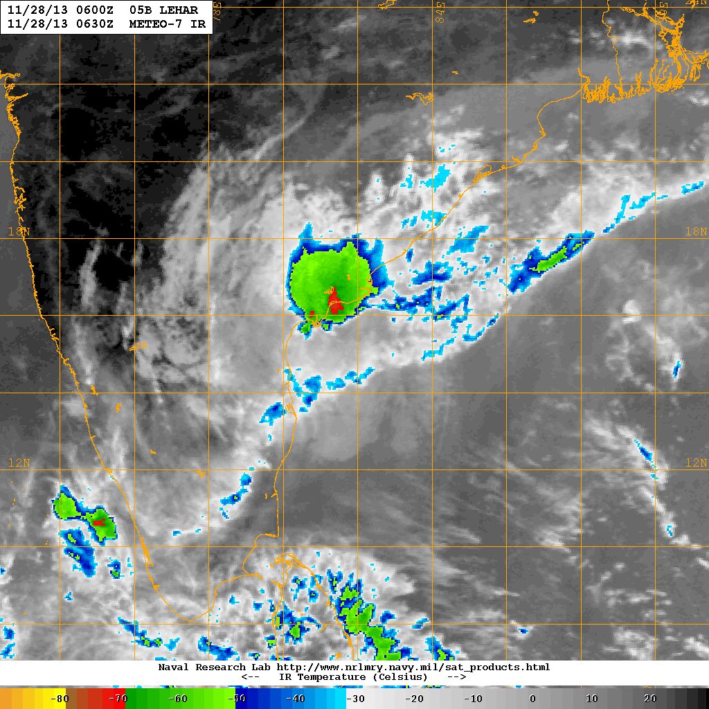
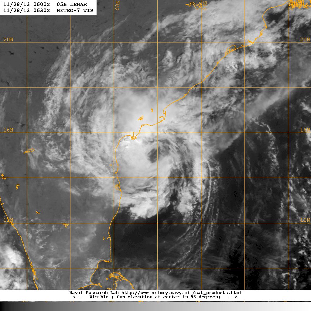
Compare the above IR Satellite Image with the Visible Satellite Image below to see the difference. The System Center is clearly visible on the Visible Image below while the IR shows the dense convective clouds over the Coastal Andhra areas.
NRL Visible Satellite Image Of 05B.LEHAR
on 28th November 2013 at 0630 UTC ( 12.00 pm. IST)
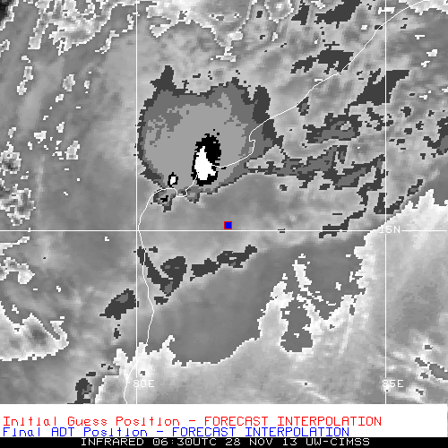
UW-CIMSS Forecast Interpolation of System Center
on 28th November 2013 @ 0630 UTC ( 12.00 pm.)
From IMD Bulletin No.: BOB07/2013/36 issued at 1100 hours IST Dated 28-11-2013
Sub: Deep Depression over westcentral Bay of Bengal.
The deep depression over westcentral Bay of Bengal moved west-northwestwards with a speed of 20 kmph during past six hrs and lay centred at 0830 hours IST of today, the 28th November 2013 over the westcentral Bay of Bengal near latitude 15.70 0 N and longitude 81.70 0 E, about 80 km east-southeast of Machillipatnam. It would move west-northwestwards, weaken further and cross Andhra Pradesh coast near Machillipatnam by today, the 28thth November afternoon.
Note: Refer/Rely on IMD/RSMC/ Bulletins/Advisories