Current Weather Conditions on 20th February 2013 @ 10.30 am.
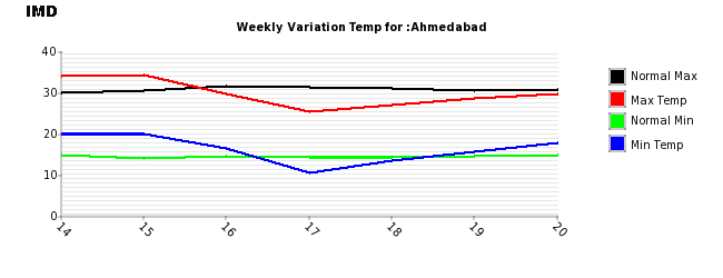
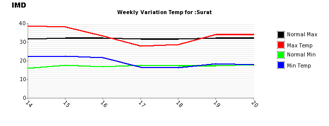
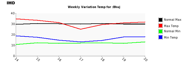
Above normal Temperature was Forecast on 18th February for the period 20th to 22nd. February. Most of the places of Saurashtra, Kutch & Gujarat have experienced increase in both Minimum as well as Maximum Temperature. The Weekly Temperature charts for Rajkot, Ahmedabad, Surat & Bhuj shows the Temperature change in the last seven days.
Yesterday’s Maximum for Rajkot Max.32.5 C & Morning Min. 15.6 C.
Normal for Rajkot is Max. 30.0 C & Min. 15 C

Yesterday’s Maximum for Ahmedabad Max. 29.7 C & Morning Min. 17.8 C.
Normal for Ahmedabad is Max. 31 C & Min. 15 C.
Yesterday’s Maximum for Surat Max. 34.0 C & Morning Min. 17.6 C.
Normal for Surat Max. 32 C & Min. is 17 C.
Yesterday’s Maximum for Bhuj Max. 31.8 C & Morning Min. 18.0 C.
Normal for Bhuj Max. 30 C & Min. is 13 C.
Forecast: 20th February to 23th February Saurashtra, Kutch & Gujarat
The Maximum Temperature is expected to remain above normal till 22nd February over most parts of Saurashtra, Kutch & Gujarat. The winds are from Northerly direction and is expected to change to from Northwest from tomorrow the 21st February. Subsequently the winds will be from the Westerly direction on 23rd February. The morning humidity will increase on 23rd. February so there is possibility of Fog over some parts of Saurashtra. The Temperature will trend downwards from 23rd February and will become near normal.
Forecast for North India: 20th to 23rd February
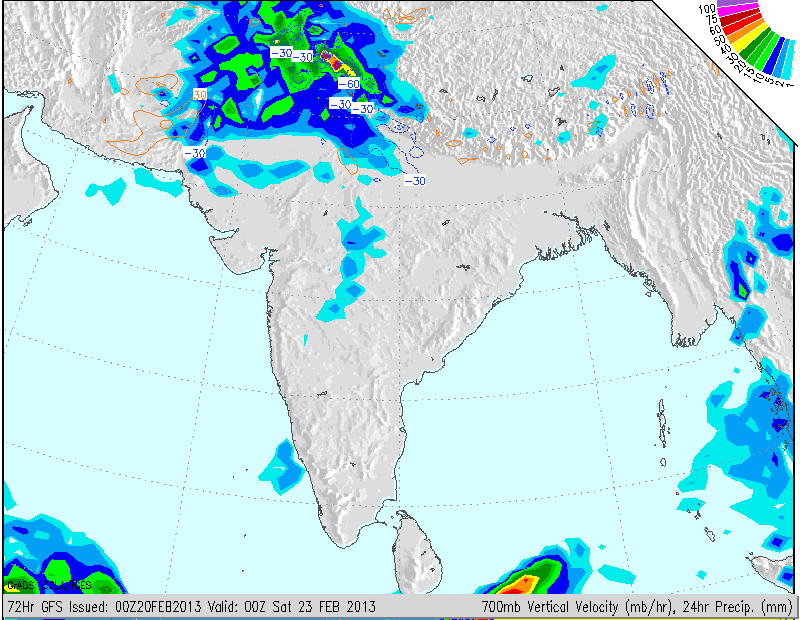
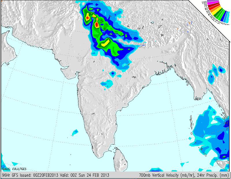
Western Disturbance will affect Pakistan on 21st February and due to this some clouding and scattered showers possible on 21st along Rajasthan bordering Pakistan. Subsequently the Western Disturbance will move over Jammu & Kashmir and other parts of North India on 22nd when there will be Snowfall over the hilly regions of Jammu & Kashmir, Himachal Pradesh and Uttrakhand. Rainfall is expected over the plains of above regions aparts from Punjab, Haryana, New Delhi and Rajasthan. On 23rd as the WD moves Eastwards, snowfall over above hilly regions and rain will continue over most of the above regions and there will be rain in U.P. and some parts of adjoining Madhya Pradesh.
Areas that would be affected by rain on 22nd/23rd February as can be seen from COLA precipitation forecast maps till 23rd February 00z and 24th February 00z.
Weather Forecast In Akila Daily Dated 20th February 2013 @ 10.30 am.