Current Weather Conditions on 26th July 2019
Some weather features from IMD :
The Monsoon Trough at mean sea level now passes through Phalodi, Alwar, Agra, Banda, Churk, Gaya, Purulia and the Center of Low Pressure Area over Northwest Bay of Bengal & adjoining Coastal West Bengal and then Southeastwards to Eastcentral Bay of Bengal and extends up to 1.5 km above mean sea level.
The feeble off-shore trough at mean sea level from north Maharashtra coast to Karnataka coast has become less marked.
Under the influence of Cyclonic Circulation over Northern parts of West Bengal & neighborhood a Low Pressure Area has formed over Northwest Bay of Bengal & adjoining Coastal areas of West Bengal. Associated Cyclonic Circulation extends up to 7.6 km above mean sea level, tilting Southwestwards with height.
A trough runs from the above Cyclonic Circulation to Haryana across Jharkhand, north Chhattisgarh, Cyclonic Circulation over South Uttar Pradesh & neighborhood and Northeast Rajasthan between 3.1 & 7.6 km above mean sea level tilting Southwards with height.
The Cyclonic Circulation over South Haryana & neighborhood between 5.8 & 7.6 km above mean sea level has merged with the above trough.
The Cyclonic Circulation over Northeast Uttar Pradesh & neighborhood now lies over south Uttar Pradesh & neighborhood extending up to 5.8 km above mean sea level.
The Western Disturbance as a cyclonic circulation between 4.5 & 5.8 km above mean sea level over Afghanistan & neighborhood persists.
Saurashtra, Gujarat & Kutch: Current conditions
There is a shortfall of 54% rain till 25th July 2019 for Saurashtra & Kutch Region, while Gujarat Region has 32% Deficit till 25th July 2019. Kutch is a 82% shortfall from normal till 25th July 2019.
Forecast: 26th July to 31st July 2019
Note: I do not Forecast more than a week ( Referred to as Hu LGAKN in the blog comments)
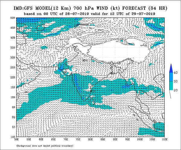
Cloudy weather on most days of the forecast period. Wind speeds of 25 to 50 km at some times daily during the forecast period over different areas of Saurashtra, Kutch & Gujarat. The Western end of Monsoon trough is expected to slide Southwards towards South Rajasthan/Gujarat around 28th-30th July.
South Gujarat could receive Medium/Heavy Rainfall with some places receiving Very Heavy Rainfall on some days of the forecast period. High rainfall areas could reach total of 200 mm Rainfall during the forecast period.
North Gujarat could receive Medium/Heavy Rainfall with some places receiving Very Heavy Rainfall on some days of the forecast period. Mainly during 28th-30th July. High rainfall areas could reach total of 200 mm Rainfall during the forecast period.
East Central Gujarat could receive Medium/Heavy Rainfall with Isolated places receiving Very Heavy Rainfall on some days of the forecast period. High rainfall areas could reach total of 150 mm Rainfall during the forecast period.
Kutch could receive Medium/Heavy Rainfall with some places receiving Very Heavy Rainfall on some days of the forecast period. Mainly during 28th-31st July. High rainfall areas could reach total of 150 mm Rainfall during the forecast period.
Saurashtra Districts of Surendranagar, Rajkot, Morbi, Jamnagar, Dev Bhumi Dwarka could receive Medium/Heavy Rainfall with Isolated places receiving Very Heavy Rainfall on some days of the forecast period. Mainly during 28th-31st July.
Rest of Saurashtra Districts could receive Light/Medium/Heavy rainfall on some days of the Forecast period.
Advance Indication: 1st to 5th August 2019
After the completion of current Bay of Bengal System, there is a possibility of a fresh System over Bay of Bengal around 31st July. This System along with other weather conditions would give beneficial rain to many parts of Saurashtra, Kutch & Gujarat during this period.
સૌરાષ્ટ્ર, ગુજરાત અને કચ્છ: તારીખ 26 જુલાઈ થી 31 જુલાઈ 2019
નોર્થવેસ્ટ પશ્ચિમ બંગાળ અને આસપાસ ના વિસ્તાર માં એક અપર એર સાયક્લોનિક સક્યુલેશન (યુએસી) ગઈ કાલે થયું હતું. તેની અસર તળે આજે નોર્થવેસ્ટ બંગાળ ની ખાડી અને લાગુ પશ્ચિમ બંગાળ ના કોસ્ટલ વિસ્તાર માં લો પ્રેસર થયું છે. તેને આનુસંગિક સાયક્લોનિક સર્ક્યુલેશન 7.6 કિમિ ની ઉંચાય સુધી ફેલાયેલ છે અને વધતી ઊંચાઈએ દક્ષિણ પશ્ચિમ તરફ ઝુકે છે.
બંગાળ ની ખાડી ની સિસ્ટમ ના આનુસંગિક આ યુએસી થી એક ટ્રફ હરિયાણા સુધી લંબાય છે, વાયા ઝારખંડ , નોર્થ છતીશગઢ, દક્ષિણ યુપી અને આસપાસ ના યુએસી માંથી. જે 3.1 કિમિ થી 7.6 કિમિ ની ઉચાયે છે અને વધતી ઉંચાઈએ દક્ષિણ તરફ ઝુકે છે.
ચોમાસુ ધરી મજબૂત થઇ ને 1.5 કિમિ ની ઉંચાય સુધી છે જે ફલોદી, અલવર, બંદા, ગયા, પુરુલિયા, અને ત્યાં થી લો પ્રેસર ના સેન્ટર પછી મધ્ય પૂર્વ બંગાળ ની ખાડી સુધી લંબાય છે.
ઓફ શોર ટ્રફ નોર્થ મહારાષ્ટ્ર થી કેરળ સુધી હતો તે નબળો પડ્યો છે.
વેસ્ટર્ન ડિસ્ટર્બન્સ 4.5 કિમિ થી 5.8 કિમિ ની ઉંચાઈએ યુએસી તરીકે છે જે અફઘાનિસ્તાન અને આસપાસ ના વિસ્તાર પર છે.
સૌરાષ્ટ્ર કચ્છ વિસ્તાર માં 25 જુલાઈ સુધી માં વરસાદ ની 54% ની ઘટ રહી છે જયારે ગુજરાત વિસ્તાર માં 32% ઘટ રહી છે. એકલા કચ્છ માં 82% ઘટ છે.
આગાહી: 26 જુલાઈ થી 31 જુલાઈ 2019
નોંધ: હું એક અઠવાડિયા થી વધુ ની આગાહી કરતો નથી. Hu LGAKN એટલે હું લાંબા ગાળા ની આગાહી કરતો નથી !
આગાહી ના લગભગ દિવસો માં વાદળ છાયું વાતાવરણ તેમજ બહુ તેઝ પવનો દર રોજ વધી ને 25 કિમિ થી 50 કિમિ પ્રતિ કલાક સુધી ફૂંકાશે.
ચોમાસુ ધરી નો પશ્ચિમ છેડો 28-30 જુલાઈ દરમિયાન દક્ષિણ તરફ સરકશે જેથી તે દક્ષિણ રાજસ્થાન/ગુજરાત પર આવશે.
દક્ષિણ ગુજરાત માં આગાહી ના અમુક દિવસો મધ્યમ/ભારે વરસાદ અને અમુક જગ્યાએ અતિ ભારે વરસાદ ની શક્યતા. આગાહી દરમિયાન વધુ વરસાદ વાળા (અમુક) સેન્ટરો માં કુલ વરસાદ 200 mm. સુધી પહોંચે.
નોર્થ ગુજરાત માં આગાહી ના અમુક દિવસો મધ્યમ/ભારે વરસાદ અને અમુક જગ્યાએ અતિ ભારે વરસાદ ની શક્યતા. મુખ્ય વરસાદ 28 થી 30 જુલાઈ દરમિયાન. આગાહી દરમિયાન વધુ વરસાદ વાળા (અમુક) સેન્ટરો માં કુલ વરસાદ 200 mm. સુધી પહોંચે.
મધ્ય પૂર્વ ગુજરાત માં આગાહી ના અમુક દિવસો મધ્યમ/ભારે વરસાદ અને એકલ દોકલ જગ્યાએ અતિ ભારે વરસાદ ની શક્યતા. આગાહી દરમિયાન વધુ વરસાદ વાળા (અમુક) સેન્ટરો માં કુલ વરસાદ 150 mm. સુધી પહોંચે.
કચ્છ માં આગાહી ના અમુક દિવસો મધ્યમ/ભારે વરસાદ અને અમુક જગ્યાએ અતિ ભારે વરસાદ ની શક્યતા. મુખ્ય વરસાદ 28 થી 31 જુલાઈ દરમિયાન. આગાહી દરમિયાન વધુ વરસાદ વાળા (અમુક) સેન્ટરો માં કુલ વરસાદ 150 mm. સુધી પહોંચે.
સૌરાષ્ટ્ર ના સુરેન્દ્રનગર, રાજકોટ, મોરબી, જામનગર, દેવ ભૂમિ દ્વારકા જિલ્લા માં આગાહી ના અમુક દિવસો મધ્યમ/ભારે વરસાદ અને એકલ દોકલ જગ્યાએ અતિ ભારે વરસાદ ની શક્યતા. મુખ્ય વરસાદ 28 થી 31 જુલાઈ દરમિયાન.
સૌરાષ્ટ્ર ના બાકી ના જિલ્લાઓ માં આગાહી ના અમુક દિવસો હળવા/મધ્યમ/ભારે વરસાદ ની શક્યતા.
27 જુલાઈ સુધારો: બ્રેકેટ વાળું (અમુક)
આગોતરું એંધાણ: 1 થી 5 ઓગસ્ટ 2019
હાલ ની બંગાળ ની ખાડી બાજુ થી એક સિસ્ટમ આવવાની છે તે સિસ્ટમ બાદ ફરી બંગાળ ની ખાડી બાજુ એક નવી સિસ્ટમ થશે જેની તેમજ બીજા પરિબળો ની અસર થી સૌરાષ્ટ્ર, ગુજરાત અને કચ્છ ના ઘણા વિસ્તાર માં વરસાદ માટે ઉજળી તક છે.
Caution: Please refer/rely on IMD/RSMC Bulletins/Advisories for Storms & Weather related matter.
સાવચેતી:
સ્ટોર્મ કે હવામાન અંગે ની માહિતી માટે ભારતીય હવામાન ખાતા/ગવર્મેન્ટ ના બુલેટીન/સુચના પર નિર્ભર રહેવું.
Click the links below. Page will open in new window
Read Forecast In Akila Daily Dated 27th July 2019
Read Forecast in Sanj Samachar Daily Dated 26th July 2019
Read Forecast In Akila Daily Dated 26th July 2019
ઉપર ની બધી અલગ લિન્ક ક્લિક કરો. નવી વિન્ડો માં પેજ ખૂલશે