Foggy Weather Expected Next Few Days Over Parts Of Saurashtra Gujarat & Kutch – Heavy Snowfall Expected Over Hilly Regions Of North India – Update 29th January 2024
સૌરાષ્ટ્ર, ગુજરાત અને કચ્છ માં આગામી થોડા દિવસો વિવિધ વિસ્તાર માં ઝાકર યુક્ત વાતાવરણ ની શક્યતા – ઉત્તર ભારત ના પહાડી વિસ્તારો માં ભારે બરફ વર્ષ ની શક્યતા – અપડેટ 29 જાન્યુઆરી 2024
Current Weather Conditions on 29th January 2024
From IMD Morning Bulletin:
The Western Disturbance as a trough in middle tropospheric westerlies at 5.8 km above mean sea level now runs roughly along Long. 55°E to the north of Lat. 32°N.
A cyclonic circulation lies over northwest Rajasthan and adjoining Punjab & Haryana and extends up to 1.5 km above mean sea level.
Jet Stream Winds of the order of 140-160 knots at 12.6 km above mean sea level continue to prevail over North India.
A fresh Western Disturbance is likely to affect Northwest India from 30th January and another from 03rd February, 2024.
Gujarat Observations:
The Maximum Temperature is about 2 C above normal over most parts of Gujarat.
Maximum Temperature on 28th January 2024 was as under:
Ahmedabad 31.1 C is 2 C above normal
Rajkot 32.3 C which is 2 C above normal
Deesa 29.9 C which is 2 C above normal
Vadodara 32.2 C is 2 C above normal
Bhuj 30.7 C which is 2 C above normal
The Minimum Temperature is near normal to 1 C to 2 C above normal over most parts of Gujarat except Bhuj where it was 6 C above normal.
Minimum Temperature on 29th January 2024 was as under:
Ahmedabad 13.9 C which is 1 C above normal
Rajkot 15.2 C which is 2 C above normal
Deesa 14.0 C which is 2 C above normal
Vadodara 13.2 C which is normal
Bhuj 17.2 C which is 6 C above normal
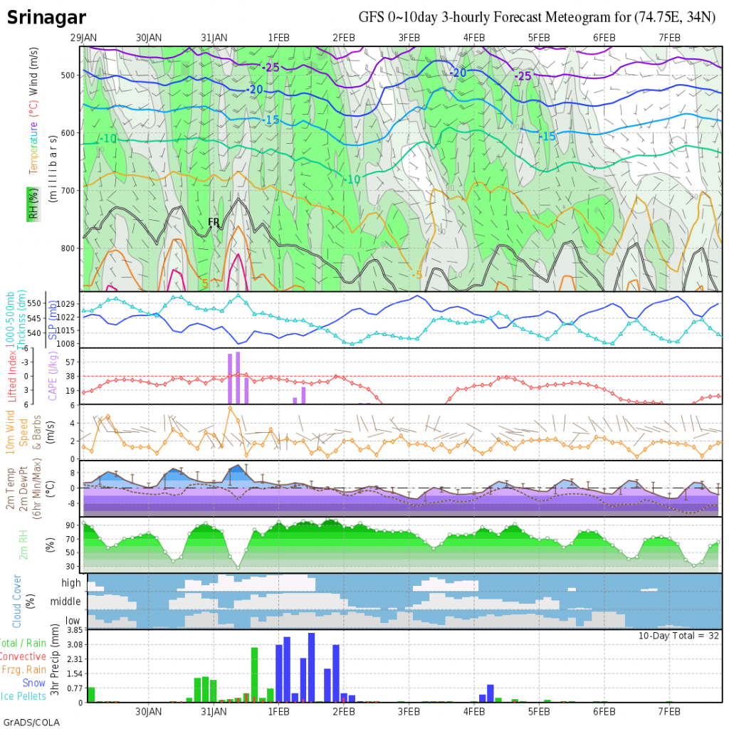
Forecast For North India:
Very good round or Snowfall/Rainfall expected during the forecast period with multiple spells on 30th, 31st January and 1st February over Hilly regions of Jammu & Kashmir, Himachal Pradesh and Uttarakhand. Rainfall expected over plains of North Indian States. Another round expected around 3rd to 5th February.
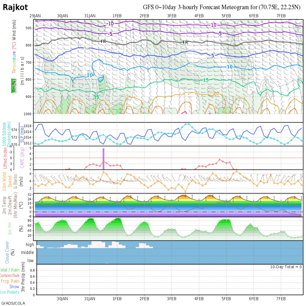
Forecast: Saurashtra, Gujarat & Kutch: 29th January To 5th February 2024
Winds will be mainly from Westerly direction till 2nd February morning and from Northerly direction till 3rd February night. Winds will again change to Westerly direction on 4th/5th February. Wind speed 12 to 20 kms/hour speed expected on 30th, 31st January & 1st February. Wind speed expected to be 8 to 15 km/hour for rest of the forecast period. Due to Westerly winds and high morning humidity, Foggy conditions expected on 30th, 31st January & 1st February. Humidity expected to increase again on 5th February. Off and on scattered clouds expected on some days of the forecast period.
Currently the Normal Minimum Temperature is 11 C to 13 C for most parts of Gujarat. The Minimum Temperatures are expected to be near normal to above normal during the forecast period with a range of 12 C to 17 C over most parts of Gujarat. Maximum Temperature expected to be near normal to above normal during the forecast period in the range 28C to 34 C against the normal Maximum Temperature of 28 to 30 C.
પરિસ્થિતિ:
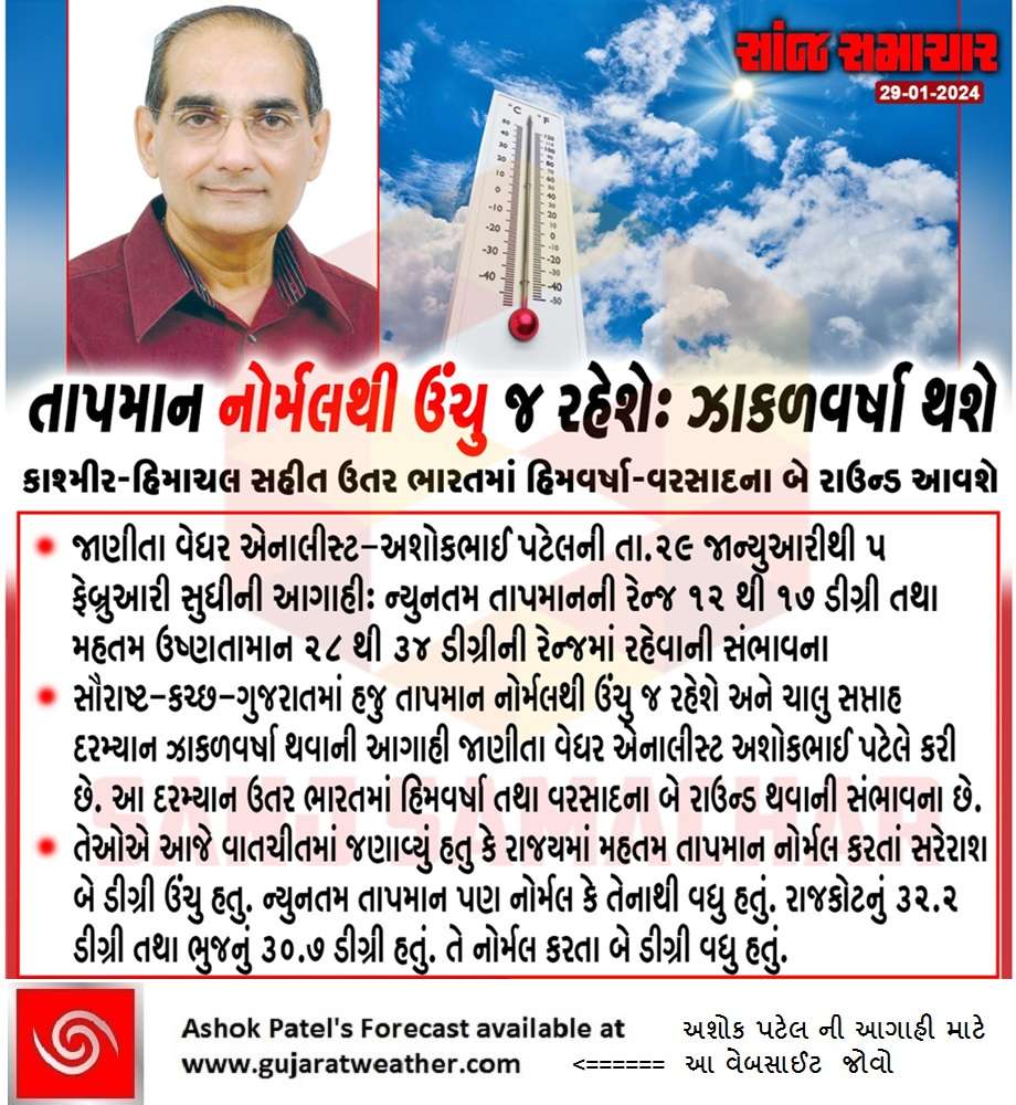
તારીખ 28 જાન્યુઆરી ના સૌરાષ્ટ્ર ગુજરાત અને કચ્છના વધુ ભાગો માં મહત્તમ તાપમાન નોર્મલ થી 2 C સુધી વધુ હતું.
તારીખ 29 જાન્યુઆરી ના સૌરાષ્ટ્ર ગુજરાત અને કચ્છના વધુ ભાગો માં ન્યુનત્તમ તાપમાન નોર્મલ નજીક અથવા નોર્મલ થી 1 C – 2 C સુધી વધુ હતું. અપવાદ માં ભુજ જે 6 C નોર્મલ થી વધુ હતું.
નોર્થ ઇન્ડિયા માટે આગાહી : તારીખ 29 જાન્યુઆરી થી 5 ફેબ્રુઆરી 2024
જમ્મુ કાશ્મીર, હિમાચલ પ્રદેશ અને ઉત્તરાખંડ ના પહાડી વિસ્તારો માં બરફ વર્ષા તેમજ વરસાદ નો સારો રાઉન્ડ થશે મુખ્યત્વે 30, 31 જાન્યુઆરી અને 1 ફેબ્રુઆરી. ત્યાર બાદ તારીખ 3 થી 5 ફેબ્રુઆરી વચ્ચે આ વિસ્તારો માં બીજો રાઉન્ડ ની શક્યતા છે. નોર્થ ઇન્ડિયા ના મેદાની વિસ્તારો માં ઉપરોક્ત તારીખો માં વરસાદ ના રાઉન્ડ ની શક્યતા.
સૌરાષ્ટ્ર, ગુજરાત અને કચ્છ: તારીખ 29 જાન્યુઆરી થી 5 ફેબ્રુઆરી 2024
2 ફેબ્રુઆરી સુધી પવનો મુખ્યત્વે પશ્ચિમી રહેવાની શક્યતા. ત્યાર બાદ 3 ફેબ્રુઆરી રાત્રી સુધી પવનો ઉત્તરાદા. 4 ફેબ્રુઆરી થી પવનો ફરી પશ્ચિમી દિશા માં થી ફૂંકાશે બાકી ના આગાહી સમય માટે. તારીખ 30, 31 જાન્યુઆરી અને 1 ફેબ્રુઆરી ના પવન ની સ્પીડ 12 થી 20 કિમિ/કલાક રહેશે. બાકી ના આગાહી સમય માટે પવન ની સ્પીડ 8 થી 15 કિમિ/કલાક ની શક્યતા. પશ્ચિમી પવનો અને સવાર ના હ્યુમિડિટી ના વધારા ને હિસાબે આગાહી સમય માં અનેક દિવસો ઝાકર ની શક્યતા છે જે 30, 31 અને 1 ફેબ્રુઆરી. તેમજ તારીખ 5 ફેબ્રુઆરી ના પણ સવારની હ્યુમિડિટી વધે તેવી શક્યતા છે. આગાહી સમય માં છુટા છવાયા વાદળો થવાની શક્યતા.
સૌરાષ્ટ્ર ગુજરાત અને કચ્છ ના મોટા વિસ્તારો માં નોર્મલ ન્યુનત્તમ તાપમાન 11 C થી 13 C ગણાય. ન્યુનત્તમ તાપમાન નોર્મલ નજીક અથવા નોર્મલ થી ઉંચુ રહેશે. ગુજરાત રાજ્ય ના વધુ સેન્ટરો માં તાપમાન 12 C થી 17 C ની રેન્જ માં.
હાલ નોર્મલ મહત્તમ તાપમાન 28 C થી 30 C ગણાય. આગાહી સમય માં મહત્તમ તાપમાન વધુ દિવસો નોર્મલ અથવા નોર્મલ થી ઉંચુ જોવા મળે તેવી શક્યતા છે. એટલે રેન્જ 28 C થી 34 C ગણાય.
Caution: Please refer/rely on IMD/RSMC Bulletins/Advisories for Storms & Weather related matter.
સાવચેતી: સ્ટોર્મ કે હવામાન અંગે ની માહિતી માટે ભારતીય હવામાન ખાતા/ગવર્મેન્ટ ના બુલેટીન/સુચના પર નિર્ભર રહેવું.
Read Comment Policy – કમેન્ટ માટે માર્ગદર્શન વાંચો
How To Upload Profile Picture For WordPress – વર્ડપ્રેસ માં પ્રોફાઈલ પિક્ચર કેમ રાખવું
Forecast In Akila Daily Dated 29th January 2024
Forecast In Sanj Samachar Daily Dated 29th January 2024