Current Weather Conditions on 11th December 2016
INDIA METEOROLOGICAL DEPARTMENT
Bulletin No.: 33 (BOB 06/2016)
Sub: Very Severe Cyclonic Storm, VARDAH over west central and adjoining southwest Bay of Bengal: Cyclone Alert for South Andhra Pradesh and north Tamil Nadu Coasts
Time of issue: 0830 hours IST
Dated: 11.12.2016
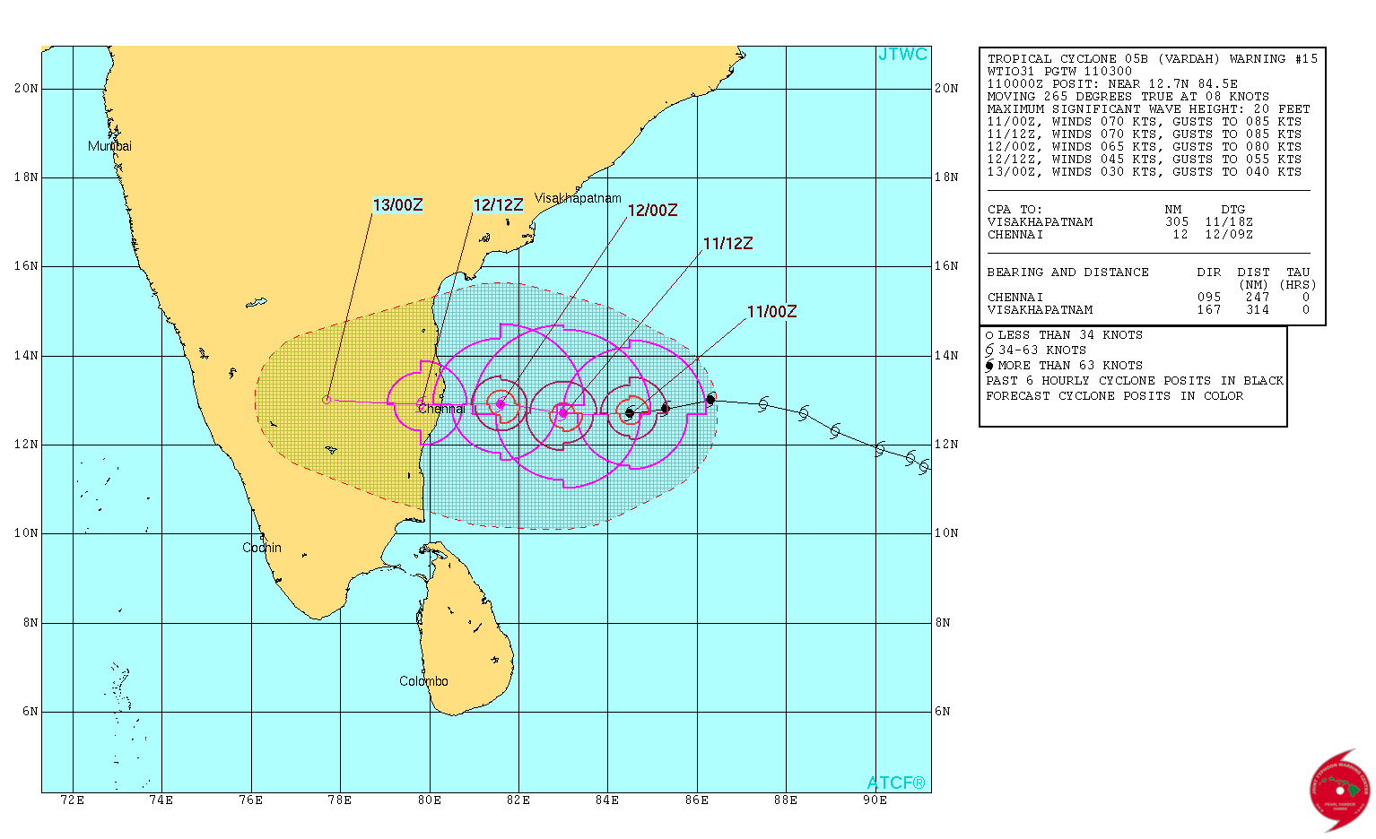
The Very Severe Cyclonic Storm, VARDAH over West Central and adjoining South Bay of Bengal moved further Westwards during past 06 hrs with a speed of 11 kmph and lay centered at 0530 hrs IST of today, the 11 th December, 2016 over West Central and adjoining Southwest Bay of Bengal near Latitude 13.3ºN and Longitude 84.7ºE, about 520 km East-Southeast of Nellore, 490 km Eastsoutheast of Machilipatnam and 480 km East-Northeast of Chennai. The system is very likely to move nearly West-Southwestwards and maintain its intensity up to the evening of today, the 11th December 2016. Thereafter, it is likely to weaken gradually while moving towards South Andhra Pradesh coast and adjoining North Tamilnadu coast. It is very likely to cross North Tamilnadu and South Andhra Pradesh coast, close to Chennai by 12th December 2016 afternoon.
The details are available here IMD Bulletin No.: Thirty Three
1 knot= 1.85 km./hour
JTWC Tropical Cyclone 05B.VARDAH (Very Severe Cyclonic STorm “VARDAH”) Warning No. 15
Issued at 0300 UTC on 11th December 2016
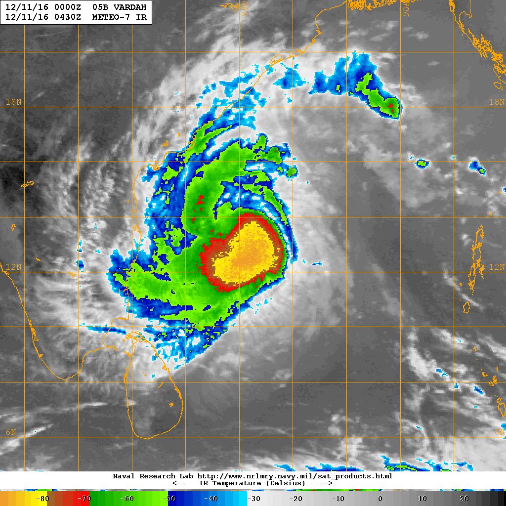
NRL IR Satellite Image of 05B.VARDAH (Very Severe Cyclonic Storm “VARDAH”)
on 11th December 2016 @ 0430 UTC (10.00 am. IST)
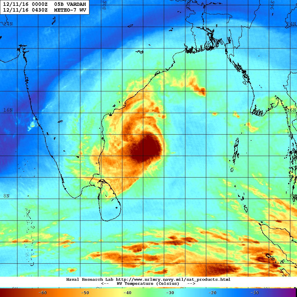
NRL Water Vapor Satellite Image of 05B.VARDAH (Very Severe Cyclonic Storm “VARDAH”)
on 11th December 2016 @ 0430 UTC (10.00 am. IST)
| UW-CIMSS Automated Satellite-Based Advanced Dvorak Technique (ADT) Version 8.2.1 Tropical Cyclone Intensity Estimation Algorithm |
|
| Current Intensity Analysis | |
                     UW - CIMSS
              ADVANCED DVORAK TECHNIQUE
                  ADT-Version 8.2.1
         Tropical Cyclone Intensity Algorithm

             ----- Current Analysis -----
     Date :  11 DEC 2016    Time :   040000 UTC
      Lat :   12:41:51 N     Lon :   83:58:15 E


                CI# /Pressure/ Vmax
                3.8 / 989.9mb/ 61.0kt


             Final T#  Adj T#  Raw T#
                3.8     3.9     3.9

 Center Temp : -81.7C    Cloud Region Temp : -83.0C

 Scene Type : UNIFORM CDO CLOUD REGION

 Positioning Method : FORECAST INTERPOLATION

 Ocean Basin : INDIAN
 Dvorak CI > MSLP Conversion Used : CKZ Method

 Tno/CI Rules : Constraint Limits : NO LIMIT
                   Weakening Flag : OFF
           Rapid Dissipation Flag : OFF

 C/K/Z MSLP Estimate Inputs :
  - Average 34 knot radii :   83km
  - Environmental MSLP    : 1009mb

 Satellite Name :    MET7
 Satellite Viewing Angle : 34.5 degrees
|
Estimate:
Distance of the VSC Storm is around 400 kms. nearly East of Chennai at 0400 UTC (09.30 am. IST) as per UW-CIMSS
Landfall expected over North Tamilnadu coast around Chennai on 12th December 2016 afternoon.
Caution: Please refer/rely on IMD/RSMC Bulletins/Advisories for Storms & Weather related matter.
સાવચેતી:
સ્ટોર્મ કે હવામાન અંગે ની માહિતી માટે ભારતીય હવામાન ખાતા/ગવર્મેન્ટ ના બુલેટીન/સુચના પર નિર્ભર રહેવું.