Update of Weather Conditions on 1st May 2019
અત્યંત તિવ્ર વાવાઝોડું ‘ફોની’ હાલ મધ્ય પશ્ચિમ અને લાગુ દક્ષિણ પશ્ચિમ બંગાળ ની ખાડી ઉપર 1st May 2019 – ઓડીશા પશ્ચિમ બંગાળ અને આંધ્ર ના કાંઠા ના જિલ્લાઓ માટે સાયક્લોન અલર્ટ.
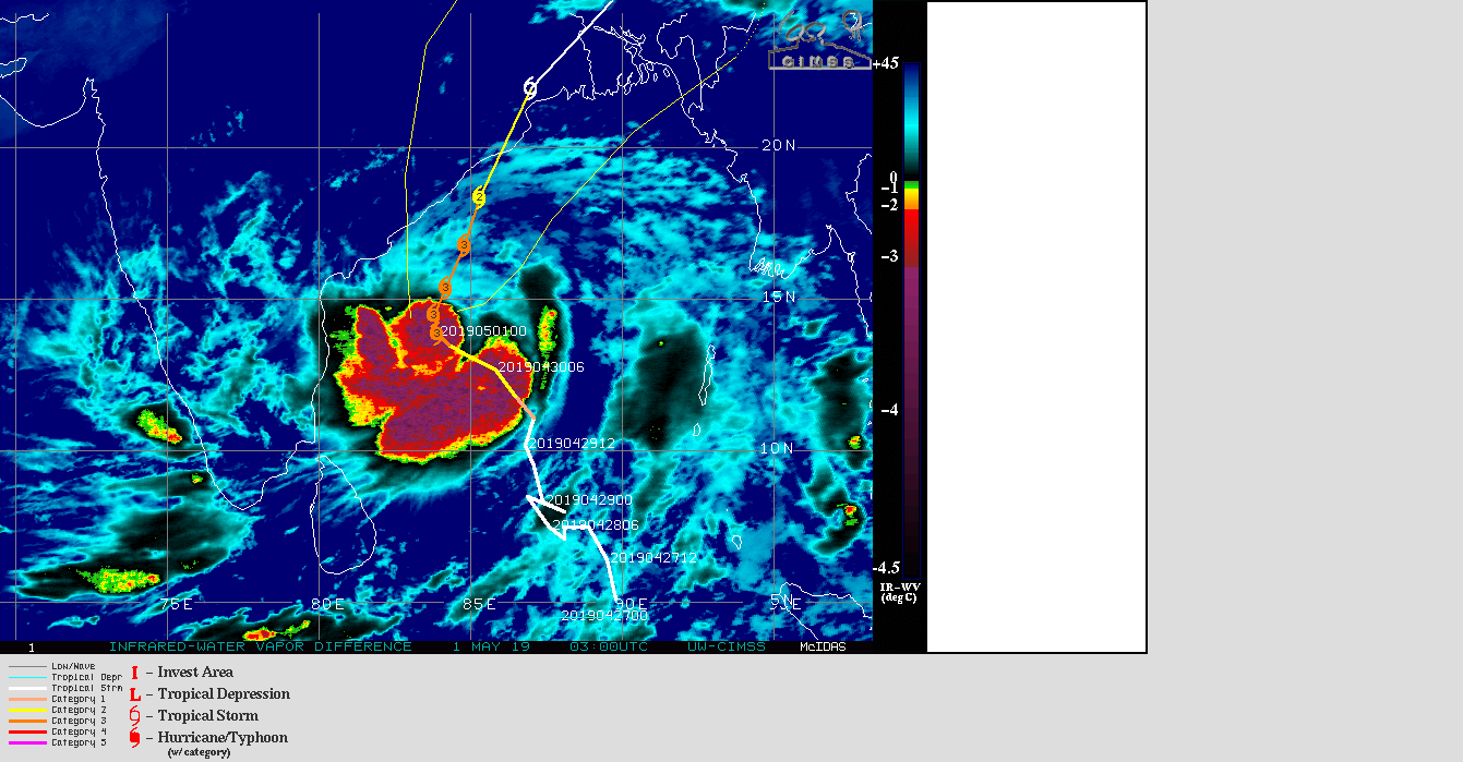
UW-CIMSS ‘FANI’ IR/WV Satellite Image With Cyclone Track & Forecast Cyclone Track
on 1st May 2019 @ 0300 UTC (09.30 am. IST)
1 knot= 1.85 km./hour
JTWC Tropical Storm 01B (FANI) Warning No. 17
On 1st May 2019 @ 0300 UTC ( 08.30 am. IST) (Extremely Severe Cyclonic Storm ‘FANI’)
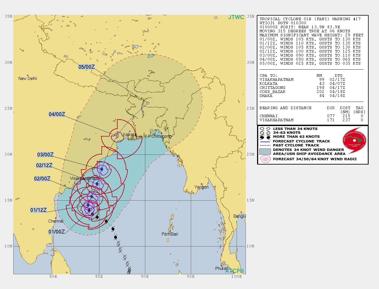
નકશામાં લખેલ છે તે તારીખ અને ટાઈમ છે.
01/00Z એટલે 1 તારીખ અને 00 Z એટલે સવારે 05.30 IST
01/12Z એટલે 1 તારીખ અને 12 Z એટલે સાંજે 05.30 IST
ઇન્ટરનૅશનલ એજન્સી મુજબ 105 નૉટ પવન ની ઝડપ છે ( જે એક મિનિટ ની શરેરાશ પવન મુજબ ગણે છે ,જયારે હવામાન ખાતા મુજબ પવન ની ઝડપ 3 મિનિટ ની શરેરાશ મુજબ ગણતરી થાય.)
1 નૉટ = 1.85 કિમિ/કલાક
INDIA METEOROLOGICAL DEPARTMENT
BULLETIN NO. : 37 (BOB/02/2019)
TIME OF ISSUE:0900 HOURS IST DATED: 01.05.2019
Extremely Severe Cyclonic Storm “FANI” over Westcentral and adjoining Southwest Bay of Bengal: Cyclone Alert for Odisha, West Bengal and Srikakulam, Vijayanagaram & Visakhapatnam Districts of Andhra Pradesh Coasts: Yellow Message
Here below is a five page Document. Click Page Up Down arrows at the bottom left corner on the Document page to read all the pages.
indian_1556705924
Note: IMD considers wind speed based on 3 minute Average in their System classifications.
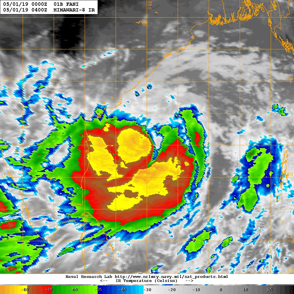
NRL IR Satellite Image of Cyclone 01B.FANI (Extremely Severe Cyclonic Storm FANI )
on 1st May 2019 @ 0400 UTC (09.30 am. IST)
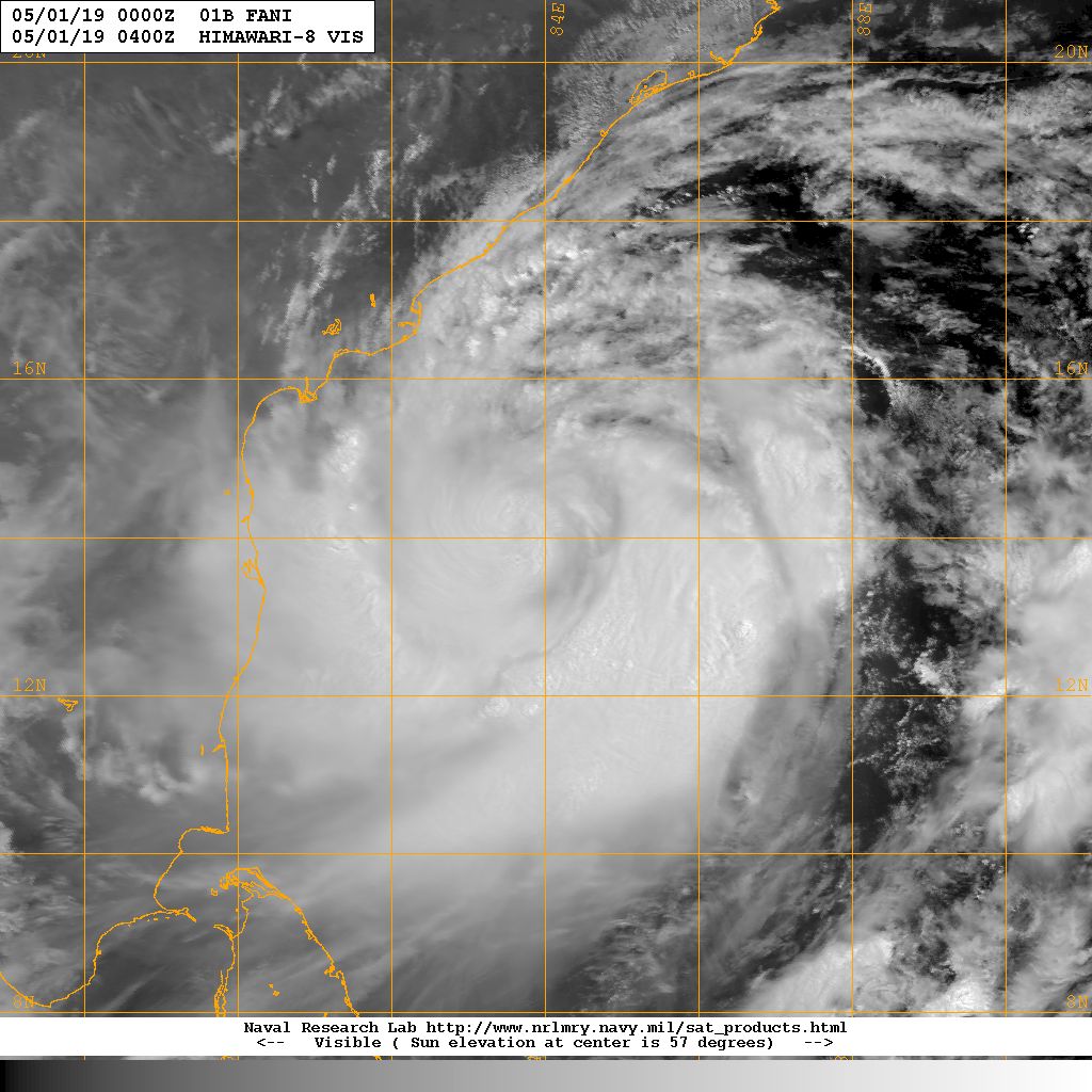
NRL Visible Satellite Image of Cyclone 01B.FANI (Very Severe Cyclonic Storm FANI )
on 1st May 2019 @ 0400 UTC (09.30 am. IST)
| UW-CIMSS Automated Satellite-Based Advanced Dvorak Technique (ADT) Version 9.0 |
|||||
|
|||||
Caution: Please refer/rely on IMD/RSMC Bulletins/Advisories for Storms & Weather related matter.
સાવચેતી:
સ્ટોર્મ કે હવામાન અંગે ની માહિતી માટે ભારતીય હવામાન ખાતા/ગવર્મેન્ટ ના બુલેટીન/સુચના પર નિર્ભર રહેવું.