Update 8th August 2018
Daily Rainfall figures are here
Check Weather Forecast Websites. See here
Current Meteorological features based on IMD Bulletin :
The Depression over North Interior Odisha and neighborhood moved West Northwestwards and weakened into a Well Marked Low Pressure area and lies over North Chhattisgarh and neighborhood in the morning hours of today. Associated Cyclonic Circulation extends up to 5.8 km above mean Sea level, tilting Southwards with height.
The Axis of Monsoon trough at mean sea level now passes through Bikaner Churu, Jhansi, Umaria Center of the Well Marked Low Pressure area over North Chhattisgarh & neighborhood, Gopalpur and thence Southeastwards to East Central Bay of Bengal.
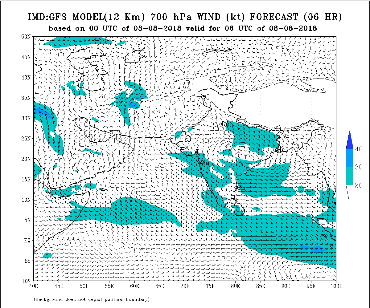
Trough at 700 hPa extends up to Northwest M.P./Southeast Rajasthan from the WMLP System.
Another Low Pressure expected to develop over the Northern Bay of Bengal after 5-7 days.
Saurashtra, Gujarat & Kutch: 8th to 12th August 2018
Windy conditions for Saurashtra and Kutch is expected on some days of forecast period. Winds are expected to reduce marginally during 8th to 10th August. BOB System is expected to weaken further when over Madhya Pradesh. The associated UAC has a broad Circulation at 700 hPa extending up to Northwest M.P./SOutheast Rajasthan. Humidity at 1.5 to 2 km level is good over many parts of Saurashtra, Kutch & Gujarat and Humidity at 3.1 km level over varying parts of Saurashtra, Kutch and Gujarat from 8th August on wards till 12th August, there is a chance of scattered showers/light rainfall with few pockets of medium rain over Saurashtra, Kutch & Gujarat during the forecast period. Widespread rainfall is ruled out.
Caution: Please refer/rely on IMD/RSMC Bulletins/Advisories for Storms & Weather related matter.
હાલ ની પરિસ્થિતિ અને નિચોડ: 8 ઓગસ્ટ 2018
ડિપ્રેસન નબળું પડી વેલ માર્કંડ લો થયું અને નોર્થ છતીશગઢ પહોંચ્યું છે.
ચોમાસુ ધરી બિકાનેર, ચુરુ, જાંસી , લો નું સેન્ટર અને ત્યાં થી ગોપાલપુર અને મધ્ય પૂર્વ બંગાળ ની ખાડી સુધી લંબાય છે
જે સિસ્ટમ છે ત્યાં થી એક 700 hPa નું બહોળું સર્કુલેસન નોર્થ વેસ્ટ એમપી /દક્ષિણ પૂર્વ રાજસ્થાન સુધી ફેલાયેલ છે.
5-7 દિવસ માં નવું લો બંગાળ ની ખાડી માં થશે.
સૌરાષ્ટ્ર, ગુજરાત અને કચ્છ: તારીખ 8 ઓગસ્ટ થી 12 ઓગસ્ટ 2018
બંગાળની સિસ્ટમ આજે નોર્થ છતીશગઢ છે અને ત્યાંથી પૂર્વ એમપી સુધી આવશે પછી લો નબળું પડશે. તેનું યુએસી નું બહોળું સકુલેશન પૂર્વ રાજસ્થાન/નોર્થ વેસ્ટ એમપી સુધી ફેલાયેલ છે. ગુજરાત, સૌરાષ્ટ્ર અને કચ્છ 1.5 થી 2 કિમિ માં ભેજ છે. 3.1 કિમિ માં ભેજ પણ અમૂક દિવસો અમૂક ભાગો માં વધે છે એટલે હાલ સૌરાષ્ટ્ર, ગુજરાત અને કચ્છ માં છુટા છવાયા ઝાપટા, હળવો વરસાદ અને ક્યાંક મધ્યમ વરસાદ ની શક્યતા છે. સિસ્ટમ ફક્ત બે દિવસ અસર કરે ત્યાર બાદ જે યુએસી/કે યુએસી નું ટ્રફ અને અરબી ના પવનો કામ કરે. સાર્વત્રિક વરસાદ નથી.
સાવચેતી:
સ્ટોર્મ કે હવામાન અંગે ની માહિતી માટે ભારતીય હવામાન ખાતા/ગવર્મેન્ટ ના બુલેટીન/સુચના પર નિર્ભર રહેવું.