Current Weather Conditions on 25th May 2018
As per IMD:
In view of the strengthening and deepening of cross equatorial flow and enhanced cloudiness and rainfall, Southwest Monsoon has advanced into some parts of Southeast Bay of Bengal, South Andaman Sea and Nicobar Islands. The Northern Limit of Monsoon (NLM) passes through Lat. 5N/Long 80E, Lat.8N/Long 87E, Car-Nicobar and Lat. 11N/Long 99E. Conditions are favorable for further advance of Southwest Monsoon into some parts of South Arabian Sea, Comorin-Maldives areas; some more parts of South Bay of Bengal, Andaman Sea and Andaman & Nicobar Islands during next 48 hours. Conditions are very likely to become favorable for further advance of Southwest Monsoon into some more parts of South Arabian Sea, Lakshadweep, Comorin area, South Kerala, South Tamilnadu, some more parts of south Bay of Bengal, remaining parts of Andaman Sea and some parts of east-central Bay of Bengal during subsequent 48 hours.
IMD Advance Of Southwest Monsoon Map
સૌથી ઉપર ની લીલી લીટી ના છેડે જે તારીખ હોઈ તે તારીખે લીટી ની નીચે ના ભાગ માં બધે ચોમાસું પોંચી ગયું છે તેમ સમજવું.
લાલ ત્રુટક લીટી જે તે વિસ્તાર માં નોર્મલ ચોમાસું બેસવાની તારીખ દર્શાવે છે
The date shown at the end of green line shows that the Southwest Monsoon has set in over areas below the green line on that date.
The red dashed line shows the normal date of onset of Southwest Monsoon over various regions
Other observations:
There is a broad Upper Air Cyclonic Circulation 3.1 to 5.8 km above mean sea level over South Bay of Bengal, adjoining Comorin areas as well as Southeast Arabian Sea.
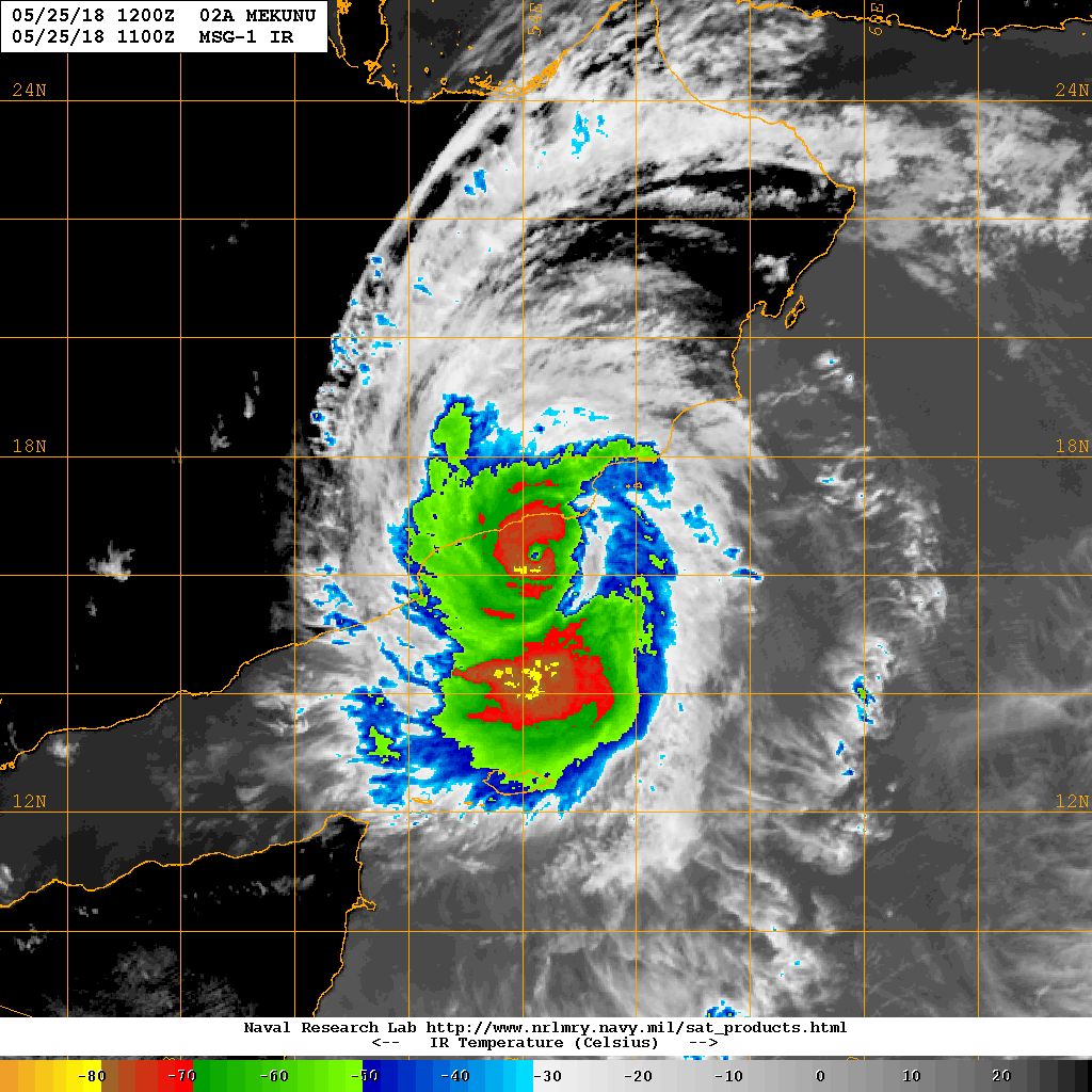
Extremely Severe Cyclonic Storm (ESCS) ‘Mekunu’ over Westcentral Arabian Sea
INDIA METEOROLOGICAL DEPARTMENT
BULLETIN NO. : 29 (ARB 03/2018)
TIME OF ISSUE: 1430 HOURS IST DATED: 25.05.2018
Extremely Severe Cyclonic Storm (ESCS) ‘Mekunu’ over Westcentral Arabian Sea
Here below is a four page Document. Click Page Up Down arrows at the bottom left corner on the Document page to read all the pages.
indian_1527263860
JTWC Tropical Cyclone 2A (MEKUNU) Forecast Track on 25th May 2018 @ 0900 UTC
NRL IR Satellite Image on 25th May 2018 @ 1100 UTC ( 04.30 pm. IST)
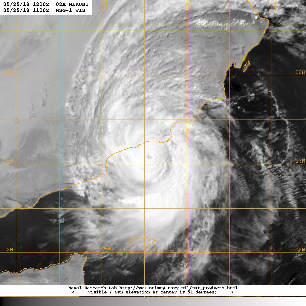
NRL Visible Satellite Image on 25th May 2018 @ 1100 UTC ( 04.30 pm. IST)
Caution: Please refer/rely on IMD/RSMC Bulletins/Advisories for Storms & Weather related matter.
સાવચેતી:
સ્ટોર્મ કે હવામાન અંગે ની માહિતી માટે ભારતીય હવામાન ખાતા/ગવર્મેન્ટ ના બુલેટીન/સુચના પર નિર્ભર રહેવું.