Current Weather Conditions on 21st July 2015 @ 2.30 pm.
The Low Pressure area over North Central Madhya Pradesh and adjoining areas has merged with monsoon trough. Associated Upper Air Cyclonic Circulation now extends up to 3.1 km above mean sea level.
The Axis of Monsoon passes through Phalodi, Ajmer, Sidhi, Ambikapur, Digha and thence Southeastwards to East Central Bay of Bengal and extends up to 1.5 km above mean sea level.
A fresh Upper Air Cyclonic Circulation lies over Sindh,Southwest Rajasthan & Kutch neighborhood and extend up to 1.5 km above mean sea level.
Due this new UAC the Western end of Monsoon trough will shift further Southwards during the next two days.
The Western Disturbance as an Upper Air Cyclonic Circulation now lies over Jammu & Kashmir and adjoining north Pakistan and extends upto 5.8 km above mean sea level.
The off-shore trough has been activated by the UAC over Madhya Pradesh and now runs from Konkan coast to Kerala coast.
IMD GSF (T574) 850 hPa Forecast Wind Valid 1200 UTC 21st July 2015

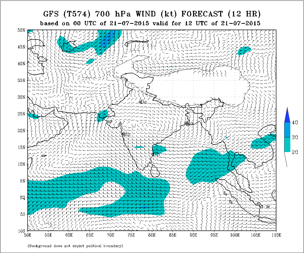
IMD GSF (T574) 700 hPa Forecast Wind Valid 1200 UTC 21st July 2015
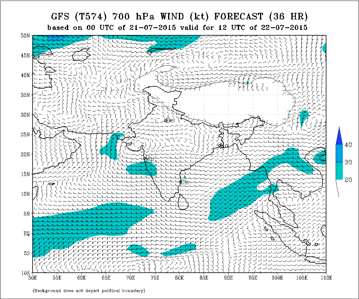
IMD GSF (T574) 700 hPa Forecast Wind Valid 1200 UTC 22nd July 2015
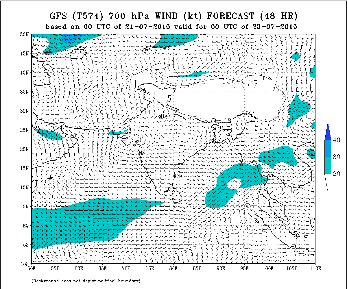
IMD GSF (T574) 700 hPa Forecast Wind Valid 00 UTC 23rd July 2015
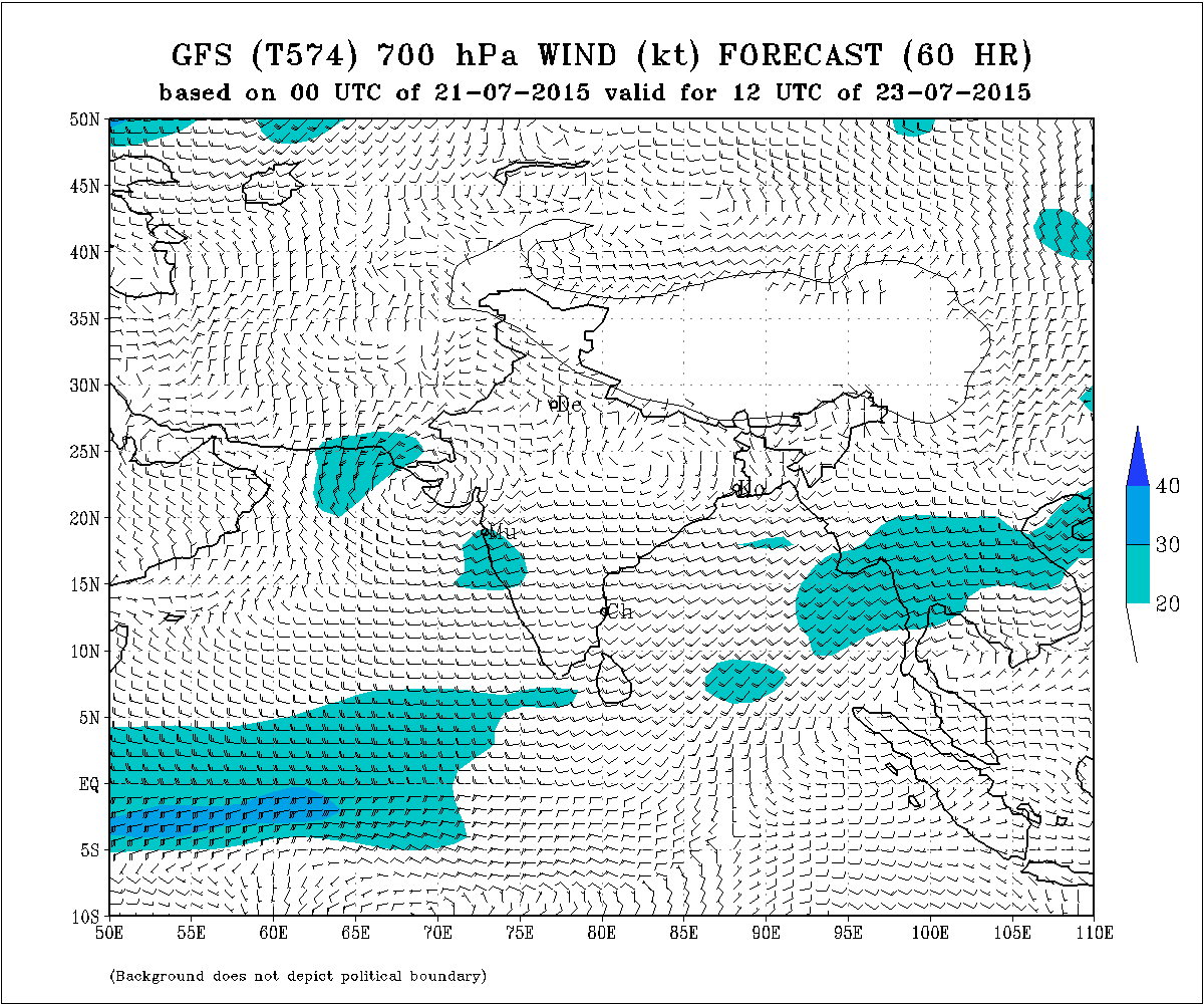
IMD GSF (T574) 700 hPa Forecast Wind Valid 1200 UTC 23rd July 2015
Forecast: 21st July to 23rd July 2015
Saurashtra, Gujarat & Kutch:
There will be a broad Upper Air Cyclonic Circulation over Saurashtra, Gujarat & Kutch and will extend up to Madhya Pradesh and Eastwards. In short an East West shear zone will extend from Saurashtra to over Madhya Pradesh and Eastwards at 3.1 km. level on 22nd/23rd July.
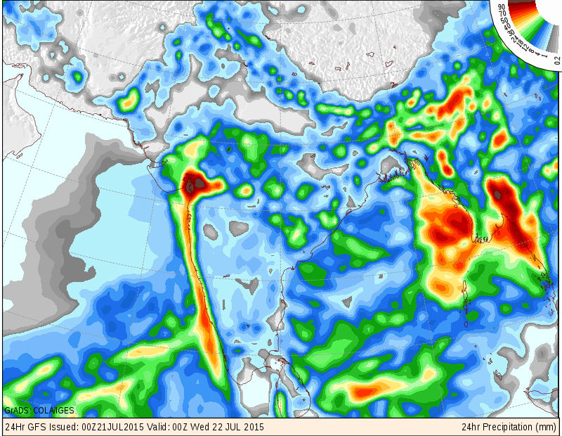
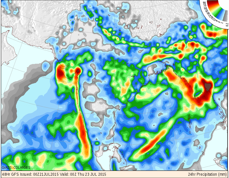
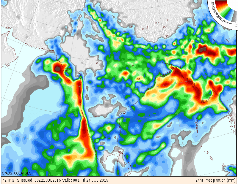
Due to the above conditions to improve for meaningful round of light -medium rainfall during 21st to 23rd July over whole Gujarat on one/two or all three days. Some centers to receive heavy rainfall. The quantum of rainfall over various regions of Saurashtra, Gujarat & Kutch is depicted by COLA/IGES precipitation map for all three days below.
COLA/IGES Precipitation Forecast Valid 00 UTC of 22nd July 2015 ( For 21st July)
COLA/IGES Precipitation Forecast Valid 00 UTC of 23rd July 2015 ( For 22nd July)
COLA/IGES Precipitation Forecast Valid 00 UTC of 24th July 2015 ( For 23rd July)
તારીખ 21 જૂલાઈ થી 23 જૂલાઈ :
સૌરાષ્ટ્ર ગુજરાત અને કચ્છ:
સૌરાષ્ટ્ર ગુજરાત અને કચ્છ માં વારસદ નો હળવો- માધ્યમ રાઉન્ડ આવશે. અમૂક વિસ્તાર માં ભારે વરસાદ ની સંભાવના છે. ક્યાં વિસ્તાર માં શું તેનો અંદાજ ઉપર ના કલર વાળા COLA/IGES નકશા માં આપેલ છે. વરસાદ ની માત્રા નો અંદાજ માટે ચાર્ટ છે. આકડા બતાવેલ છે તે 24 કલાક માં મીમી માં વરસાદ ની માત્રા છે.
સૂચના: આગાહી આપેલ છે તેના થી આગળ ના સમય માટે કઈ સાવલ ના કરવા. જેમ જેમ આગળ નું ચિત્ર સ્પષ્ટ થશે તેમ તેમ અપડેટ થશે. 25 જૂન 2015 થી કમેન્ટ ના જવાબ દિવસ માં એક કે બે વાર એક સાથે આપવામાં આવશે.
Weather Forecast In Akila Daily Dated 21st July 2015
Weather Forecast In Sanj Samachar Daily Dated 21st July 2015
