Current Weather Conditions on 10th April 2015
The Maximum Temperature has risen yesterday as had been forecast on 6th April that the Maximum Temperature will cross 40 C in some places of Saurashtra, Gujarat & Kutch. The Maximum Temperature yesterday for some locations were Rajkot 40.9 C (+3), Surendranagar & Naliya 40.8 C, Kandala 40.6 C & Gandhinagar 40.0 C.
A Western Disturbance is located over Pakistan. There is an Upper Air Cyclonic Circulation over South Gujarat & vicinity at 700 Mb. level. Wind discontinuity runs diagonally across Southern Peninsula from Kerala to South Chhatishgarh.
Forecast: 11th to 16th April 2015
Saurashtra, Kutch & Gujarat:
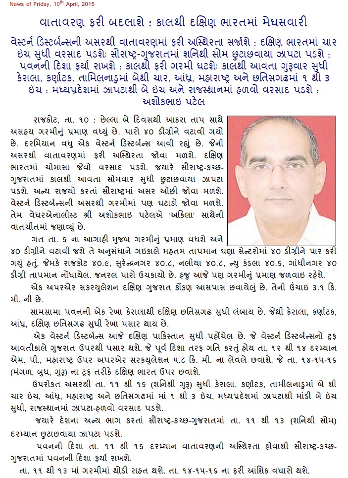
The trough of Low at 500 Mb associated with fresh Western Disturbance as an Upper Air Cyclonic Circulation affect Rajasthan and Saurashtra, Gujarat & Kutch 11th to 13th April. Due to UAC vicinity of Gujarat and atmospheric instability and the effects of WD there is a possibility of scattered showers over parts of Saurashtra, Gujarat and Kutch on 11th to 13th April. See maps below for forecast rain/shower areas.
The Maximum Temperature is expected to decline during 11th to 13th April and again increase during 14th to 16th April over Saurashtra, Kutch & Gujarat.
COLA/IGES Precipitation Forecast Map
Valid for 24 hours ending 00 UTC 12th April 2015 ( for 11th April)
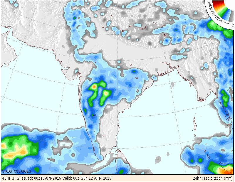
COLA/IGES Precipitation Forecast Map
Valid for 24 hours ending 00 UTC 13th April 2015 ( for 12th April)
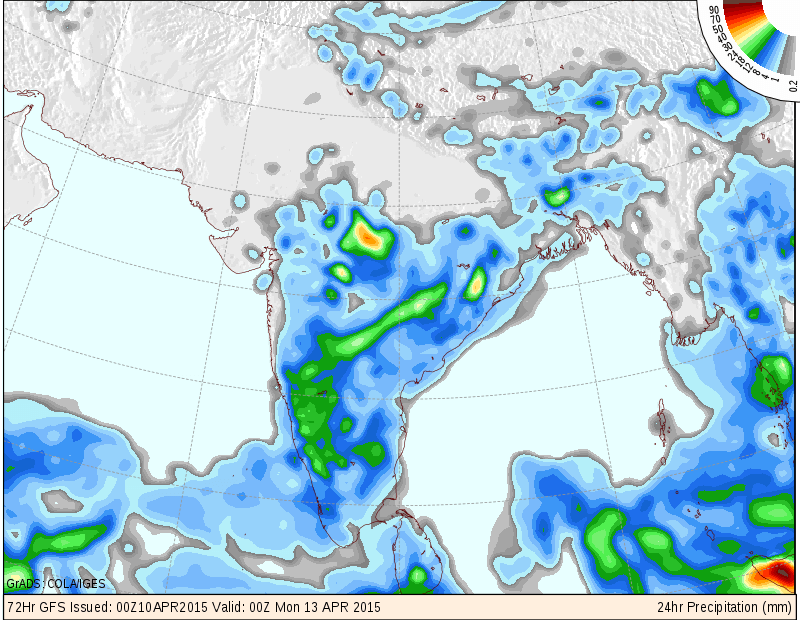
COLA/IGES Precipitation Forecast Map
Valid for 24 hours ending 00 UTC 14th April 2015 ( for 13th April)
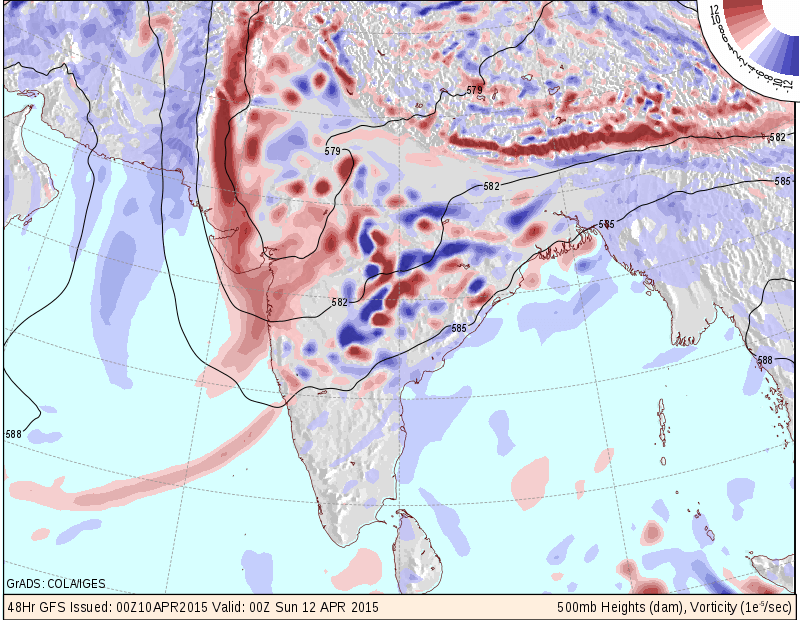
COLA/IGES 500 Mb. Vorticity Forecast Map
Valid for 24 hours ending 00 UTC 12th April 2015 ( for 11th April)
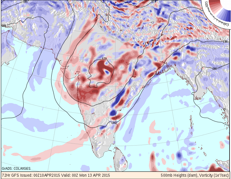
COLA/IGES 500 Mb. Vorticity Forecast Map
Valid for 24 hours ending 00 UTC 13th April 2015 ( for 12th April)
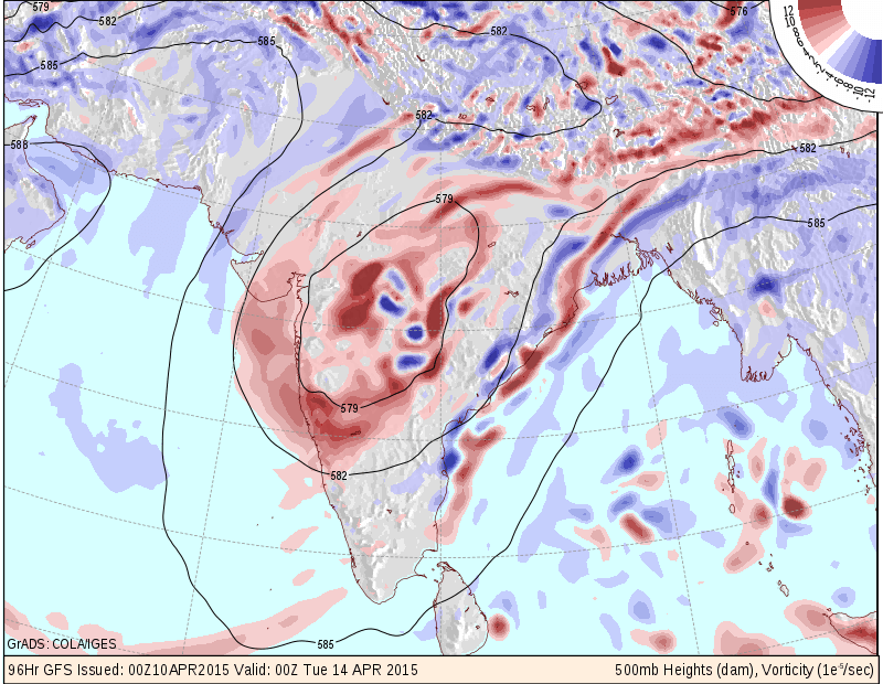
COLA/IGES 500 Mb. Vorticity Forecast Map
Valid for 24 hours ending 00 UTC 14th April 2015 ( for 13th April)
Rest of India: 11th to 16th April
The incoming Western Disturbance will track Eastwards and will be located over Madhya Pradhesh/Maharashtra on 12th/13th April. Together with other atmospheric conditions prevailing over Peninsular India, will give rain to most States of Central and Peninsular India during some days of the forecast period.
Expected rain quantum during the forecast period:
Kerala, Karnataka & Tamilnadu 5 Cms. to 10 Cms.; Andhra Pradesh, Maharashtra, Chhatishgarh 3 Cms. to 8 Cms.; Madhya Pradesh Showers to 3 Cms.; Rajasthan Showers to 2 Cms.
Weather Forecast In Akila Daily Dated 10th April 2015